HomeEng Website Design and Content © by Eric Krause, Krause House Info-Research Solutions (© 1996)
      All Images © Parks Canada Except Where Noted Otherwise

Researching the Fortress of Louisbourg
National Historic Site of Canada
  Recherche sur la Forteresse-de-Louisbourg
Lieu historique national du Canada

Search All Sites/All Menus ~
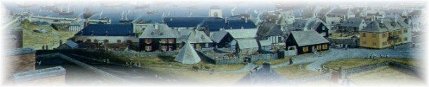
Cherche Tous les Sites/Tous les Menus

© Lew Parker - 18th-Century Louisbourg

 Fortress Home  |  Fortress Site Policy-Copyright
----------------------------------


FORTRESS 
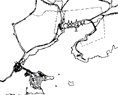
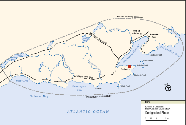
OF LOUISBOURG NATIONAL HISTORIC SITE OF CANADA (N.S.) 

GETTING HERE MAPS

The Fortress of Louisbourg  is located south of Sydney on Route 22, just beyond the modern town of Louisbourg. Take Exit 8 near Sydney. Driving time is 30 minutes. An alternate route is the scenic and coastal Marconi Trail, Route 255, from Glace Bay. Driving time is one hour.

If you're driving from the Canso Causeway, take Route 4, the Fleur-de-Lis Trail, or TransCanada Highway 104 to Sydney. Or follow TransCanada Highway 105 through Baddeck to North Sydney and take Highway 125 to Sydney. Then take Exit 8 near Sydney to Route 22. Driving time for either route is 2.5 hours.


(Please Note: Some Maps will load slowly)

  
SELECT TOUR MAPS


A visitor tour map of the Fortress of Louisbourg, the largest reconstructed 18th-century French fortified town in North America

A visitor tour map map of the Fortress of Louisbourg and surrounding area as it is today
A bi-lingual visitor tour map map of the Fortress of Louisbourg and surrounding area as it is today

A visitor tour map showing Rue Royalle, one of the main streets in the reconstructed town-site


SELECT GENERAL ORIENTATION MAPS


A map of Cape Breton Island showing its main highways
 

A map of Cape Breton Island showing its Parks Canada sites and several main highways
 

The location of Cape Breton Island in relation to Eastern/Central Canada/United States
 

The location of Louisbourg in relation to Eastern/Central Canada/United States
 

The location of Cape Breton Island in relation to Atlantic Canada
 

This is a simple, black and white, birds-eye map of the local Louisbourg area


SELECT INFORMATIONAL MAPS


The location of the communities of Cape Breton during the 18th Century
 

The location of Louisbourg in relation to 18th-century Atlantic Canada/Europe
 

The location of Louisbourg in relation to 18th-century Atlantic Canada
 

A Town map of 1901. In the course of looking at the streets of the modern town, a number of surveyors plans and other plans were reviewed
 
A Town map of 1901


FORTRESS OF LOUISBOURG NATIONAL HISTORIC SITE OF CANADA: 
MANAGEMENT PLAN ~ 2001 ~ MAPS


1734 - Town of Louisbourg and Surrounding Area 
  
Designated Place 
  
Regional Setting 
  
1745 Siege of Louisbourg 
  
Reconstructed Townsite
   
Visitor Facilities and Activities 
  
Proposed Fleur-de-Lis Trail 
  
1738 - French System of Roads