YvonLeBlanc
Website Design and Content
© by Eric Krause, Krause House
Info-Research Solutions (© 1996)
All Images ©
Parks Canada Unless Otherwise Designated
Researching
the Fortress of Louisbourg National Historic Site of Canada
Recherche sur la Forteresse-de-Louisbourg Lieu historique national du Canada
Yvon LeBlanc Site
Contributions: Louisbourg Institute and Yvon LeBlanc
YVON LEBLANC~ PHOTO/DRAWING GALLERIES ~ARCHITECTURE AND RECONSTRUCTION OF THE FORTRESS OF LOUISBOURG (1713-1983)
BACK
OVERALL VIEWS OF
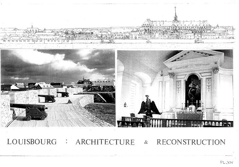
LOUISOURG ARCHITECTURE FROM FOUNDATION TO PARTIAL RECONSTRUCTION AS BEFORE
1745 SIEGE
To
see a larger view of a picture, please click on it
Please hover over the image for the caption to appear
OVERALL VIEW ONE
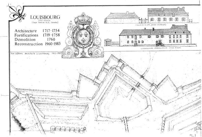
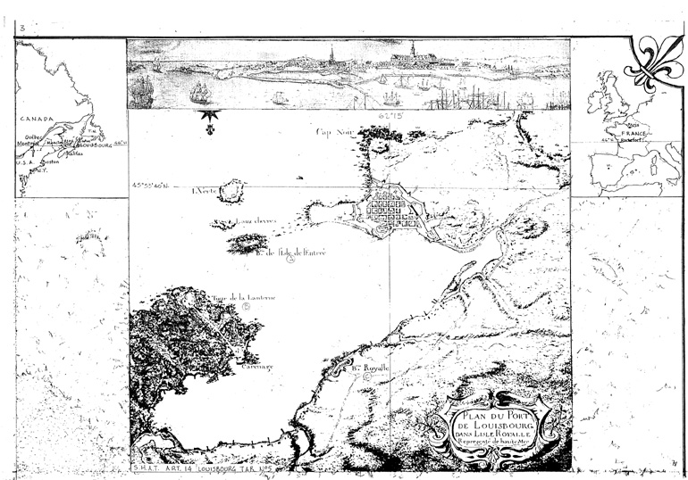
From "Louisbourg Isle Royale (Cape Breton N.S. Canada) Architecture 1717 - 1754
/ Fortifications 1719 - 1758 / Démolition 1760 / Reconstruction 1960 - 1983 /
By Yvon LeBlanc, Architecte ŕ Louisbourg 1972 - 1983"
|
Plate 1 Plate 6 Plate 7 Plate 8 Plate 21 |
||
|
Plate 2
Plate 4
|
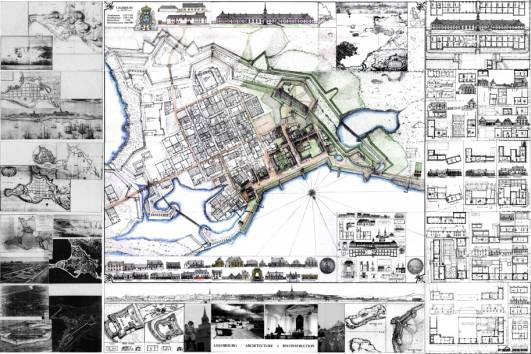 |
Plate 22
|
| Plate 5 Plate 18 Plate 19 Plate 20 Plate 25 |
Note:
Plates 9-17 are in the
centre portion labelled from left to
right: i.e top (9-11), middle
(12-14), bottom (15-17)
©
Yvon LeBlanc
Key to the Plates
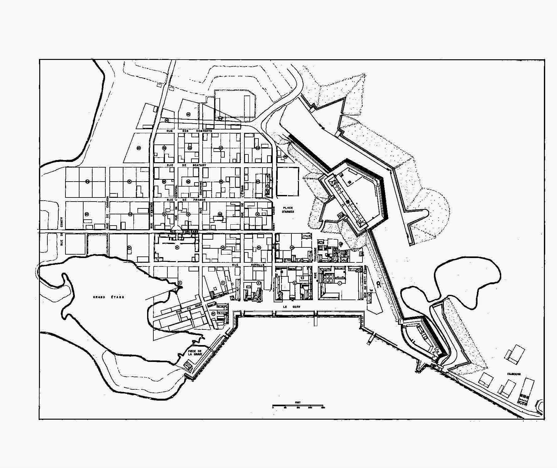
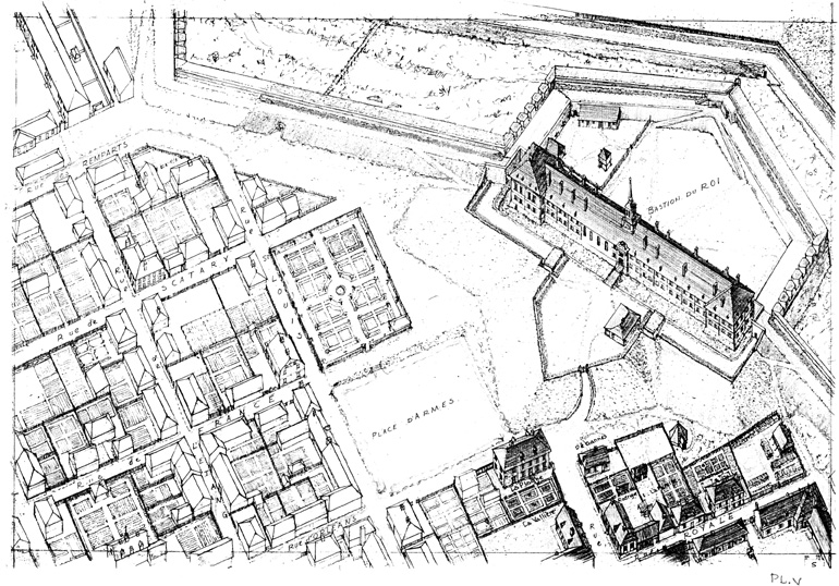
La Ville / The Town (Histoire/History)
Plate 1: 1717
Plate 2: 1730-1731
Plate 3: 1745-1758
Plate 4: 1760-1960
Plate 5: 1926-1982
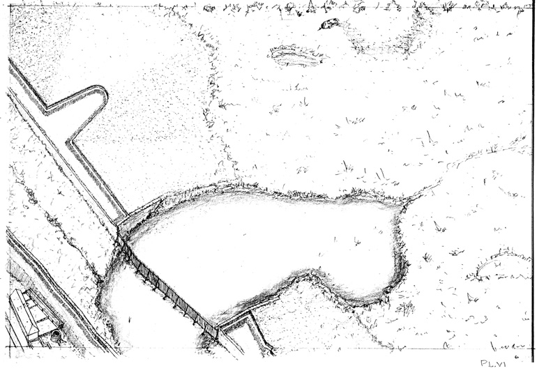
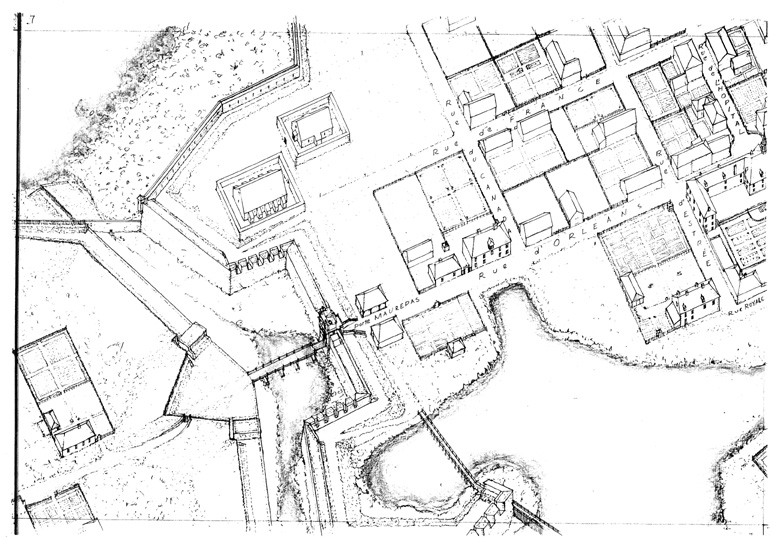
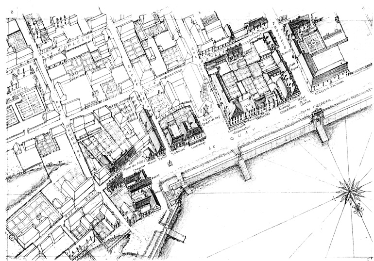
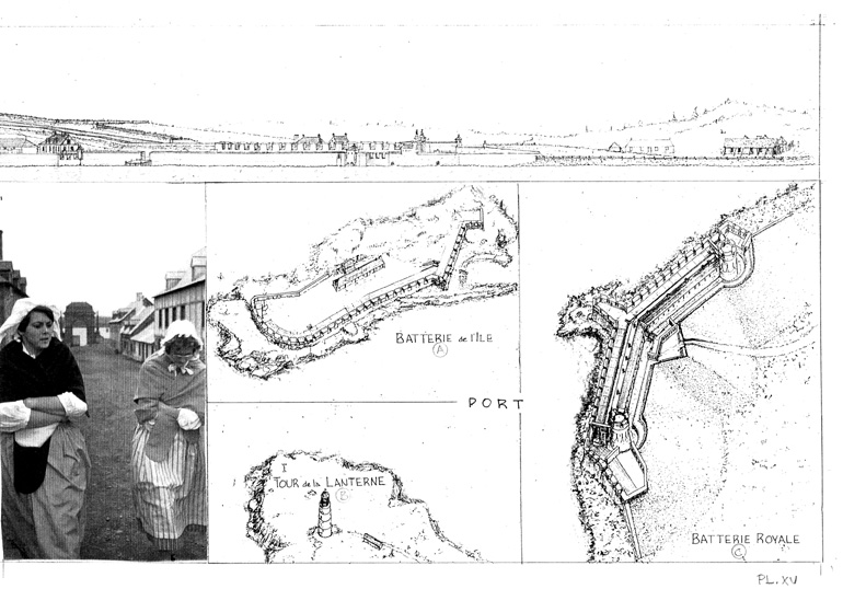
Plates 6-17: Vue aérienne / Aerial view (Vue ŕ vol d'oiseau /birdseye view)
Plates 18-20: Vue frontale / Frontal view; Autres / Other Fortifications; Photos (Silhoutte / skyline, autres / other fortifications, photos)
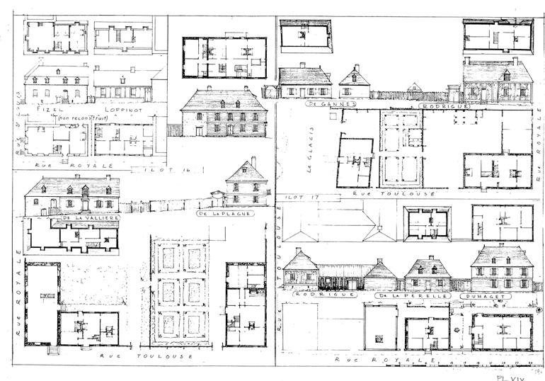
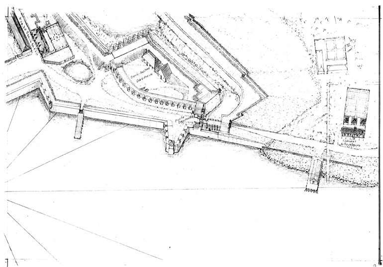
Plates 21 - 25: Lieux d'habitation reconstruits / Living areas reconstructed
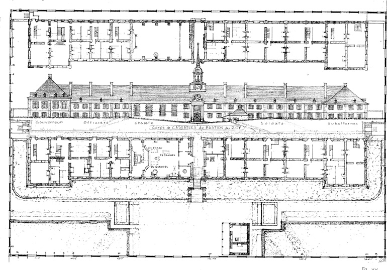
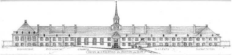
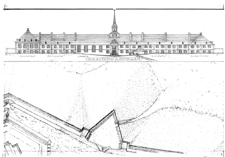
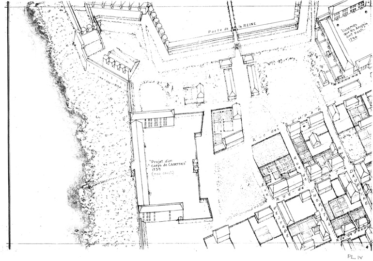
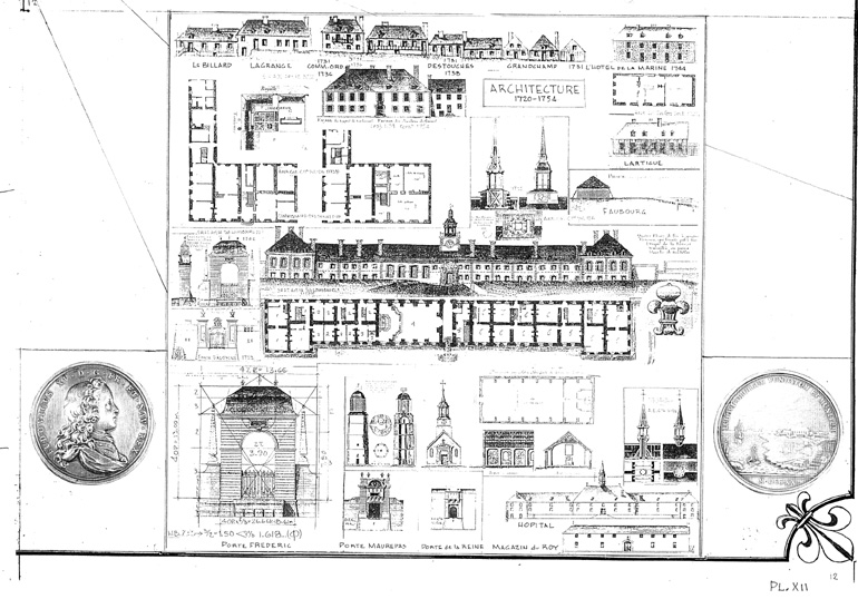
Plate 21: Casernes du Bastion du Roi / King's Bastion Barracks
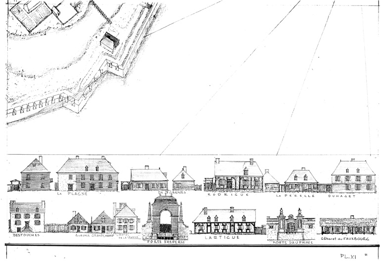
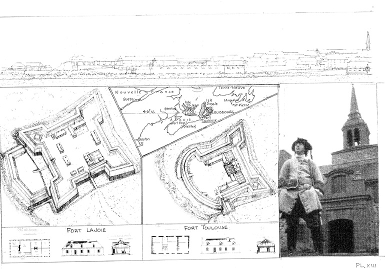
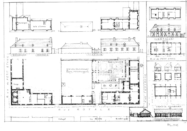
Plate 22: La Plagne, La Valličre, De Gannes, Rodrigue, La Pérelle, Duhaget
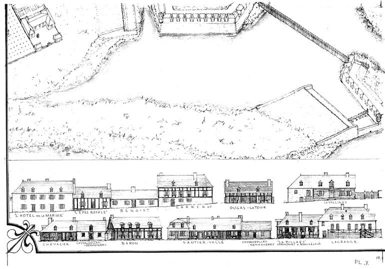
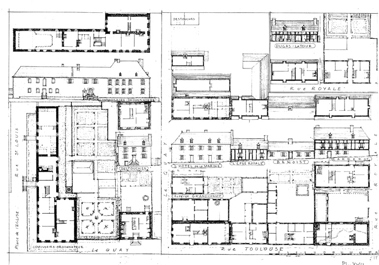
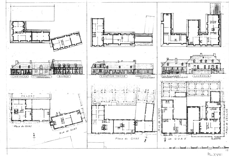
Plate 23: Lagrange, Le Billard, Cassagnoles-Detcheverry, Santier-Vallée, Baron, Chevalier
Plate 24: Dugas-Latour, Carrerot, Benoit, Epée Royale, Hôtel de la Marine, Auberge Grandchamp, Pugnant dit Destouches, Commissaire-Ordonnateur (Bigot)
Plate 25: Ingénieur Verrier, Lartigue, Faubourg
OVERALL VIEW TWO
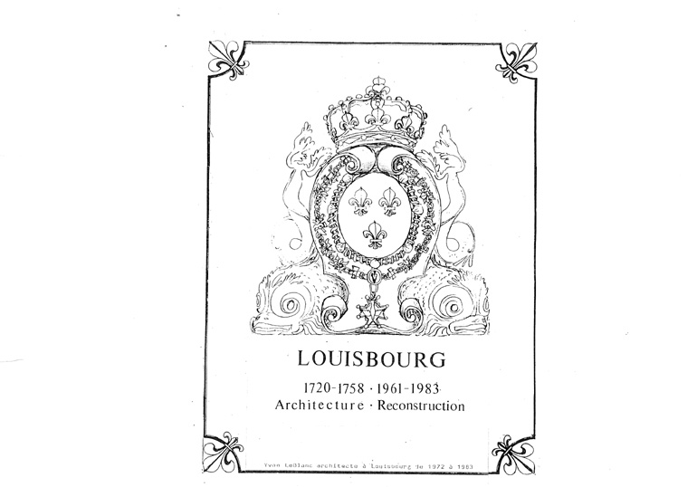
From LOUISBOURG 1720-1758 / 1961-1983, Architecture - Reconstruction, Yvon LeBlanc architecte ŕ Louisbourg de 1972 ŕ 1983
|
|
|
Cover |
|
|
 |
 |
||
| Plate 1 | Plate 2 | Plate 3 | ||
 |
 |
 |
||
| Plate 4 | Plate 5 | Plate 6 | ||
 |
 |
 |
||
| Plate 7 | Plate 8 | Plate 9 | ||
 |
 |
 |
||
| Plate 10 | Plate 11 | Plate 12 | ||
 |
 |
 |
||
| Plate 13 | Plate 14 | Plate 15 | ||
 |
 |
 |
||
| Plate 16 | Plate 17 | Plate 18 | ||
|
|
|
|
|
Plate 19 |
Plate 20 |
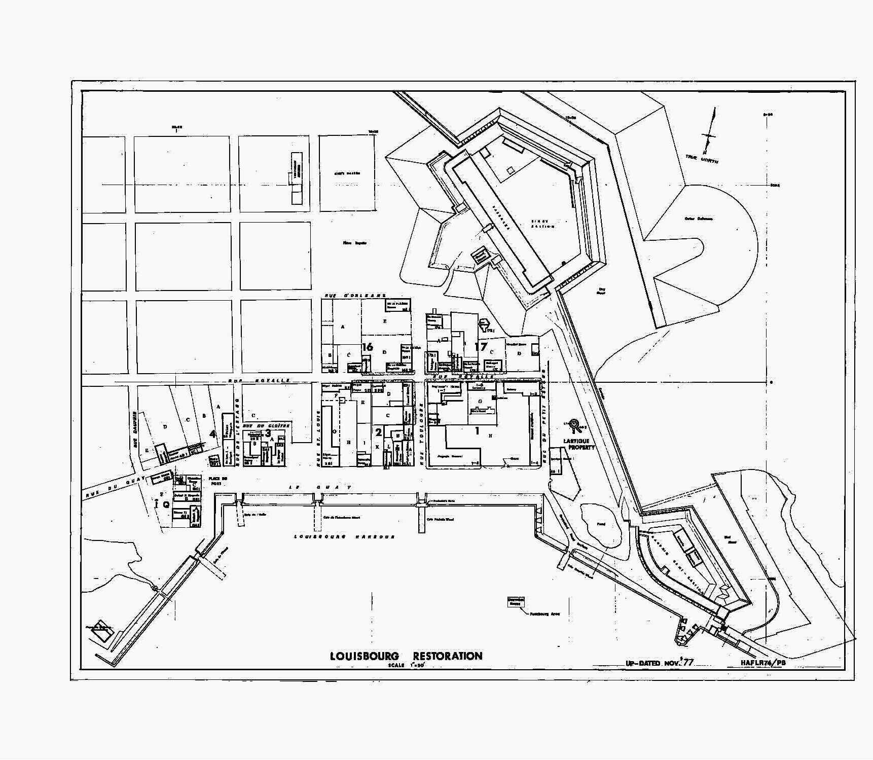
OVERALL VIEW THREE
From the Fortress of Louisbourg, Year 1744-1745: The reconstruction of the Fortress of Louisbourg
|
|
|
|
|
If the Entire Town |
|
Reconstructed |
© Parks Canada
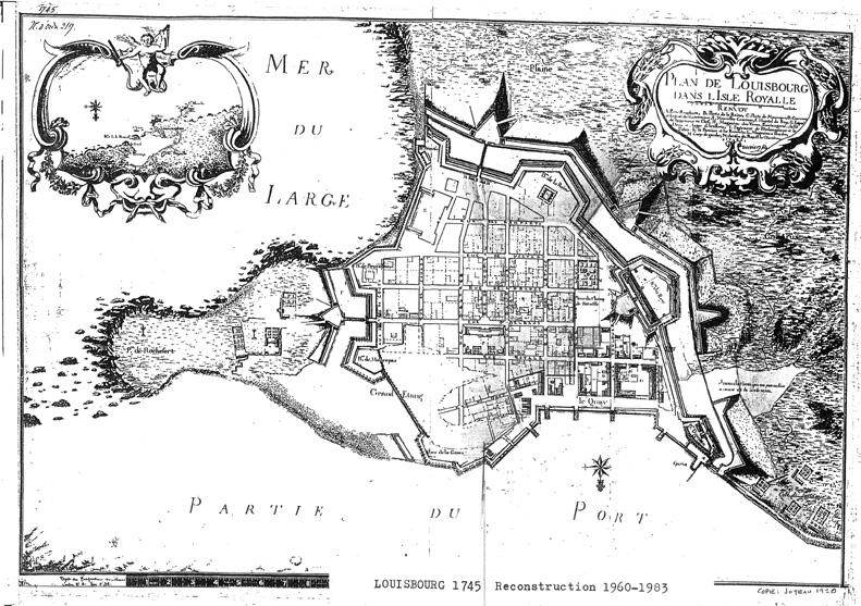
OVERALL VIEW FOUR
From Yvon LeBlanc
|
|
|
Louisbourg 1745 / |
|
© Yvon LeBlanc |