Bigotyard
Website Design and Content © December 14, 2001, by
Eric Krause, Krause House Info-Research Solutions
(© 1996)
All Images © Parks Canada Except
Where Noted Otherwise
Researching the
Fortress of Louisbourg National Historic Site of Canada
Recherche sur la Forteresse-de-Louisbourg Lieu historique national du Canada
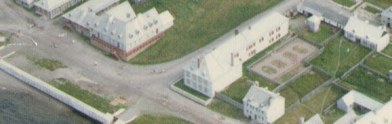
Fortress of Louisbourg, Block Two,
Lots F/G/H Properties:
Landscape Arrangements as of 1744
REPORTS
BACK
Chronological Index ~ Annotated Extracts from Historical and Archaeological
Reports of the Fortress of Louisbourg, 1959 - Present
Note: [[...]] represent Krause Annotations
Richard E. Cox, "Pugnant dit Destouches" Property, 1978 Excavation Report, Unpublished Report A-E41 (Fortress of Louisbourg, 1978 [Also includes the 1969 report]) - Extracts
[1978]
[2]
The 1978 excavations had the purpose of defining the yard boundaries and the occupants' activities within the yard, through the identification of the structural remains and the stratigraphic sequence ...
Dark brown sandy soil (Lots 12 and 22) ...
Moreover, it was affected by the presence of the eastern boundary "piquet" fence, 1721-1738 [2L28-29-30Q22 (Event 2I38)] ... [[2L28-29-30Q22 portion of Lot H/I Fence - Archaeology: Prévost portion of 2L28-29-30Q22/Archaeology: 2L28-29-30Q22]]
[4]
East Boundary Fence (Drg: HAFLR78P9-3, Photo 2L00089M) Event 2I38 (1721-1738)
This piquet fence [[2L28-29-30Q22 portion of Lot H/I Fence - Archaeology: Prévost portion of 2L28-29-30Q22/Archaeology: 2L28-29-30Q22]] ran in a north-south direction on the east boundary of the Pugnant yard. It was partially excavated by Cox in 1969, and fully excavated in 1978. The fence is associated with the fill deposited in the Commissaire Ordonnateur's yard (post 1727), the weight of which caused it to lean in a westerly direction. This would indicate that the Pugnant yard would have been lower than that of the commissaire Ordonnateur ...
[5]
A quantity of wood beams were unearthed in the Pugnant yard (Drg: HAFLR78P9-3) ...
Moreover, the wood beams running in an east-west direction at the northen [sic] limit of the Pugnant property, could constitute the remains of the fenceline [[sic]] [[Lot E/I Fence - Archaeology: 2L30N,O,P,Q]] between lots E and I (photo: 2L00131) ...
[[Note: At Louisbourg, within the town, the general boundary or garden fence was of piquet construction. A fence leaving remnants of boards would have been highly unusual.]]
[1969]
[No Page]
The Fence [[2L28-29-30Q22 portion of Lot H/I Fence - Archaeology: Prévost portion of 2L28-29-30Q22/Archaeology: 2L28-29-30Q22]]
An irregular row of post molds was traced along part of the property line between the Pugnant house and the land lying behind the West [Prévost] Addition to the Commissaire Ordonnateur's house. The row of post molds was about 25 ft. long and started about 61 ft. south of the West [Prévost] Addition [More likely, 61 feet south of the Destouches House]. The posts must have been fairly light as their diameters rarely exceeded 0.5 ft. and the spacing between averaged 0.9 ft. The scattering of stones found among the posts probably indicate field clearance rather than an attempt at reinforcement. The date at which the fence was built is difficult to determine although the level of the associated stones was below the material assumed to have been deposited in 1754 when the near by cellars of the West [Prévost] Addition to the Commissaire Ordonnateur's house was dug. Probably the fence existed before this date and was partially buried by the dumping of the cellar spoils. There is a possibility that the fence dates to the earlier occupancy of the Rodrigues, who were resident in this lot until the fire of 1737 which destroyed the Rodrigue house [Lot H 2nd Rodrigue House (c. 1725-1737)] ...