Table des Matičres
Search
Website Design and Content © by Eric Krause,
Krause House Info-Research Solutions (© 1996)
All Images © Parks Canada Except
Where Noted Otherwise
Report/Rapport © Parks Canada / Parcs Canada
---
Report Assembly/Rapport de l'assemblée © Krause
House
Info-Research Solutions
Researching the
Fortress of Louisbourg National Historic Site of Canada
Recherche sur la Forteresse-de-Louisbourg Lieu historique national du Canada
PRINCESS
BASTION REPORT:
A SURVEY OF THE AREA FROM THE RIGHT REENTRANT
ANGLE OF THE PRINCESS BASTION TO THE RIGHT REENTRANT
ANGLE OF THE BROUILLAN BASTION, AND THE RELATION OF THIS
AREA TO CAP NOIR
BY
MARGARET FORTIER
February, 1966
(Supervision: W. Stevenson, J. Hanna)
(Fortress of Louisbourg Report H B 3)
Presently,
only some illustrations are
included here.
For all of them, please consult the original report in the archives of the Fortress of Louisbourg
![]() Return/retour
- Table of Contents/
Return/retour
- Table of Contents/
Table des Matičres
SECTION II
CHAPTER 3
Loophole Wall and -Retired Battery
Strictly speaking, the Princess Bastion had no left face. However, for practical purposes it did. The French used the term to refer to the section of the Enceinte from the salient angle to the left shoulder angle despite the fact that it was not one continuous wall.
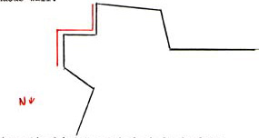
The segment between the retired battery and the left shoulder angle was occasionally - and for present purposes will be referred to as the small left face.
Similarly the area from the left shoulder angle to the left reentrant angle was known as the small left flank.
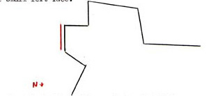
Because of their construction, every wall from the salient angle of the Brouillan Bastion to the retired battery of the Princess was considered to be a part of the Crenelated Wall
Occasionally, for examnle in 1751, [89] the loophole wall was included in the term Crenelated Wall. However, it will not be considered such at this time since the differences between the loophole wall and the other parts of the Crenelated Wall are much more striking than are their similarities. On the other hand, the small left face falls more easily into the discussion of the Crenelated Wall and will not be considered as yet. For the purposes of this report, therefore, the left face of the Princess Bastion will include only the loophole wall and the retired battery.
Some statements made during the early years of construction refer to the "left face" of the Princess Bastion. Since the loophole wall and the retired battery were built before the other parts were even begun, this designation may be considered to refer to them only. In 1734 it was reported that the foundations of part of the left face had not been laid by the end of 1733. [90] By 1735, the level of the cordon had been reached all along the Enceinte except for part of the left face. According to St. Ovide, the left face had been raised 15 pieds. [91] Verrier gave a different account, stating that all but a small part of the left face had been raised to the cordon, and that the part which had not been so raised had reached a height of 12 pieds. [92] All of the left face was completed by the end of 1735. [93]
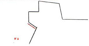
LOOPHOLE WALL and CASEMATE
The most unique section of the Princess Bastion was the loophole wall (mur meutričre). Extending from the salient angle of the Bastion to the retired battery, this wall looked out onto the sea and was not able to be attacked from the landward side. Behind the wall stood a casemate about which little was said to indicate how or why it was built. The exact use of the structure until the arrival of the English is unknown. And, after their departure from Louisbourg, its history becomes a complete mystery. There is no evidence to show that it was used in the same manner as the casemates of the King's Bastion.
In November, 1734 it was reported that the loophole wall was vaulted and raised 12 pieds. [94] A plan of the same year shows the wall pierced by seven loopholes and the casemate in place spanning five of these. There is nothing in the documents to indicate the number of loopholes in the wall-or the number within the bounds of the casemate. The inconsistency of the plans in this regard makes them of little help. Two plans show an empty space where the casemate should be. These show six loopholes. How many the casemate would have spanned cannot be determined.[95] Of the plans which show both loopholes and casemate, the variations are:
| No. of loopholes |
No. in bounds of casemate |
|
|
1734-3
(MAC 204)
1737-1 (MAC 37) 1737-3 (MAC 39) 1744 (Uncatalogued Contact Print) 1745-11 (MAC 73) |
7 9 10 8 7 |
5 6 5 6 5 |
A profile taken through the partially completed wall provides a cross-section of the wall, a loophole and the casemate. By scaling for dimensions it is possible to arrive at a set of approximate measurements. [96] (Plate 1; Figures 4 and 6)
|
(Dimensions scaled) |
toises | pieds | pouces |
|
Height
of
wall completed Height of wall projected Height of interior of casemate Height of covered firing step Height of loophole - outside Height of loophole - inside Full width of structure - at base Width of casemate Width of escarp Width of covered firing step Width of interior revetment Width of masonry vault |
2 3 1 1 - - 3 1 - - - 2 |
- 4 2 - 3 - - 2 3 2 5 4 |
- - 6 - 6 - - - - - - - |
By 1736 the loophole wall had been finished. [97] The best plan of the left side of the Princess Bastion appeared a year later. There are two variations of this plan:
1 - Neither loopholes nor casemate are shown. The barbette on the terreplein of the right face has been extended to the east wall of the Bastion. A few feet north of the barbette is a platform supported by eight posts and approached by two steps from the terreplein of the rampart. This platform would allow firing over the east wall. It does not appear that it would have been wide enough to hold cannon. The east wall continues down the right side of the retired battery to a point midway through the width of the battery, so that the platform would probably have made it possible to shoot over this also. [99] (Plate 3)
2 - Ten loopholes are revealed by raising the flap found on the above plan. These are backed by covered firing steps. The casemate is shown spanning five of the loopholes. No difference in elevation is indicated along the side of the retired battery. [99] (Plate 2)
Though there is no concrete evidence to single out the last version of this plan as the most accurate view of the left side of the Bastion, it would not appear unreasonable to suppose that it was. Some of the details on the plan were projections, but by 1737 the loophole wall and the casemate has been completed. Care was usually exercised by the French engineers when they dealt with such a limited area. The 1734 profile of the loophole wall coincides quite well with the picture given by this plan. A view of the city, albeit found on the same plan, shows the exterior of the Bastion. The loophole wall becomes lower at just about the place where the casemate would end on the inside. The lower section seems to be on the same level as the retired battery. The ten loopholes appear and are in the shade of inverted keyholes - long and narrow at the top and bulb-like at the bottom. These loopholes are surrounded by a different type of stone than that used in the wall itself. [100] In the absence of a detailed description, it would appear that this plan best portrays the loophole wall as it stood; at least, it contradicts nothing which is known. (Figure 9)
Prior to 1740 a request was made for 12, 4 and 2 calibre cannon with which to arm the ramparts and the loopholes of the Princess Bastion's left face. [101] It was reported in the latter part of 1740 that six cannon would be placed to protect the loophole wall so that it might defend the Crenelated Wall in case of an enemy landing on the beach before it. [102] There is no record of the guns having actually been placed in the loopholes.
During the 1745 siege, the French placed pickets along the low wall at the -southeast side of town in order to raise it to the same height as the other sections. [103] Whether or not these pickets were placed on the low part of the loophole wall cannot be determined. The French also reported that they put 10 foot boards (planches), pointed at one end and nailed with scaffolding nails, at the loopholes (aux meutrieres) in order to hinder an assault. [104] How these were positioned is hard to say. To place them anywhere at or near the loopholes would render the latter useless since they were not high enough to allow firing over the boards. They may, therefore, have been placed on top of the wall as a picket or along the shore, but there is no record to verify either possibility.
The English were not at all taken with the design of the Princess Bastion. Seeing no logical reason for its odd shape, they wished to remake it into a proper bastion having two flanks and two faces. Such a plan would necessarily mean the incapacitation,if not elimination, of the loophole wall.[105] A plan outlining the changes the English wished to make showed the Bastion enlarged along more regular lines. The casemate would disappear, and the terreplein of the rampart would extend all the way over to the loophole wall in which no openings were shown. The new left face would be pierced by three embrasures. It would seem that they did not plan on doing away with what was there, but rather would build on to the existing structure. [106] (Figure 15)
What actually did happen to the wall becomes extremely confusing in 1746. The casemate, it is known, was converted into a powder magazine by the English.[107] To do this, it would seem to have been necessary for them to close up the loopholes which were within the casemate. Did they also close those outside the casemate? Did they enlarge the covered area by adding on to the casemate? Did they adjust the terreplein of the rampart so as to extend it around to face east over the loophole wall?
These questions and others are raised by the English plans of 1746 and 1747. Unfortunately, none of them are answered in written accounts. Also unfortunate is the fact thatt almost without exception, the English plans are so poorly drawn that one cannot put faith in the detail they show. It would appear, however, that some sort of extension was added to the casemate and some arrangement was made to permit firing over the loophole wall. And, it would also seem that a firing step or platform was approached from the terreplein of the right face. The difficulty can best be illustrated by the presentation of several drawings made by the English following the first siege.[108] (Figures 20 and 21)
The problem does not become any less puzzling with the return of the French. If anything, the wall and the casemate fade farther into obscurity. A reference which may have applied to the loophole wall appeared in 1749. A list of artillery needed for the fort contained provision for the "loopholes" of the Princess Bastion. If these were the loopholes of the loophole wall, it would seem to indicate that all of the openings had not been blocked up. There is the possibility that it may have been a reference to the crenelations of the small left face and flanks variously called loopholes. In any case, the list read: [109]
| Effective in Battery | Calibre of Cannon | Total necessary |
Remaining to be sent |
| 0 | 4 | 6 | 6 |
The angle linking the loophole wall with the retired
battery had several "encroachments" and a total defacement of
the masonry joints in 1749. Weather and lack of maintenance were blamed
for these adverse conditions. [110]
According to the toisé of the same year, the loophole wall was to
receive the same covering of pine frames and pine planked revetment as the
right face and flank. Twenty-seven pieces of pine 18
pieds long were required for the job. Their
total length equaled 486 [286 is given in the document, but
this is probably an error] pieds, and their width was 7 pieds
8 pouces. The length of the wall was given as 18 toises, with
an average height of 3 toises. Fifty-four clamps, weighing
1080L, and 6 toises of sod were also needed.
[111]
From this point forward both the loophole wall and the casemate drift into oblivion. Most plans show no trace of the casemate. A few plans show an outline of the casemate with the terreplein of the rampart appearing to extend to the old loophole wall and around to face east over it in a manner similar to that portrayed by the English in 1745-46. (Figure 22, 31 and 34)
In 1758 Franquet stated that the wall which could be considered the left face of the Princess Bastion had been thickened "d'un parapet de 18 pieds" and pierced by a postern. [113] There is no other record of a parapet having ever been formed at the loophole wall previous to this time. According to the 1734 profile mentioned above, the full width of the wall - with casemate - was 18 pieds. In his reference, Franquet had stated that the wall itself was only 4 pieds thick. Perhaps at this time, or at some previous date, the area over the casemate had been built up to form a parapet. If this were the case, it was possibly this arrangement which was being shown on the drawings of the 1740's and 1750's when it appeared as if provision had been made to fire over the casemate from an adjusted terreplein.
The postern which Franquet mentioned was shown on a 1757 plan [the plan is undated, but because of other evidence is presumed to be from 1757] as a tunnel through the covered area behind the loophole wall. [114] (Figure 31) More likely it was as shown on the demolition plans; that is, a passage between the old casemate and the extension. [115] (Figures 35 and 37)
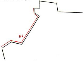
RETIRED BATTERY
The first reference to the retired battery of the Princess Bastion came in 1734 when it was noted that it had been raised to a height of 10 pieds. [116]A plan of the same year shows this section partially completed. [117] (Figure 4) By August of the next year the part of the left face remaining to be raised had reached its full height. [118] This, presumably, included the retired battery since, in October of that year, it was reported that three embrasures had been perfected and their summits [probably the tops of the merlons] covered with sod and earth 2 pieds in depth. [119] The sod, Verrier felt, would protect the embrasures against the ravages of weather. [120]
It was pointed out on a plan from 1737 that the terreplein of the retired battery had not yet been completed. [121] (Figure 8) When this remaining work was done cannot be said. A second plan from the same year shows the retired battery in its final form. However, projections were put on this plan along with the accomplished works. Therefore, it may be assumed that the terreplein of the battery was being represented as a project. (Plate 3)
Exactly when the battery's terreplein was finally completed is not certain. A plan drawn in 1739 does seem to show the retired battery with a finished terreplein; [123] however, it lacks one feature which does appear on a 1740 plan. [124] The missing feature is the set of steps which apparently led from the terreplein of the Bastion to that of the retired battery at the latter's northwest corner. These steps seem to have served in place of the ramp which was usually employed at a raised work. Whether the steps had been omitted from the 1739 plan because they had not yet been formed or because of carelessness on the part of the artist cannot be determined. (Figures 12 and 13)
From the time of its completion to the English occupation, the retired battery does not seem to have been of much concern to anyone. Even after the arrival of the English, it was only a secondary consideration at best. For, like the loophole wall, it would have been a useless work had they gone ahead with their plans to alter the Bastion. The plan from 1745 on which the English outlined their scheme shows three walls extending from the loophole wall to the proposed left face. The elevation of the three walls was not given, but since the retired battery itself was approximately 18 pieds high, [125] it is possible that these would have served to cut off the battery's range of fire. [126] (Figure 15)
If the retired battery was a forgotten entity before 1749, subsequent to that date it became a paramount consideration. Facing, as it did, Cap Noir, this was only natural. The extreme concern over the menace created by this hill would almost make inescapable thoughts of rendering the battery more effective, or, to put it more precisely though more negatively, less vulnerable.
According, to Franquet, this wall was the only one along the seaward front which was not reveted with planking, and it was, consequently, falling in rains. [127] In 1749 there had been a plan to revet this battery in pine planking in the manner described previously (Chapter 1 of this section, page 14) but it was never carried further than the planning stage. However, the provisional toisé for the project listed the following dimensions:
Pine woodwork - 17 pieces 18 pieds long
Length (total) 306 - 0
Width 7 - 8 119-0-0
Pine planking 2 pouces thick
Length 11 - 0 - 0
Height 3 - 0 - 0 33-0-0
Parapet above
length 11 - 0 - 0 20-2-0
Width (developed) 2 - 4 - 0
Iron clamps - 54 weighing 1080L [128]
Masonry
Length 11 - 0 - 0
Height 3 - 0 - 0
Thickness 0 - 2 - 6 13-4-6
Parapet above including embrasures and merlons
Length 11 - 0 - 0
Height (average) 3 - 0 - 0 10-4-2
Thickness 1 - 1 - 0
Sod - 6 toises [129]
In the course of the Bastion's demolition in 1760, the English recorded the length of the battery as 66 feet. This figure is quite close to the French figure in the above toisée - 66 pieds (70 feet 4 1/2 inches). [130]
In 1751 new plans were made to raise and thicken the retired battery, keeping in tact the three embrasures.[131] The expenses for this project included:
80 cubic toises of earth at 9" ............................................. 720: 0: 0:
198 cubic toises of gravel at 10" ....................................... 1980: 0: 0:
24 cubic toises of masonry at 125" ................................... 3000: 0: 0:
34 square toises of sod at 5" ............................................. 170: 0: 0:
32 pine wood beams at 3" .................................................. 96: 0: 0:
28 square toises of planks 2 pouces thick
at 12" 16s ........................................... 318: 8: 0:
320L of iron at 9s ............................................................... 144: 0: 0:
____________
6468: 8: 0:
As shown on the plans drawn to illustrate the projects, the retired battery would have disappeared had the whole Bastion been enlarged and a new left face formed. [133] (Plates 8 and 9) And, since such an enlargement appears on the plans of the works ordered by the King, it would seem that the battery was to be eliminated as a problem. [134] (Plates 10, 11, 12 and 13) However, since more modest goals had to be settled for, the retired battery remained and work on it continued. It was declared by Franquet in 1755 to be one of the most critical points in the place. [135]
The left side of the Bastion was to be strengthened by the extension of the covert way and the right face. These extensions were to cover the retired battery. If, however, the face were not enlarged, it was thought that a palisade should be placed from the retired battery to the extended covert way. [136] (Plate 6) The face did receive its addition and the idea of a palisade was abandoned. Nevertheless a similar idea was put into effect when the foundations were laid for a wall facing the sea which would run from the battery to the covert way, meeting en route the right face and the contregard which was built in front of the face. [137] (Figures 31, 32, 34 and 37)
To correct the faults of the battery itself, work was done to thicken it with earth and fascines. Its parapet - whether before or after repairs is not known - was 18 pieds wide. [138] The battery lasted throughout the siege, emerging from the ordeal in relatively good condition. [139] At the surrender three 24 pound cannon were found in place on its terreplein. [146] During the demolition, it was found that the battery stood on earth that was composed of small stones and sand. [141]