Table des Matičres
Search
Website Design and Content © by Eric Krause,
Krause House Info-Research Solutions (© 1996)
All Images © Parks Canada Except
Where Noted Otherwise
Report/Rapport © Parks Canada / Parcs Canada
---
Report Assembly/Rapport de l'assemblée © Krause
House
Info-Research Solutions
Researching the
Fortress of Louisbourg National Historic Site of Canada
Recherche sur la Forteresse-de-Louisbourg Lieu historique national du Canada
PRINCESS
BASTION REPORT:
A SURVEY OF THE AREA FROM THE RIGHT REENTRANT
ANGLE OF THE PRINCESS BASTION TO THE RIGHT REENTRANT
ANGLE OF THE BROUILLAN BASTION, AND THE RELATION OF THIS
AREA TO CAP NOIR
BY
MARGARET FORTIER
February, 1966
(Supervision: W. Stevenson, J. Hanna)
(Fortress of Louisbourg Report H B 3)
Presently,
only some illustrations are
included here.
For all of them, please consult the original report in the archives of the Fortress of Louisbourg
![]() Return/retour
- Table of Contents/
Return/retour
- Table of Contents/
Table des Matičres
APPENDIX
The purpose of this appendix is to bring together the various bits of information which, while dealing with the Princess Bastion, did not fit in any particular section of the report. The evidence for each heading to be discussed is not staggering. In some cases the lack of information is the significant feature. When a facet of these topics was previously discussed in the body of the report, it has not been repeated.
I - Artillery At The Princess Bastion
The various references to the number of cannon found at the several parts of the Bastion have been dealt with. However, there are three references which pertain to the Bastion as a whole.
In 1745 it was stated by an Englishman that Louisbourg held some 100 cannon at its capture. Six out of the 100 cannon were found to be brass. The "South East Corner" - the area occupied by the Princess Bastion - was said to hold three of the brass guns. [533]
A list of artillery compiled by the English in 1757 contains reference to both the "Prince of Orange's" Bastion (the name given the Princess Bastion by the English after the first siege) and Collier's Battery (the name used for the Bastion by the English in the 1750's). Which of these actually was the Princess Bastion in this instance is not certain. The list reads: [534]
Guns Mortars
|
Name of Battery |
43 pds |
32 pds |
24 pds |
18 pds |
12 pds |
9 pds |
6 pds |
4 pds |
to- tal |
13" | 10 1/2" | 10" | 7 1/2" | 5 1/2" | 4 1/2" | to- tal |
|
Prince of Orange's |
9 | 4 | 13 | 0 | ||||||||||||
|
Collier's Battery |
6 | 6 | 2 | 2 |
Following the 1758 siege a man named Gordon recorded in his diary that "Collier's Battery" held 6 nine pound, 8 twenty-four pound and 1 forty-two pound cannon. [535]
II - Unidentified Buildings
During the first siege, Roger Walcott reported that the French had set fire to some houses outside of the wall at the "South East" gate. Since there was no gate which faced southeast, it is not easy to determine the nature or number of the buildings referred to. The Porte de la Reine - the South Gate - opened upon very marshy land, and it is not likely that any houses would have been located there. The East Gate, or the Porte Maurepas, opened onto Rochefort Point where there definitely had been houses erected. However, there is no apparent reason for the French to have fired the buildings in this area. The French did burn houses located before the Porte Dauphine, but this gate was on the northwest side of the city. It may simply have been the Walcott's sense of direction was faulty. [536]
A view of the city drawn in 1758 shows a building just north of Cap Noir. There is every reason to believe that this had been constructed as a shelter for the men working on Cap Noir in the 1750's or as a storehouse for their tools. [537]
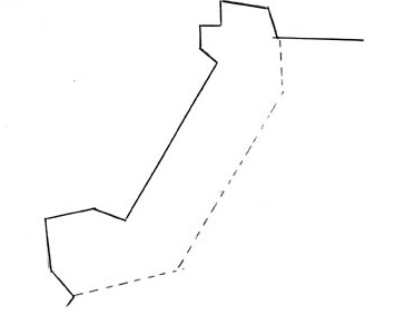
A few plans show some sort of structure standing along the right side of the retired battery. This does not appear prior to 1745, and is shown on only one plan subsequent to that date. The extension of the casemate which was spoken of previously (Section II, Chapter 3, page 3l ) overlaps the ground occupied by this building on the plans from 1746 and the years thereafter. The size of the building varies from drawing to drawing. [538] (Figures 17, 18 and 19)
A very small building at the northwest corner of the terreplein of the retired battery appears on two 1746 plans. Located. very near the stairs which led from the terreplein of the Bastion to that of the battery there is no indication given of the function of this structure. [539] (Figure 21, no. 1 and no. 2)
III - Cordon
Whether there was a cordon at the Princess Bastion is as difficult to determine as it is with the other sections of the fortifications. On innumerable occasions the term "jusqu'au cordon" was used by the French, and the English also seem to have found the cordon to be a handy level for describing construction progress. In the Demolition Report of 1760, the phrase "at the cordon" was used in reference to a measurement taken on the inside of the retired battery following the collapse of the earth there. [540]
A 1737 view of the Princess Bastion shows a heavy line extending around the Bastion from the retired battery up to, and including, the right face. [541] (Figure 9) This line is situated precisely where a cordon would be were one in place. Several projected features are depicted on this view, but by this time both the right face and the retired battery had been completed, and the view would seem to be accurate in most of the details of existing features which are shown.
IV - Flagstaffs
A plan drawn in 1745 shows a flagstaff perched atop the cavalier of the Princess Bastion. This plan is rather impressionistic in most of its representations, and cannot be taken too seriously. [542] However, a 1758 view of Louisbourg, though also crudely drawn, might be deemed more creditable. This view has been found to be correct in most of the small details shown at the Princess. The flagstaff, in this case, is shown on the right face of the Bastion. [543]
V - Guerrites
A guerrite appears on two plans which were drawn prior to the construction of the Princess Bastion. The first, dated 1723 but probably a much later plan, shows a pentagonal guerrite at the right shoulder angle of the Bastion. [544] A view of Louisbourg dated 1731 seems to show a guerrite at the Bastion's salient angle. [545] In 1735 one of the plans which outlines the progress of construction around the city depicted the formation of a passage which would lead to a guerrite at the right shoulder angle of the Princess Bastion. [546] (Figure 7) The guerrite - pentagonal in shape - did not appear on a plan again until 1737. [547] (Figure 8)
No written evidence for the guerrite at the Princess Bastion has been found prior to 1749. There was one 1745 reference to three "Watch Boxes" of hewn stone which were located on the wall of the city. Two of these, it was said, had been beaten down by the English during the siege. [548] It cannot, of course, be said with certainty that the guerrite at the Princess was included in this reference; however, in 1749 Boucher reported that the Bastion's guerrite had been demolished to the cordon. [549] Later that year, he stated that the guerrites at the Princess, Dauphin and King's Bastions had been broken to the cul de lamp. It is not known whether the top or the bottom of the cul de lamp corresponded with the level of the cordon. Six hundred square pieds of facing were said to be necessary for the repair of the guerrites at the three bastions. [550]
Only one 1751 plan of the works in their unaltered state shows the Princess Bastion with a guerrite at its right shoulder angle. [551] Two others show the passage to the guerrite, but not the guerrite itself. [552] None of the 1751 projects appear to have included provision for a rebuilt guerrite. Nevertheless, it was stated in 1753 that there were 45 wooden guerrites on the ramparts and in the interior of the city, and that these, being in poor condition, would be replaced ten at a time until all had been taken care of. Around the angles of the enceinte there were masonry guerrites, one of which had been so badly damaged that all that remained was the cul de lampe. The less damaged guerrites had been covered with boards and shingles, but no provision seems to have been made for repairing their masonry. [553]
The plans of the works ordered by the King in the 1750's do not show a guerrite at the Princess Bastion. The parapets of the face and flank were to meet at the shoulder angle. No passage would separate them. [554] (Plates 10, 11, 12 and 13)
What actually happened to the guerrite and its passage is not entirely clear. The guerrite itself does not appear on any of the plans which show in detail the work done in the 1750's. It has disappeared permanently from the poorly drawn plans also. It might be assumed, therefore, that the guerrite, badly damaged during the first siege, had never been rebuilt. Two of the better plans however, do show the passage for the guerrite still in place. [555] (Figures 32 and 34) When the work on the parapet of the right face was done, it would have been possible to block up the passage and continue the parapet so that it would meet that of the flank. But, it is also possible that the French did intend to repair the guerrite, and, therefore, decided to leave the passage intact.
It is probable, accepting the plans evidence as correct, that the guerrite at the Princess Bastion was pentagonal in shape. A few plans do show a round guerrite, but they are minority and are not as well drawn. [556]
VI Palisades
A - On the Covert Way
The first of two plans which indicate the presence of palisades along the covert way in front of the Princess Bastion was drawn in 1737. [557] The only other plan appeared in 1745. [558]
An estimate of repairs made in 1749 lists 171 toises running of palisades needed for the covert way from the salient angle of the Queen's Bastion to the Princess Bastion. This figure included provision for the place of arms opposite the Porte de la Reine. [559]
In 1751 an Etat Général contained a reference to the palisades which would be needed to replace those of the old works on the Princess-Queen's front and to strengthen the new works which had been projected. For the two branches of the covert way, the two faces of the reentrant place of arms, the two traverses and their passages, and the crochets they required 180 toises of palisades 8 1/2 pieds long and 16 toises of palisades 11 1/2 pieds long. A traverse to the left of the proposed salient place of arms, its passage and crochet would need 5 toises of palisades of the first length given above and 7 toises of the second length. [560]
It was reported in August of 1756 that the whole "circumference" of the covert way would be entirely palisaded by the fall of that year. [561] No palisades were shown on either the 1751 or the 1756 profiles of the covert way. [562] In June of 1757 it was stated that the covert way which surrounded the demi-lune and contregard had been palisaded. [563] Palisades were shown on the profile which accompanied the one of 1760 demolition plans. [564] (Figure 34)
B - 1745 Picket
During the 1745 siege the French place a palisade, or picket, within the city. It extended from the right reentrant angle of the Princess Bastion to the left reentrant angle of the Brouillan Bastions Constructed to act as a blockade in the event that the Crenelated Wall - itself topped with palisades - was scaled by the English, [565] the picket stood 8 feet high. [566] Several passages through the picket are shown on two of the plans..[567]
These appear, on one plan, to be backed by more palisades. [568]
VII - Ramp
On all plans there is a ramp shown leading from the terreplein of the Bastion to that of the rampart along the right flank of the Princess Bastion. It begins near the right reentrant angle and ends opposite the right shoulder angle. Nothing further is known of this ramp. The Demolition Report gives a figure for the width of the slope of the rampart of the right flank which seems to include the ramp. If this is the case, and if it can be assumed that the width-at-the right flank closely approximated that at the right face the width of the ramp must have been between 13 and 16 feet. [569]
VIII - Salient Angle
During the years prior to the extension of the right f of the Princess Bastion, few of the well-drawn plans show the salient angle of the Princess Bastion to be pointed. During the 1750's, however, those plans which show the extended right face tend to show a pointed, angle. Taking together all the plans which do not show the extension of the face, the variations are
| Rounded | Flat (Squared Off) | Pointed |
|
1723-1 (MAC 10) |
1734-3 (MAC 204) 1737-1 (MAC 37) 1741 (Contact Print) 1744 (Uncatalogued Contact Print) 1745-11 (MAC 73) |
1735-1 (MAC 215) 1742 (Contact Print) 1745-3 (MAC 174) 1745-17 (MAC 79) 1745-20 (MAC 82) 1745-21 (MAC 84) 1745-26 (MAC 121) 1746-1 (MAC 90) 1746-2 (MAC 91) 1746-4 (MAC 93) 1746-5 MAC 94) 1746-6 (MAC 172) 1746-7 (MAC 169) 1746-8 (MAC 228) 1747-1 (MAC 86) 1751-10a (MAC 203a) 1751-17a (MAC 209a) 1751 (Uncatalogued Contact Print, No. 20) 1756-1 (MAC 96) N.D. (Uncatalogued Contact Print No. 32) N.D. C1IA (Vol. 126) |
Numerically, it would seem that the Princess Bastion's salient angle was pointed. However, as was stated the few "pre-extension" plans which show a flat angle are generally more accurate than the long list of those which do not.
IX - Miscellaneous
Two 1751 Plans show one or two steps on the retired battery's terreplein. These are adjacent to the battery's flank, and it would appear that their presence would serve to allow firing over the wall. Neither of the plans represent a project, and the step or steps do not appear on any other plans. [570] (Figure 26)