|
3.0
Strategic Direction for Commemorative Integrity, 3.5 Visitor Services and Access A. Services in the Reconstructed Townsite Parks Canada provides, either directly or through others, a wide range of services. Most of these have been referenced in previous sections. Approximately 130,000 visitors per year come to the reconstructed townsite and stay for an average of four hours each.
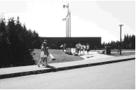
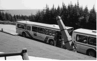
The visitor reception centre links services to the reconstructed townsite, and provides exhibits, washrooms, telephones, local information, a gift shop, and a reservation system for tours and group visits. An elevator provides improved access for visitors using wheelchairs. Bus transportation is provided to visitors from the visitor centre to the reconstructed townsite. (The service is included in the entrance fee.) The transit buses are equipped with lifts for transporting visitors who use wheelchairs. There is an interpretive walking trail through the ruins to Rochefort Point, starting at the edge of the reconstructed townsite. There are self-guiding pamphlets at the trailhead. Plans are progressing for the provision of a day camp program, food services have been expanded in recent years, and closed captioning is now available for audio-visual programs in the theme lounges.
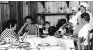
Accessibility to and within the reconstructed townsite continues to be an important issue, particularly in light of the increasing number of visits by senior citizens. Efforts have been made to address this issue, and an Access Plan has resulted in improved services for visitors with disabilities. The main problem remaining is the number of vehicles requiring parking behind the museum building, particularly vehicles of visitors with limited mobility. Service planning efforts to date have identified additional services based on visitor needs. These include bus loop facilities, a ferry service from the modern community of Louisbourg to the Frederick Gate, picnic areas, expanded washrooms, access to the exterior of the fortifications, concessions, and various opportunities for increased interpretation. The public have indicated that an expansion of services within the reconstructed townsite would be welcomed such as accommodations in reconstructed buildings, costume rentals and craft outlets. A suggestion that modern food be available has already been acted upon. In the past few years the Fortress has become increasingly popular as a "set" for films. Film projects can have a major impact on staff time, resources and visitor experience, yet they have major revenue potential, not only for the Fortress but also for the local communities. Strategic Actions
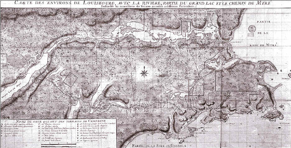
B. Services in Other Areas of the Site Although Fortress of Louisbourg National Historic Site of Canada encompasses a land base of 6,000 hectares, the emphasis has been placed on services and interpretation programs within the reconstructed townsite since major development began in 1961. Most financial resources have been allocated to support and recreate the "moment in time" approach for which the Site is best known.
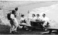
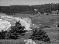
Traditional use of other areas led to the development of some services, such as at Lighthouse Point, Kennelly's Point, the Royal Battery, Marconi picnic site, and Kennington Cove [MAP 6]. These areas are all of historic interest, but the main focus has generally been on recreational pursuits. All of these sites have some basic services, and most have interpretive signs. Lifeguard services are available at Kennington Cove during July and August. There are interpretive trails at the Royal Battery, as well as the Mi'kmaq trail near the visitor reception centre. Picnic tables are located at various locations. Angling is popular at a number of the lakes and streams.
During the winter months, the Kennington Cove Road and a segment of the old French Road, starting from the water tower, are groomed and maintained as cross-country ski trails. There are other trails, but they are not groomed. The trails vary in degree of difficulty, but range mainly from novice to intermediate levels.
Service planning efforts at the Site have identified a number of potential opportunities for service improvements based on visitor needs and expectations. These include improved facilities at Kennington Cove, more natural history interpretation, development of ocean look-offs and viewpoints, enhanced interpretation of the Marconi site and the Royal Battery, development of interpretive trails, and trailhead facilities for hiking, cross-country skiing and mountain biking. Site staff wish to enhance and enrich the visitor experience and encourage visitors to stay longer. This can be accomplished by diversifying attractions and opportunities throughout the Site. Nevertheless, Parks Canada is no longer in a position to increase facilities or to assume ongoing costs associated with new or enhanced facilities. In the current operational environment, improving services through partnerships and cooperation with others, must be viewed as the primary course of action. Some improvements are actively being considered in partnership with others such as the Kennington Cove day use area. Yet there are other issues that will have an impact on future services for visitors, e.g., the development of the Fleur-de-lis Trail. Additional and/or improved services require properly maintained access. Present National Historic Park regulations are inadequate to allow for proper protection of resources, and the management and control of certain activities. For example, angling is prohibited under present regulations and National Park Business Regulations do not apply. Strategic Actions
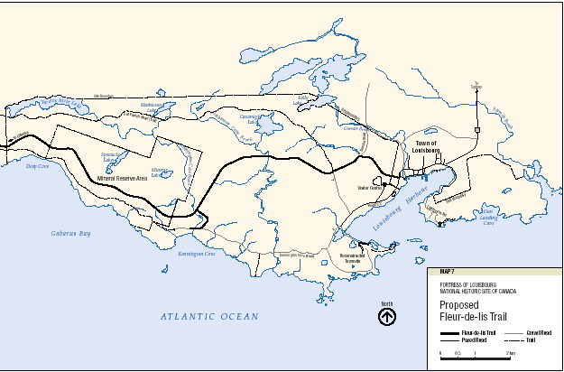
C. Visitor Access and Circulation In addition to the numerous roads which existed historically at Louisbourg, associated with the 18th century community and the two sieges, there are a number of modern roads which provide access and circulation for visitors. Work is also under way for the tourist highway, the Fleur-de-lis Trail, part of which will pass through Fortress of Louisbourg National Historic Site of Canada. Some of the roads follow historic alignments. The following sections discuss and provide direction for the management of these roads. i) Fleur-de-lis Trail In 1994, a federal-provincial government announcement was made of plans to complete the Trail from St. Peters to the modern town of Louisbourg including that section that will link Gabarus to Louisbourg through the National Historic Site. About 100 kilometres of road in total will be constructed or upgraded. Approximately 15 kilometres of new road will be required through the Site. The Fleur-de-lis Trail is part of a system of tourist auto travelways in the province. They are used extensively for promotion and marketing purposes in provincial tourism literature. The extension of the Trail has been sought so that a circular route would be available to tourists either heading to or leaving the Sydney/ Louisbourg area and eastern Cape Breton Island. The completion will place Fortress of Louisbourg on one of the main provincial travelways rather than at the end of Highway #22. It is generally accepted that the completion will have a positive impact on the number of visitors to the local area and the local economy. For many years Parks Canada has given conditional support to the completion of the section of road that will run through the Site. Support has been contingent on all costs, both capital and maintenance, being the responsibility of the province or some other agency, Parks Canada having approval over the final alignment, and an environmental assessment of the proposed route being carried out. As well, the proposed route must not impair the commemorative integrity of the National Historic Site. This is of paramount importance in selecting route options and the final alignment.
Most of Fortress of Louisbourg National Historic Site of Canada has been proclaimed under the National Parks Act for administrative purposes. The construction of the Trail would be permissible through the Site under Section II of the Act. A proposed alignment has been identified and an environmental assessment of cultural and natural resources is complete [MAP 7]. Construction of the road through the Site will be based on a federal-provincial agreement that will transfer the land for the road corridor to the province and set the conditions for transfer.
The Trail will have direct implications for other roads within the Site, particularly access to Kennington Cove, a popular day use area for many visitors. The Trail will provide an opportunity to consider a new public vehicular access to the Cove instead of along the narrow gravel road past the reconstructed Fortress. Strategic Actions
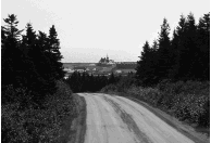
ii) Kennington Cove Road The Kennington Cove Road is a section of the former Gabarus-Louisbourg road. This dirt/gravel road is approximately six kilometres long. It provides vehicular access to a number of day-use areas and facilities, such as the beaches and picnic areas at Kennington Cove. The road is closed to vehicular traffic in the off-season to ensure that the Site's wintering concentration area for white-tailed deer is not disturbed by vehicular traffic. The closure allows for the quiet enjoyment by hikers of the heritage resources in the area. In winter the road is used as a cross-country ski trail. The Kennington Cove Road is not maintained adequately for the current level of vehicular use. Improving the road will lead to higher costs and potential conflicts with the protection of archaeological resources. Much of the roadway runs through archaeologically sensitive areas containing 18th century resources (Level I). Some sections of the roadbed were constructed during the second siege of Louisbourg. The construction of the Fleur-de-lis Trail will provide an opportunity to build a new road to Kennington Cove. This will substantially improve access and further ensure the integrity of Level I cultural resources along the present Kennington Cove road. Service Road This road, off the Kennington Cove Road, provides a service entrance to the reconstructed townsite. In addition to service vehicles, it is used by the vehicles of visitors with disabilities, and, in severe weather, by buses. Access is controlled by a gate where this road branches off from the Kennington Cove Road. The gate helps to control traffic, to protect heritage resources, including a Level I cultural landscape, and to minimize maintenance costs. Strategic Actions
iii) Lighthouse Road The Lighthouse Road is a gravel road approximately 1.6 kilometres long that provides access to Lighthouse Point. The road ends at a parking lot adjacent to the most recent lighthouse at the Point, and the ruins of the first lighthouse in Canada - a National Historic Site. The Point is also the site of siege and artillery batteries associated with the 1745 and 1758 sieges. Lighthouse Road also provides access to Careening Cove, where the French serviced the hulls of ships in the 18th century, to Kennelly's picnic area, and to informal trails past the Point. Given the historic use of the Point, there are both Level 1 and 2 cultural resources adjacent to and within sections of the roadbed. The road is generally of a poor standard, but it receives considerable use by local residents who wish to observe sea conditions and marine traffic. There is also the potential for additional traffic based on possible future facilities and services such as the development of a coastal interpretive trail. Road design, safety concerns, maintenance levels and winter use all require attention. Strategic Actions:
iv) Route 22 The French developed trails around the harbour after Louisbourg was founded in 1713, and then constructed the Chemin du Nord in the 1730s to connect the Fortress to the Royal Battery as well as to fishing and commercial establishments along the shore. The road also extended to the outlying communities of Petit Laurembec and Baleine. The completion of the road in 1734 made it one of the first roads in Nova Scotia. The road has been part of the cultural landscape here ever since. Today, most sections of the former route 22 are on the same alignment and roadbed as that of the 1730s. The road has thus seen continuous use and maintenance for over two and one-half centuries [MAP 8].
The modern section of route 22 within the Site's boundaries, was constructed in 1936 and paved in 1958. In places, the surface has deteriorated substantially. The road is also too narrow to permit the Site's transit buses to pass each other without travelling on the narrow gravel shoulder. Parks Canada has undertaken an evaluation of route 22 and determined that upgrading is required from the Site boundary through the bus loop near the reconstructed townsite. Environmental assessments have been or will be carried out to ensure archaeological resources are protected. The gate on former route 22, now located at the Stella Maris cemetery, is used only when the transit buses are operating from June to September. The condition of the road is a factor in this decision. When the safety considerations associated with the road are addressed, the gate at the Stella Maris cemetery will be removed. Strategic Actions
3.6 LANDBASE A. Site Boundaries and Mineral Reserve Area Throughout the 1940s, '50s and '60s, a number of federal and provincial orders-in-council were issued identifying the lands comprising the National Historic Site. These reflected a growing land base under the administration of Parks Canada. The most recent federal order-in-council occurred in 1976 and identifies the current legal description of the Site and conditions of transfer. Two years later the lands were set aside as a National Historic Park under the National Historic Parks Order of the National Parks Act, Chapter 1112. The derivation of the current boundaries stems from the 1960s when the last major expansion occurred. Factors at play at the time included the known and potential location of 18th century archaeological resources, documentation on 18th century occupation and military activity, protection of watersheds and the Town's water supply source, and the location of the Old French Road. The province acquired and transferred all lands to the federal crown within what are identified as Lots 1, 2 and 3. However, the province retained the administration and control of the mineral rights in Lot 3 and a right of access across Lot 1 to Lot 3. Lot 3 was never proclaimed and thus is exempted from the legal description of the National Historic Park. As a result, Lot 3, which comprises an area of about 1000 hectares, is a federal crown land enclave within the boundaries of the Site. The order-in-council specifically identifies the province has retained the administration and control of the mineral rights, not the subsurface rights, that would be inclusive of below-ground cultural resources. There are three conditions identified in the order-in-council for the transfer of lands within Lot 3 (wording is paraphrased);
In addition, there are now two pieces of legislation that bear on any future mining activity: An Act Respecting Mineral Resources (amended 1992) that governs mining activity in Nova Scotia, and the Canadian Environmental Assessment Act. Furthermore, Parks Canada's Cultural Resource Management policy would guide any response to mining activity in the reserve. Mineral claims extend back decades indicating interest in mineral exploration and extraction before the current boundaries were established. During the 1960s and 1970s, exploration activity took place but in the last ten to fifteen years, no known activity in the reserve has occurred. The lack of activity is a reflection of any number of factors. What can be stated is that after decades of exploration, no mining extraction proposals have surfaced. The potential for doing so, however, is always present. Parks Canada's foremost objective is to ensure the commemorative integrity of the Site. Parks Canada is also to demonstrate environmental stewardship of the natural resources it administers by placing emphasis on the protection of those resources that can contribute to ecological integrity. Any evaluation of the current boundaries including the mineral reserve area needs to be undertaken within this context. Several considerations are relevant:
Strategic Actions
|