FortressMaps
Website Design and Content
© by Eric Krause, Krause House
Info-Research Solutions (© 1996)
All Images ©
Parks Canada Unless Otherwise Designated
Report/Rapport ©
Krause House Info-Research
Solutions
Researching
the Fortress of Louisbourg National Historic Site of Canada
Recherche sur la Forteresse-de-Louisbourg Lieu historique national du Canada
![]()
LOUISBOURG MAPS AND PLANS:
All Maps and Plans © Institution Holding the Original
For additional text and the name of the institution holding the original
UNIVERSITY OF MICHIGAN
WILLIAM L. CLEMENTS IMAGE BANK
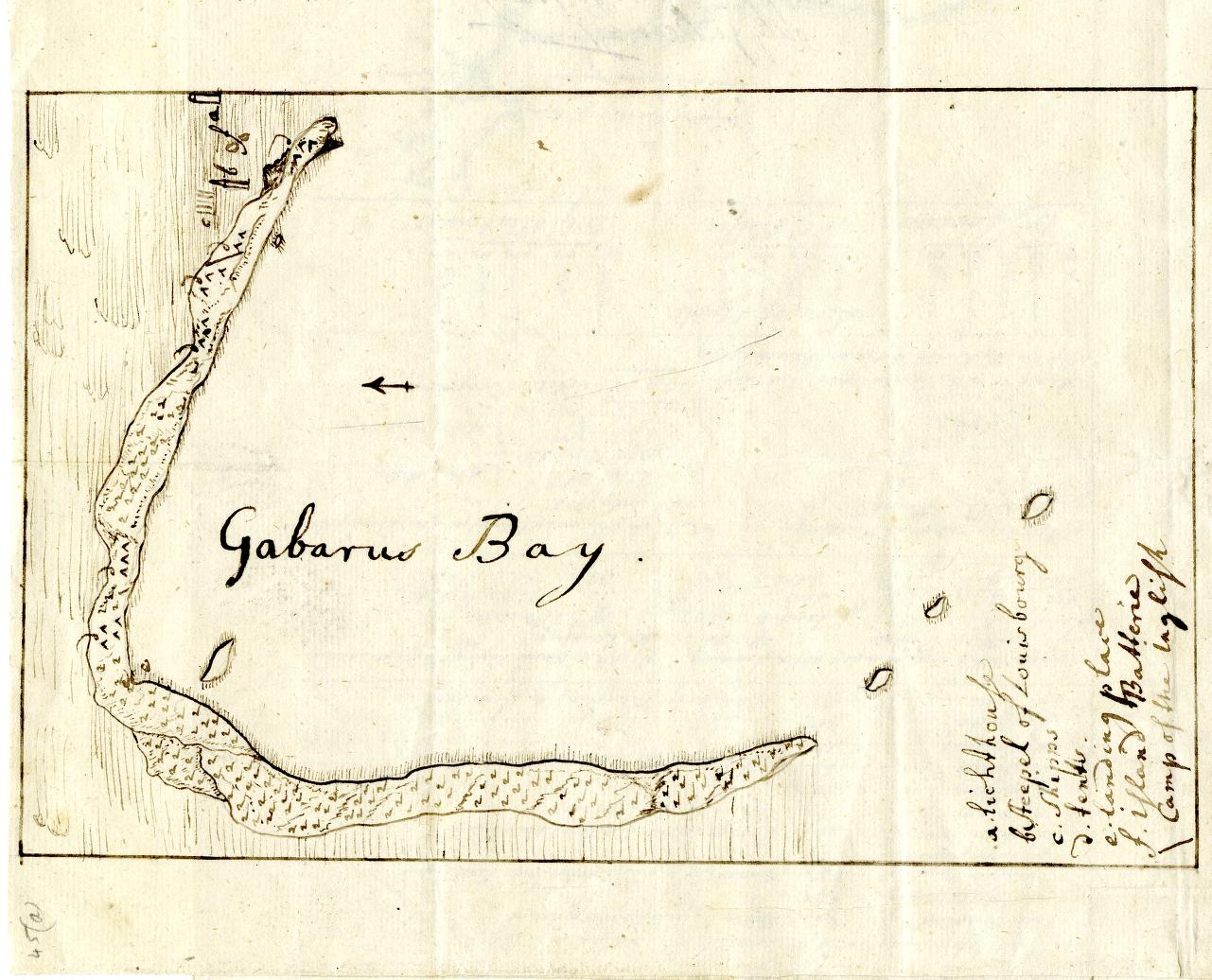
Gabarus Bay
NOTDATED-1 [U-M]
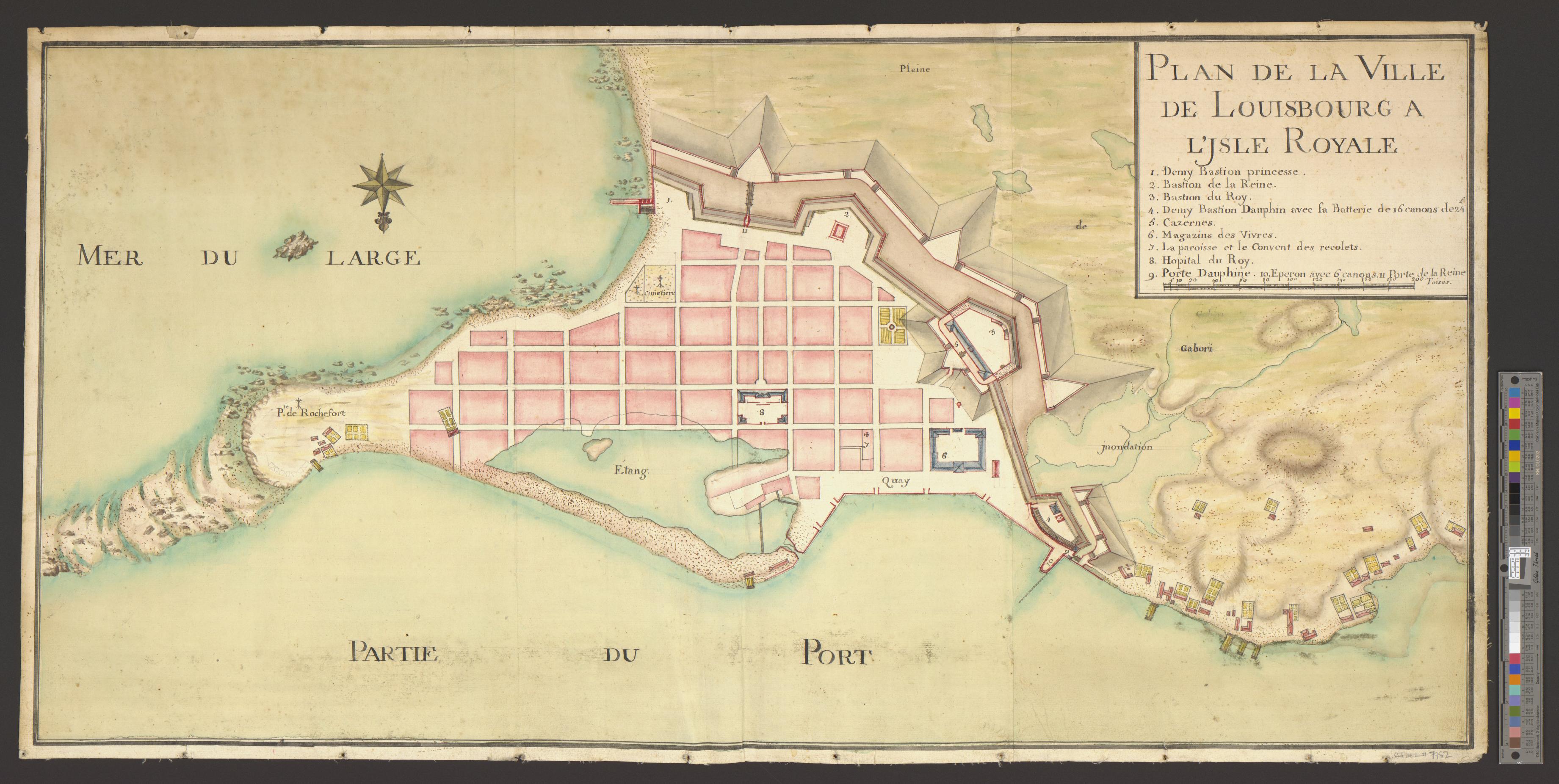
PLAN DE LA VILLE DE LOUISBOURG A L'ISLE ROYALE
NOTDATED-2 [U-M]
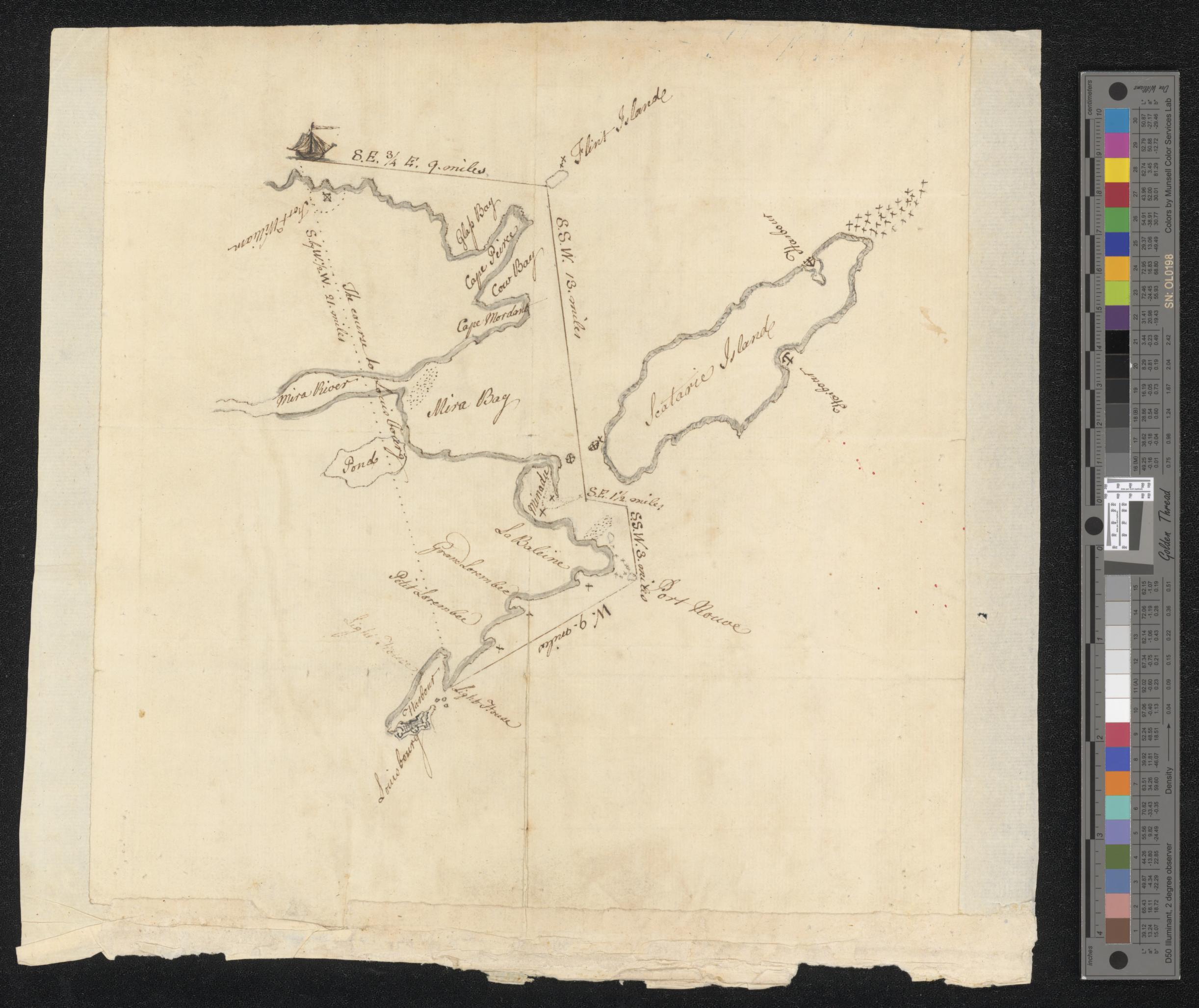
[Map of the coast of Cape Breton from Fort William to Louisbourg].
NOTDATED-3 [U-M]
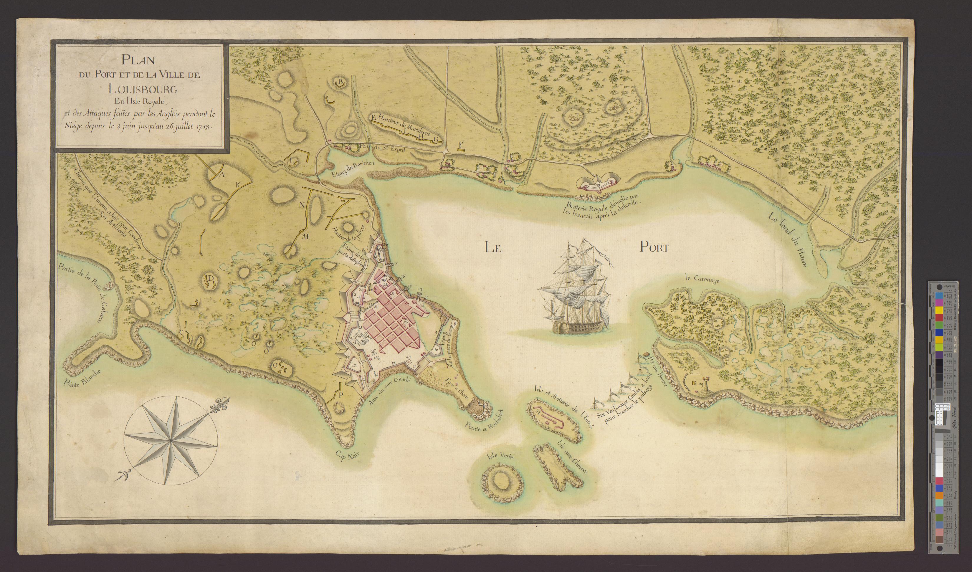
PLAN DU PORT ET DE LA VILLE DE LOUISBOURG en l'Isle Royale, et des Attaques faites par les Anglois pendant le Siége depuis le 8 juin jusqu'au 26 juillet 1758.
NOTDATED-4 [U-M]
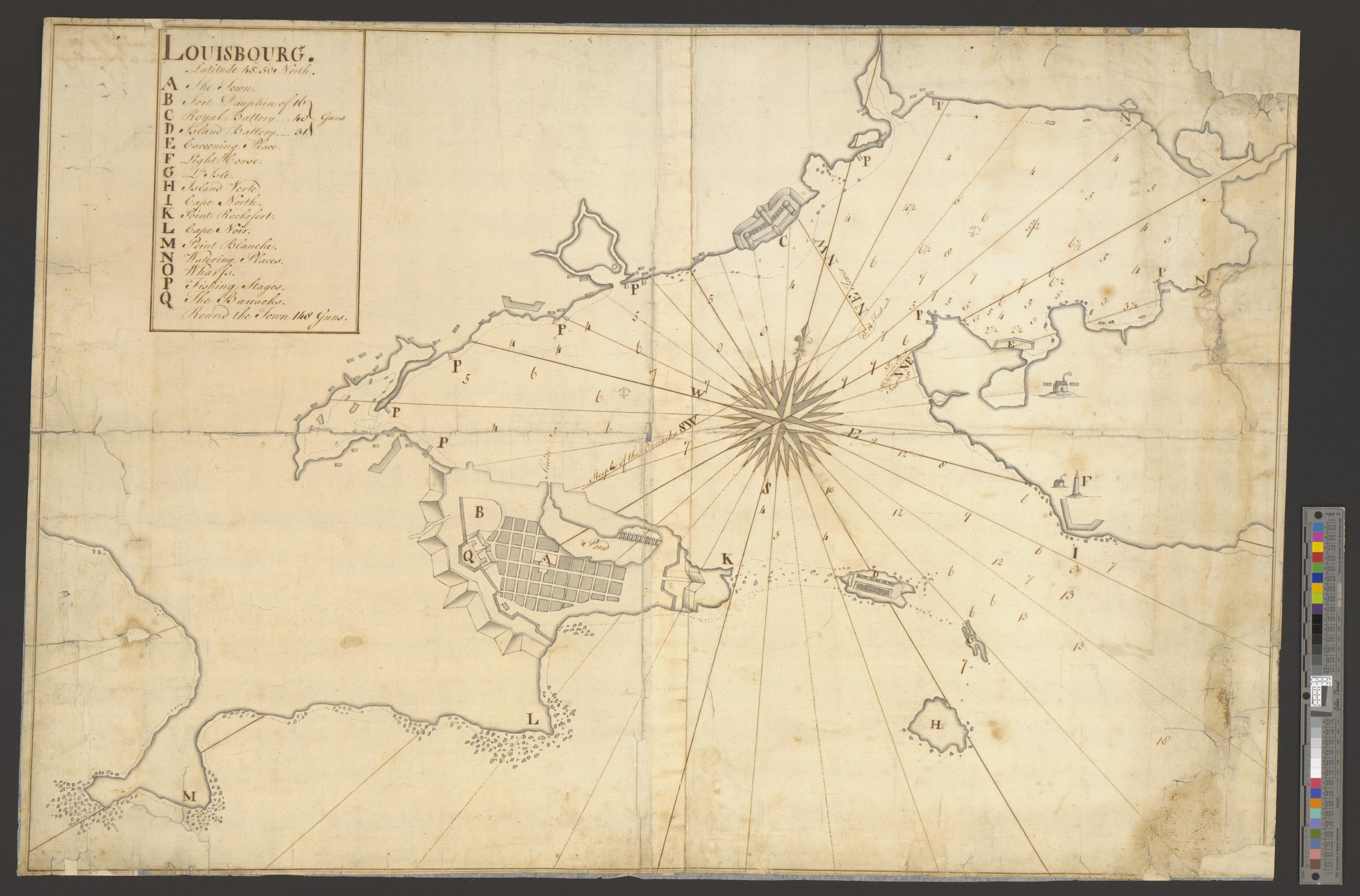
LOUISBOURG. Latitude 45⁰ 50' North.
NOTDATED-5 [U-M]
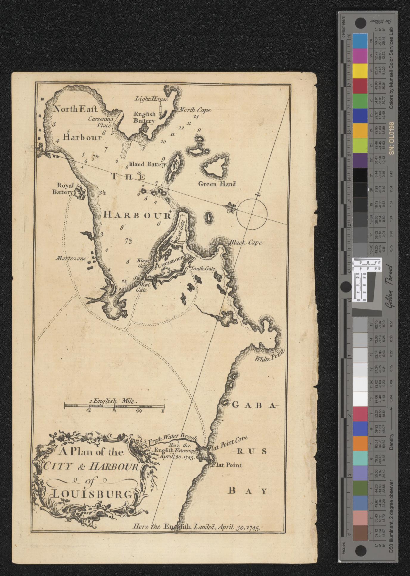
A Plan of the CITY & HARBOUR of LOUISBOURG
NOTDATED-6 [U-M]
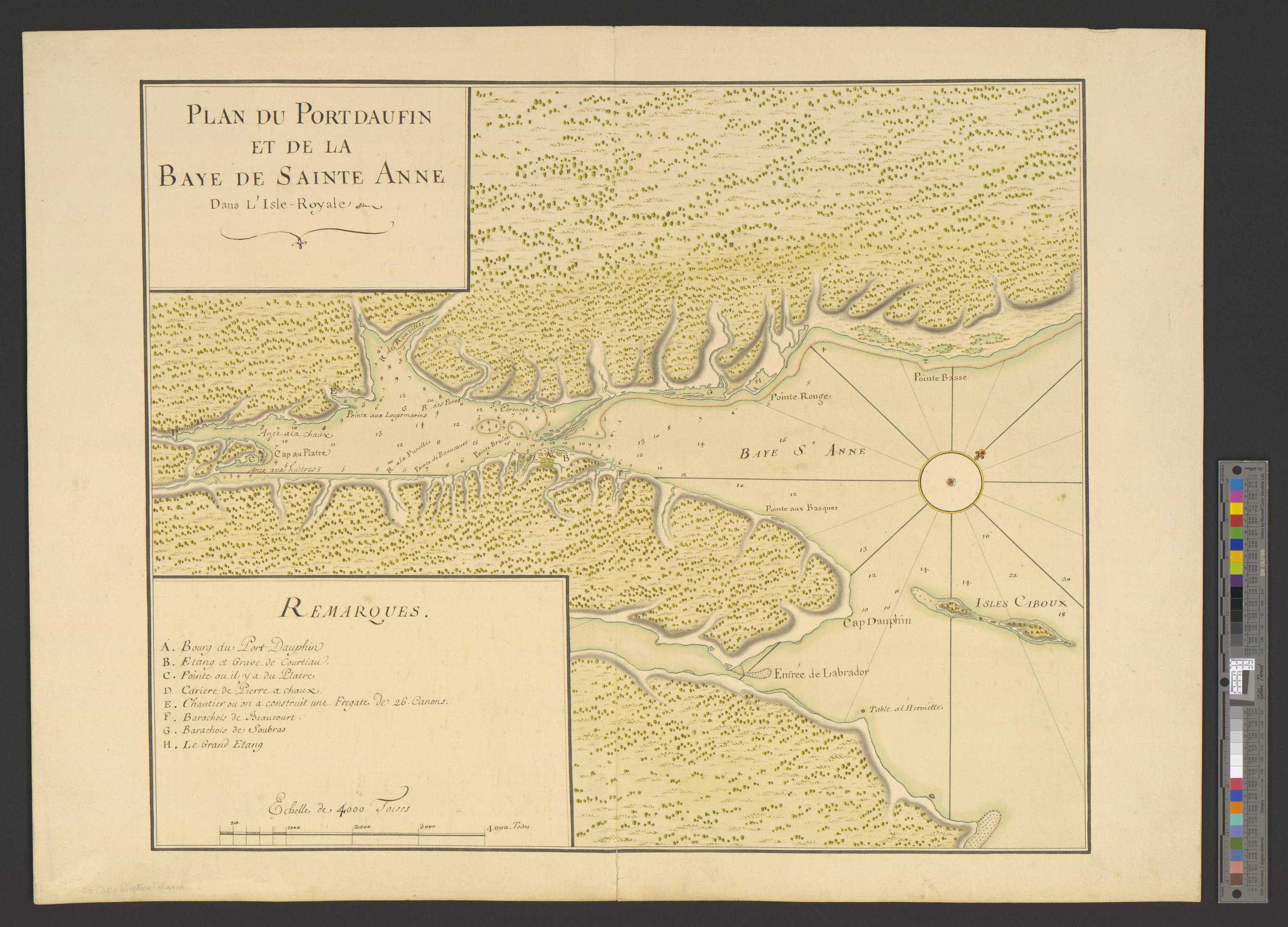
PLAN DU PORTDAUFIN ET DE LA BAYE DE SAINTE ANNE Dans L'Isle Royale
NOTDATED-7 [U-M]
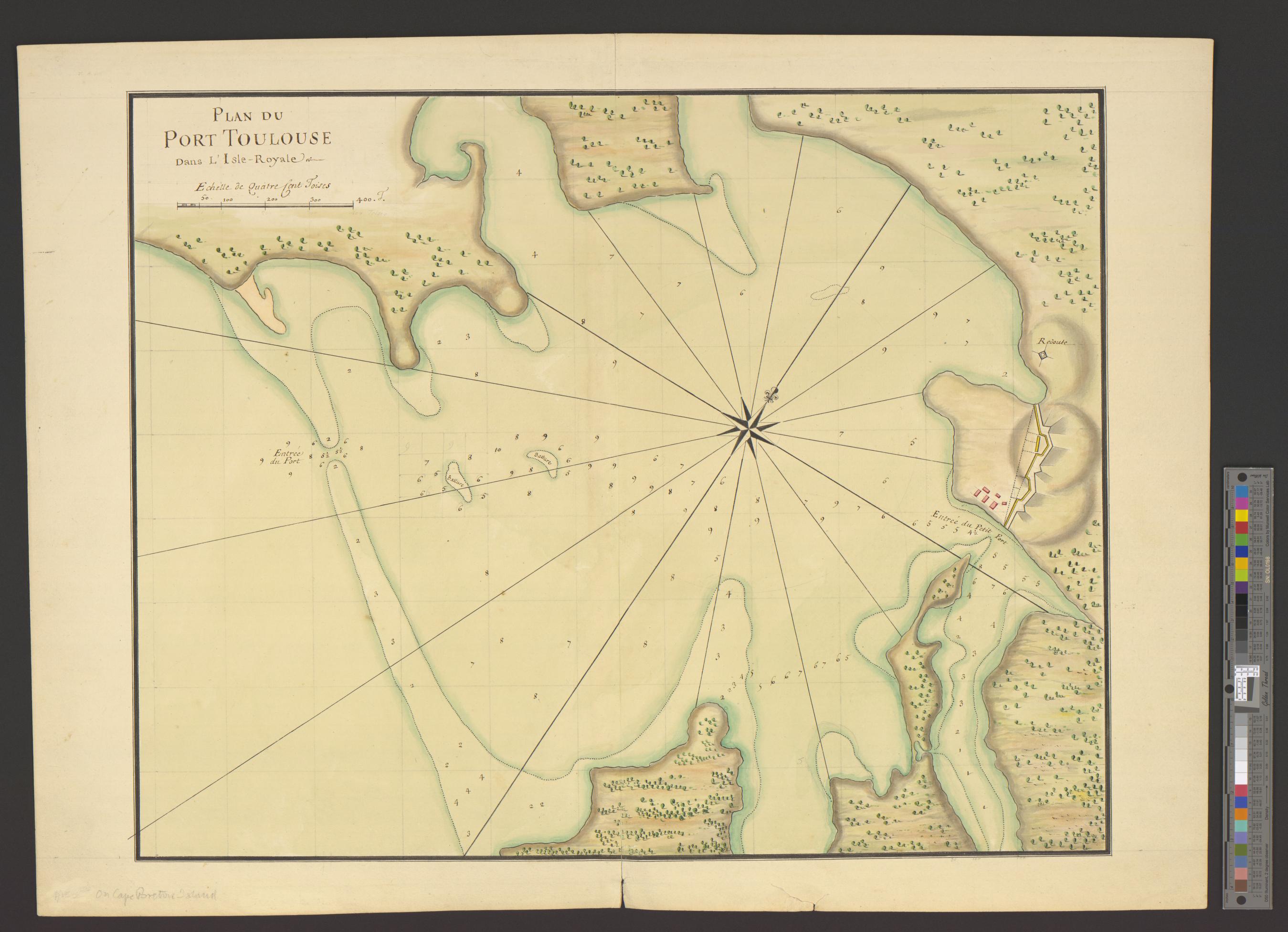
PLAN DU PORT TOULOUSE Dans L'Isle-Royale.
NOTDATED-8 [U-M]
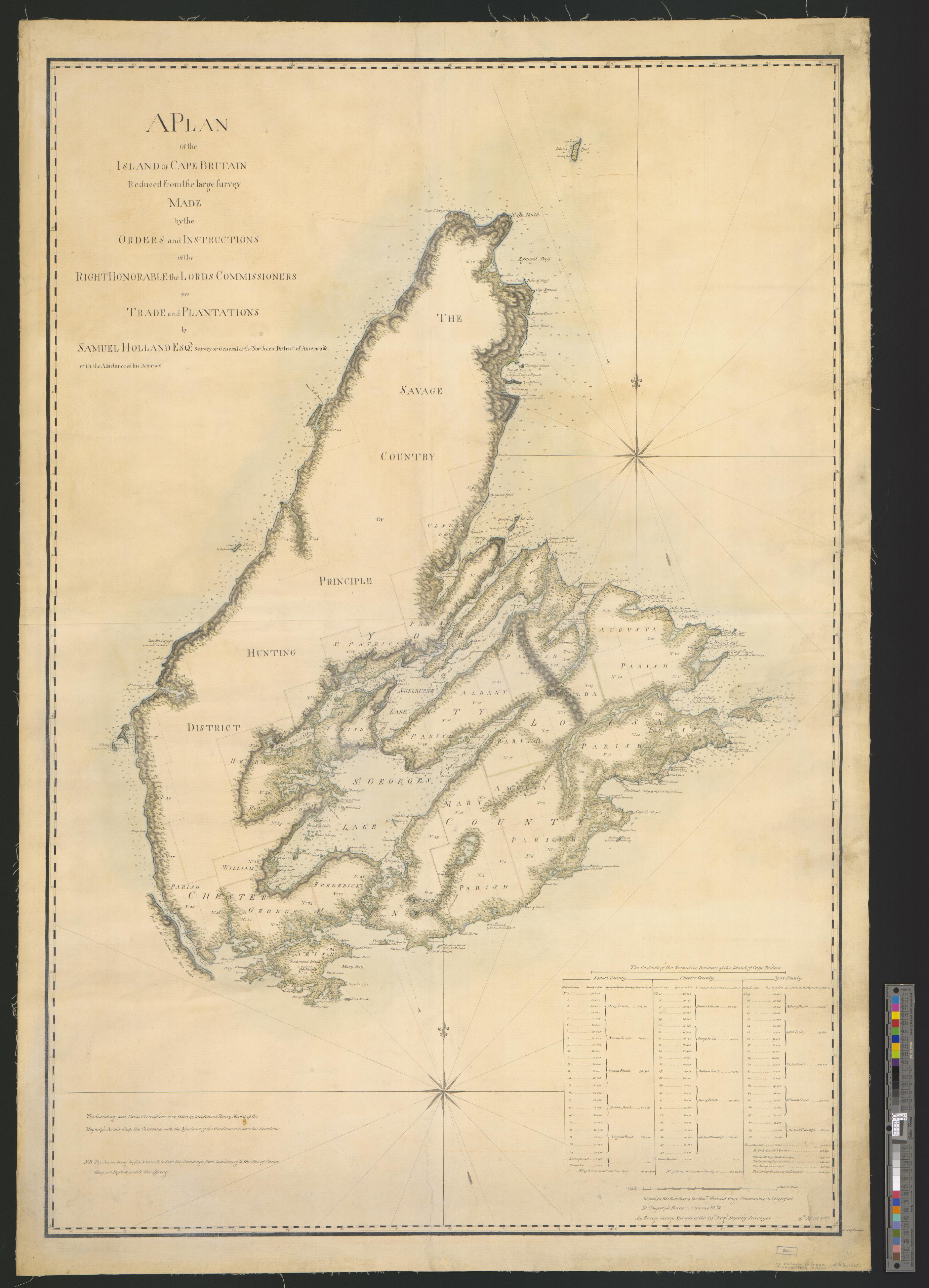
A PLAN of the island of CAPE BRETON Reduced from the large survey MADE by the ORDERS and INSTRUCTIONS of the RIGHT HONORABLE the LORDS COMMISSIONERS for TRADE and PLANTATIONS by SAMUEL HOLLAND ESQr. Surveyor General of the Northern District of America &c. with the Assistance of his Deputies.
NOTDATED-9 [U-M]
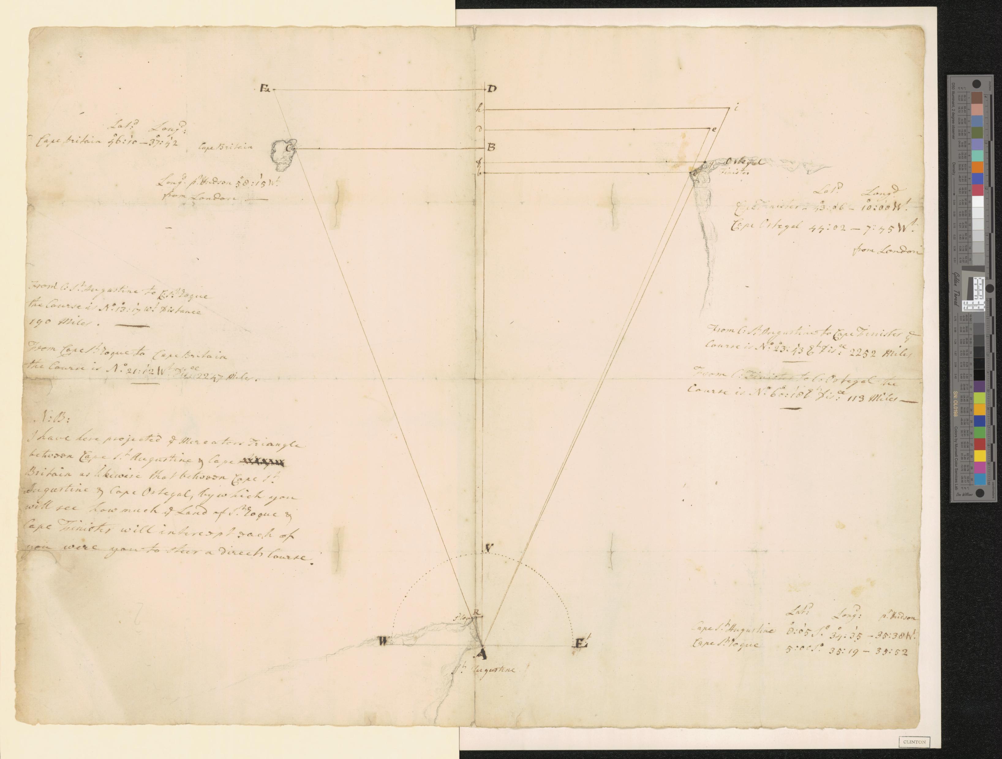
[Triangles on Mercator projection between St. Augustine and Cape Breton and St. Augustine and Cape Ortegal].
NOTDATED-10 [U-M]
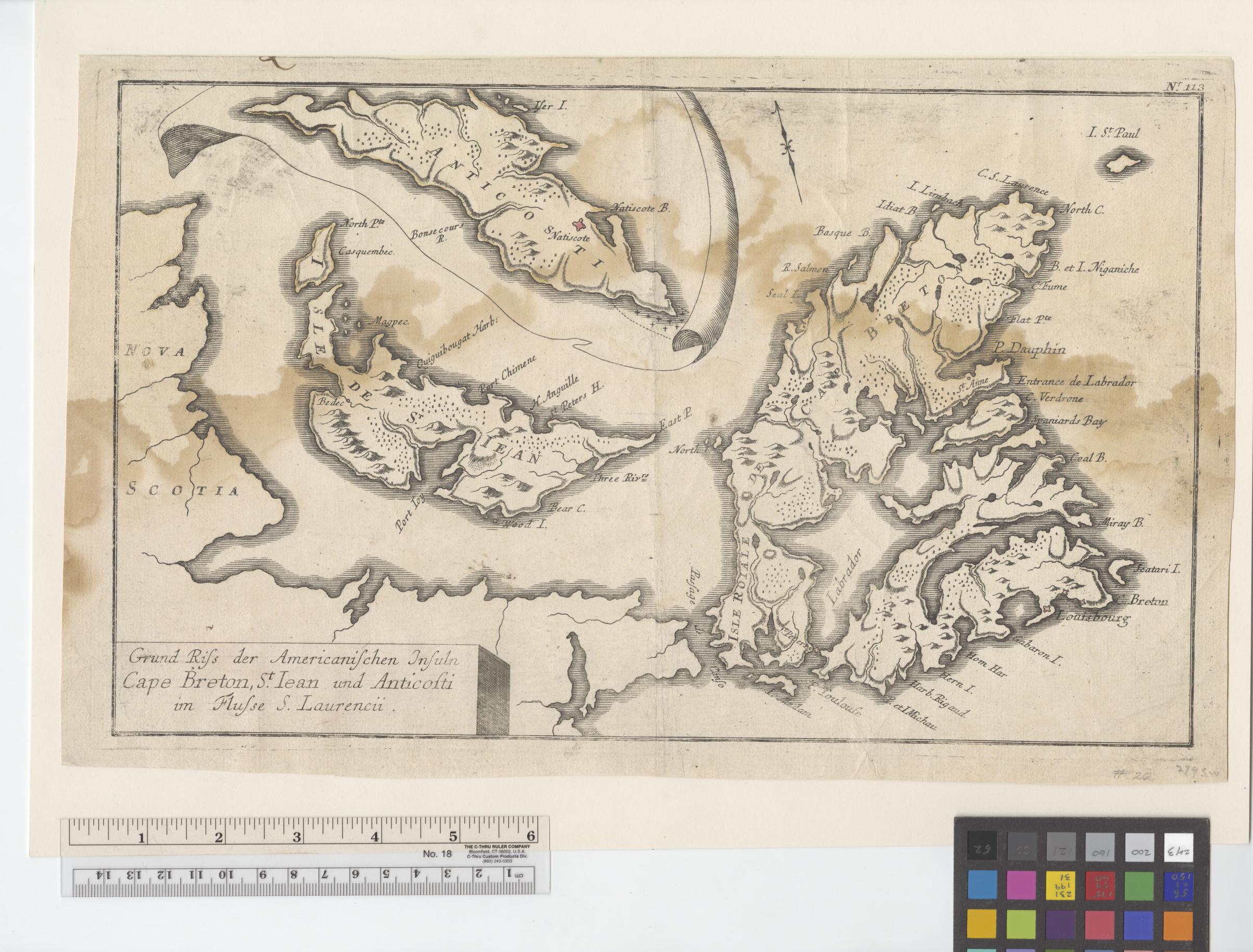
Grund Riss der Americanischen Insuln Cape Breton, St. Iean und Anticosti im Flusse S. Laurencii.
NOTDATED-11 [U-M]
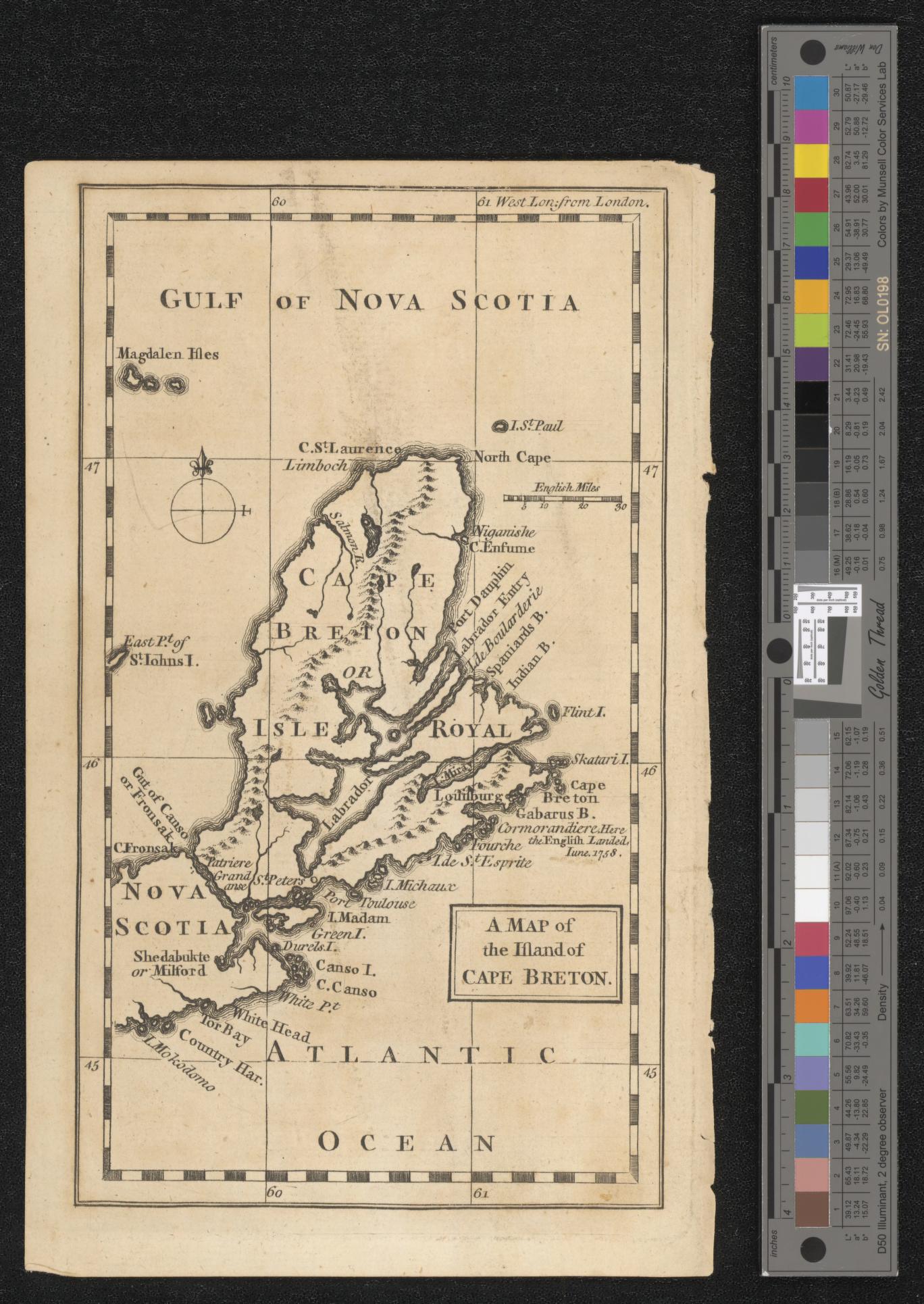
A MAP of the Island of CAPE BRETON.
NOTDATED-12 [U-M]
![]()