FortressMaps
Website Design and Content
© by Eric Krause, Krause House
Info-Research Solutions (© 1996)
All Images ©
Parks Canada Unless Otherwise Designated
Report/Rapport ©
Krause House Info-Research
Solutions
Researching
the Fortress of Louisbourg National Historic Site of Canada
Recherche sur la Forteresse-de-Louisbourg Lieu historique national du Canada
![]()
LOUISBOURG MAPS AND PLANS: ND-90 - ND-119
All Maps and Plans © Institution Holding the Original
For additional text and the name of the institution holding the original
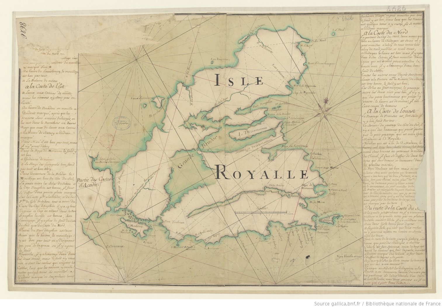
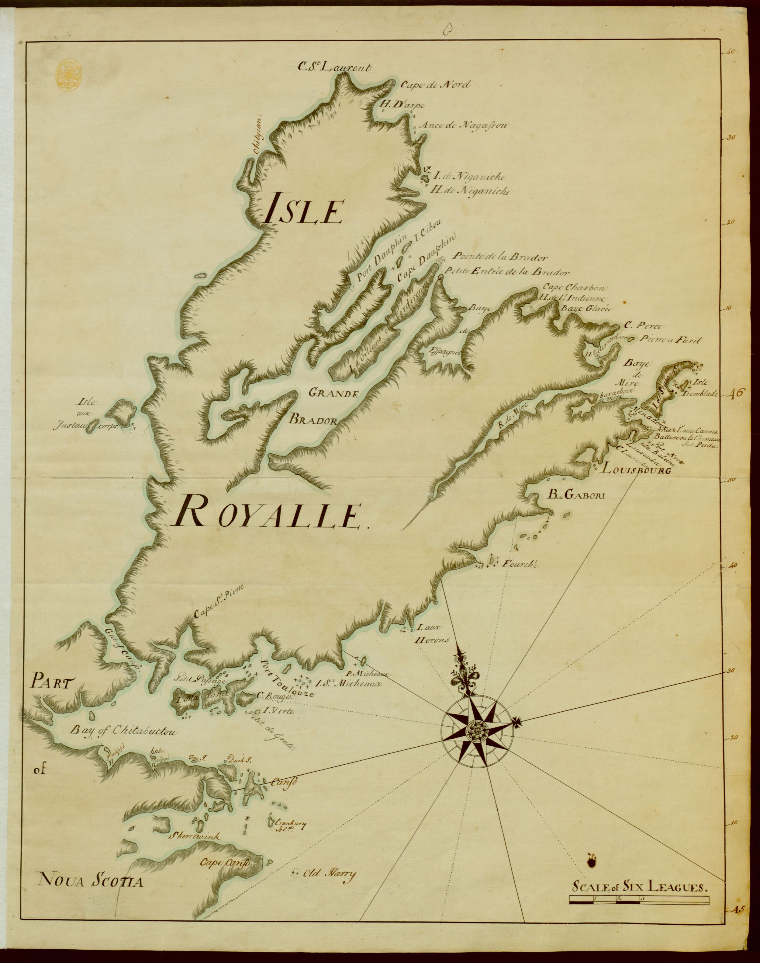
N/A [Map of Isle Royalle]
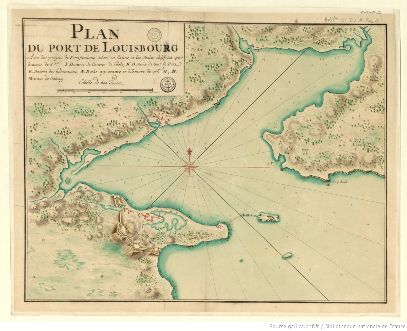
PLAN DU PORT DE LOUISBOURG Avec des projects de Fortifications coloré en Jaune, et les Sondes chiffreez pas brasses de 5 pie.
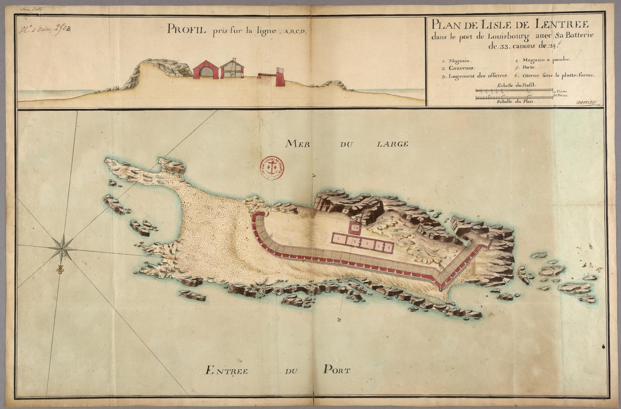
PLAN DE LISLE DE LENTREE dans le port de Louisbourg avec sa Batterie de .33. canons de .24. Ł
PROFIL pris sur la ligne ,A,B,C,D
A plan of Louisbourg situated on the Coast of Acadia in 45 degrees 50' N degrees Latitude and 322 degrees of Longitude
A plan of Louisbourg situated on the Coast of Acadia in 45 degrees 50' N degrees Latitude and 322 degrees of Longitude
Lewisburgh Harbour in the Island of Cape Britton
LOUIS-BOURG
PLAN des jsles aux juste au Corps, et du Port qu'elles forment avec les terres de l'jsle Royalle
Partie de la Coste du N.O. de l'jsle Royalle
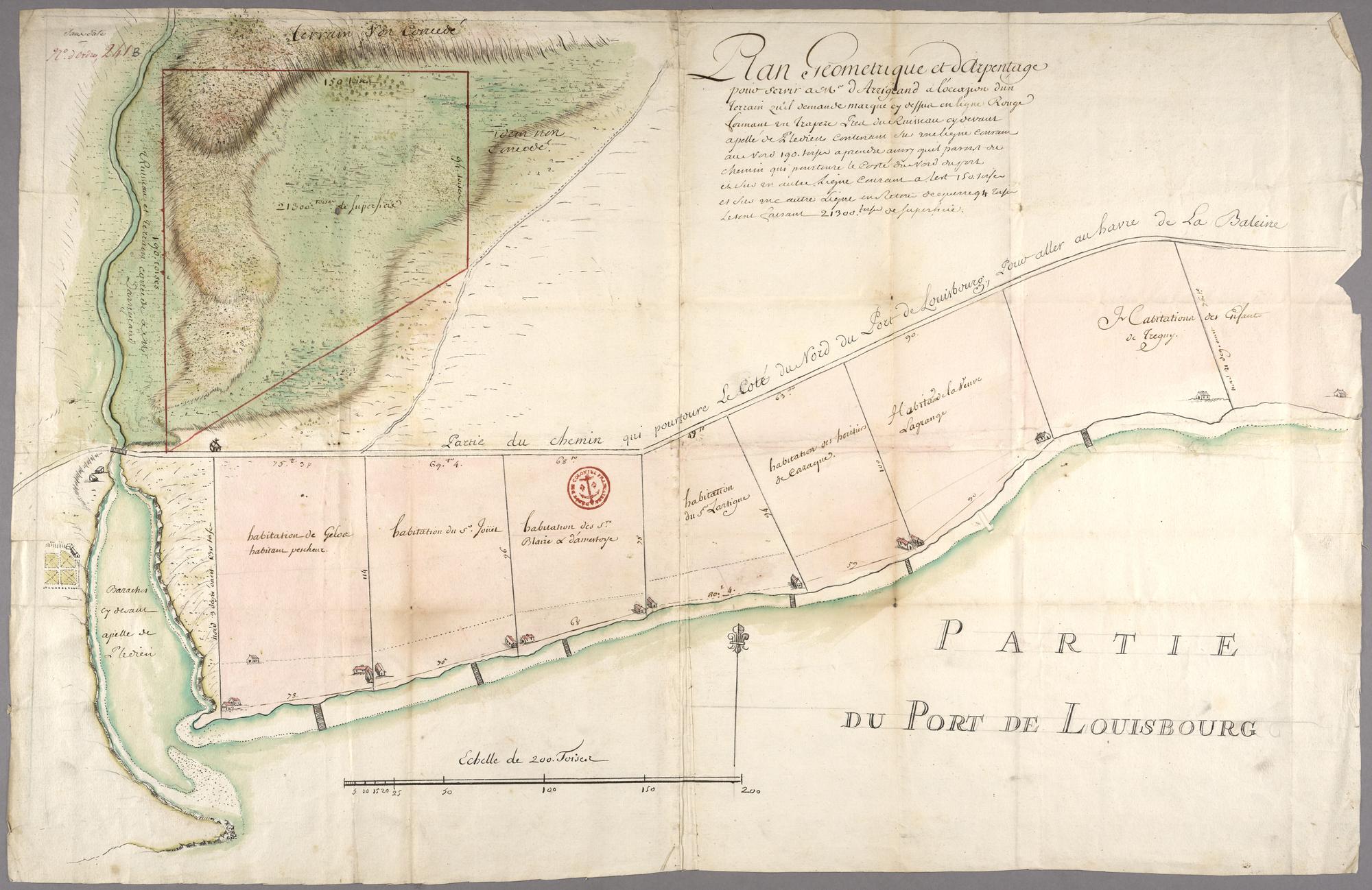
Plan Geometrique et d Arpentage pour servir ŕ Mr d Arrigrand a l'occassion d'un terrain quil demander marqué cy dessus en ligne rouge formant en trapeze Pres du Ruisseau cy devant apellé de Pledien Contenant sus une ligne courant au nord 190. toises a prendre aussi quil [pasnt?] de chemin qui poutoure le Costé du Nord de port et sus un autre ligne courant a lest 150. toises et sus une autre Ligne en Reteni de equerre 94 Toise [Letent?] faisant 21300. toises de superficie
N/A [Map of Cape Breton Island]
A PLAN of the Island of CAPE-BRETON
N/A [Map of Cape Breton Island]
A plan of the Island of Cape Breton Divided into counties
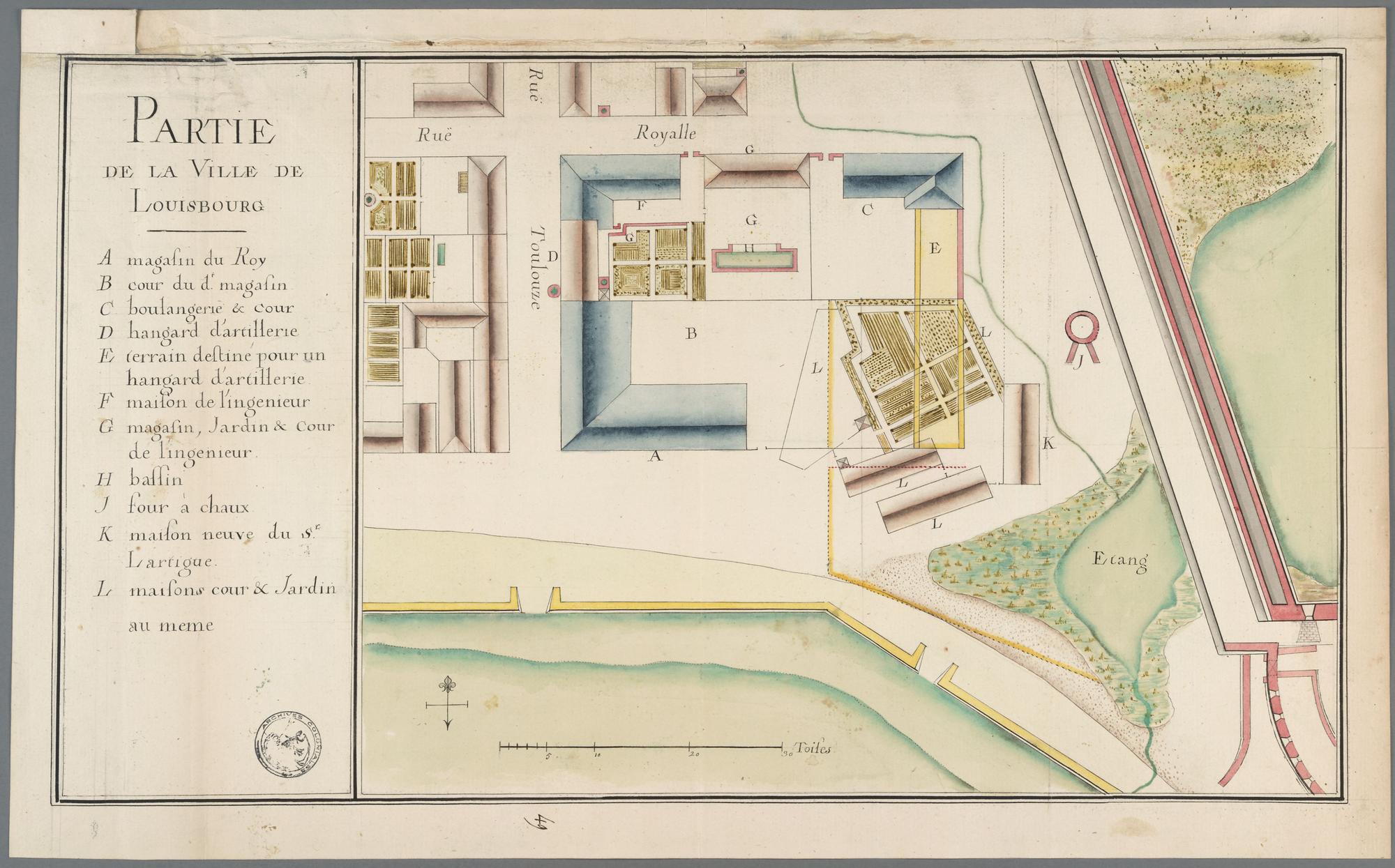
PARTIE DE LA VILLE DE LOUISBOURG
N/A [Carte de golfe St-Laurent/Map of the Gulf of St. Lawrence]
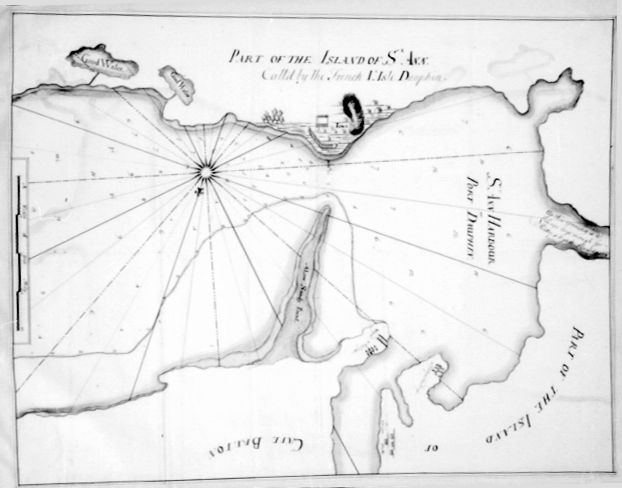
PART OF THE ISLAND OF ST ANN Called by the French L.'Isle Dauphin
N/A [Map of Isle Royalle]
N/A [Map of Isle Royalle]
PLAN ET ELEVATION DE LA BATTERIE ROYALE Dans le Port de Louisbourg.
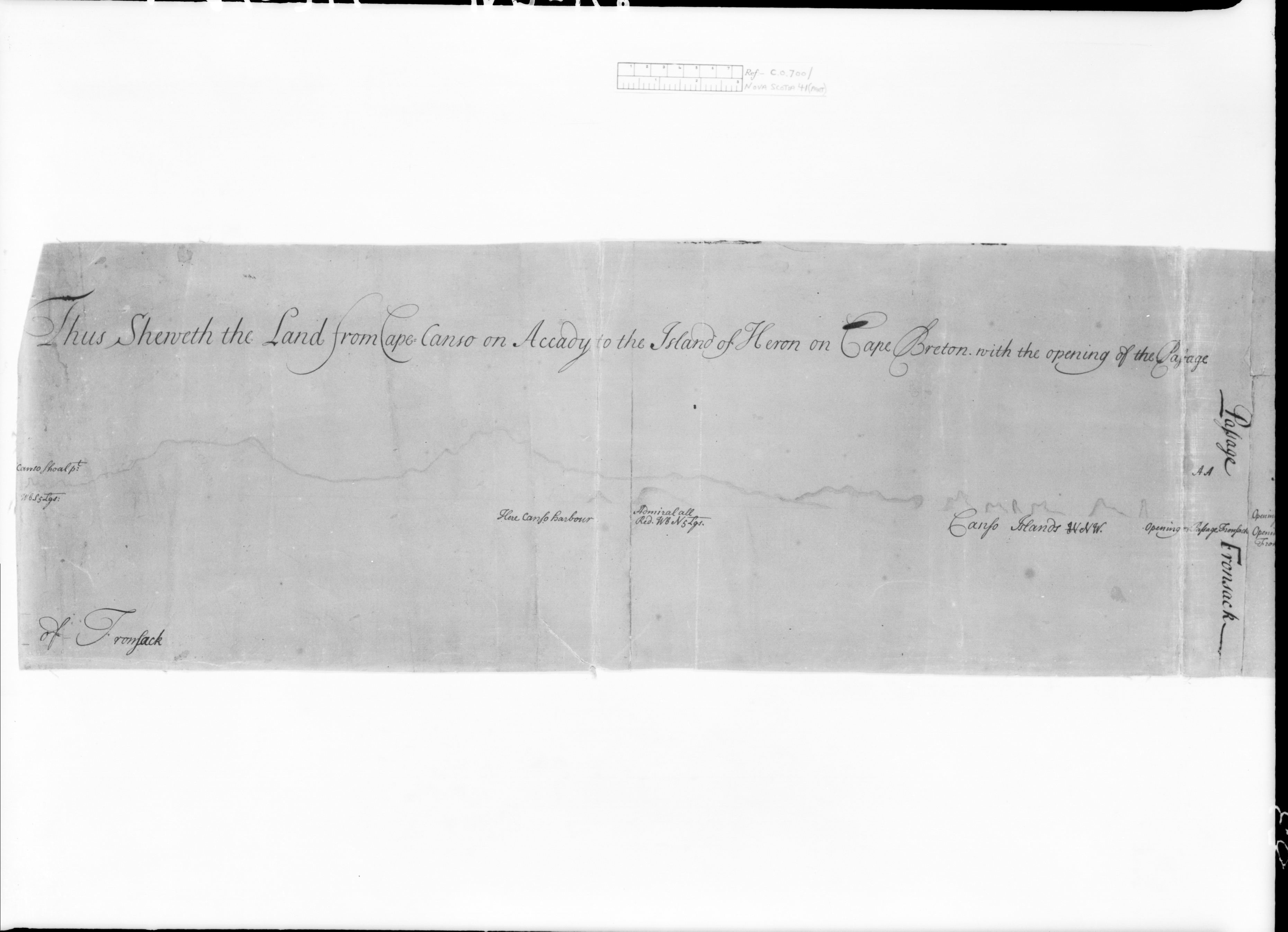
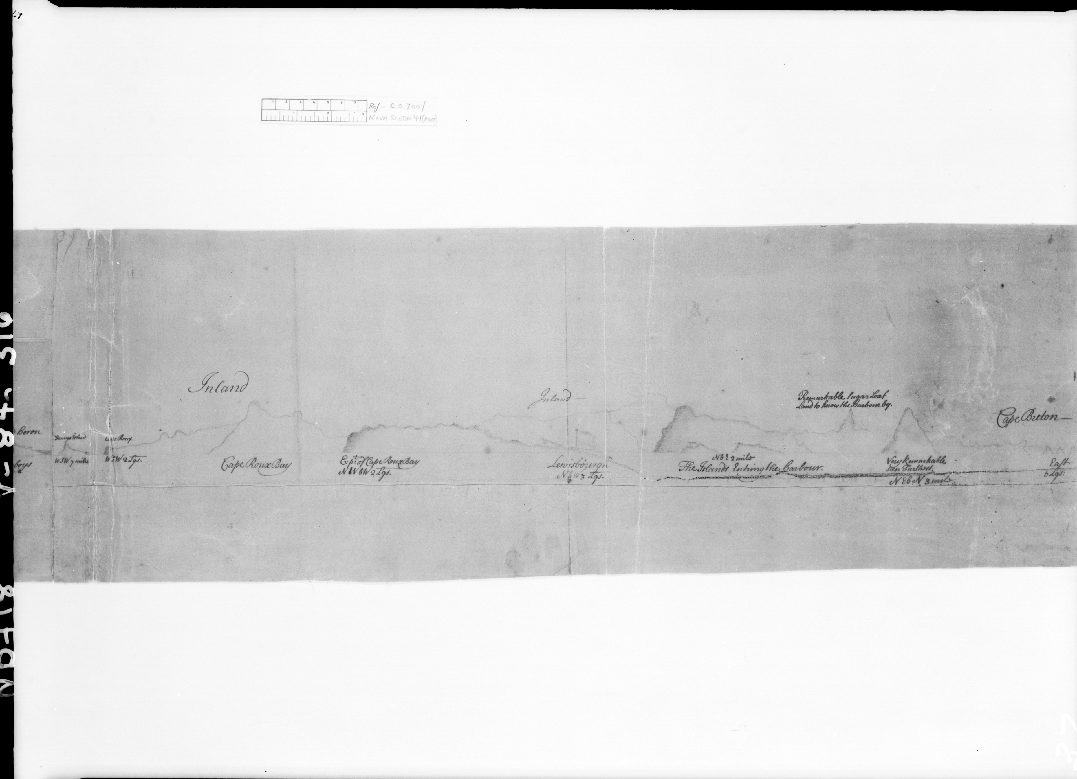
Thus Sheweth the Land from Cape Canso on Accady to the Island of Heron on Cape Breton. with the opening of the Passage of Fronsack /Thus Sheweth Cape Breton Island
Thus Sheweth the Land from Cape Canso on Accady to the Island of Heron on Cape Breton. with the opening of the Passage of Fronsack /Thus Sheweth Cape Breton Island
Thus Sheweth the Land from Cape Canso on Accady to the Island of Heron on Cape Breton. with the opening of the Passage of Fronsack /Thus Sheweth Cape Breton Island
![]()