FortressMaps
Website Design and Content
© by Eric Krause, Krause House
Info-Research Solutions (© 1996)
All Images ©
Parks Canada Unless Otherwise Designated
Report/Rapport ©
Krause House Info-Research
Solutions
Researching
the Fortress of Louisbourg National Historic Site of Canada
Recherche sur la Forteresse-de-Louisbourg Lieu historique national du Canada
![]()
LOUISBOURG MAPS AND PLANS: ND-210 - ND-239
All Maps and Plans © Institution Holding the Original
For additional text and the name of the institution holding the original
N/A [Mine Galleries]
N/A [Mine Galleries]
N/A [Mine Galleries]
N/A [Mine Galleries]
N/A [Mine Galleries]
N/A [Mortar Fire]
porte Fredrick or the King's gate
West gate
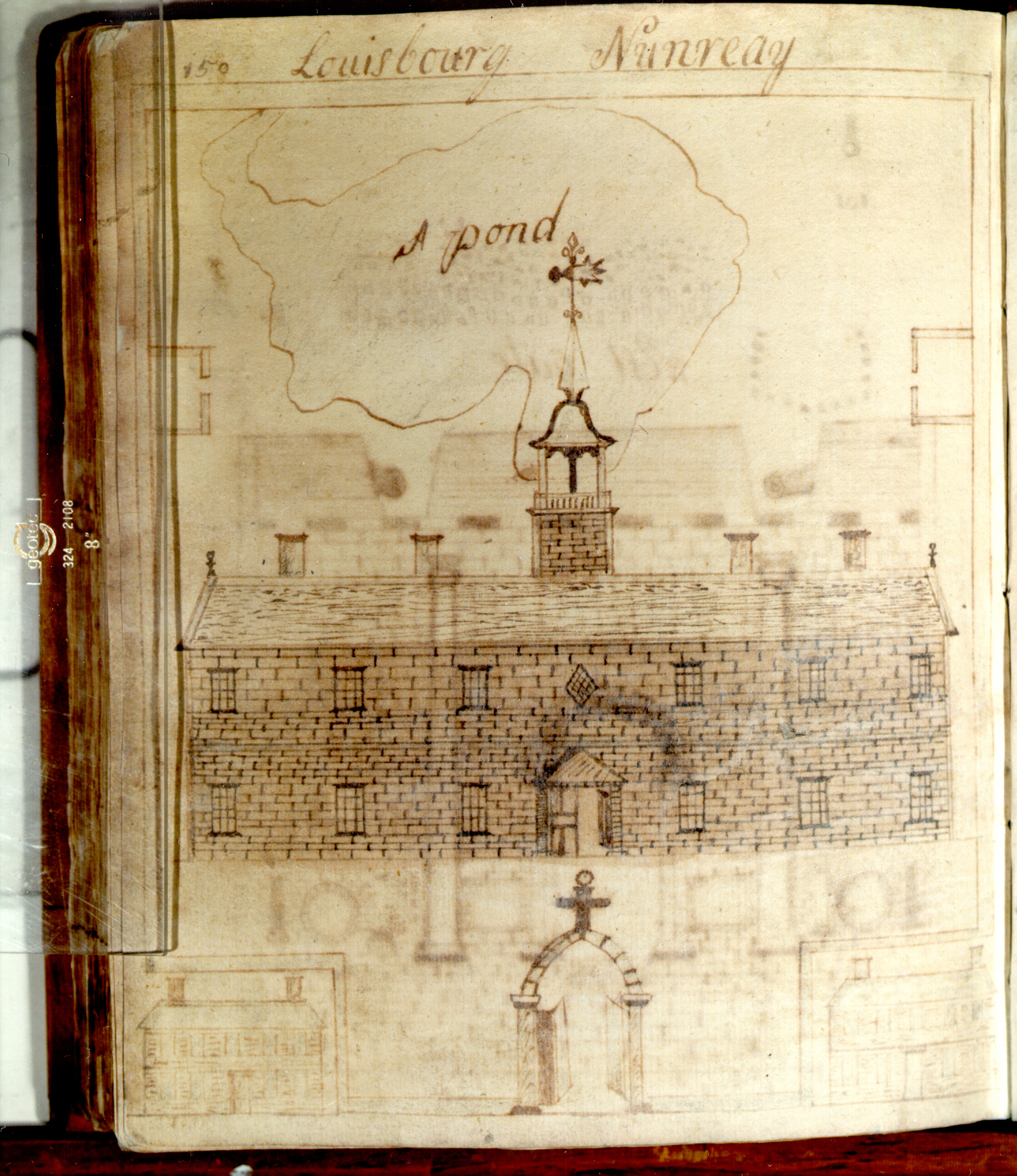
Louisbourg Nunnery
N/A [Mine Galleries]
Citadel
grand Battery
N/A [Mine Galleries]
N/A [Port de Louisbourg/Louisbourg Harbour]
Light House at Louisbourg
The Form of the Tules Used in the mines at Louisbourg
East gate
N/A [The Store House or Magezeme; The Ingenears house; Ducks yard; garden]
N/A [Mine Galleries]
The grand Hospital
The genreals House
N/A [Mine Galleries]
South gate at Louisbourg
The Nth West Side of the Citidal
N/A [Spire]
N/A [Cannon]
N/A [Battery English at Louisbourg]
A Plan of the Island Battrey as it was Rebuilt by the English in the year 1759 at Louisbourg
N/A [Booke]
N/A [Mine Galleries]
1700 Levisbourg MD. 5760 Jan... gibson Clough His Book Bought at Mr Lear ...
Salem ...
PLAN des fortifications de la VILLE de LOUISBOURG dans l'Isle de CAP-BRETON.
PLAN van de fortificatien der stad LOUIS-BORG op het Eiland Caap Breton.
Leth, H. De
[Newfoundland to N.E. New
England]
![]()