FortressMaps
Website Design and Content
© by Eric Krause, Krause House
Info-Research Solutions (© 1996)
All Images ©
Parks Canada Unless Otherwise Designated
Report/Rapport ©
Krause House Info-Research
Solutions
Researching
the Fortress of Louisbourg National Historic Site of Canada
Recherche sur la Forteresse-de-Louisbourg Lieu historique national du Canada
![]()
LOUISBOURG MAPS AND PLANS: ND-150 - ND-179
All Maps and Plans © Institution Holding the Original
For additional text and the name of the institution holding the original
PLAN DU PORT ET DE LA VILLE DE LOUISBOURG
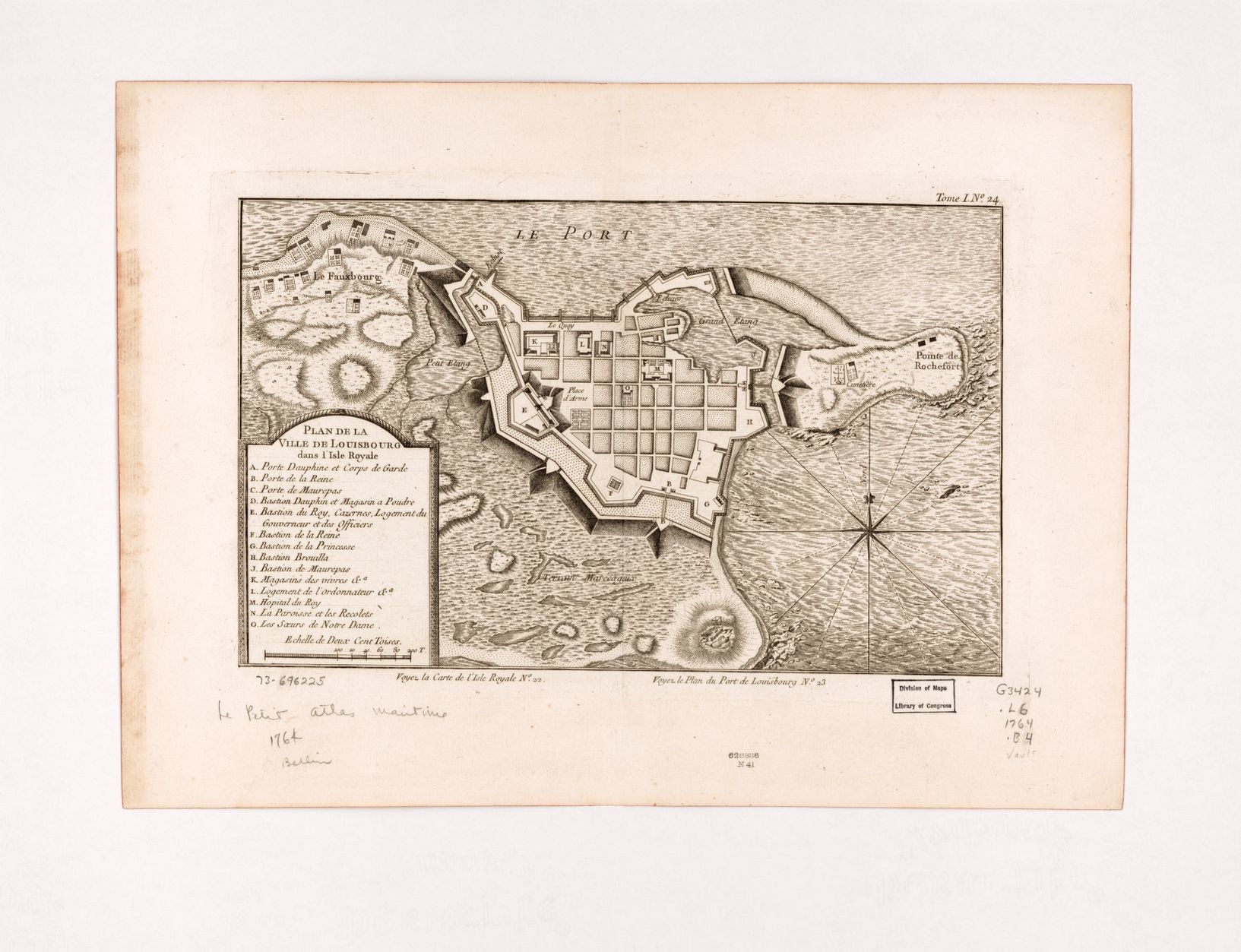
PLAN DE LA VILLE DE LOUISBOURG DANS l'Isle Royalle
A map of Royal or Cape Breton I. from the Best Authorities
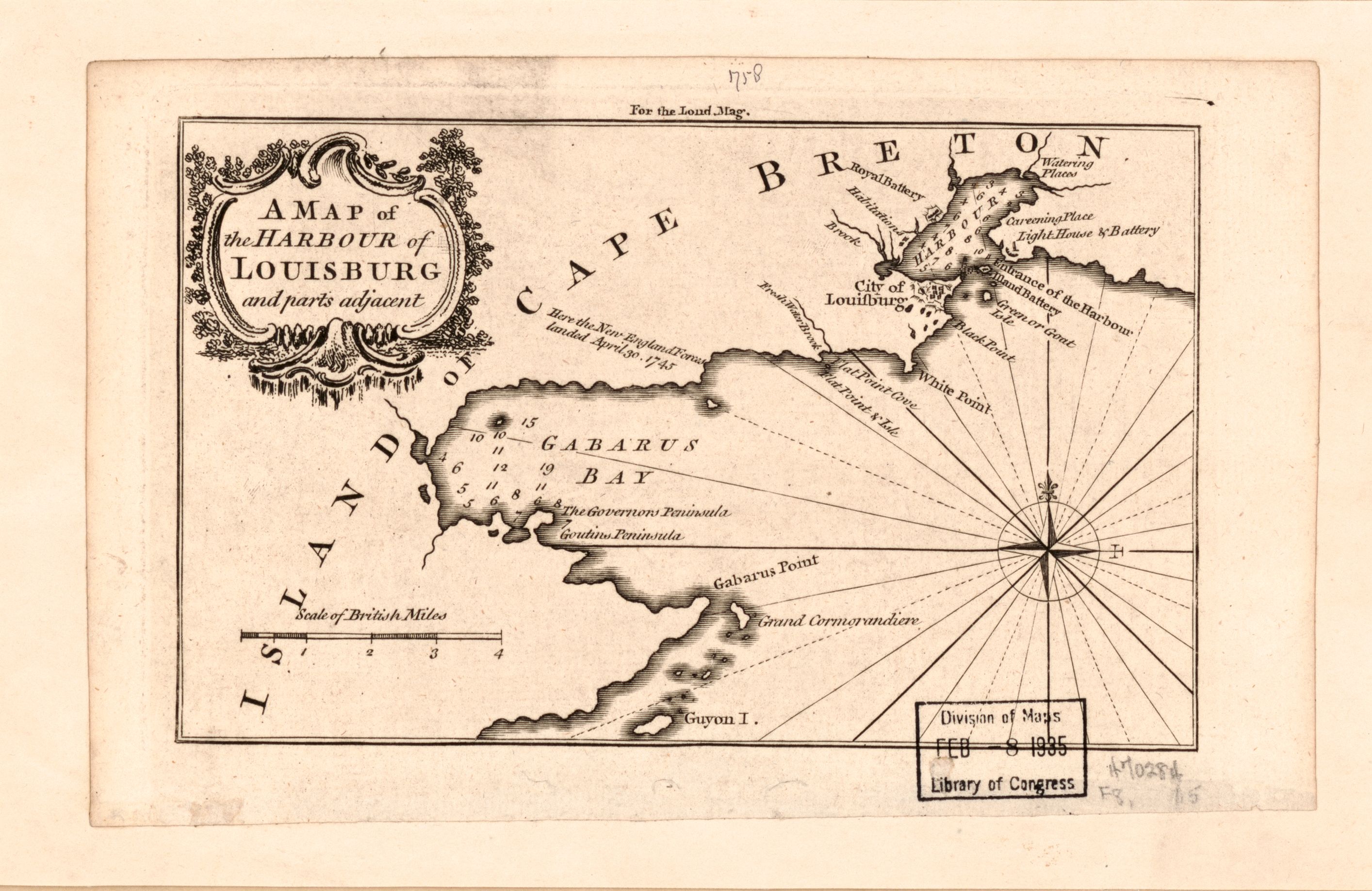
A MAP of the HARBOUR of LOUISBOURG and parts adjacent
NOVA SCOTIA AND NEWFOUNDLAND
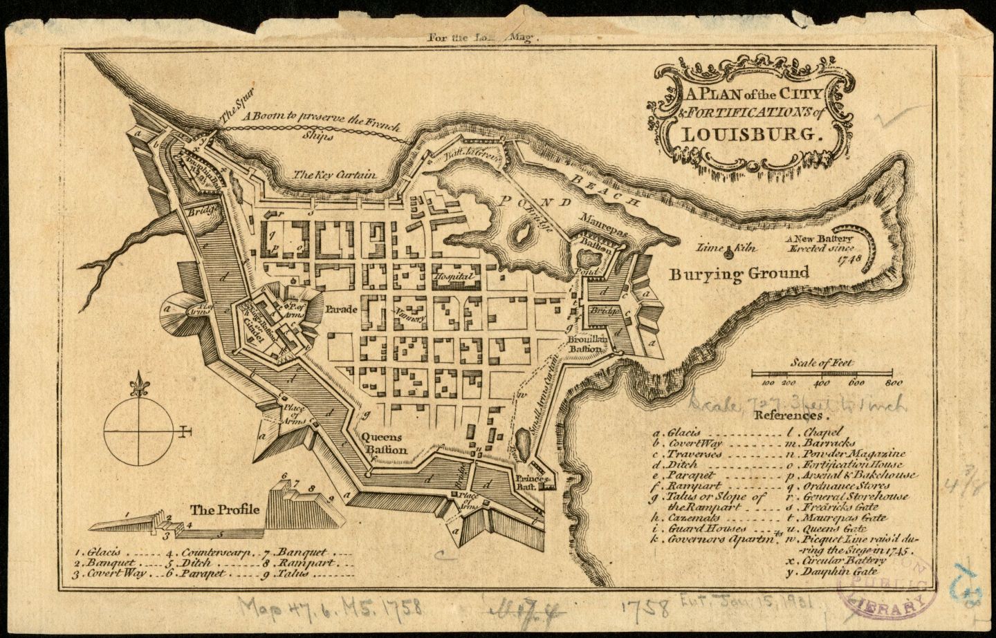
A PLAN of the CITY & FORTIFICATIONS of Louisbourg
PLAN DU PORT ROYLE dans l'Accadie Appellé aujourdhuy par les Anglais Annapolis Royale
PLAN DU PORT D'AUPHIN ET DE SA RADE AVEC l'Etrée de labrador
VUE PERSPECTIVE DE LA DESCENTE DES FRANCOIS ŕ L'ISLE DE TERRE NEUVE DU CôTÉ DE SAINT JEAN ŕ L'OCCIDENT
Plan De La partie du nord Est ou Gauche de Louisbourg depuis La pointe aux cannes Jusqu'a celle du fanal qui forme L'Entrée de La Rade
N/A [Plan de Louisbourg]
N/A
Developpement de la Redoute Bastionnée B, du Port Dauphin Sur le panchent de la hauteur A, B, C, D, de 192 toises de longueur, et 176 pieds de hauteur
Developpement de la Redoute Bastionée du Port Dauphine distante du Port de ?? sur ?? pieds de hauteur
BASSE PARTIE et ORIENTALE du FLEUVE de St. LAURENT depuis L'Isle aux Lievres jusqu'a son embouchure Dressée sur les memoires de M'de CATALONGNE Ingenieur du ROI tres chrestien
N/A [Carte de l'jsthme d'entre la Baye Verte et la Baye francoise]
PLAN DU PORT de TOULOUSE
PLAN DU PORT de TOULOUSE
CARTE DE LISLE ST JEAN dans le Golfe de St. Laurent en Canada
Plan d'une Redoute Projettée sur la pointe a la framboise scituée a droitte de l'Entrée du Port La Joye
PLAN du Port des trois Rivieres en l'Isle St. Jean
PLAN du Port des Trois Rivieres en Isle St. Jean
Plan et Profile du fort de gaspareau scitué sur la pointe de Monségu au fond de la Baye Verte faisant partie du Canada
CARTE DE L'ISLE ROYALLE Scituée Par 45 deg 14 [minut?] et 46 degr 50 [min?] nord et Par 321 degr 40 [min?] et 323 degr 10 [min?] de Longitude
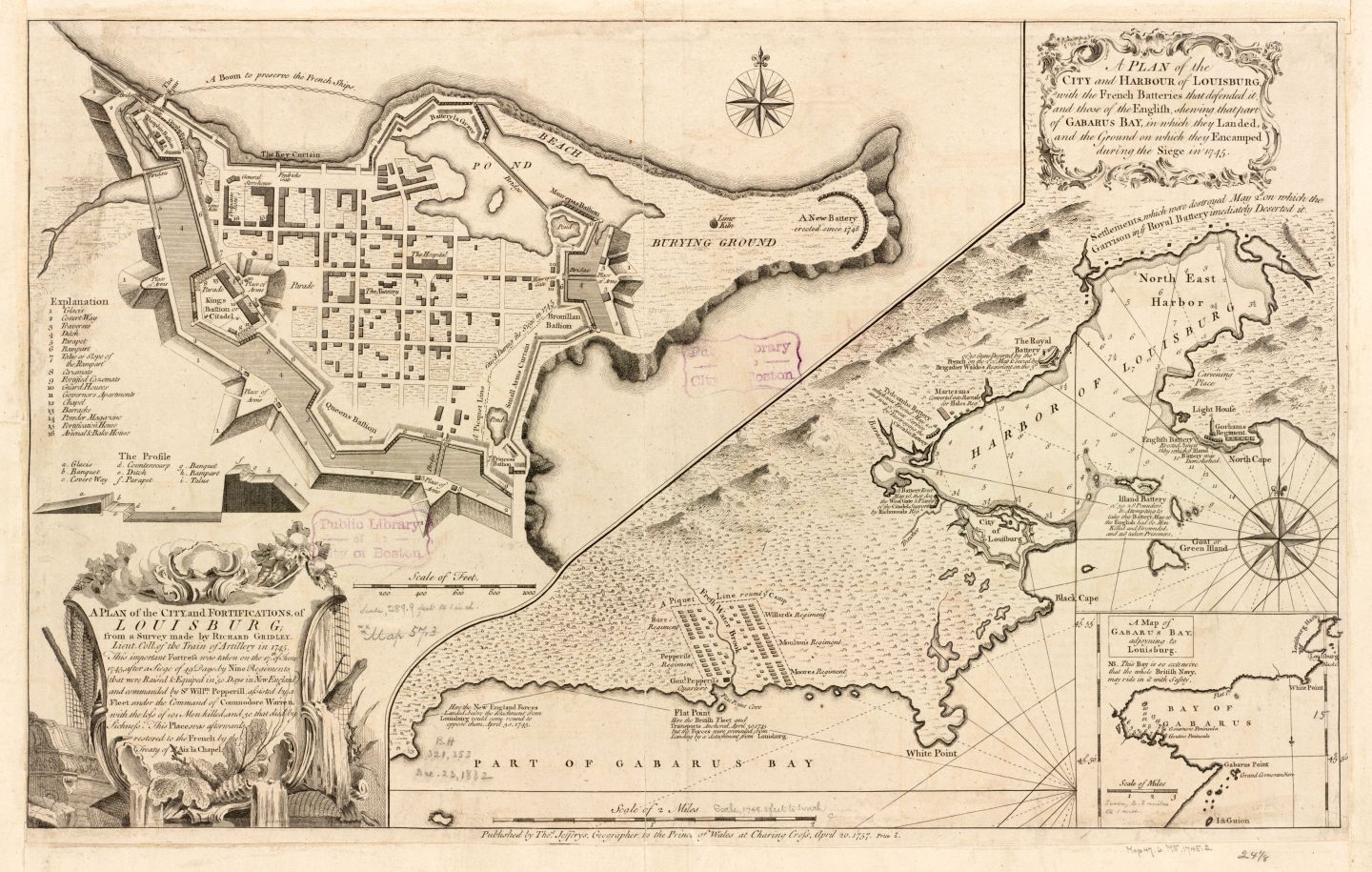
A PLAN OF THE City and Harbour of Louisbourg with the French Batteries that defended it and those of the English, shewing that part of Gabarus Bay, in which they Landed, and the Ground on which they Encamped during the Siege in 1745
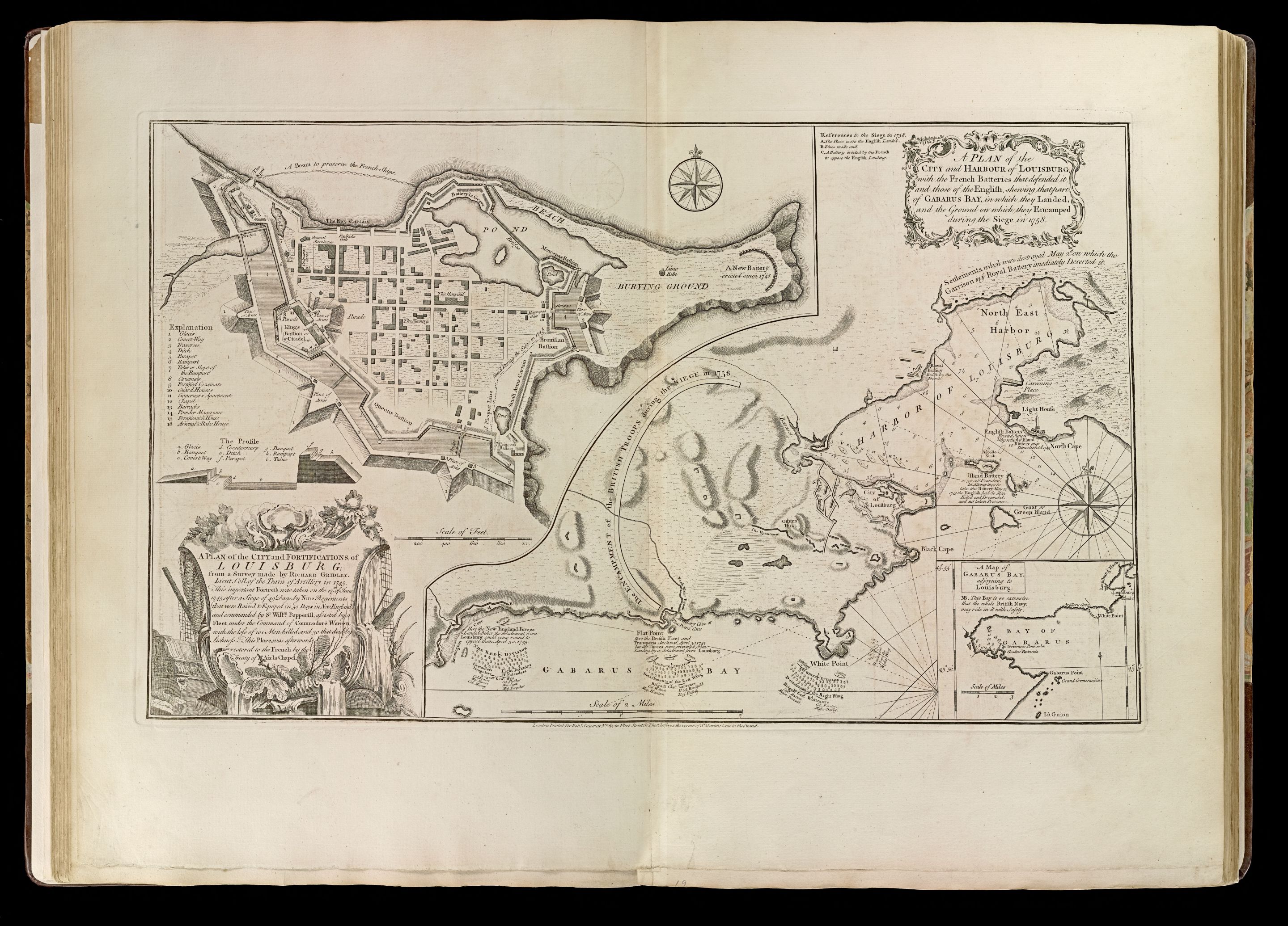
A PLAN of The City and Harbour of Louisbourg with the French Batteries that defended it and those of the English, shewing that part of Gabarus Bay, in which they Landed, and the Ground on which they Encamped during the Siege in 1758
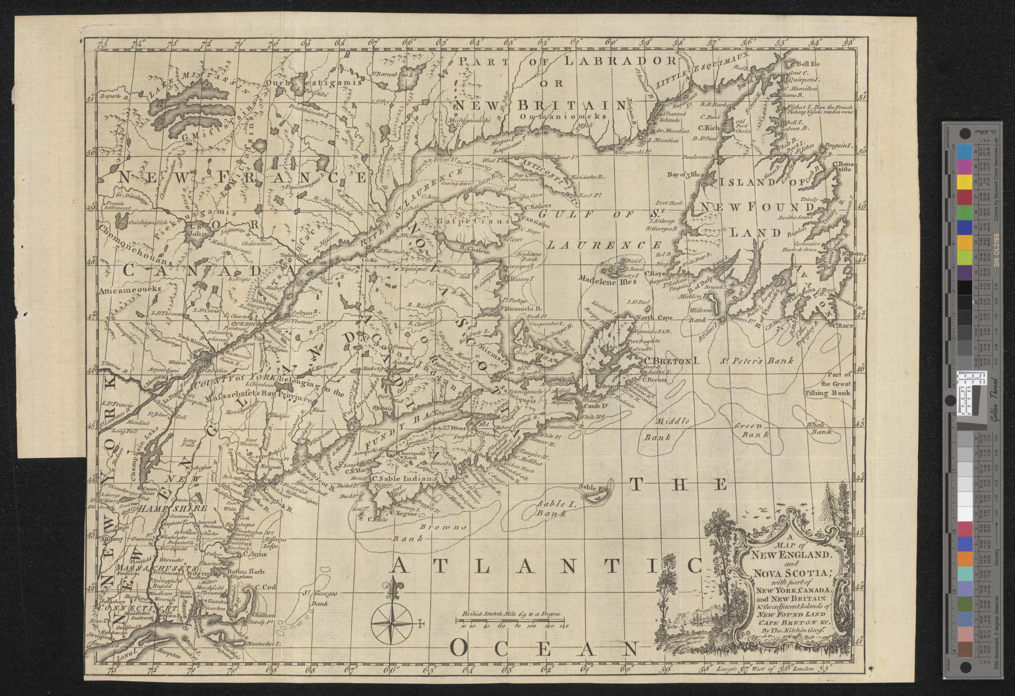
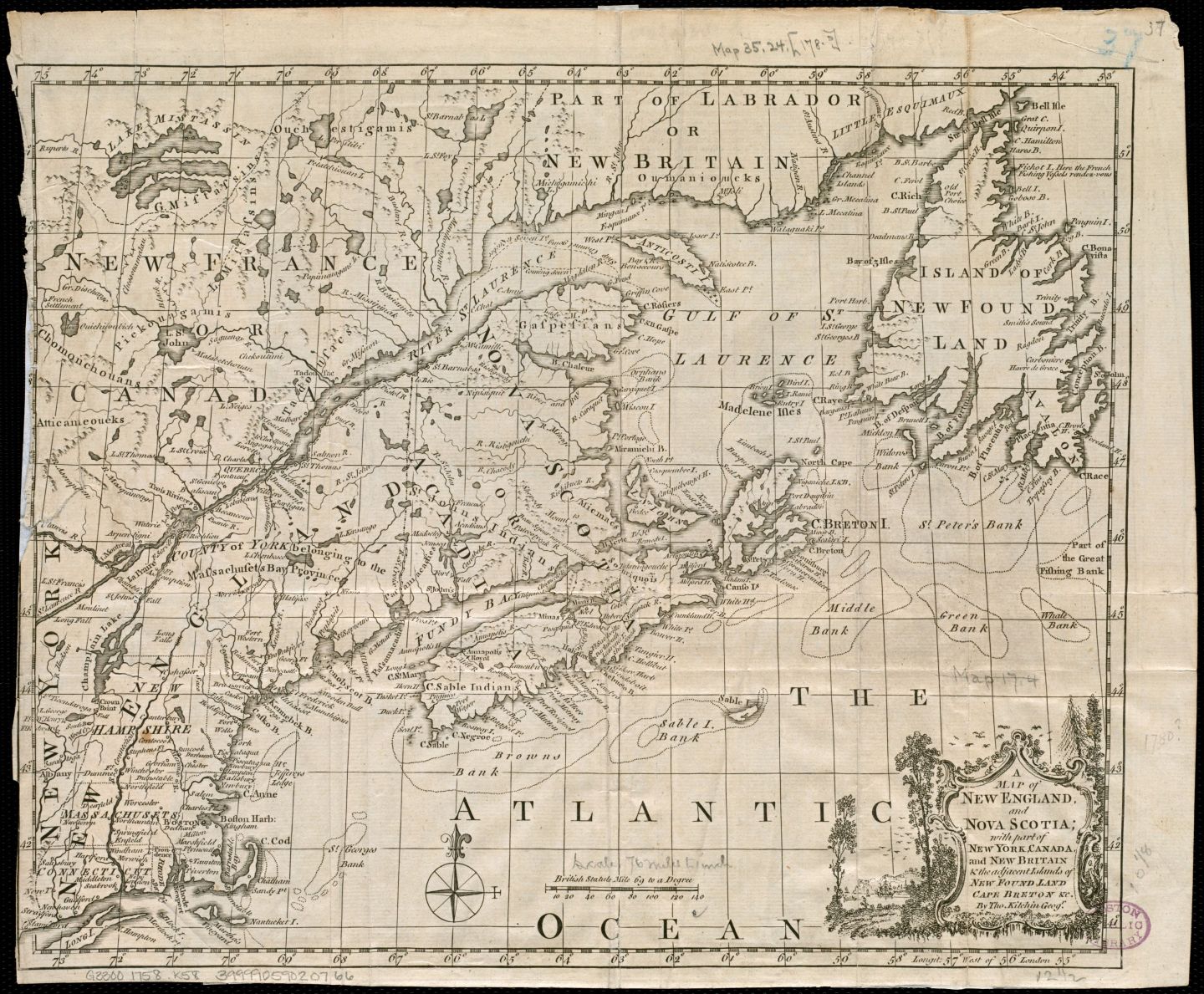
A MAP of NEW ENGLAND and NOVA SCOTIA with part of NEW YORK, CANADA and NEW BRITAIN & the adjacent Islands of NEW FOUND LAND, CAPE BRETON, &c. By Tho. Kitchin Geogr.
CARTE DU GOLFE ST. LAURENT
N/A [A Map of the English Empire]
N/A
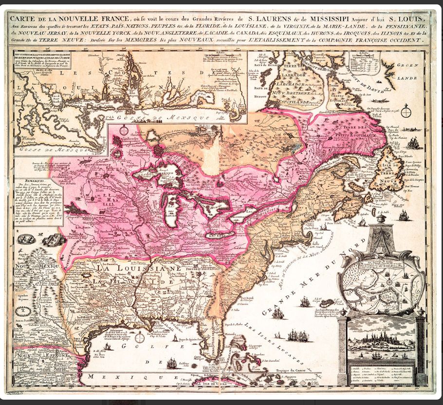
CARTE DE LA NOUVELLE FRANCE...
![]()