FortressMaps
Website Design and Content
© by Eric Krause, Krause House
Info-Research Solutions (© 1996)
All Images ©
Parks Canada Unless Otherwise Designated
Report/Rapport ©
Krause House Info-Research
Solutions
Researching
the Fortress of Louisbourg National Historic Site of Canada
Recherche sur la Forteresse-de-Louisbourg Lieu historique national du Canada
![]()
LOUISBOURG MAPS AND PLANS:
All Maps and Plans © Institution Holding the Original
For additional text and the name of the institution holding the original
Norman B. Leventhal Map & Education Center
PLAN DE LA VILLE DE LOUISBOURG AVEC LES OUVRAGES D'ATTAQUE des Anglais .... 1758 ... Lartigue ....
NOTDATED-1 [LMEC[
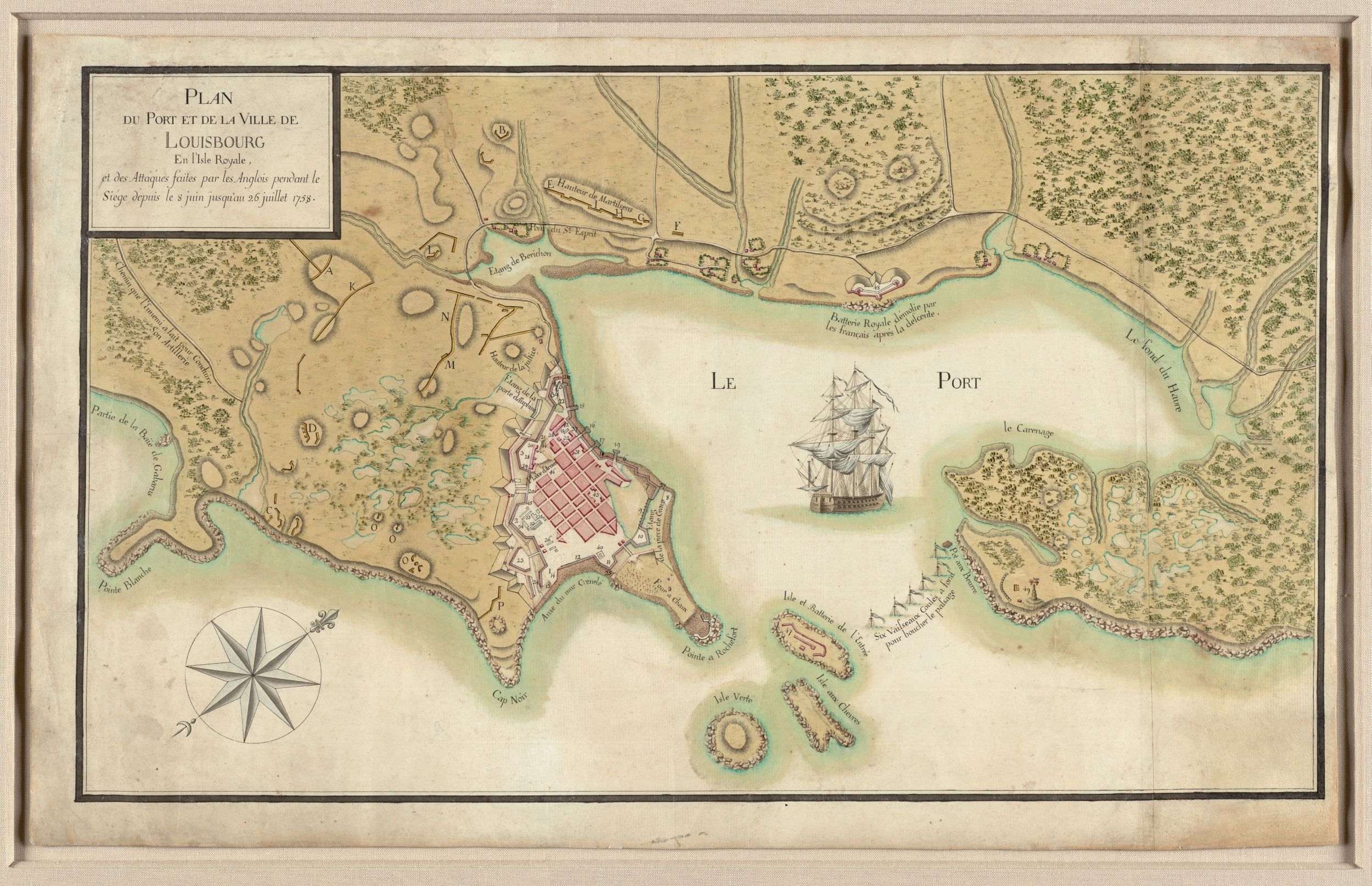
PLAN DU PORT ET DE LA VILLE DE LOUISBOURG En l'Isle Royale, .... 1758.
NOTDATED-2 [LMEC]
CARTE TOPOGRAPHIQUE DU PORT ET DE LA VILLE DE LOUISBOURG .... 1758 ... Lartigue ...
NOTDATED-3 [LMEC]
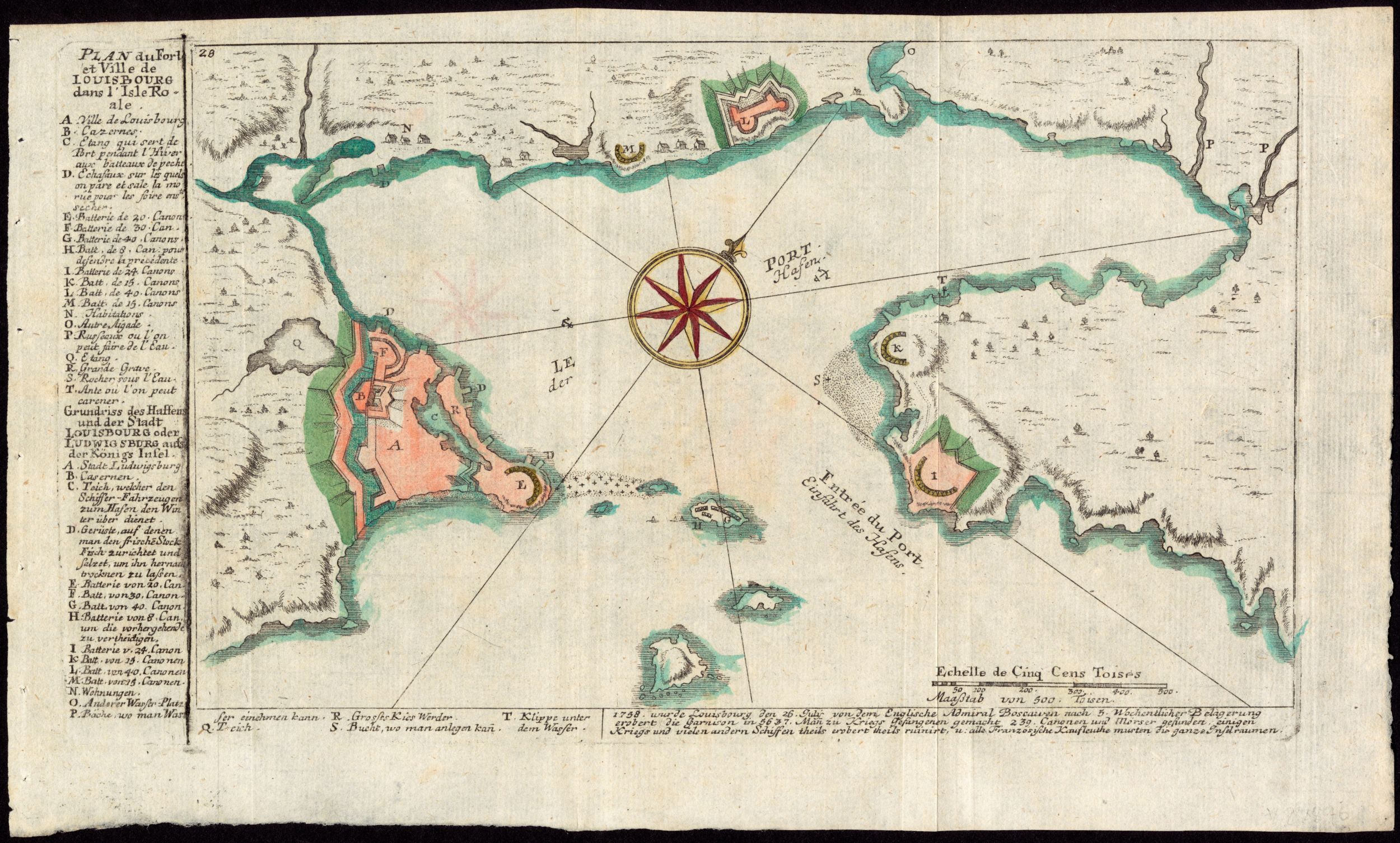
PLAN du Fort et Ville de LOUISBOURG dans l'Isle Royale
NOTDATED-4 [LMEC]
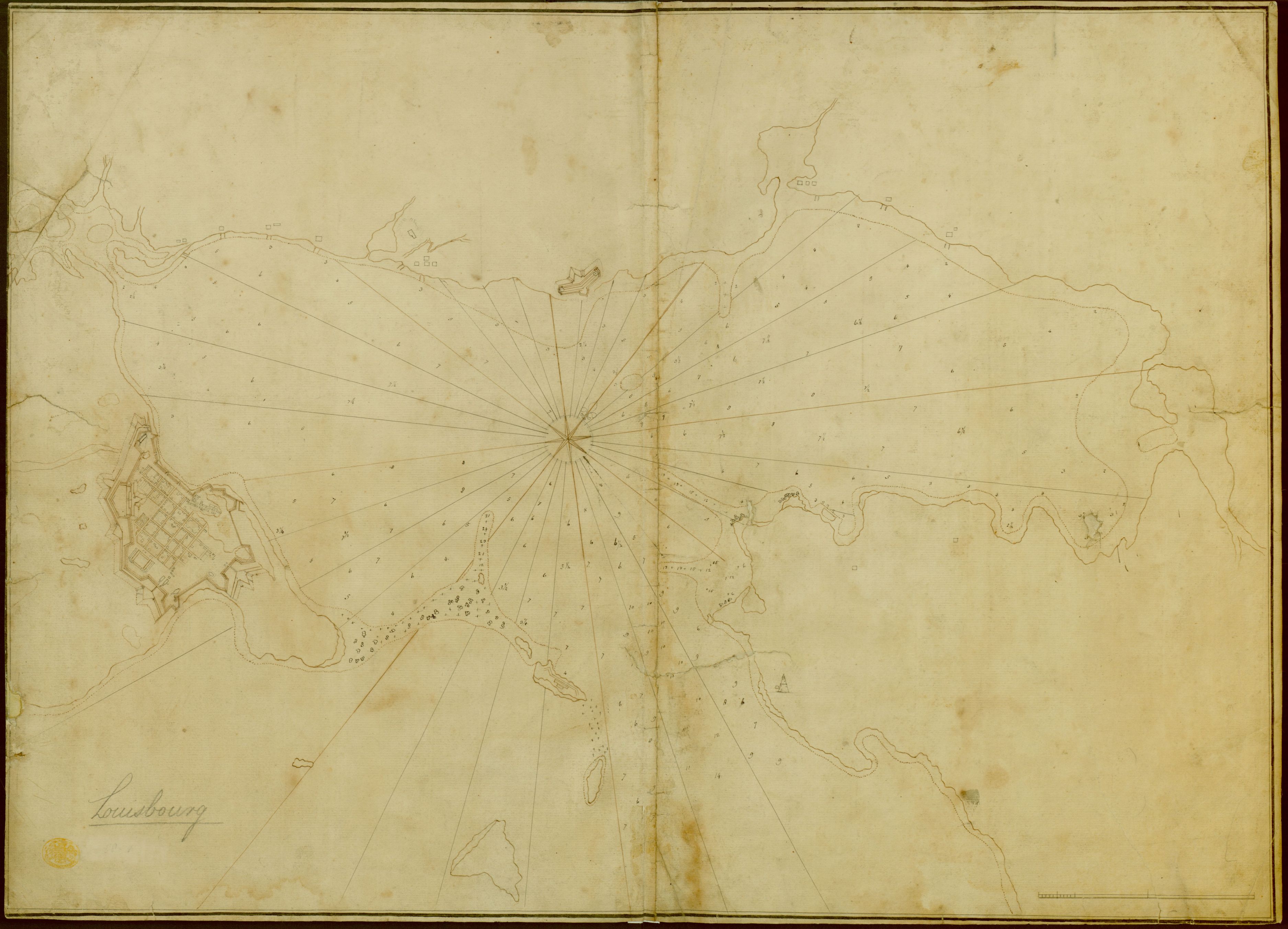
NO TITLE ["Louisbourg"]
NOTDATED-5 [LMEC]
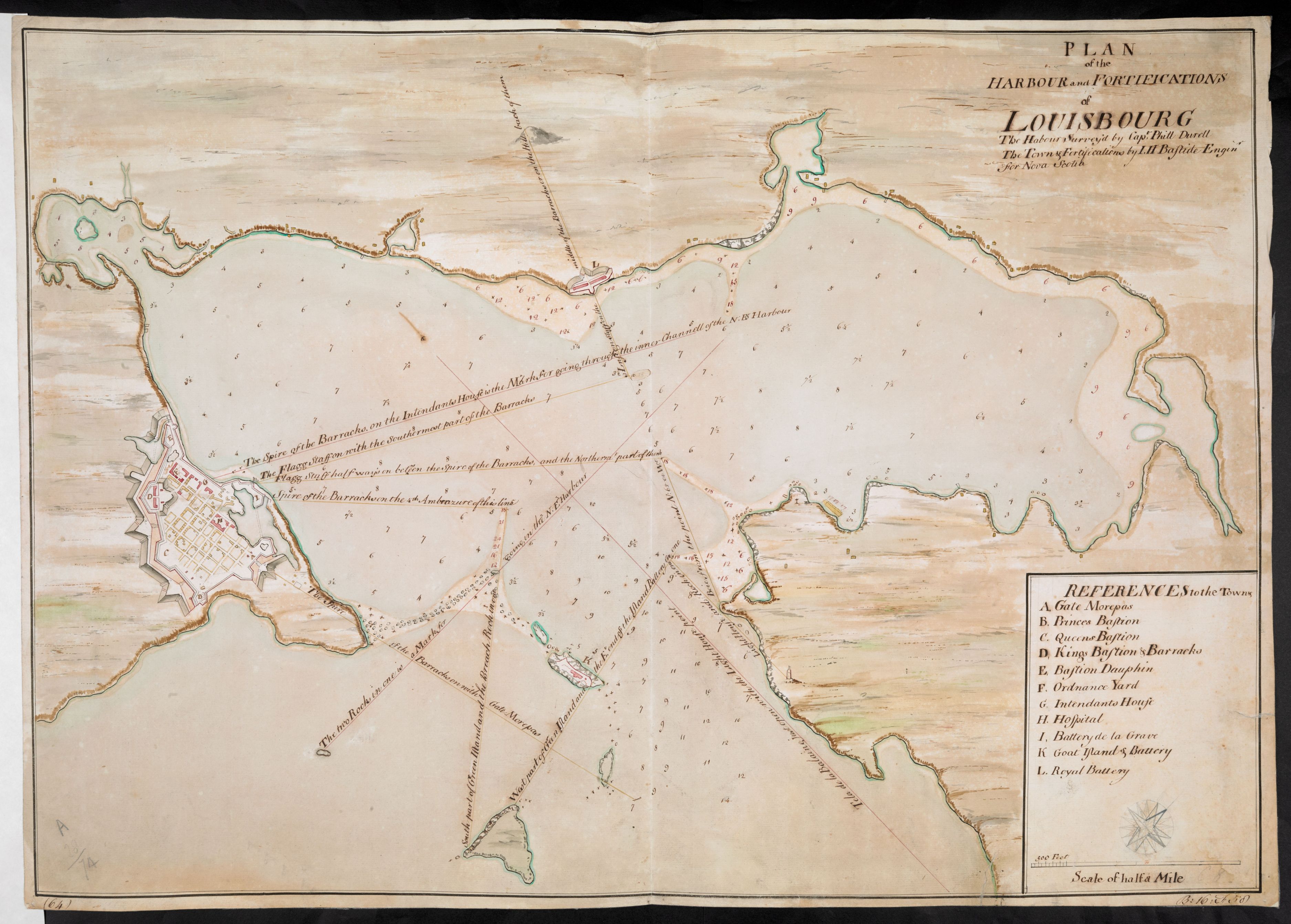
PLAN of the HARBOUR and FORTIFICATIONS of LOUISBOURG The Habour Survey'd by Capt Phill Duvell .... Bastide ...
NOTDATED-6 [LMEC]
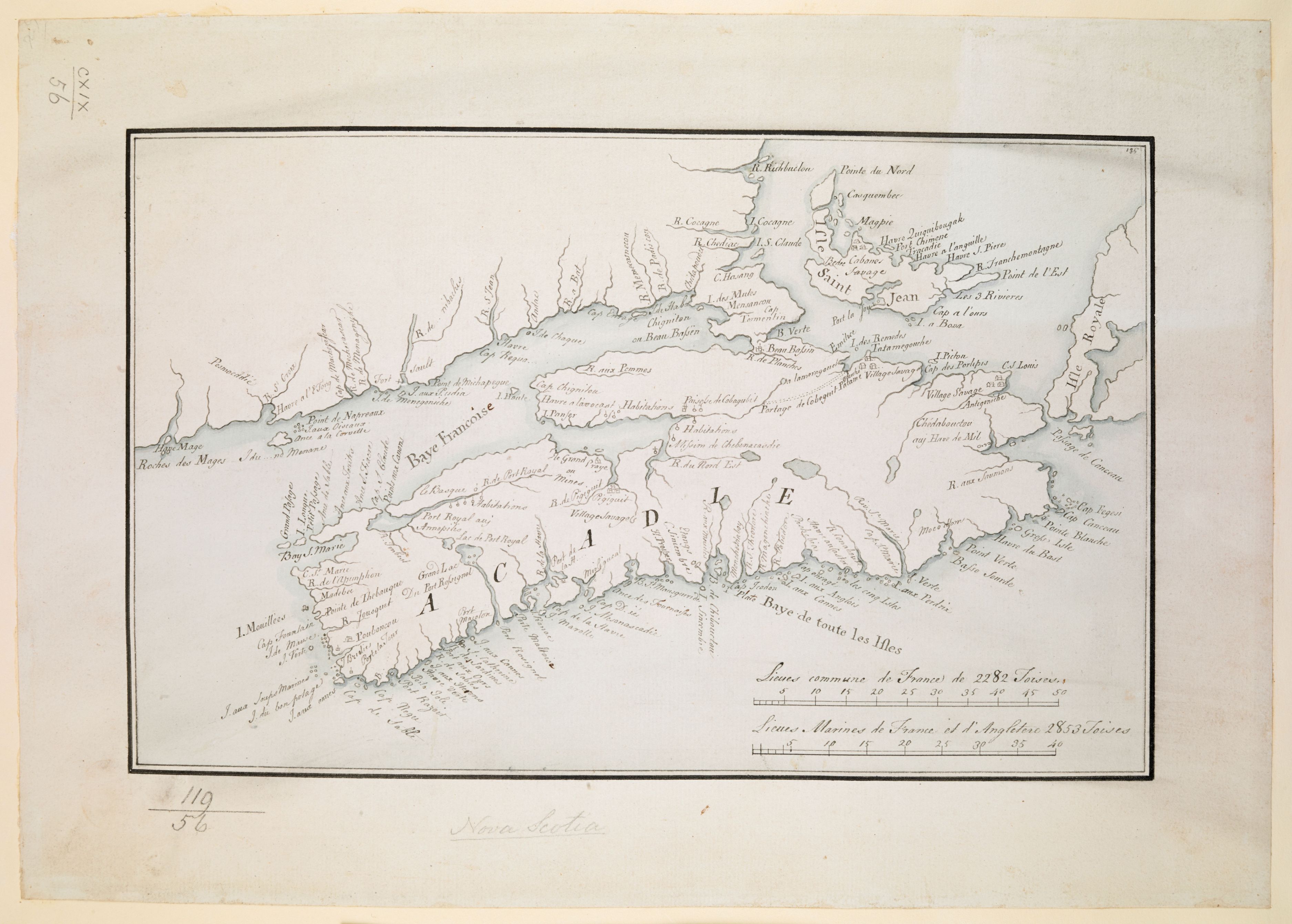
NO TITLE ["ACADIA"]
NOTDATED-7 [LMEC]
![]()