FortressMaps
Website Design and Content
© by Eric Krause, Krause House
Info-Research Solutions (© 1996)
All Images ©
Parks Canada Unless Otherwise Designated
Report/Rapport ©
Krause House Info-Research
Solutions
Researching
the Fortress of Louisbourg National Historic Site of Canada
Recherche sur la Forteresse-de-Louisbourg Lieu historique national du Canada
![]()
LOUISBOURG MAPS AND PLANS:
All Maps and Plans © Institution Holding the Original
For additional text and the name of the institution holding the original
LIBRARY OF CONGRESS
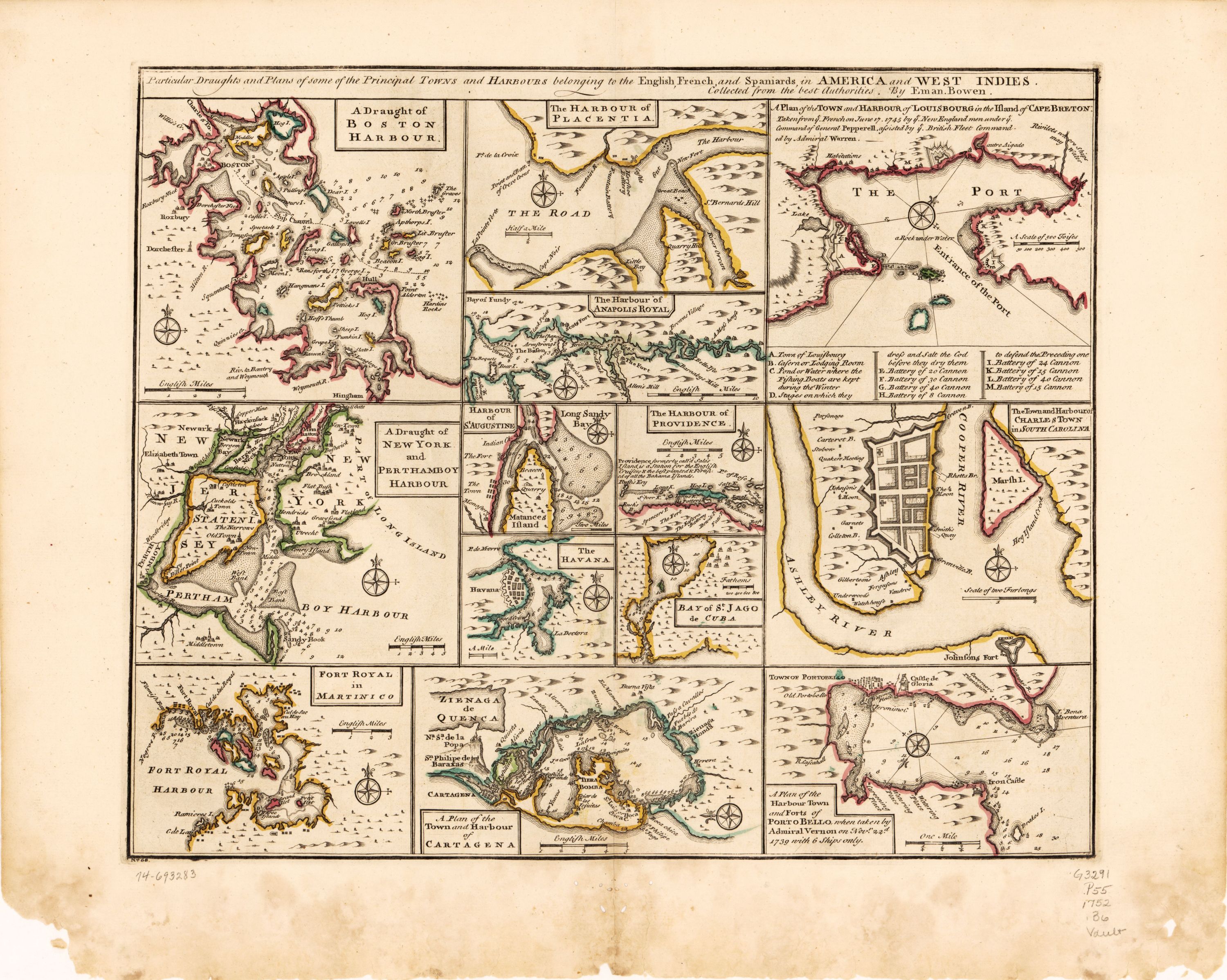
Particular Draughts and Plans of some of the Principal TOWNS and HARBOURS belonging to the English, French, and Spaniards, in AMERICA and WEST INDIES ......
NOTDATED-1 [LC]
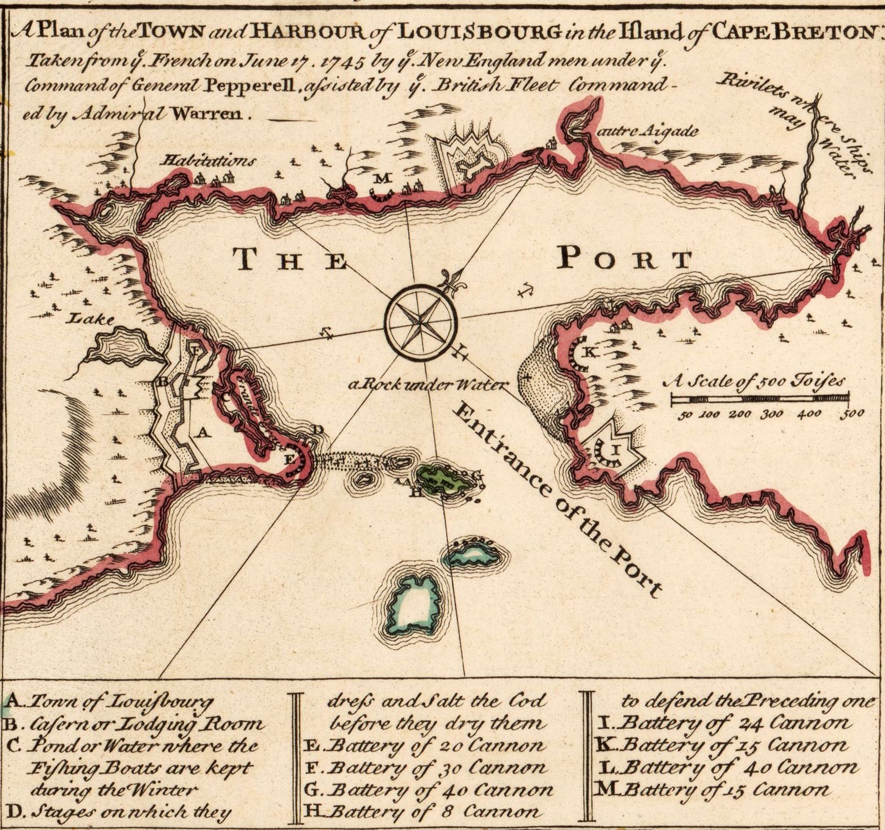
A Plan of the TOWN and HARBOUR of LOUISBOURG in the Island of CAPE BRETON Taken from ye. French on June 17. 1745 by ye. New England men ....
NOTDATED-1-1 [LC]
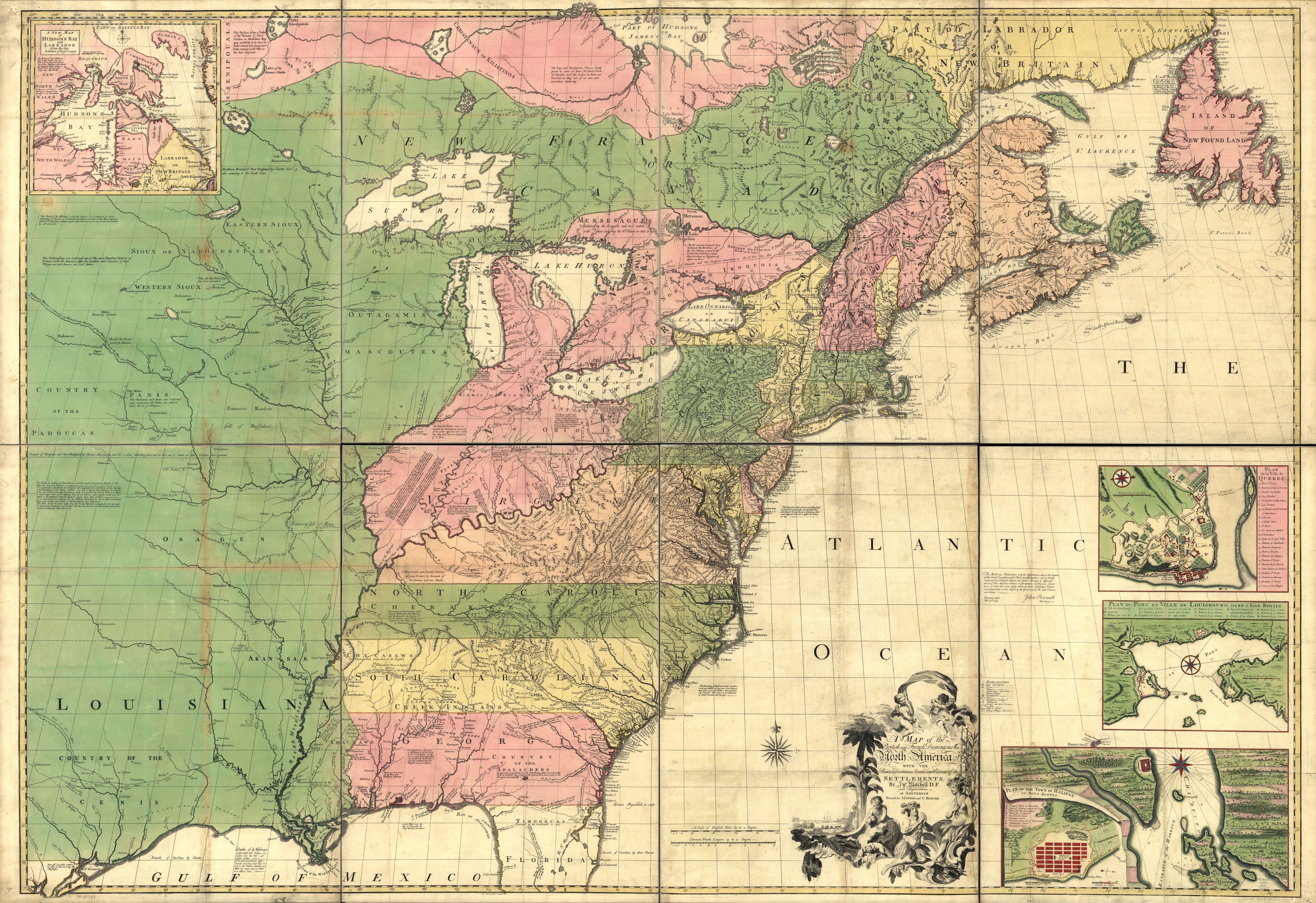
A MAP of the British and French Dominions in North America, WITH THE Roads, Distances, Limits, and Extent of the SETTLEMENTS ....
NOTDATED-2 [LC]
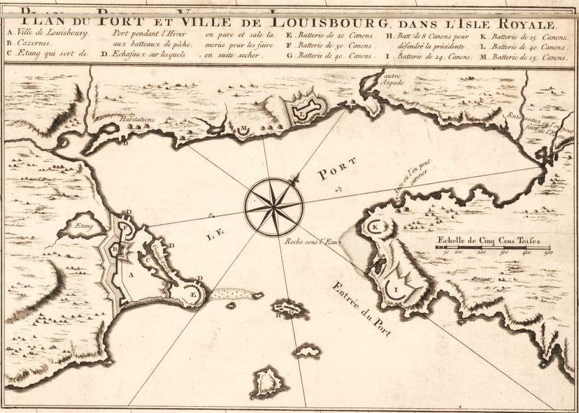
PLAN DU PORT ET VILLE DE LOUISBOURG DANS L'ISLE ROYALE.
NOTDATED-2-1 [LC]
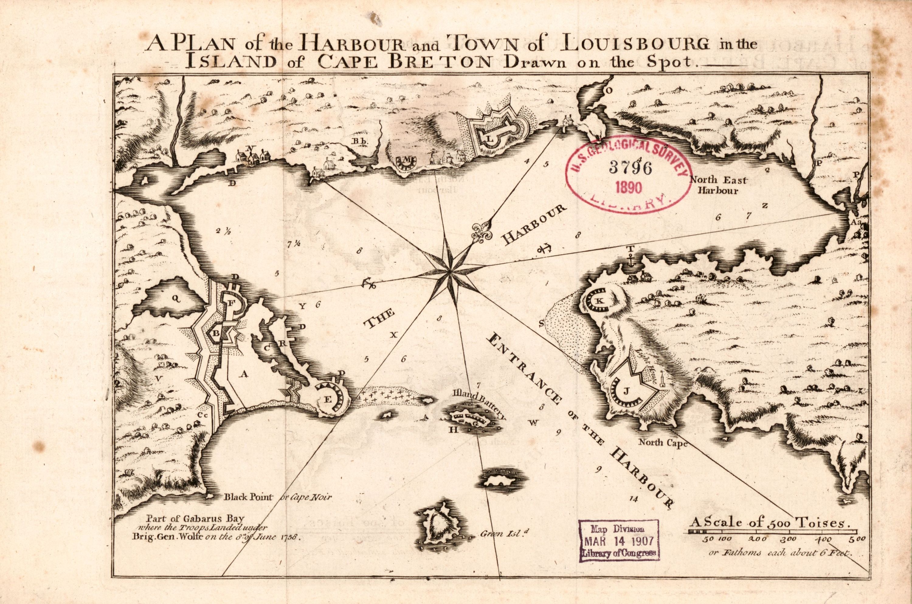
A PLAN of the HARBOUR and TOWN of LOUISBOURG in the ISLAND of CAPE BRETON Drawn on the spot.
NOTDATED-3 [LC]
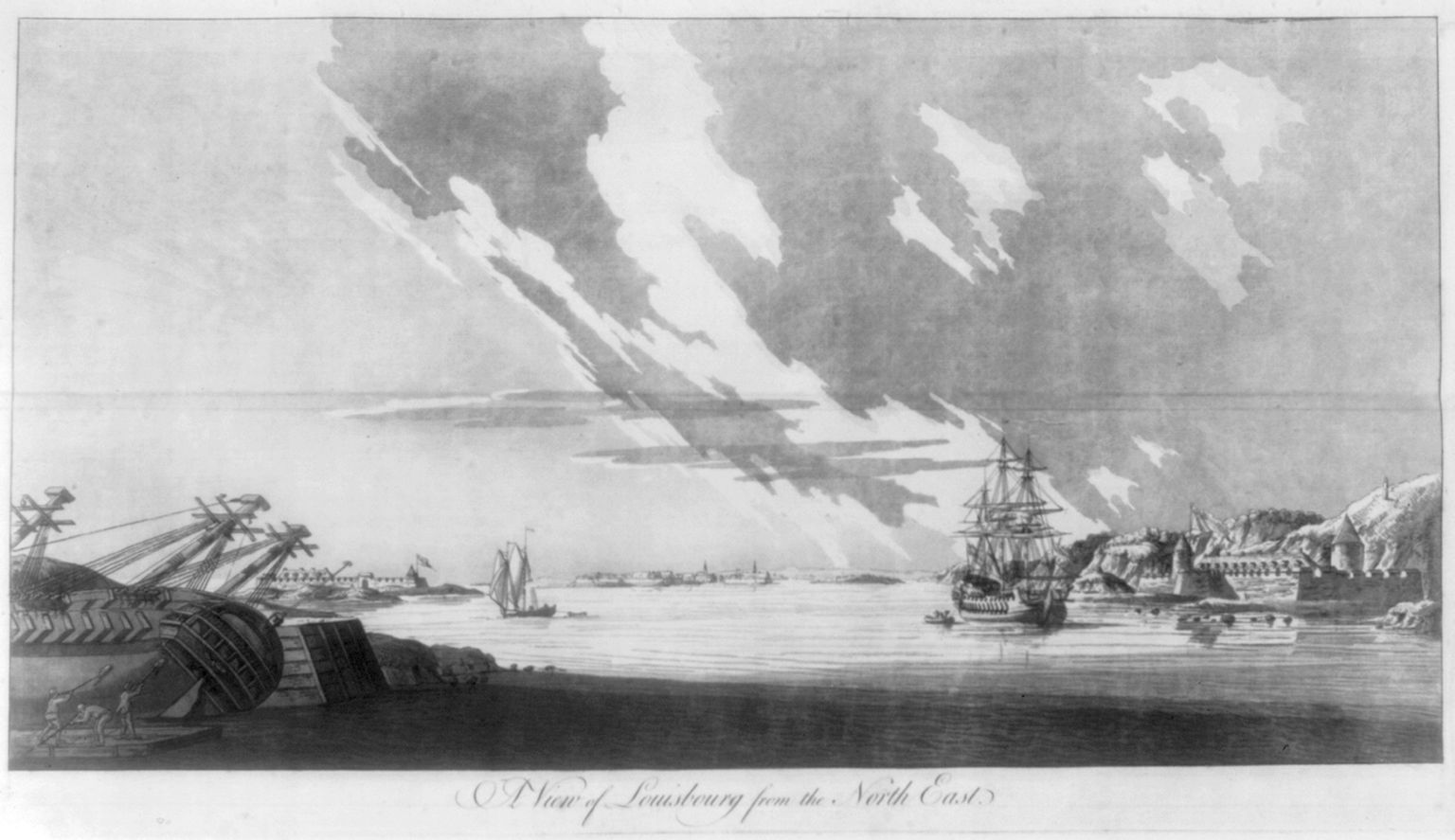
A View of Louisbourg from the North East
NOTDATED-4 [LC]
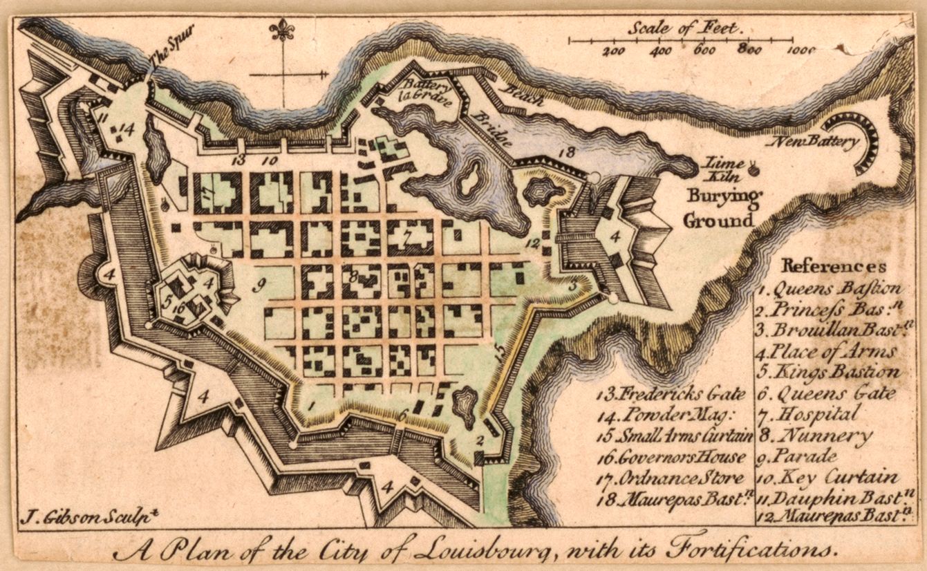
A Plan of the City of Louisbourg, with its Fortifications.
NOTDATED-5 [LC]
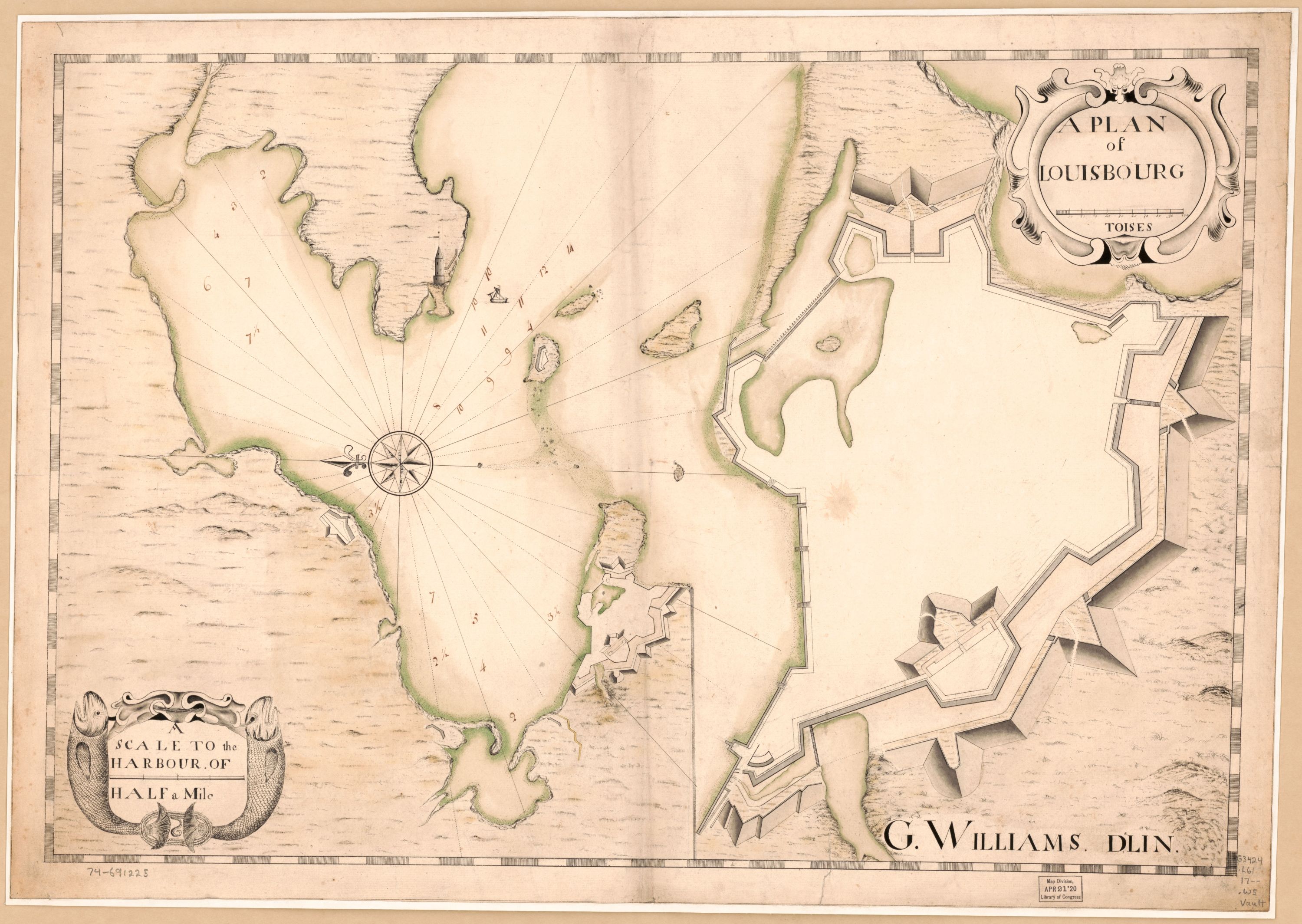
A PLAN of LOUISBURG
NOTDATED-6 [LC]
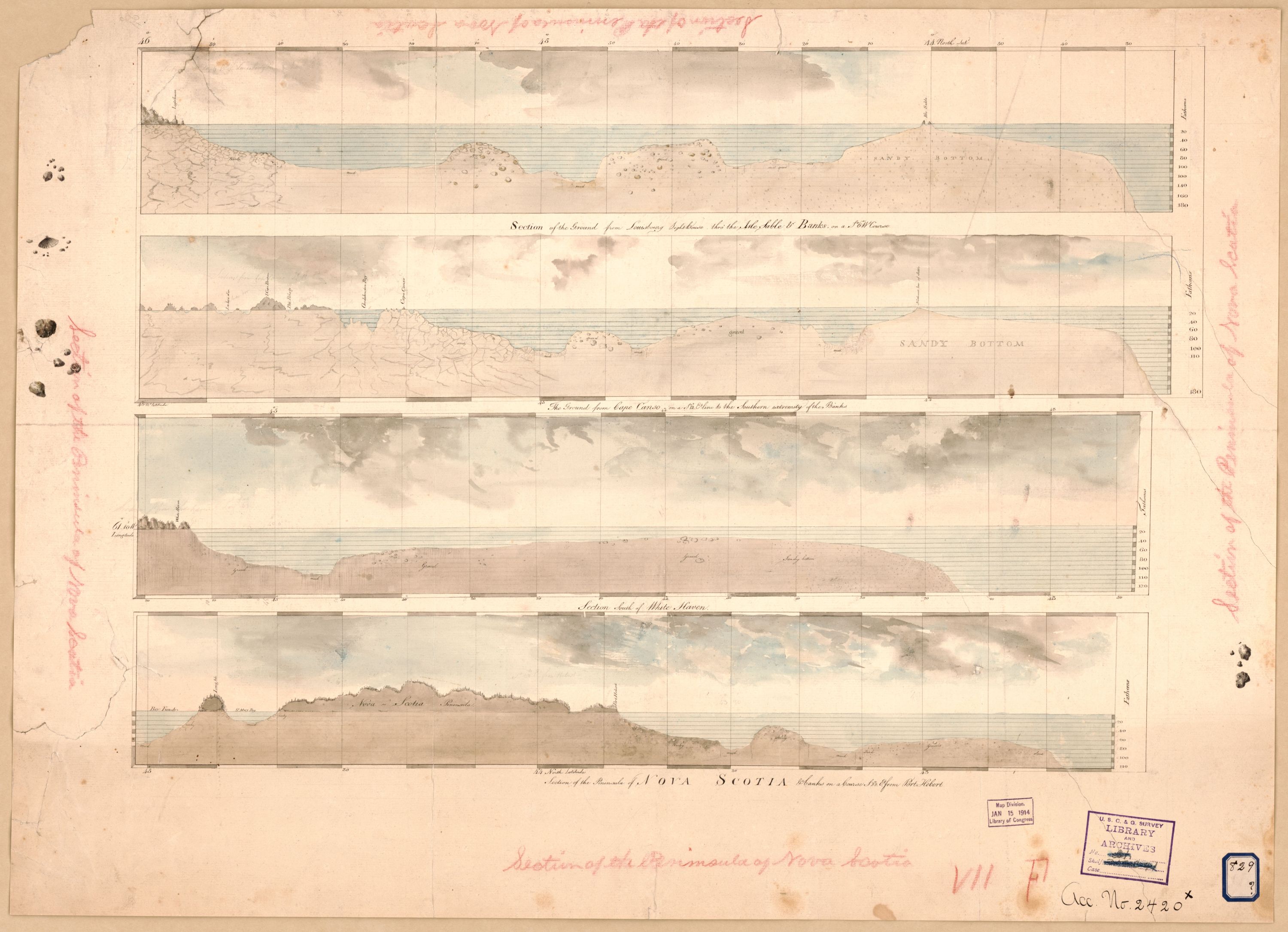
[Cross sections of the peninsula of Nova Scotia].
NOTDATED-7 [LC]
Section of the Ground from Louisbourg Lighthouse thro' the Isle Sable & Banks, on a So & Wt Course.
NOTDATED-7-1 [LC]
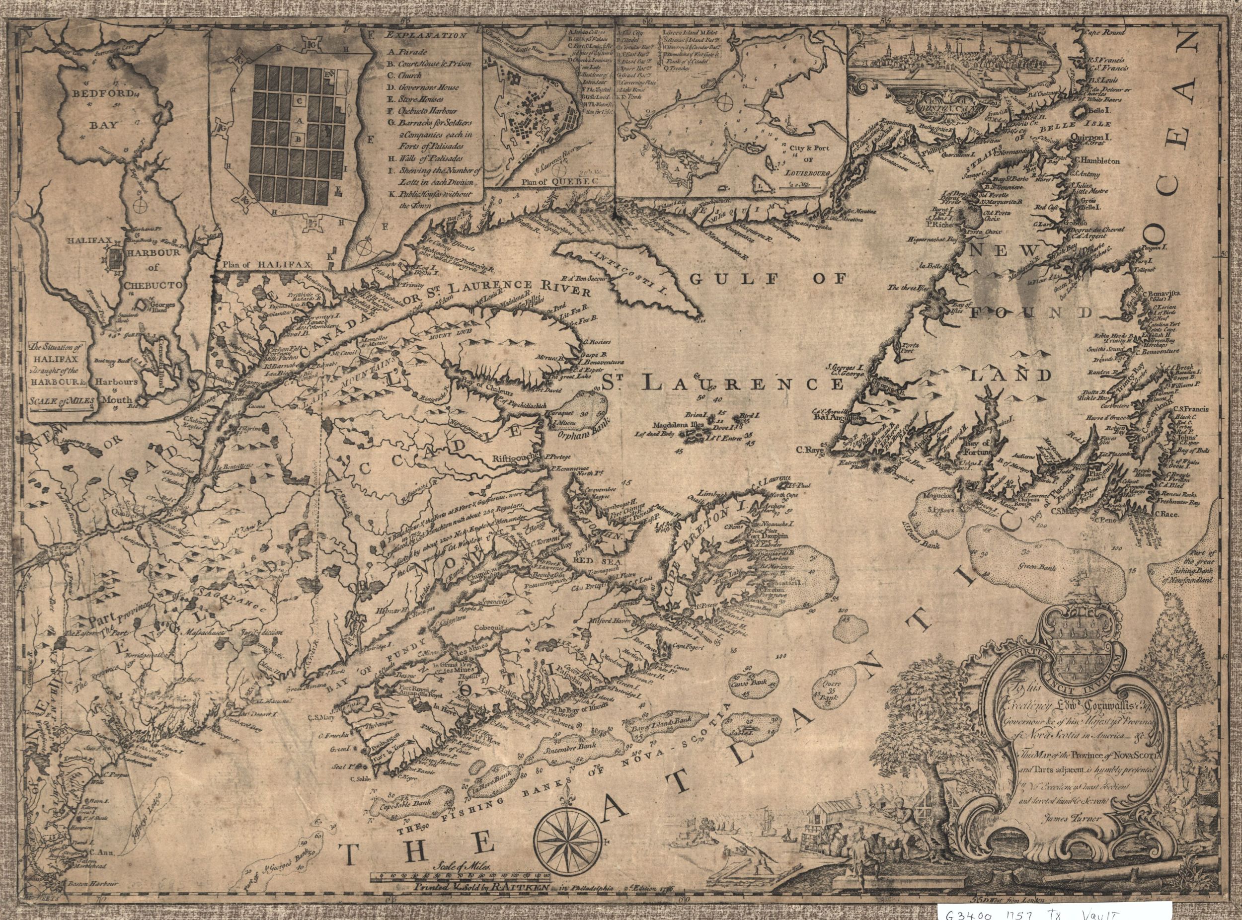
To his Excellency .... Cornwallis ....This MAP of the Province of NOVA SCOTIA and Parts adjacent ...
NOTDATED-8 [LC]
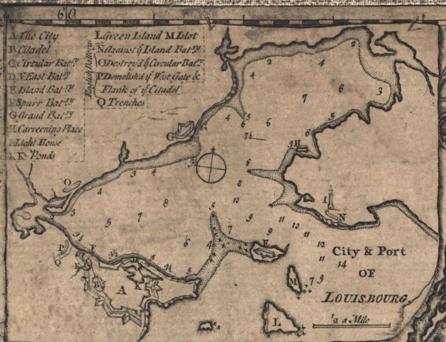
City & Port OF LOUISBOURG
NOTDATED-8-1 [LC]
![]()