FortressMaps
Website Design and Content
ę by Eric Krause, Krause House
Info-Research Solutions (ę 1996)
All Images ę
Parks Canada Unless Otherwise Designated
Report/Rapport ę
Krause House Info-Research
Solutions
Researching
the Fortress of Louisbourg National Historic Site of Canada
Recherche sur la Forteresse-de-Louisbourg Lieu historique national du Canada
![]()
LOUISBOURG MAPS AND PLANS:
All Maps and Plans ę Institution Holding the Original
For additional text and the name of the institution holding the original
DIGITAL COMMONWEALTH
MASSACHUSETTS COLLECTIONS ONLINE
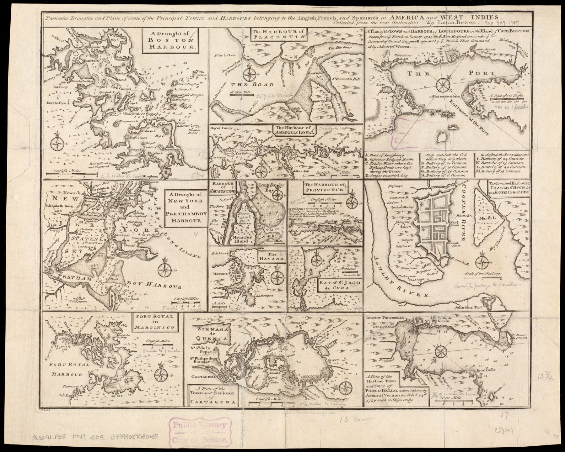
Particular draughts and plans of some of the principal towns and harbours belonging to the English, French, and Spaniards, in America and West Indies
NOTDATED-1 [Digital Commonwealth]
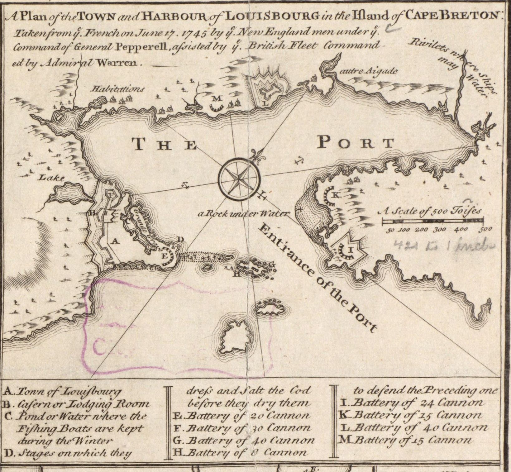
A Plan of the TOWN and HARBOUR of LOUISBOURG in the Island of CAPE BRETON Taken from ye. French on June 17, 1745 ...
NOTDATED-1-1 [Digital Commonwealth]
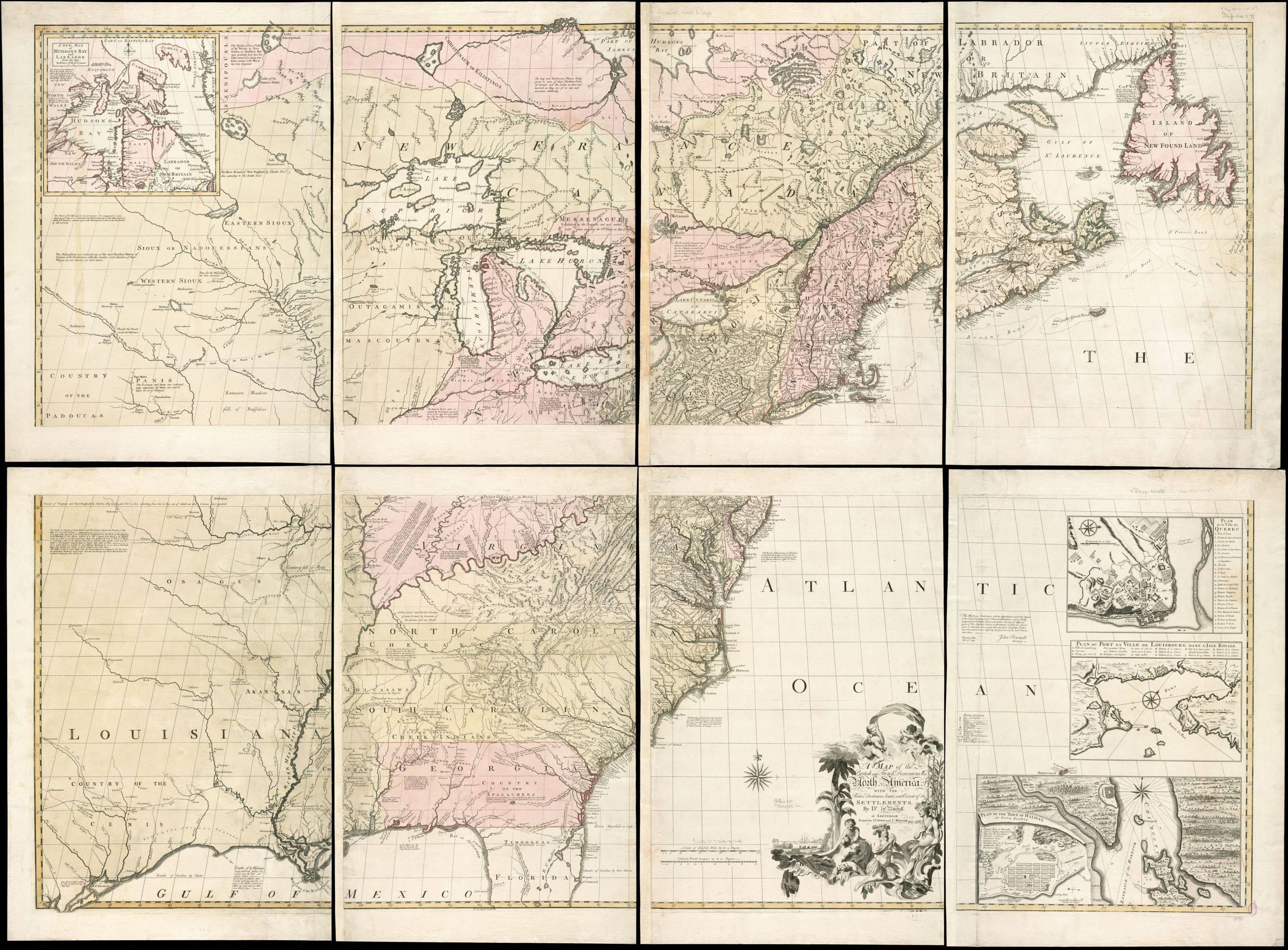
A map of the British and French dominions in North America, with the roads, distances, limits, and extent of the settlements
NOTDATED-2 [Digital Commonwealth]
PLAN DU PORT ET VILLE DE LOUISBOURG DANS L'ISLE ROYALE
NOTDATED-2-1 [Digital Commonwealth]
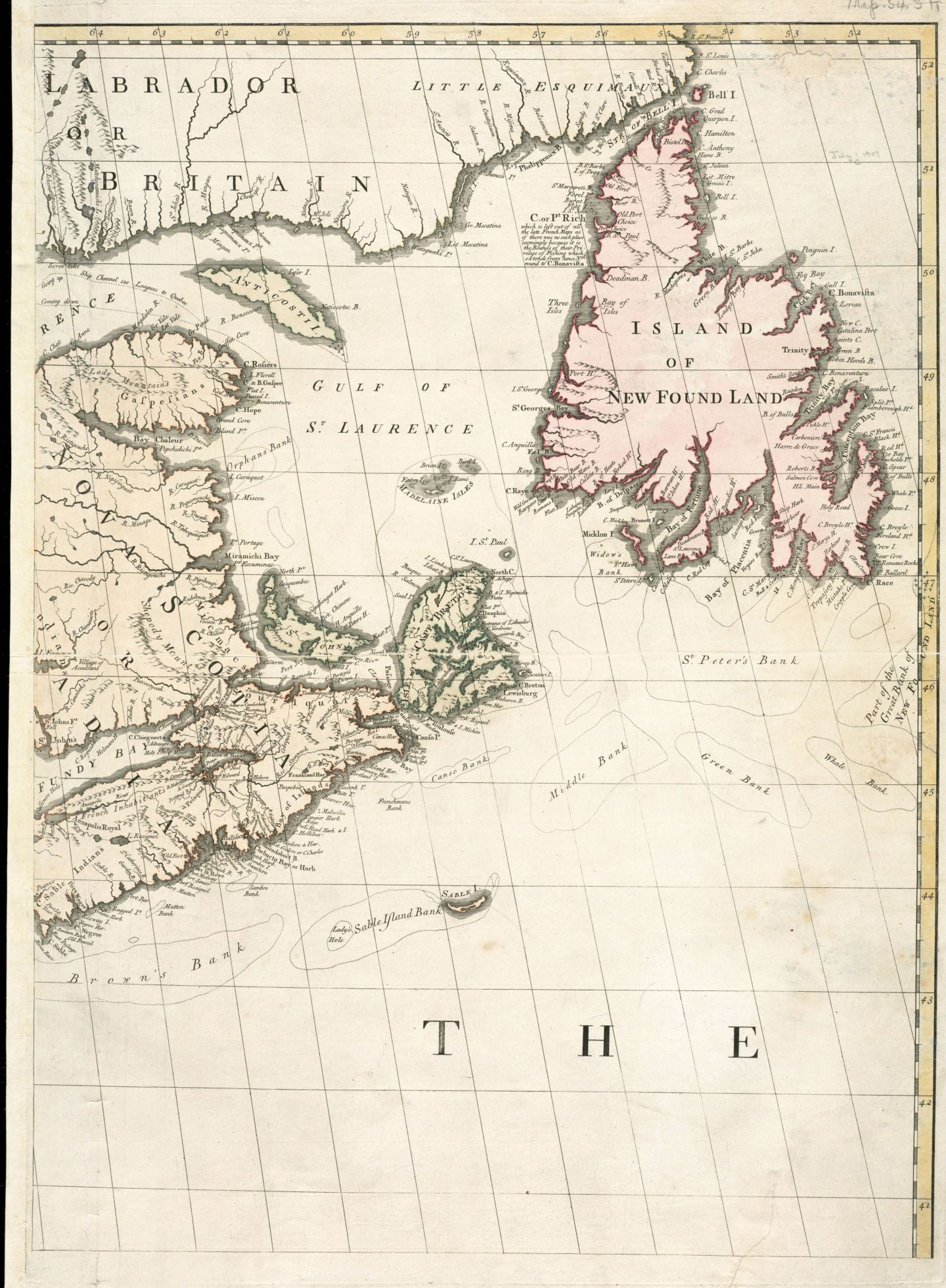
[NO TITLE]
NOTDATED-2-2 [Digital Commonwealth]
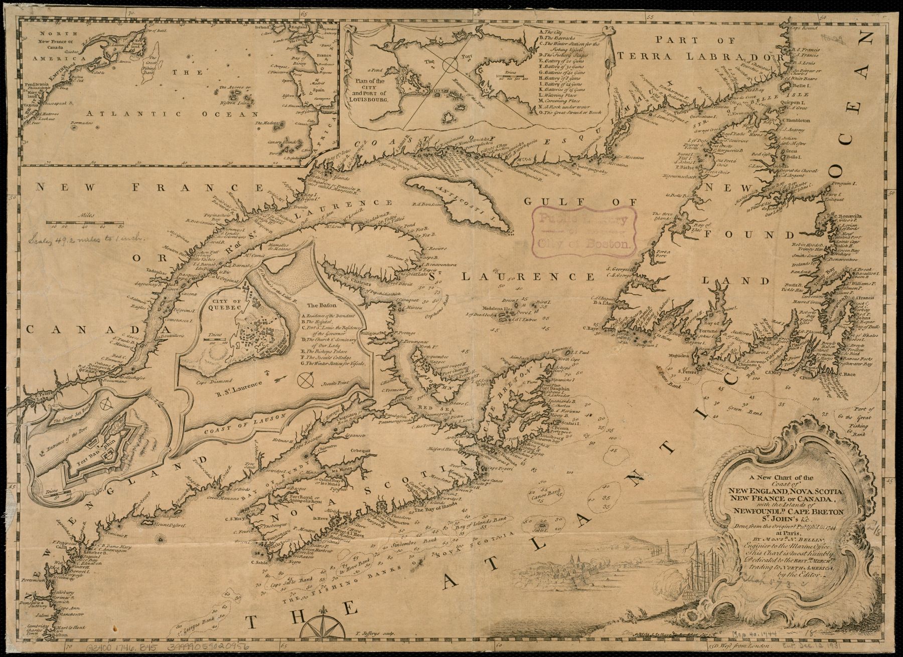
A new chart of the coast of New England, Nova Scotia, New France or Canada, with the islands of Newfoundld. Cape Breton St. John's &c : done from the original publish'd in 1744 at Paris
NOTDATED-3 [Digital Commonwealth]
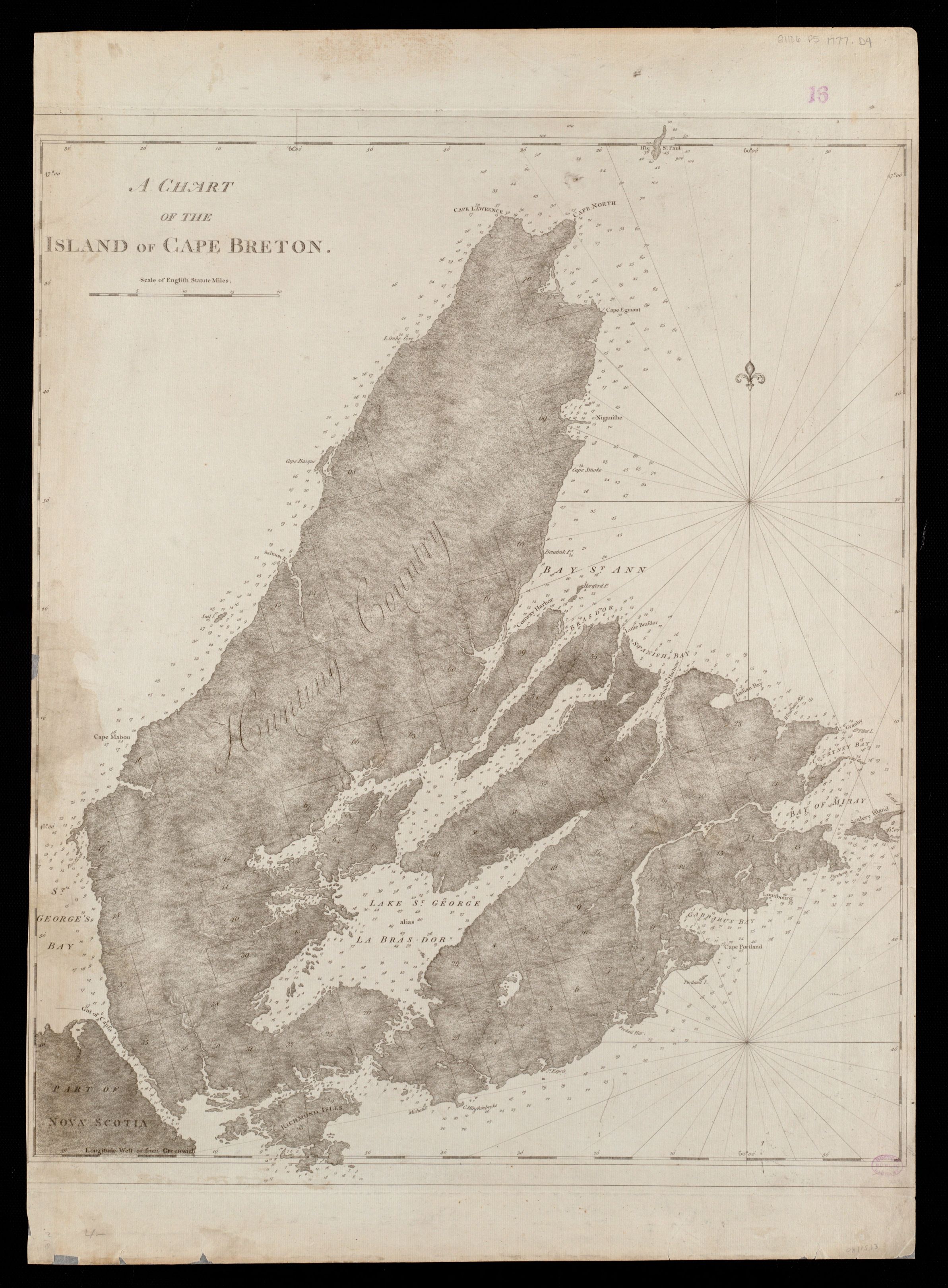
A CHART OF THE ISLAND OF CAPE BRETON
[Atlantic Neptune. London : J.F.W. Des Barres, 1777-[1781]]
NOTDATED-4 [Digital Commonwealth]
A CHART OF THE N.E. COAST OF CAPE BRETON ISLAND, FROM ST. ANN BAY TO CAPE MORIEN.
[Atlantic Neptune. London : J.F.W. Des Barres, 1777-[1781]]
NOTDATED-5 [Digital Commonwealth]
![]()