FortressMaps
Website Design and Content
© by Eric Krause, Krause House
Info-Research Solutions (© 1996)
All Images ©
Parks Canada Unless Otherwise Designated
Report/Rapport ©
Krause House Info-Research
Solutions
Researching
the Fortress of Louisbourg National Historic Site of Canada
Recherche sur la Forteresse-de-Louisbourg Lieu historique national du Canada
![]()
LOUISBOURG MAPS AND PLANS:
All Maps and Plans © Institution Holding the Original
For additional text and the name of the institution holding the original
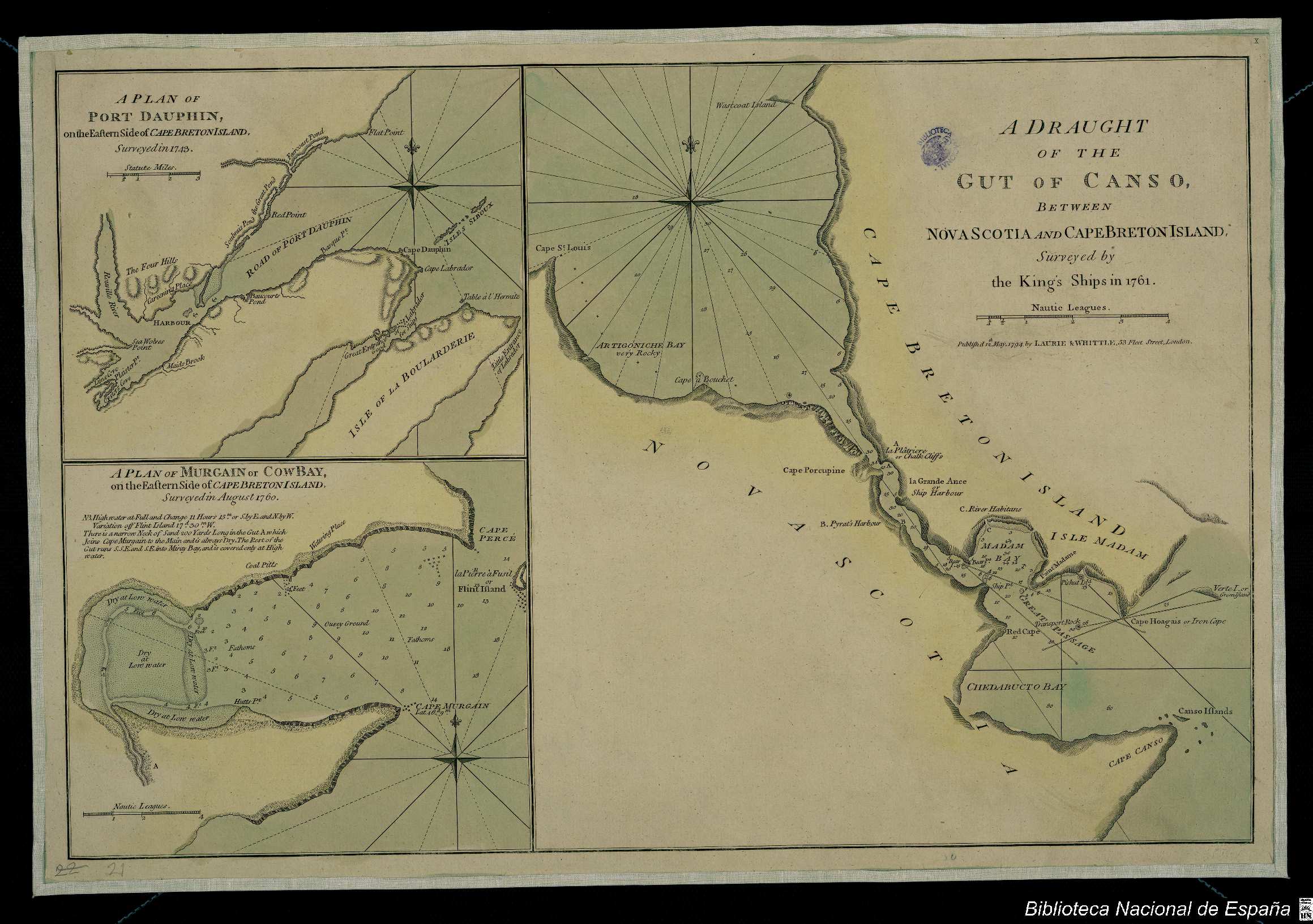
BIBLIOTECA NACIONAL DE ESPAŃA
A PLAN OF PORT DAUPHIN, on the Eastern Sided of CAPE BRETON ISLAND, Surveyed in 1743.
A PLAN OF MURGAIN or COWBAY, on the Eastern Sided of CAPE BRETON ISLAND, Surveyed in August
A DRAUGHT OF THE CUT OF CANSO BETWEEN NOVA SCOTIA AND CAPE BRETON ISLAND Surveyed by the King's Ships in 1761.
NOTDATED-1 [BNE]
A Draught of the Gut of Canso Between Nova Scotia and Cape Breton Island [Material cartográfico] : Surveyed by the King's Ships in 1761 by Robert Laurie and James Whittle - National Library of Spain, Spain - CC BY-NC-SA. https://www.europeana.eu/item/2022717/bnesearch_detalle_bdh0000033728
![]()