FortressMaps
Website Design and Content
© by Eric Krause, Krause House
Info-Research Solutions (© 1996)
All Images ©
Parks Canada Unless Otherwise Designated
Report/Rapport ©
Krause House Info-Research
Solutions
Researching
the Fortress of Louisbourg National Historic Site of Canada
Recherche sur la Forteresse-de-Louisbourg Lieu historique national du Canada
![]()
LOUISBOURG MAPS AND PLANS: 1800 - 1899
All Maps and Plans © Institution Holding the Original
For additional text and the name of the institution holding the original
Louisbourg Supposed to have been surveyed in in 1784 or 1785
Western Part of the Island of Cape Breton according to late surveys of the Roads
MAP of the Island of CAPE BRETON, shewing the Situation and extent of the Granted & Ungranted Lands ...
Louisbourg Surveyed in 1827 by Mr. Benjm. Cossit ...
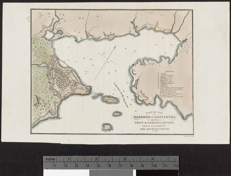
PLAN OF THE HARBOUR OF LOUISBURG and the Town & FORTIFICATIONS when it was surrendered to THE BRITISH FORCES
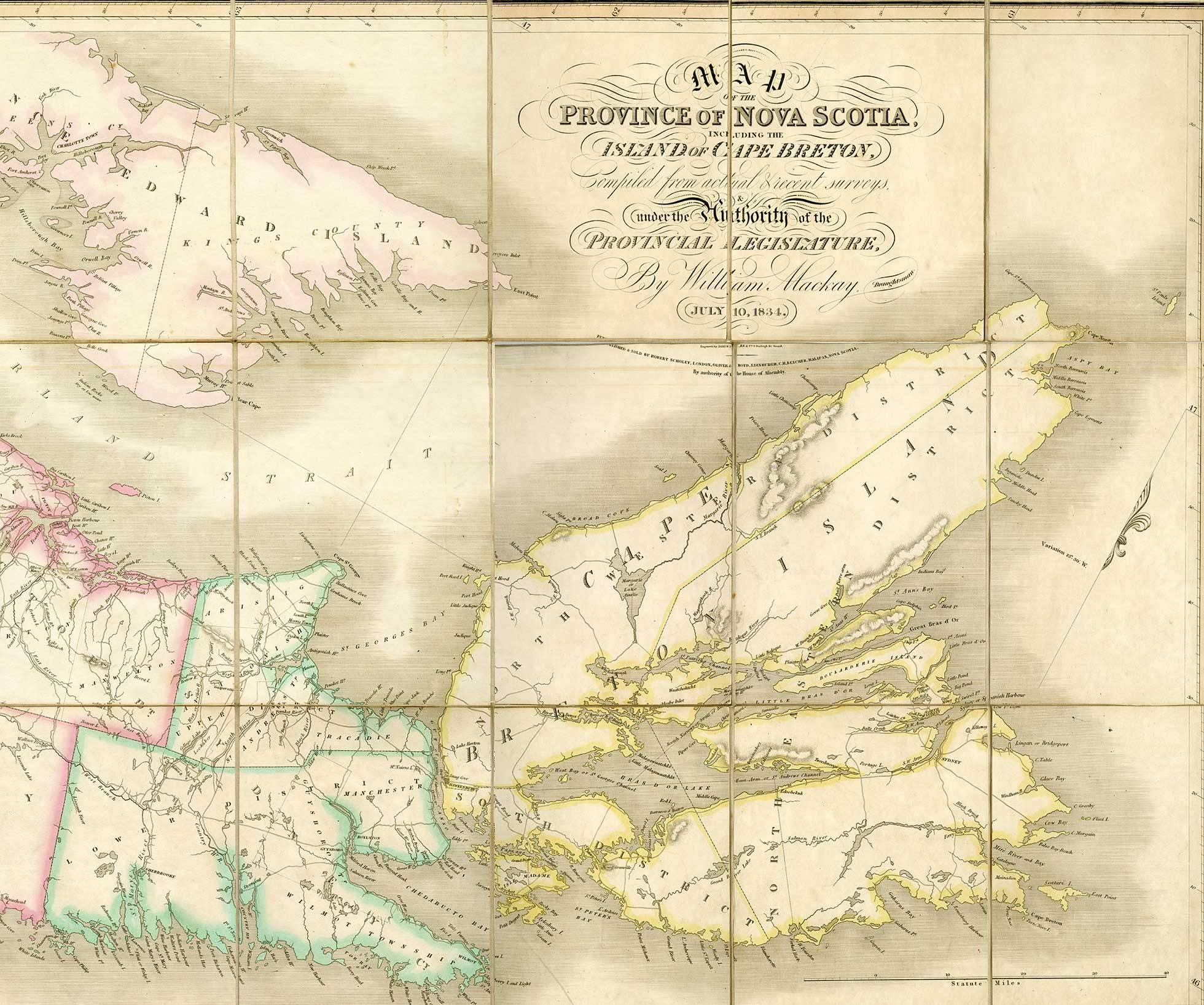
Belcher's map of the Province of Nova
Scotia, including the Island of Cape Breton,
compiled from actual & recent surveys,
& under the authority of the Provincial Legislature, by William Mackay,
draughtsman.
July 10, 1834. Second edition, corrected to 1855.
Engraved by James Neele & Co., 3 Burleigh St., Strand. Published &
sold by John Snow, 35 Patternoster Row,
London; and C.H. Belcher, Halifax, Nova Scotia.
1834-July10 [BI]
The Beaton Institute
MABOU HARBOUR SURVEYED BY CAPTAIN H.W. BAYFIELD, R.N., ... 1847
SYDNEY
HARBOUR SURVEYED BY CAPTN. H.W. BAYFIELD, R.N., ... 1849
CONTINUATION OF THE SOUTH ARM
SCATARY ISLAND
AND MENADOU BAY
SURVEYED BY CAPT. H.W. BAYFIELD .... 1850
1850 [Digital Commonwealth]
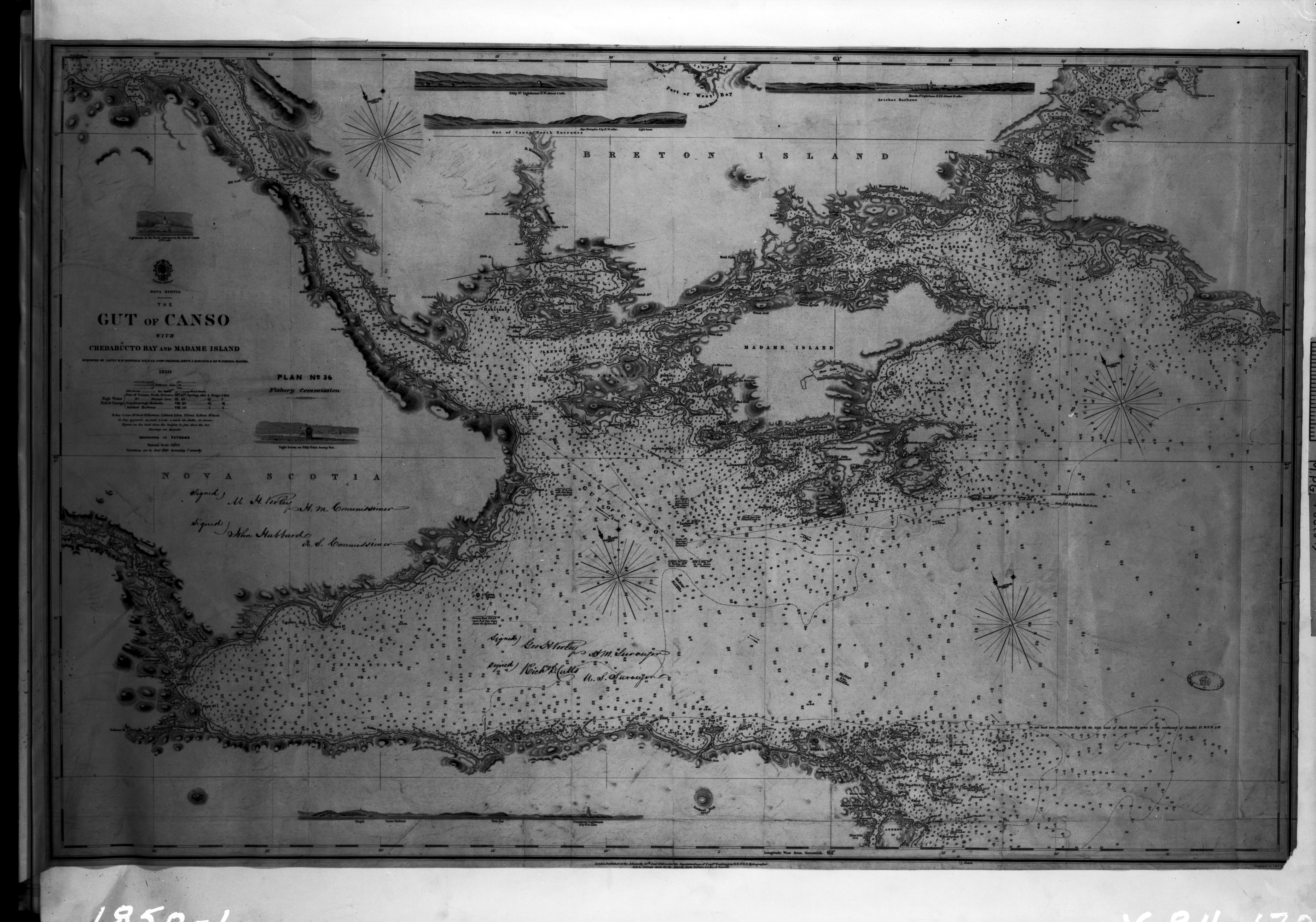
THE
GUT OF CANSO WITH CHEDABUCTO BAY AND MADAME ISLAND SURVEYED BY CAPTN. H.W.
BAYFIELD, R.N., ... 1850
Light House on ...
SCATARI ISLAND AND MENADOU BAY SURVEYED BY CAPTN. H.W. BAYFIELD, R.N., ... 1850
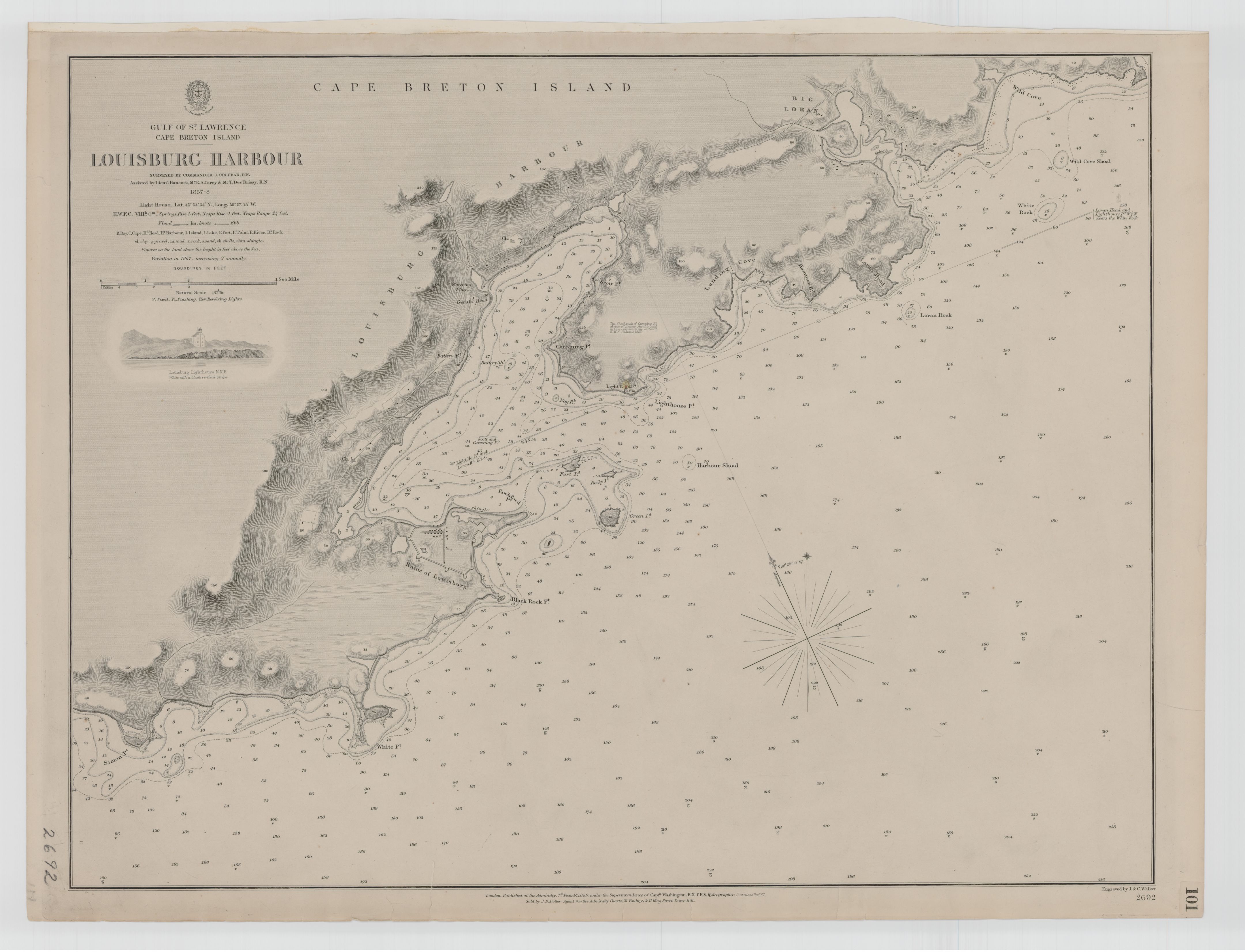
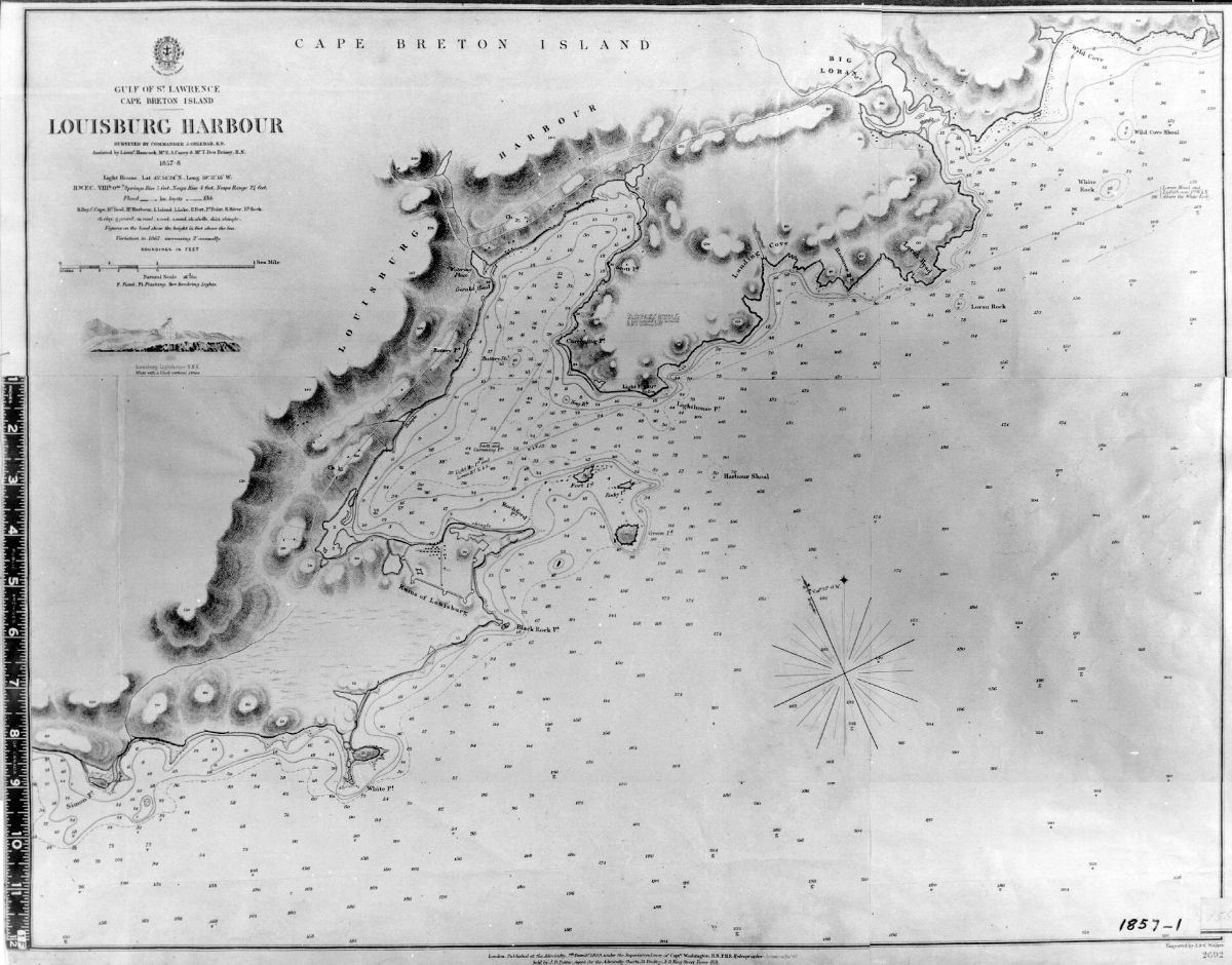
LOUISBURG HARBOUR SURVEYED BY COMMANDER J. ORLEBAR ... 1857-8
GULF OF ST. LAWRENCE CAPE BRETON ISLAND LOUISBOURG HARBOUR ... 1857-8 ...
MOUTHS OF THE MIRÉ AND GRAND RIVERS. Cape Breton. 1860
Old
Town of Louisbourg
Anonymous
Licence of occupation and sketch of 60 acres of land granted to Dennis Kennedy
and sons
Louisburg
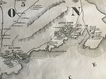
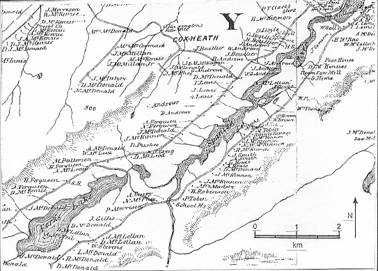
- [Church, Ambrose F. "Topographical Township Map of Cape Breton County," Nova Scotia, 1864, pub. 1877]
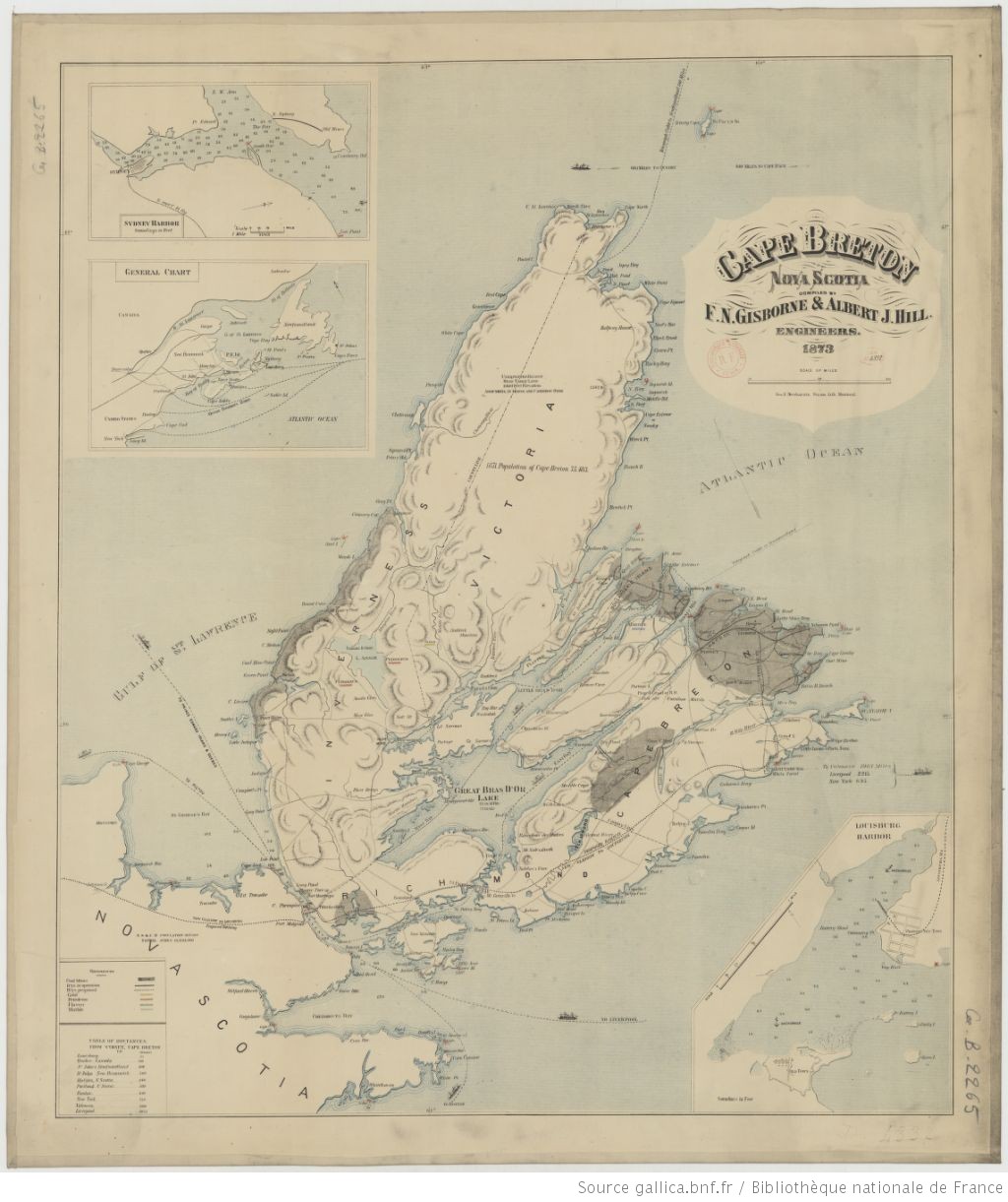
CAPE BRETON NOVA SCOTIA ... F.N. GISBORNE & ALBERT J. HILL. ENGINEERS. 1873
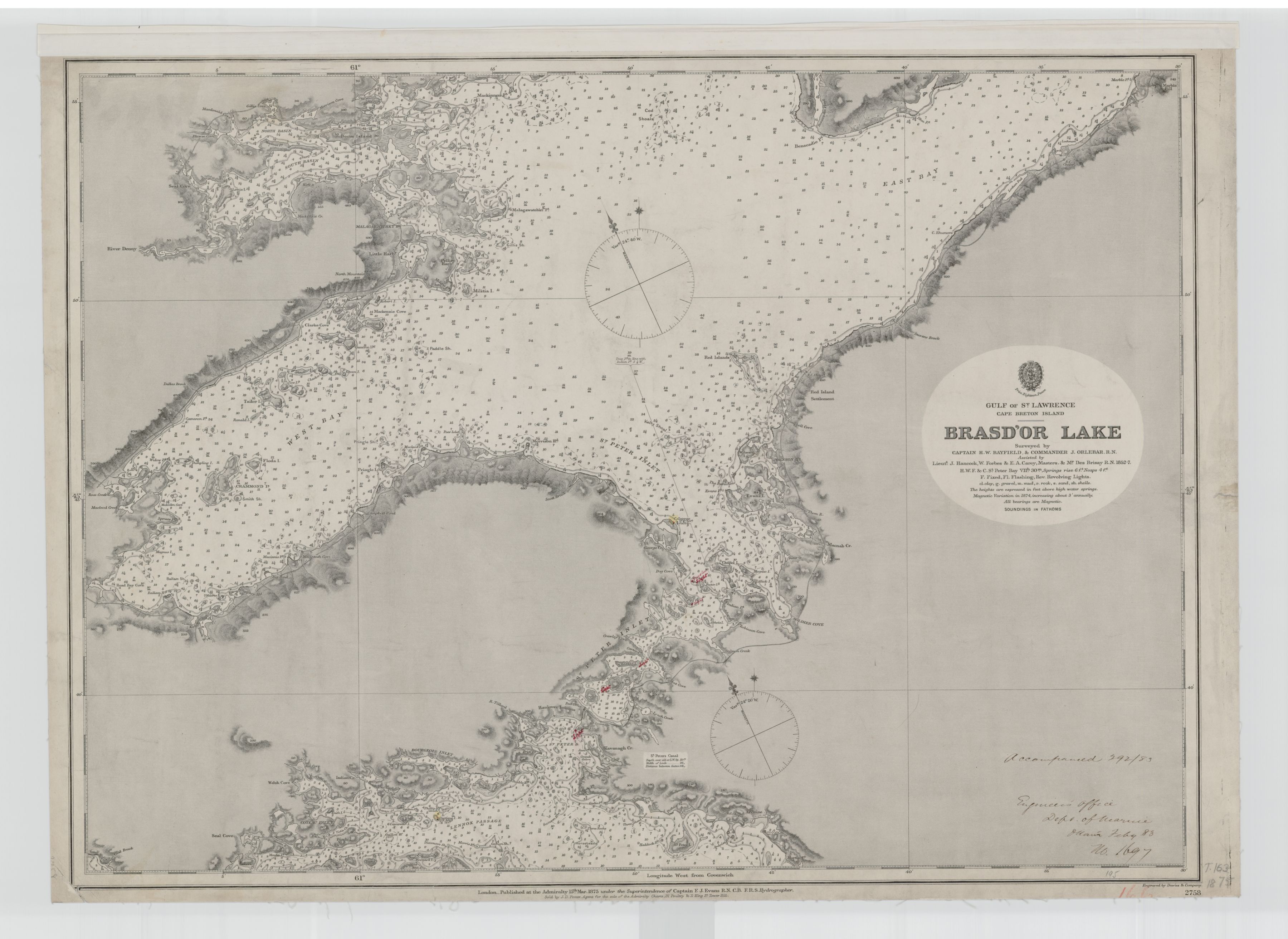
GULF OF ST. LAWRENCE CAPE BRETON ISLAND BRASD'OR ... 1852-7 ....
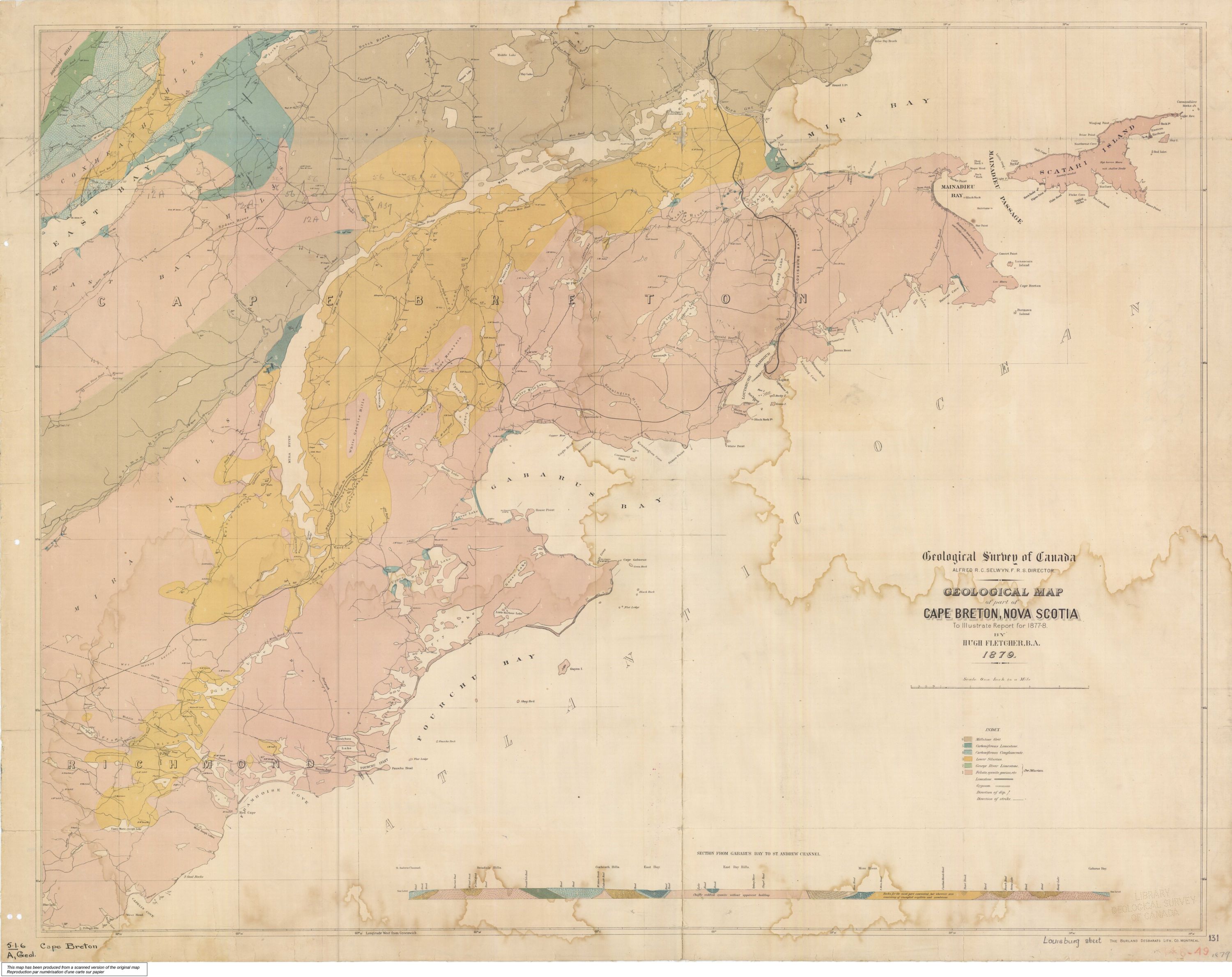
GEOLOGICAL MAP of Part of CAPE
BRETON, NOVA SCOTIA,
to Illustrate Report for 1877-8 BY HUGH FLETCHER, B.A. 1879
1879 [GSC]
Fletcher, H. (1879). Geological map
of Part of Cape Breton, Nova Scotia.
Geological Survey of Canada, Multicoloured Geological Map, 131.
https://doi.org/10.4095/108050
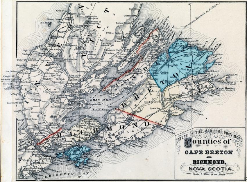
ATLAS OF THE
MARITIME PROVINCES -
Counties of Cape Breton and Richmond, Nova Scotia
1879 [BI]
The Beaton Institute
Lithographed
to accompany the Report on Canadian Archives for 1886 by Douglas Brymner,
Archivist
Report on Canadian Archives by Douglas Brymner, Archivist 1886
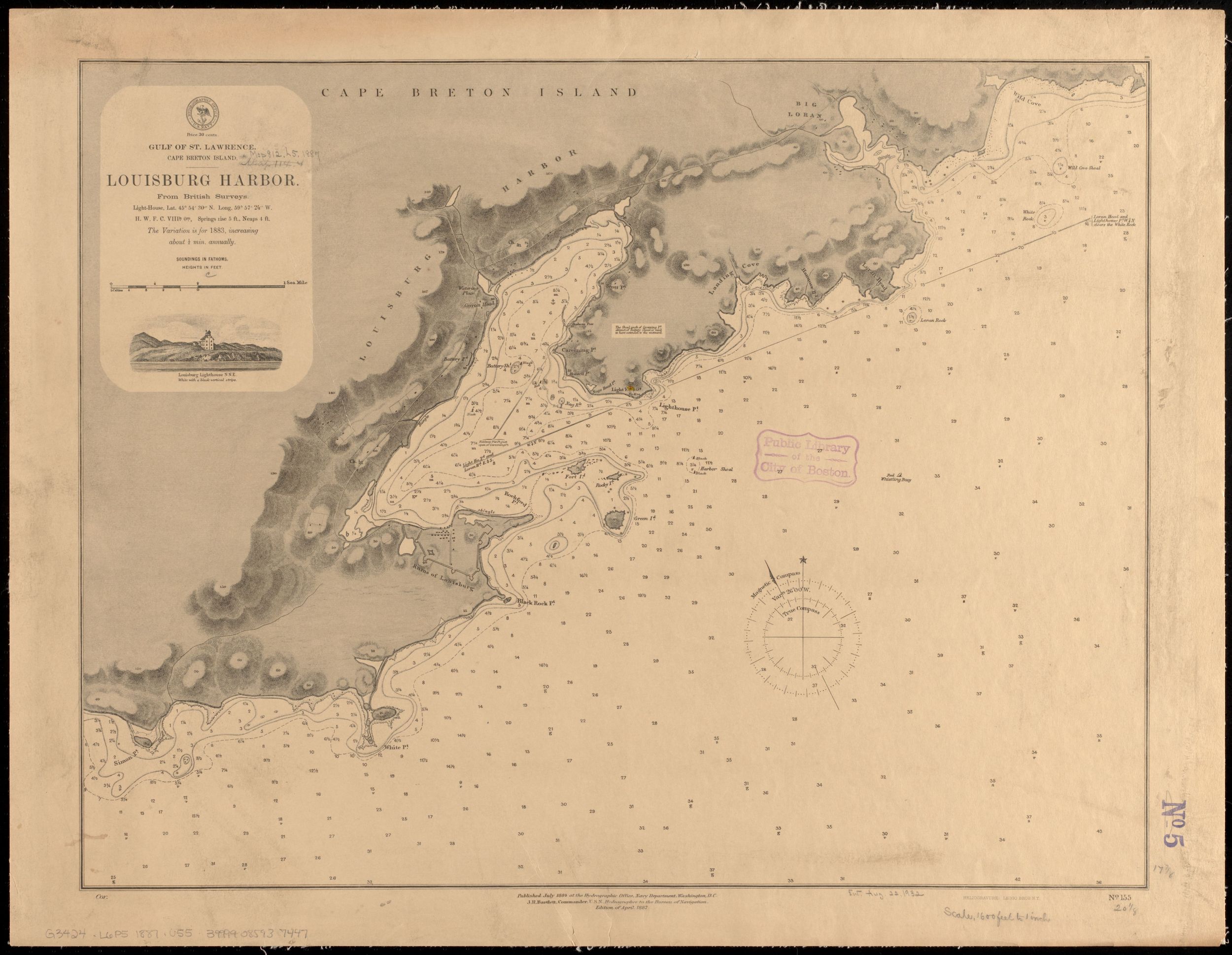
GULF OF ST.
LAWRENCE. CAPE BRETON ISLAND.
LOUISBURG HARBOR. From British Surveys.
1884-July/1887-April [LEMC]
LOUISBURG HARBOUR SURVEYED BY COMMANDER G. E. RICHARDS ... H.M. SURVEYING SHIP 'RAMBLER' 1896 ...
![]()