FortressMaps
Website Design and Content
© by Eric Krause, Krause House
Info-Research Solutions (© 1996)
All Images ©
Parks Canada Unless Otherwise Designated
Report/Rapport ©
Krause House Info-Research
Solutions
Researching
the Fortress of Louisbourg National Historic Site of Canada
Recherche sur la Forteresse-de-Louisbourg Lieu historique national du Canada
![]()
LOUISBOURG MAPS AND PLANS: 1746 - 1749
All Maps and Plans © Institution Holding the Original
For additional text and the name of the institution holding the original
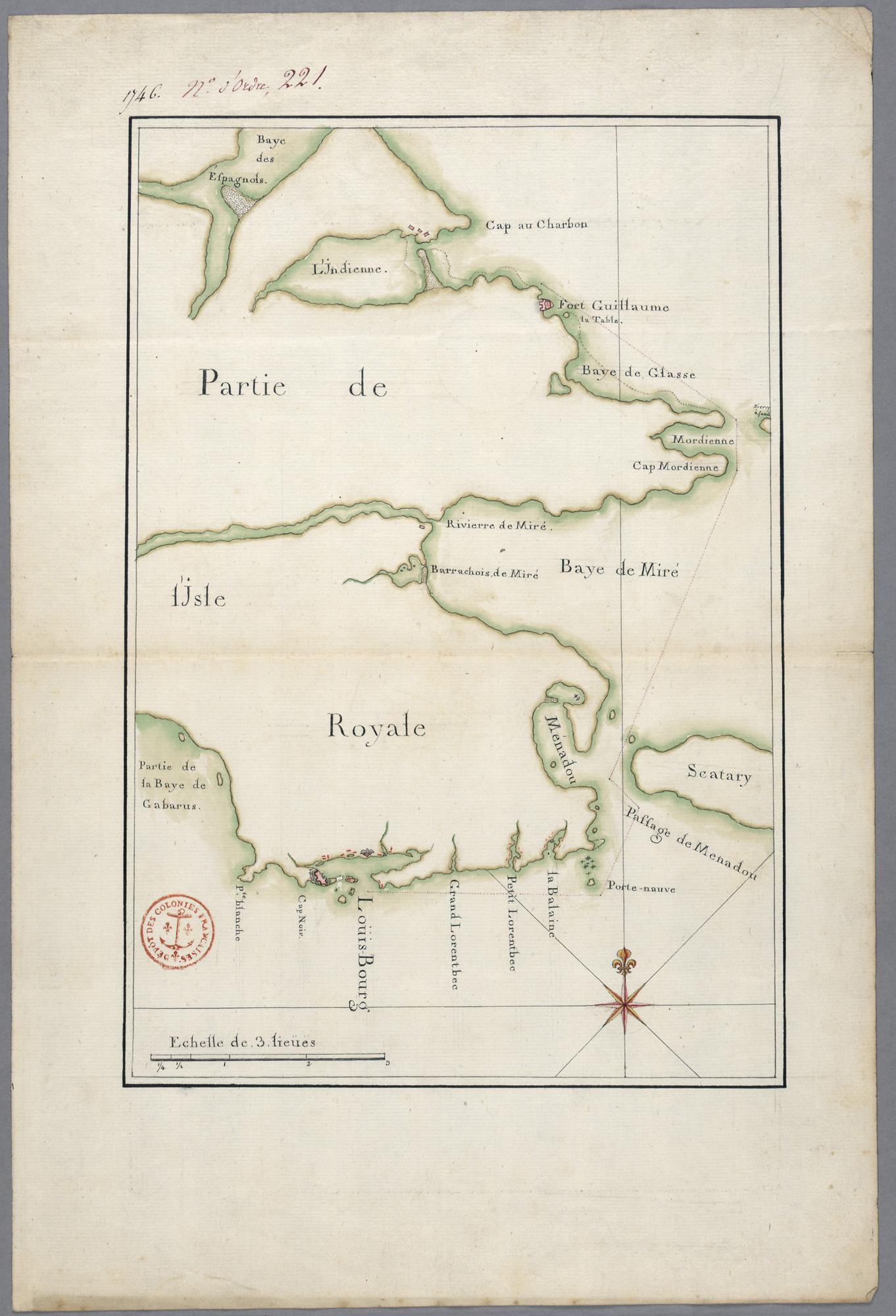
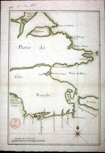
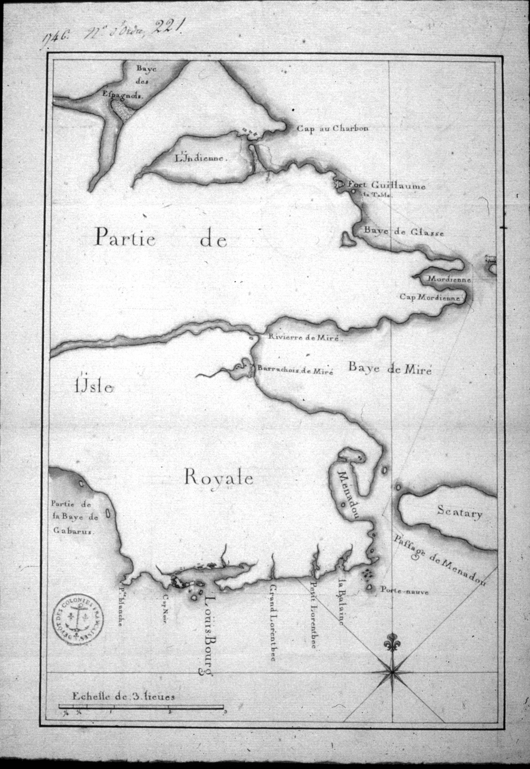
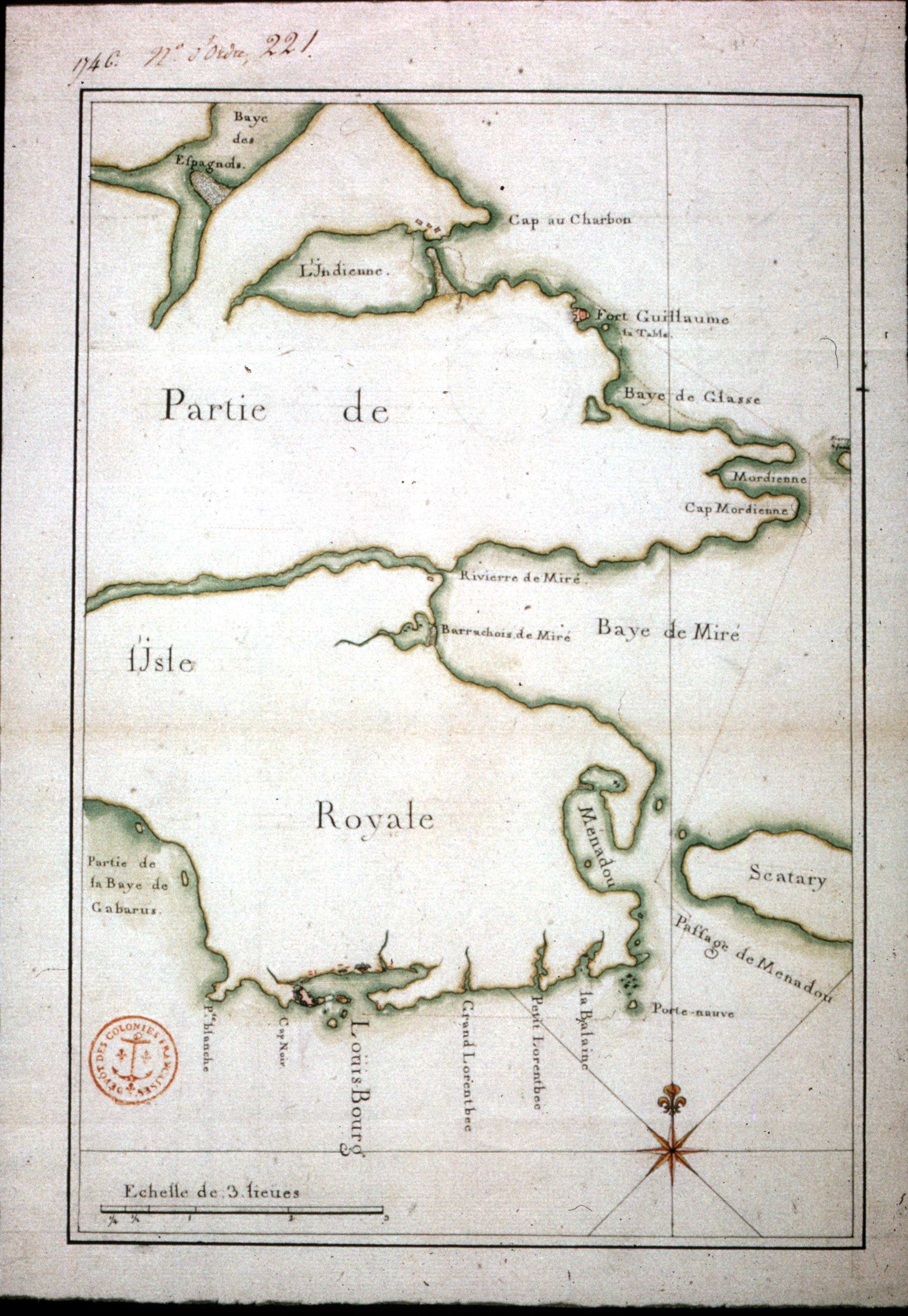
Partie de l'Isle Royale
1746 [New France Archives/Archives de la Nouvelle France]
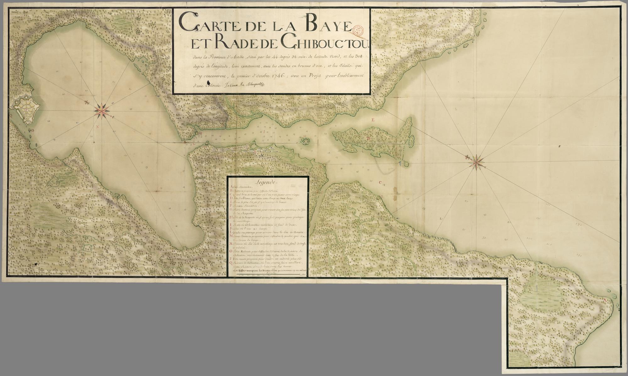
CARTE DE LA BAYE ET RADE DE CHIBOUCTOU ....
1746-October1 [New France Archives/Archives de la Nouvelle France]
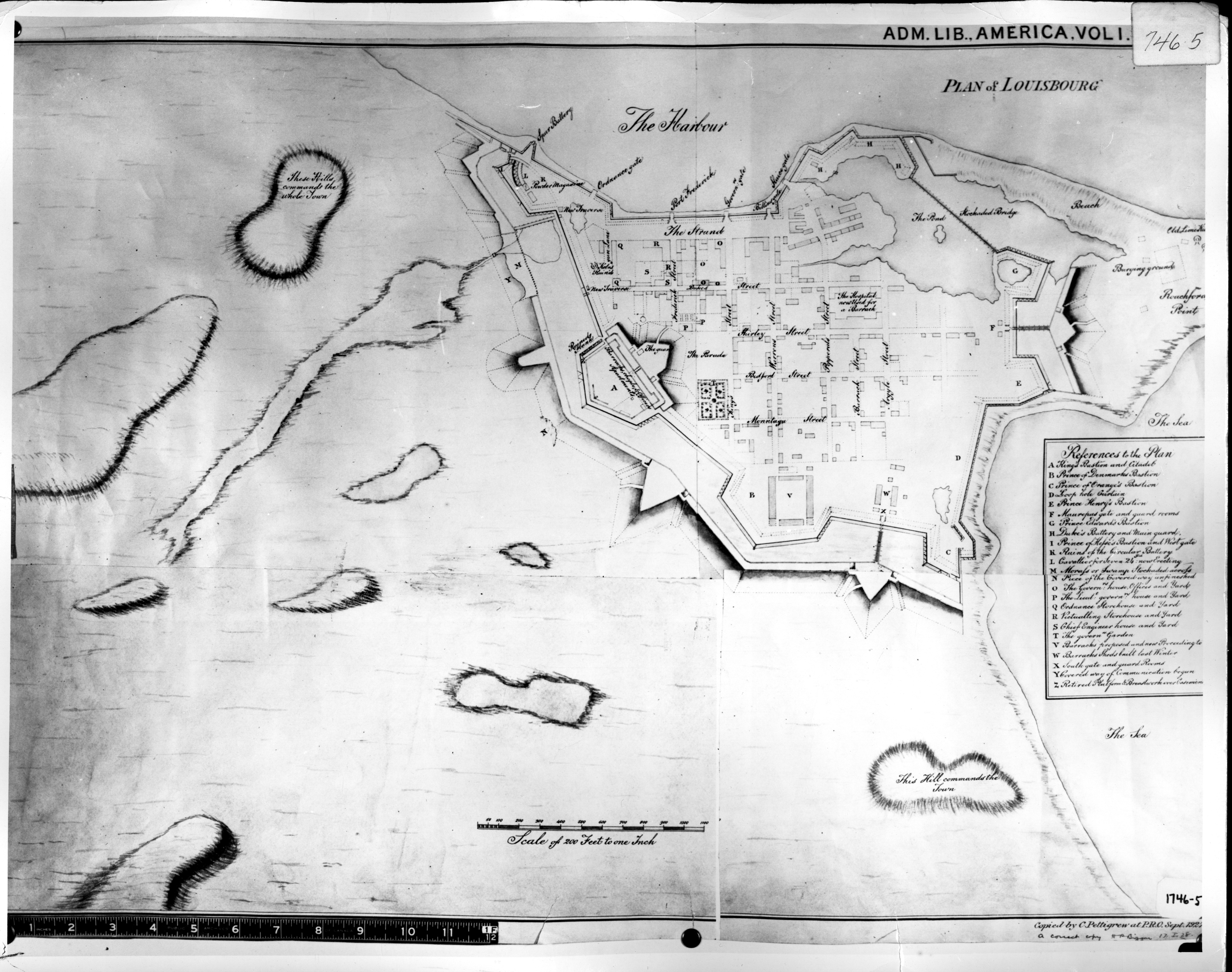
PLAN of LOUISBOURG
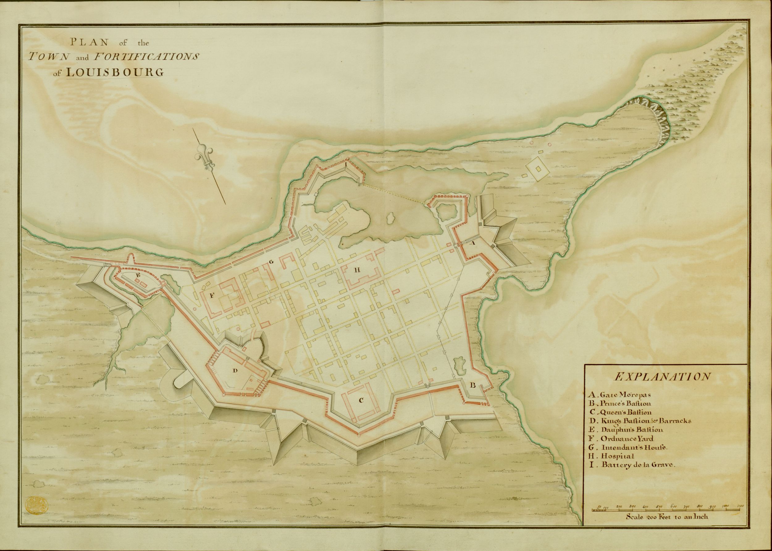
PLAN of the TOWN and FORTIFICATIONS of LOUISBOURG
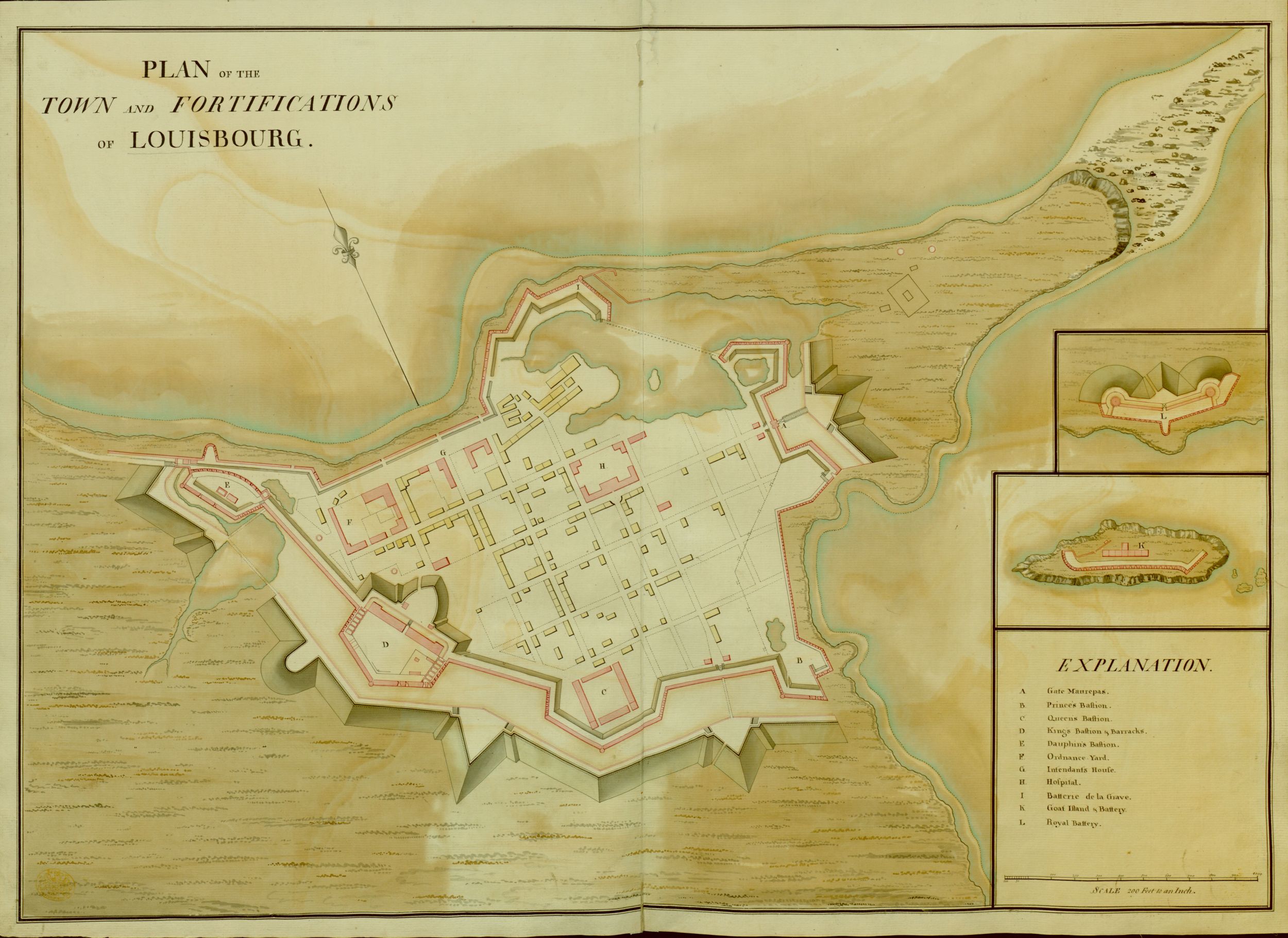
PLAN of the TOWN and FORTIFICATIONS of LOUISBOURG
PLAN of LOUISBOURG Copy'd from the Plan of Capt. Bastide Engeneer 1746
PLAN of LOUISBOURG
PLAN of LOUISBOURG
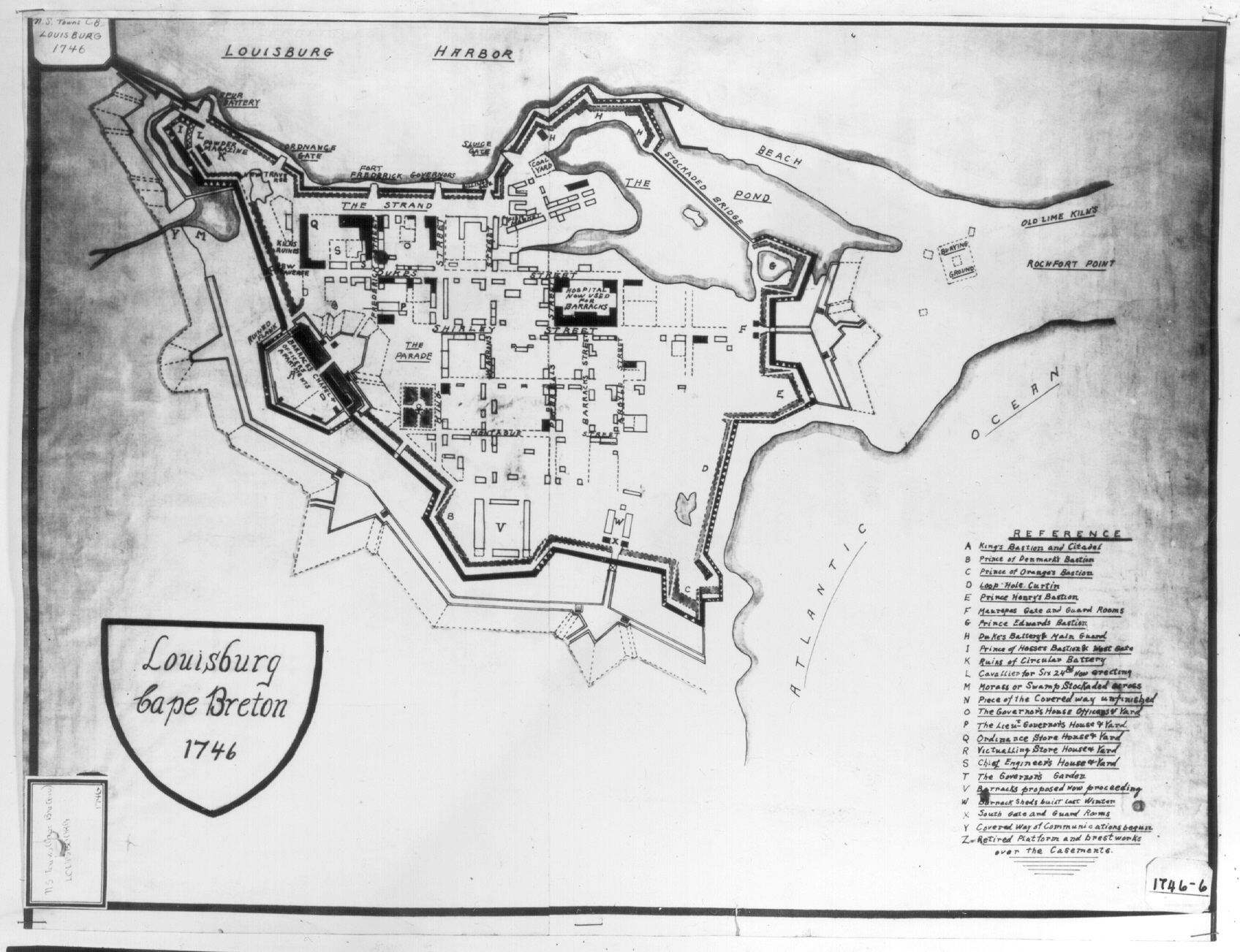
LOUISBURG Cape Breton 1746
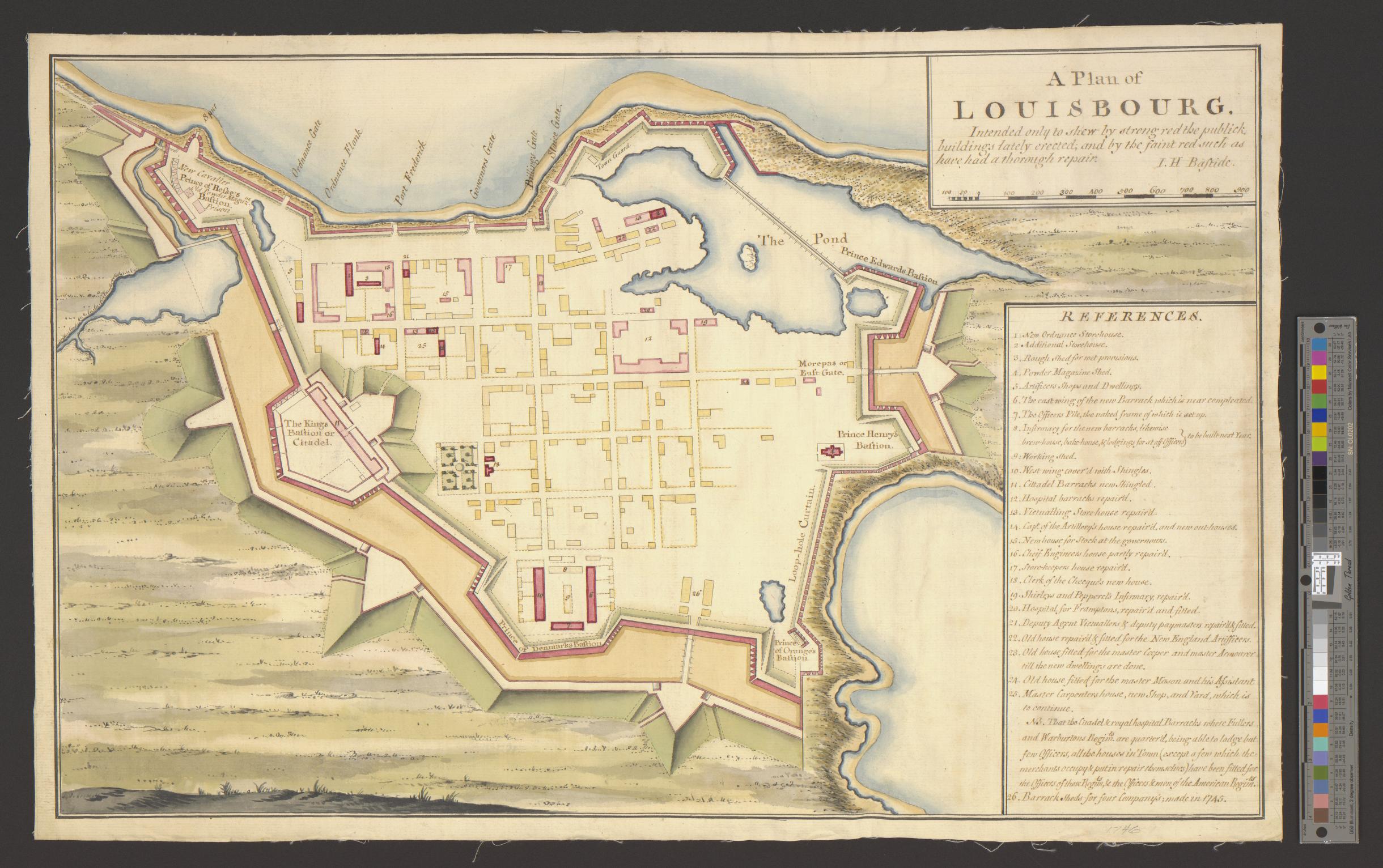
A PLAN of LOUISBOURG Intended only to shew by strong red the publick buildings lately erected, and by faint red such as have had a thorough repair
A Plan of LOUISBOURG Intended only to shew by strong red the publick buildings lately erected, and by faint red such as have had a thorough repair J. H. Bastide.
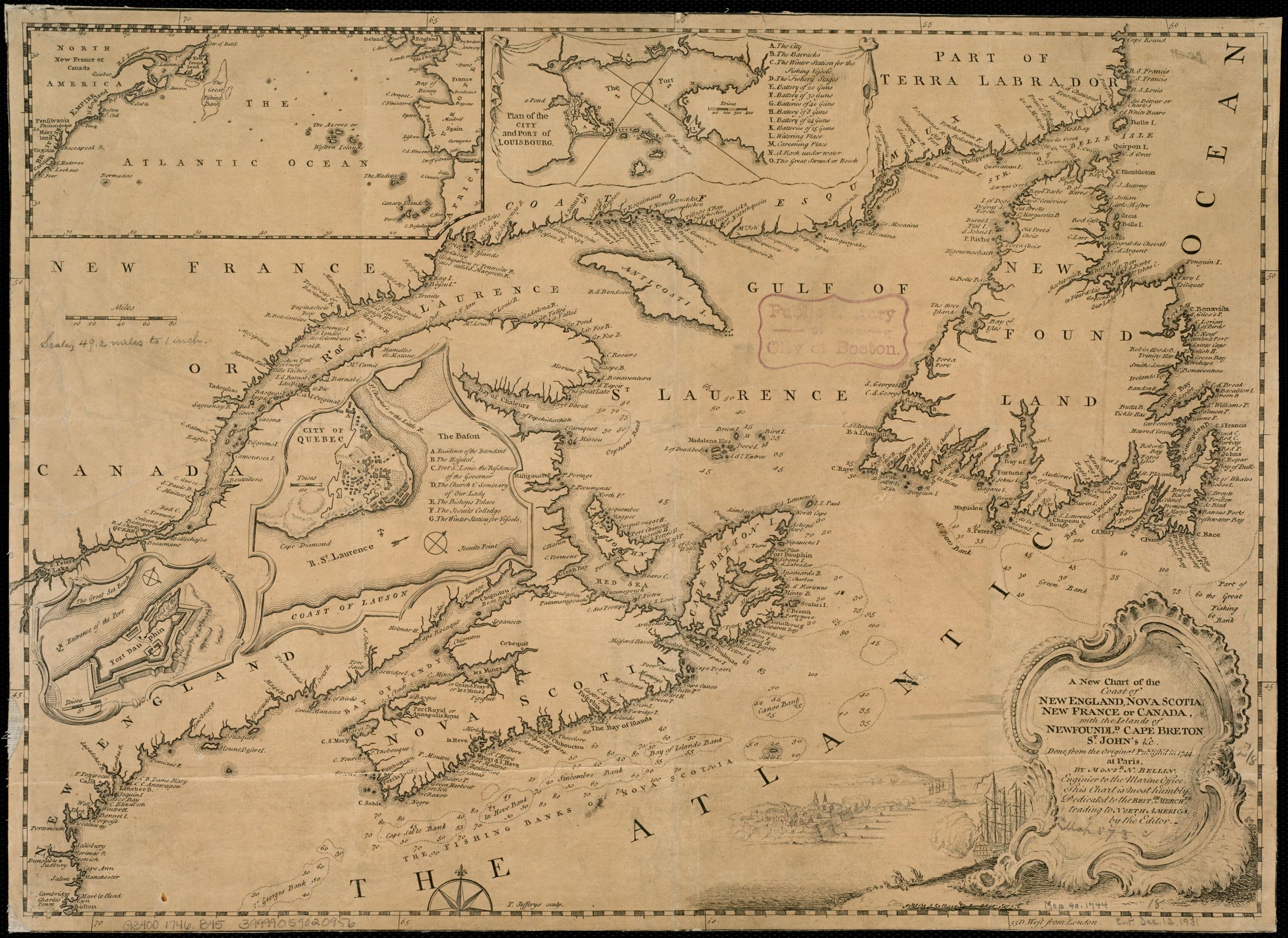
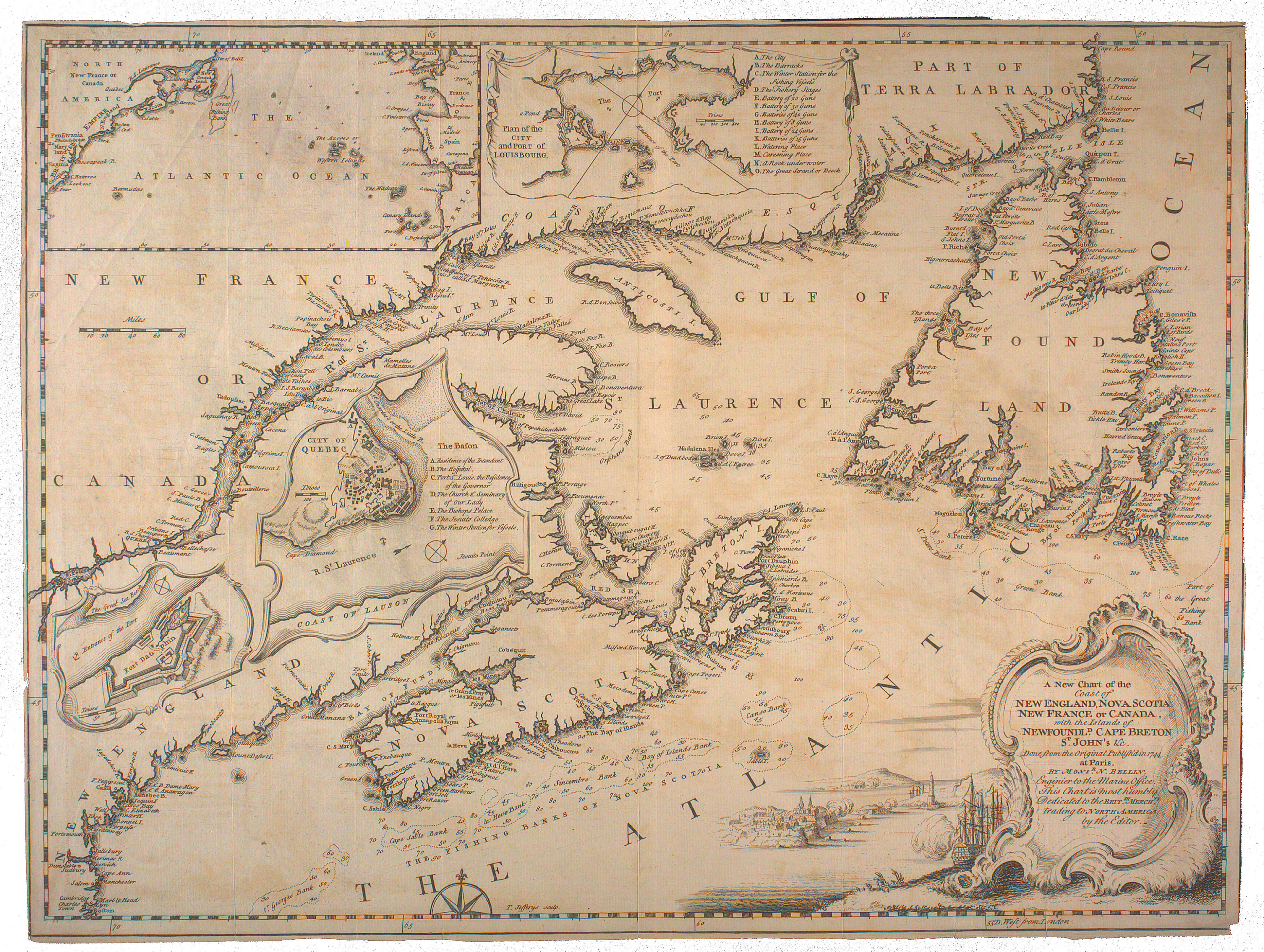
A New Chart of the Coast of NEW ENGLAND, NOVA SCOTIA NEW FRANCE OR CANADA, with the Islands of NEWFOUNDLAND. CAPE BRETON ST. JOHN'S, &c. Done from the Original Publish'd in 1744. at Paris. by M
onsr. N. BELLIN. Enginier to the Marine office This Chart is most humbly Dedicated to the
BRITSH. MERCHTS. trading to NORTH AMERICA by the Editor
Plan of the City and PORT of LOUISBOURG.
THE ATLANTIC OCEAN
CITY OF QUEBEC
FORT DAUPHIN
Partie de l'Jsle Royale
PLAN of CAPE BRETON
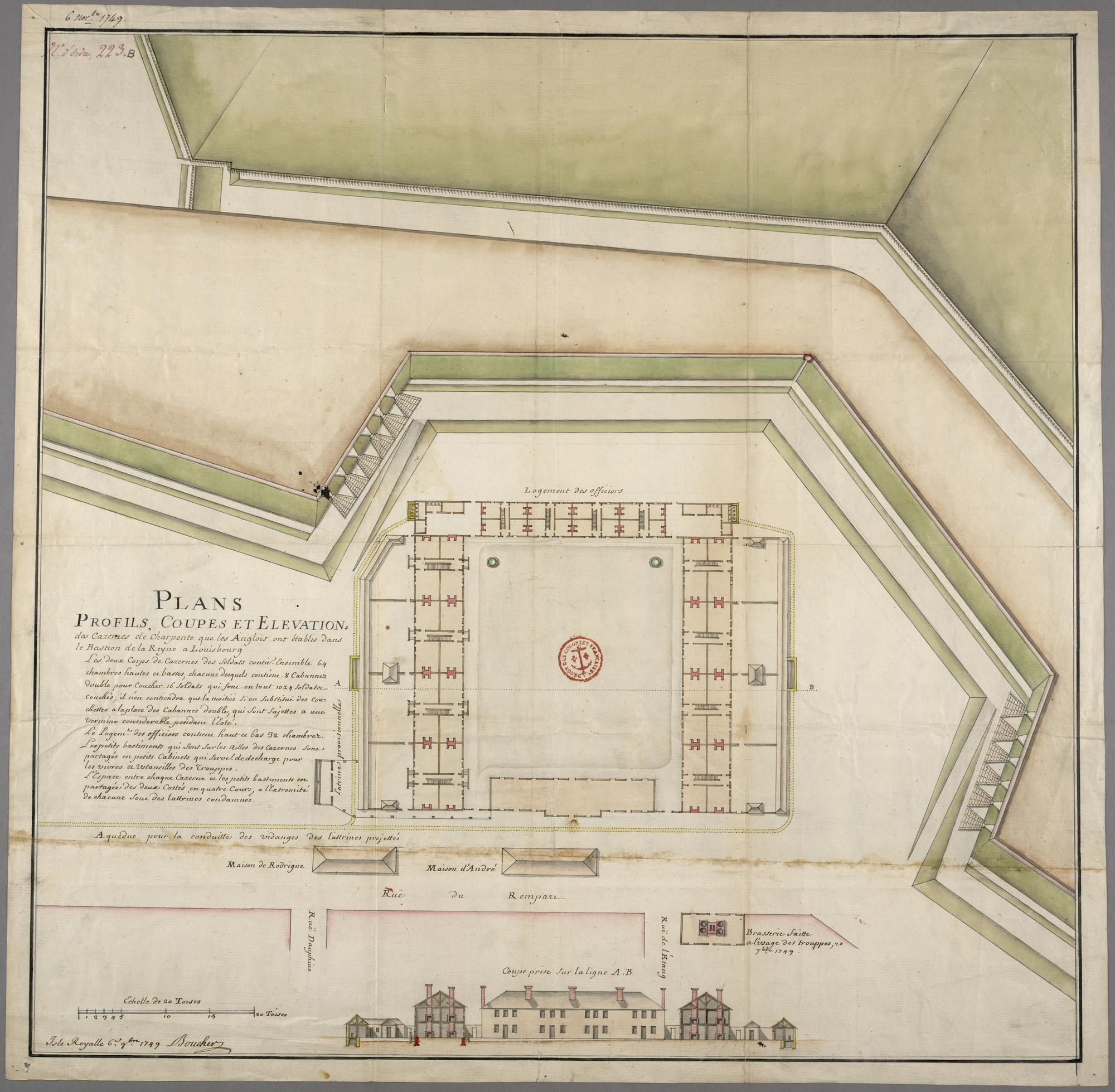
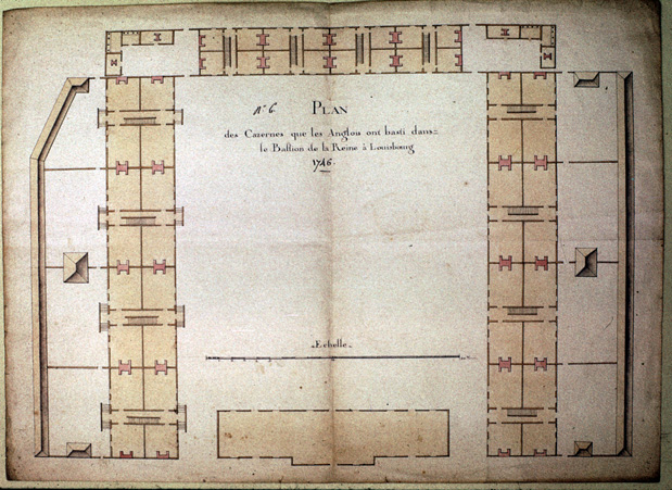
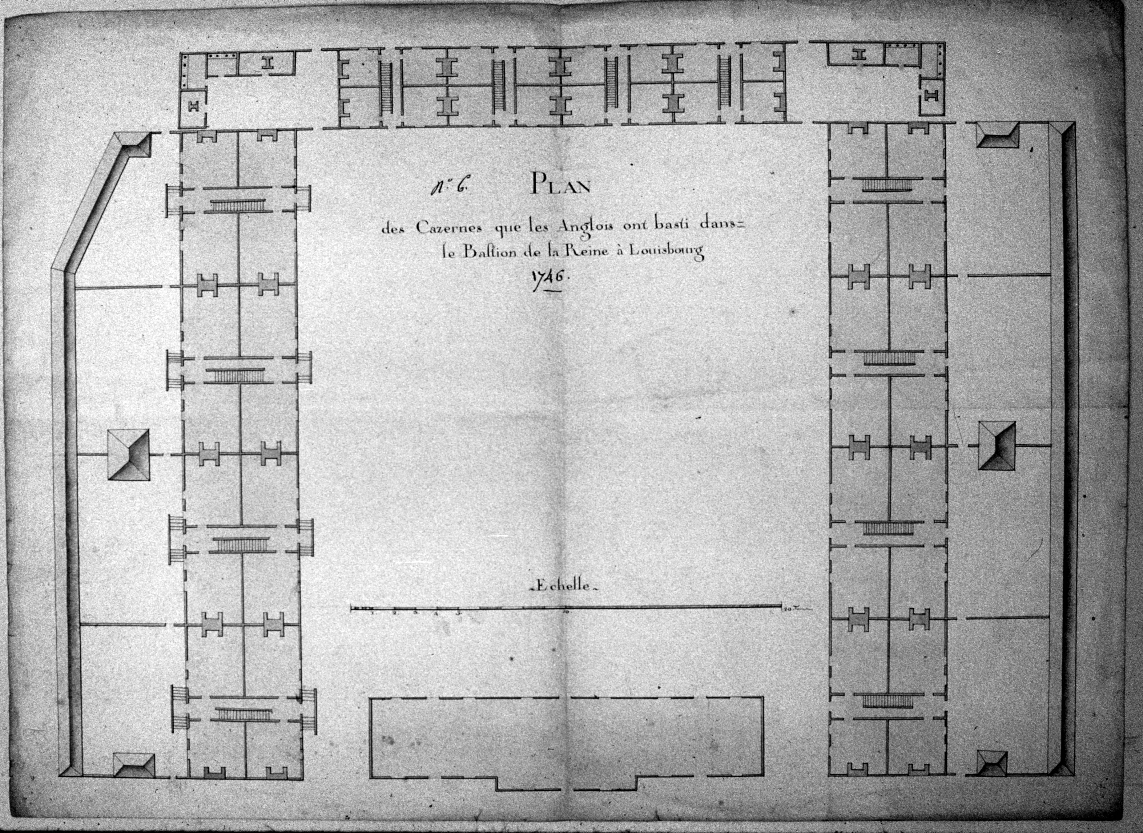
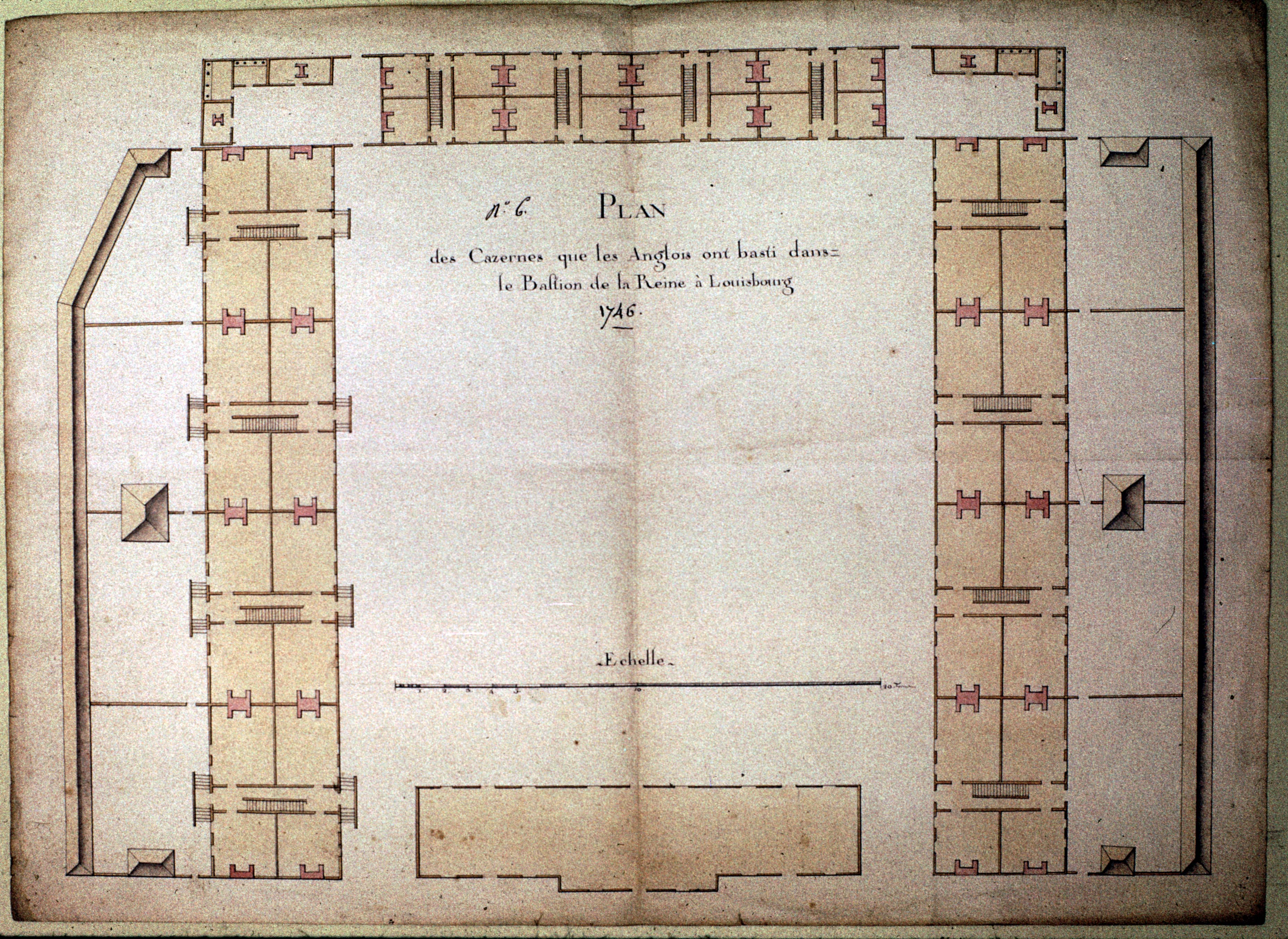
PLAN des Cazernes que les Anglois ont basti dans le Bastion de la Reine ŕ Louisbourg
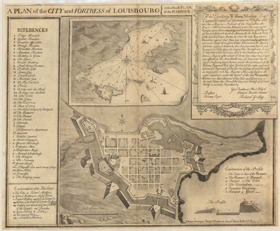
A PLAN of the CITY and FORTRESS of LOUISBOURG } with a small PLAN of the HARBOUR
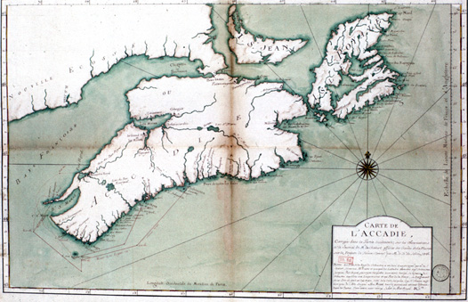
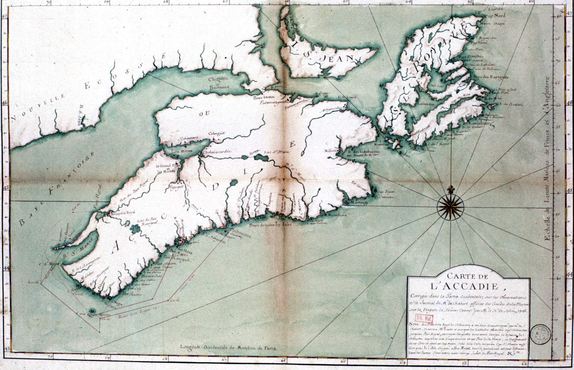
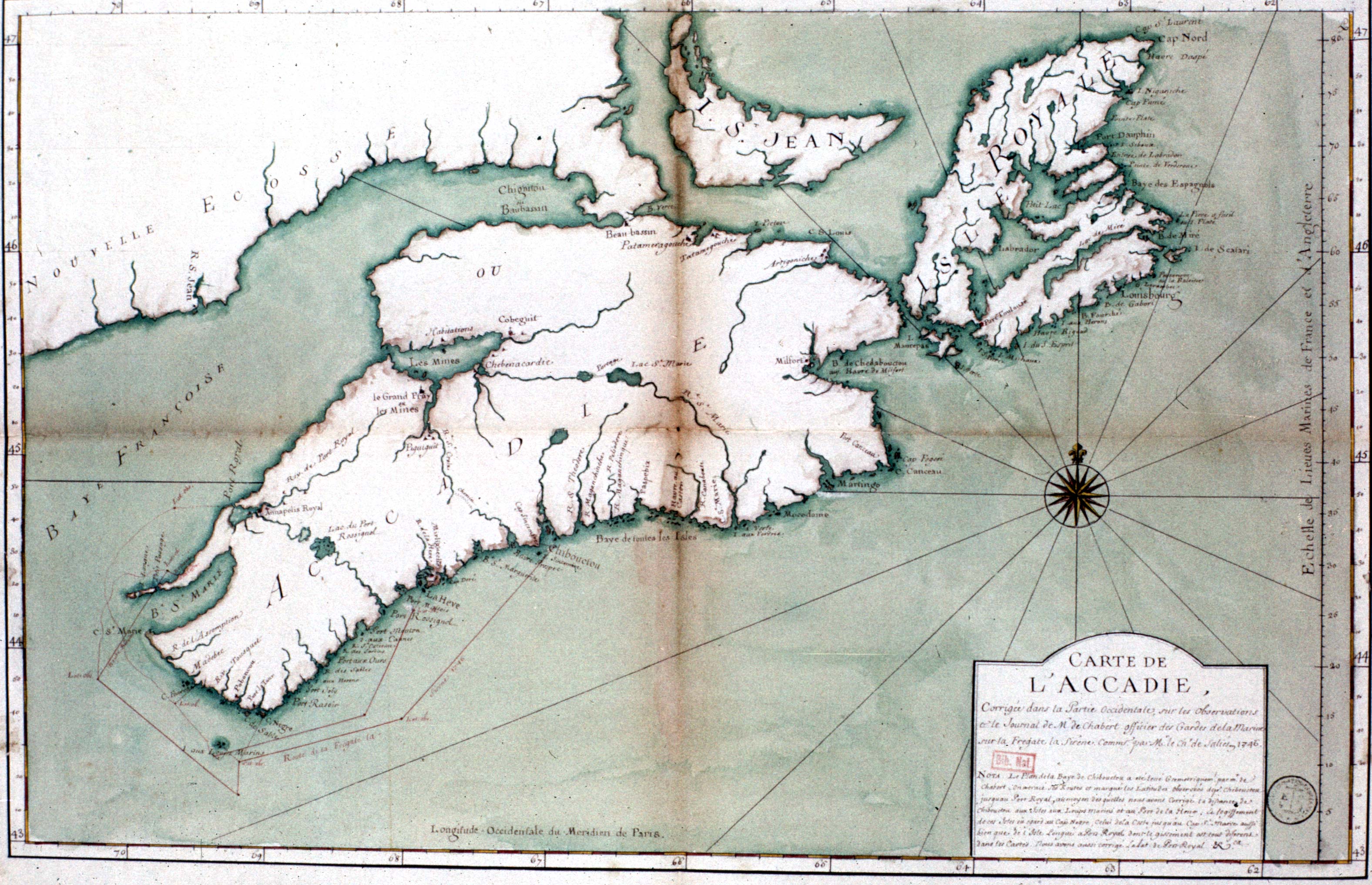
CARTE DE L'ACCADIE Corrigée dans la Partie Occidentale , sur les observations [?] le Journal de Mr de Chabert Officier des Gardes de la Marine sur la Fregate la Siriene Commd. par Mr le Ch. de Salies en 1746
N/A [La Baye de Gabarus ou les Anglois ont fait leur débarquement en 1745]
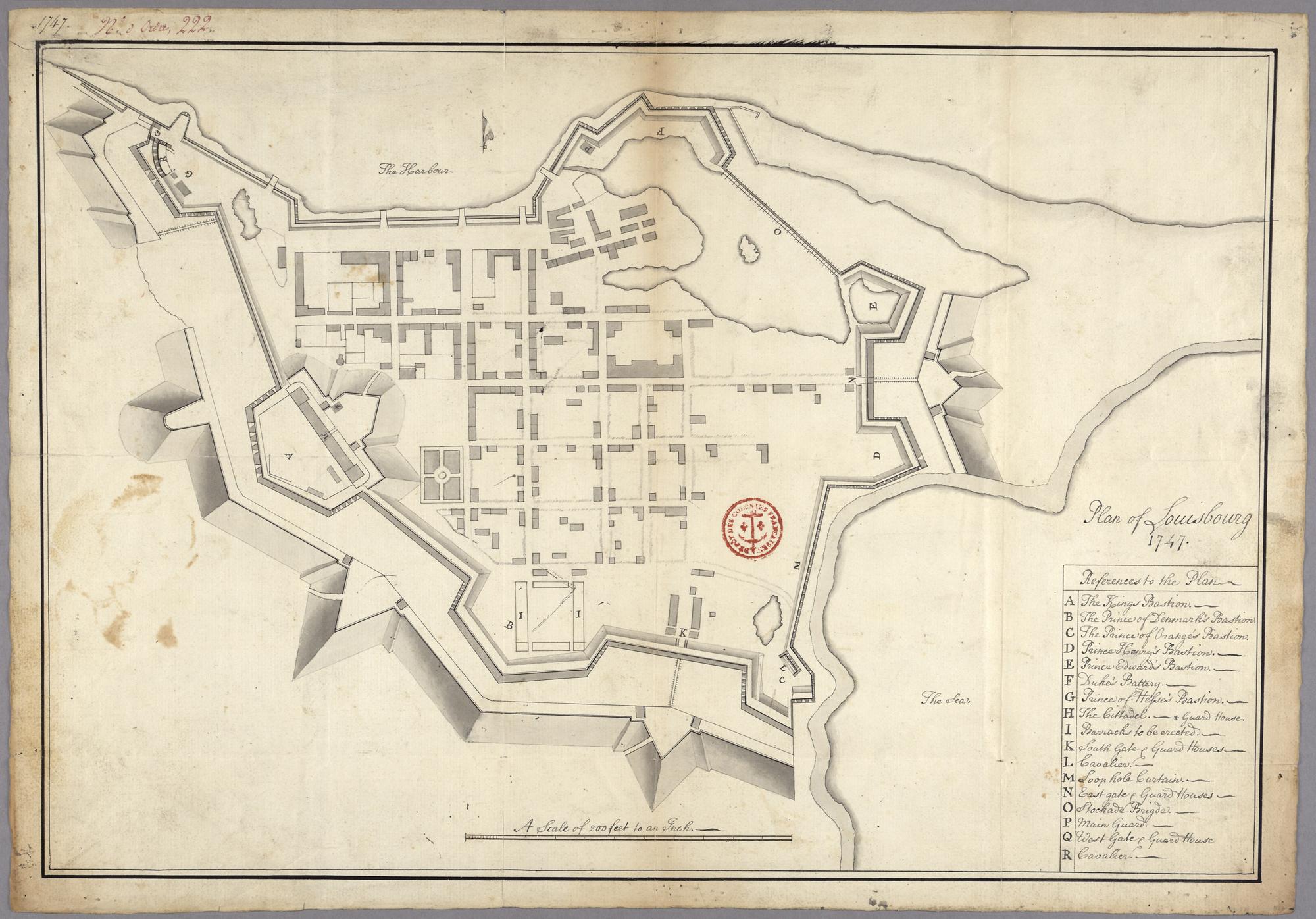
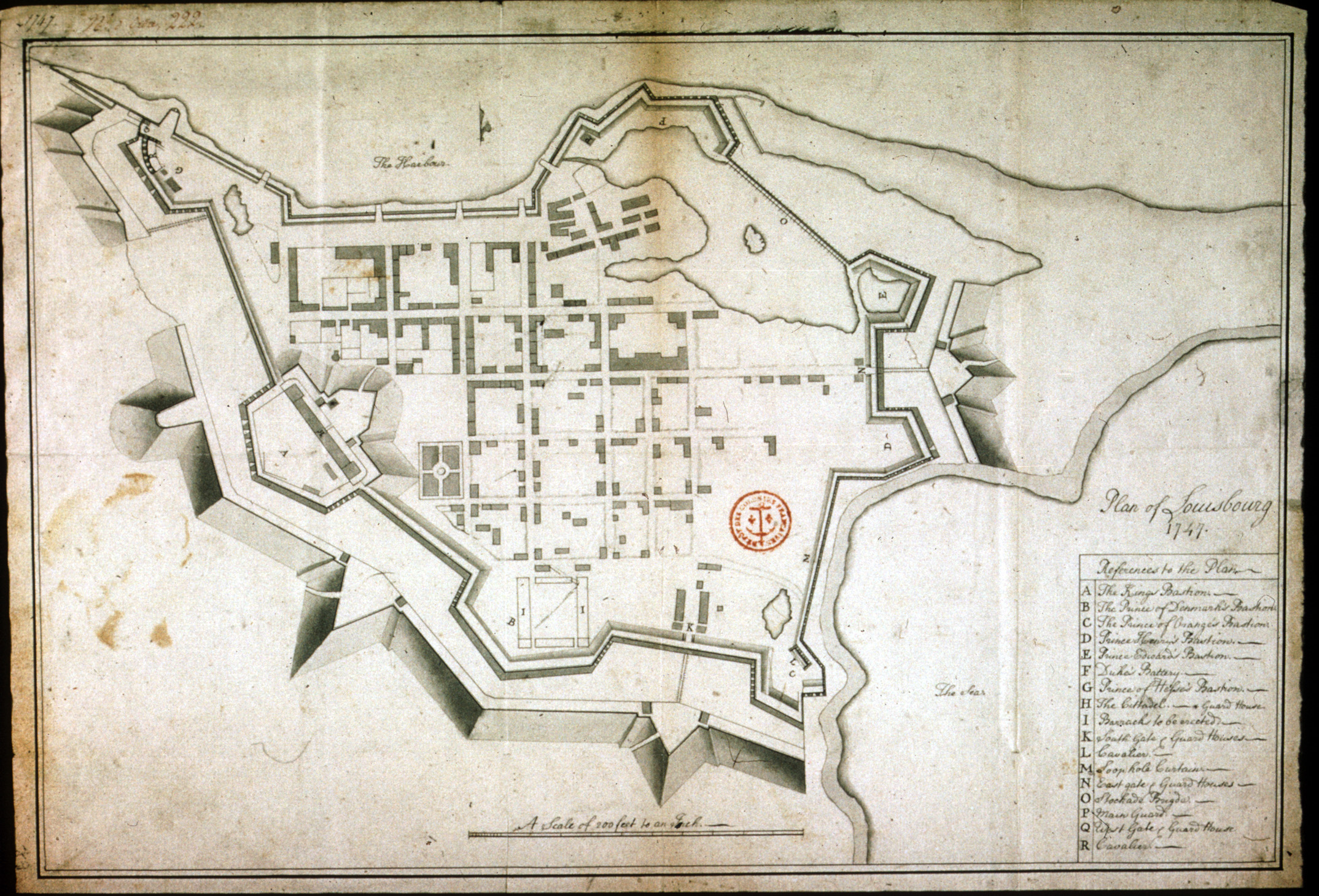
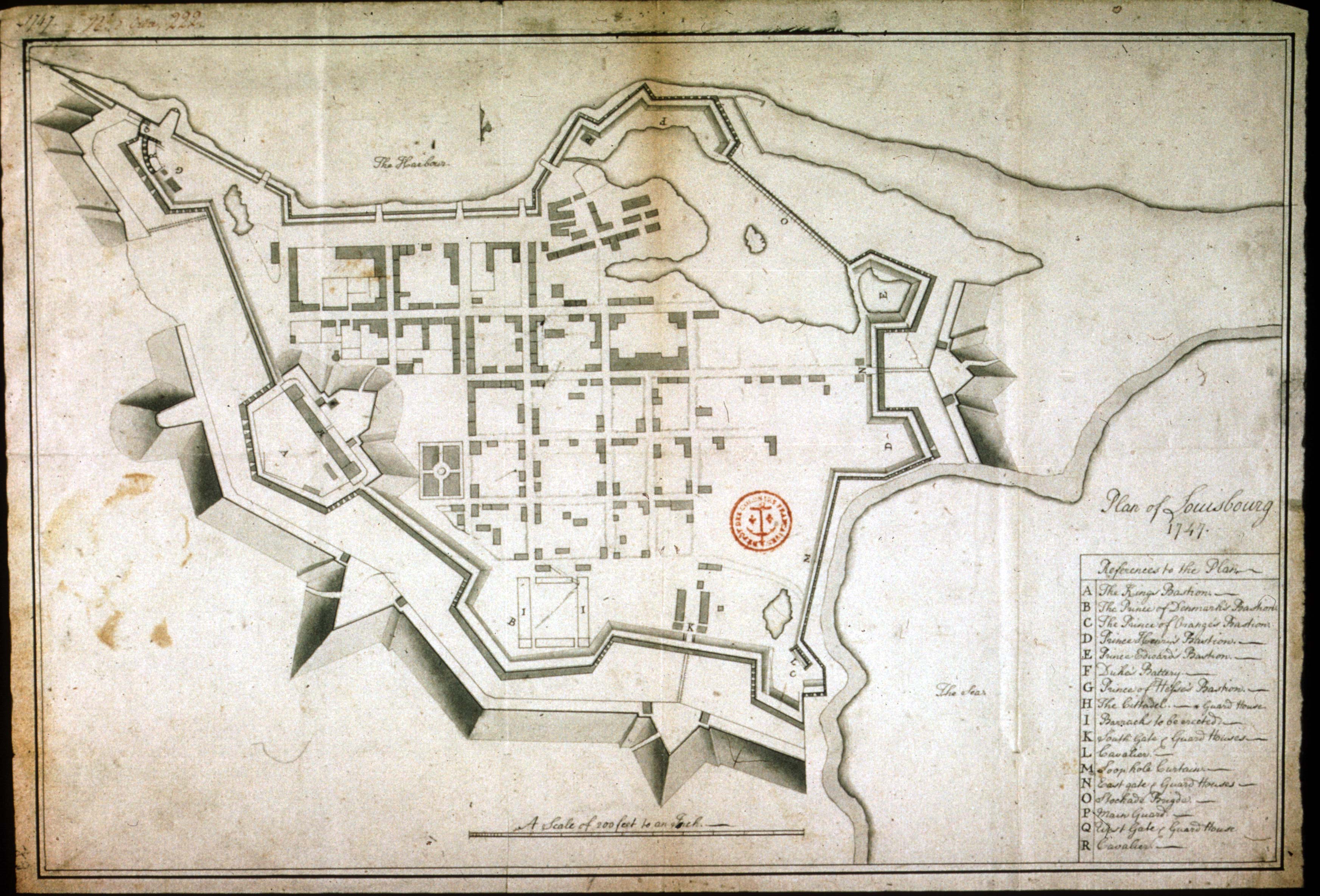
Plan of Louisbourg 1747
Harbour & City of Louisburg
Harbour & City of Louisburg
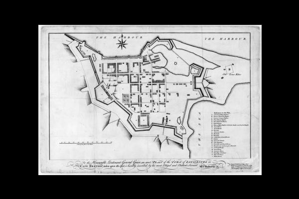
To the Honourable Lieutenant General Guise, an exact PLAN of the TOWN of LOUISBOURG in CAPE BRETON taken upon the Spot, is humbly inscribed by his most Obliged and Obedient Servant Wm. Roberts ...
Roberts, Wm.
Plan realisé ŕ Louisbourg meme et présenté au Lieutenant General Guise
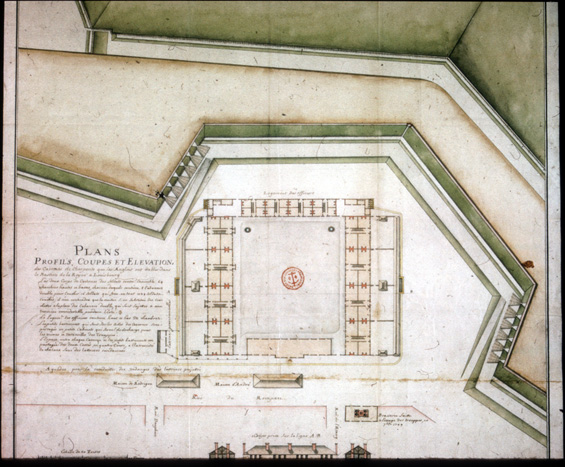
PLANS, PROFILS, COUPES ET ELEVATION, des cazernes de Charpente que les Anglois ont etablis dans le Bastion de la Reyne a Louisbourg Les deux corps de Cazernes des soldats
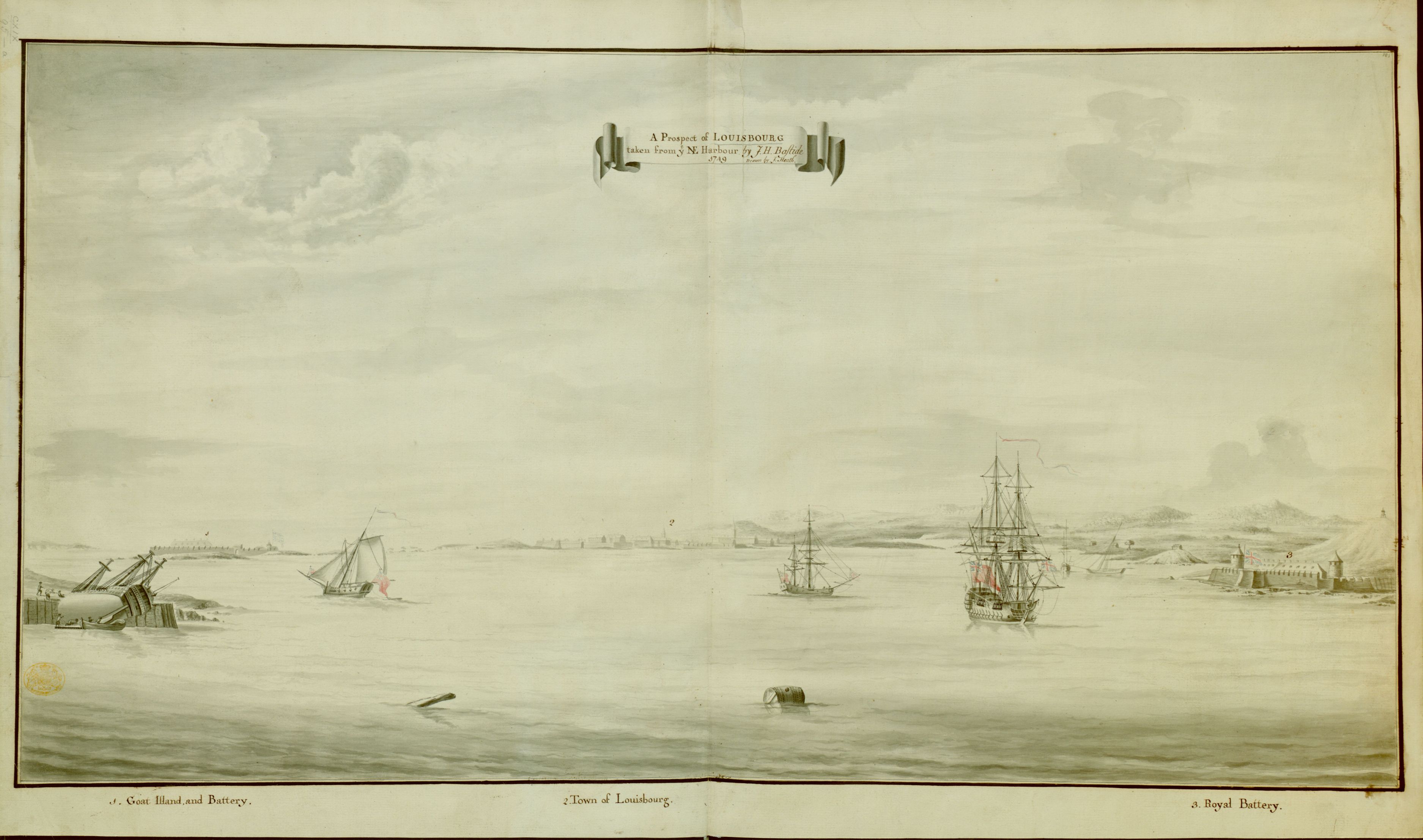
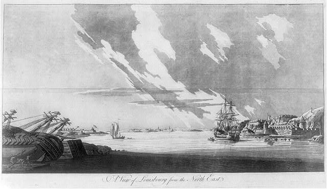
A Prospect of Louisbourg taken from ye N.E. Harbour by J.H. Bastide
A View of Louisbourg from the North East
Based on Bastide
![]()
