FortressImages
Website Design and Content
© by Eric Krause, Krause House
Info-Research Solutions (© 1996)
All Images ©
Parks Canada Unless Otherwise Designated
Report/Rapport ©
Krause House Info-Research Solutions
Researching
the Fortress of Louisbourg National Historic Site of Canada
Recherche sur la Forteresse-de-Louisbourg Lieu historique national du Canada
![]()
PROULX COMPILATION: ND-1 - ND-29
For assorted Fortress of Louisbourg image examples and resolutions click here
All
Maps and Plans © Institution Holding the Original
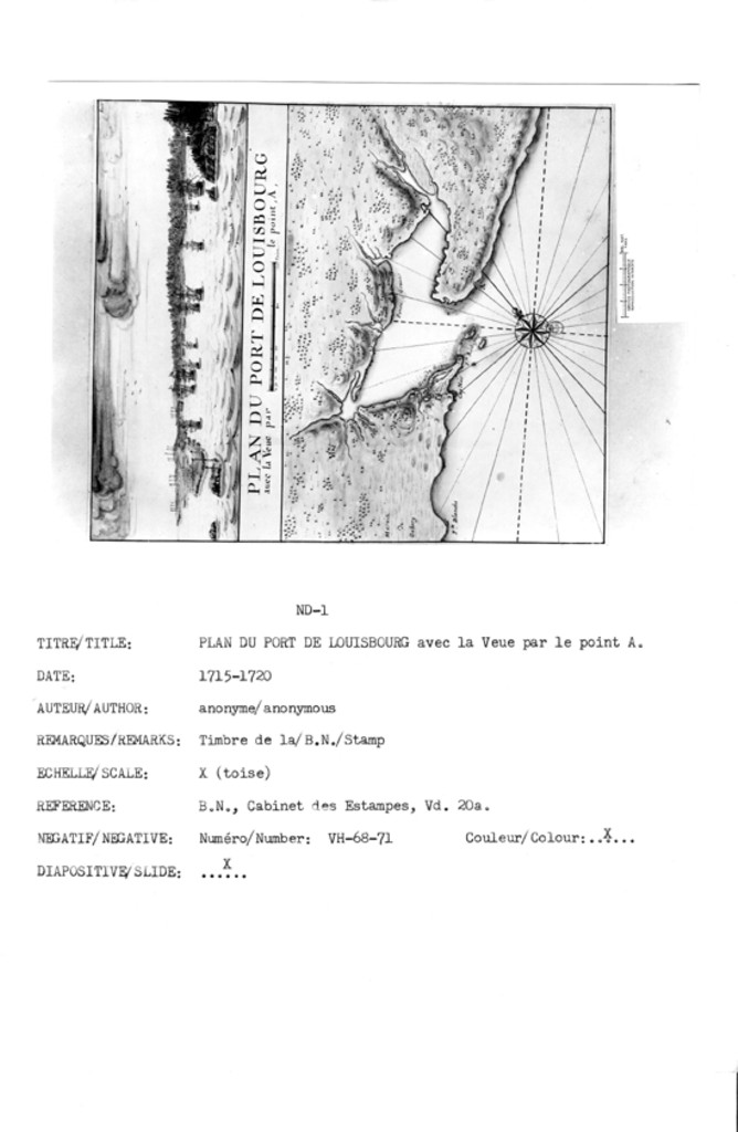
PLAN DU PORT DE LOUISBOURG avec la Veue par le point ,A,
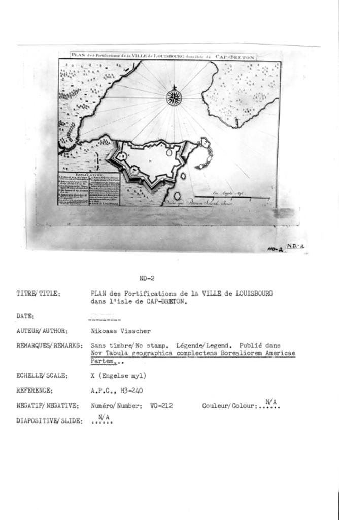
PLAN des Fortifications de la VILLE de LOUISBOURG dans I'lsle de CAP-BRETON
Veüe du Port de Louis-bourg dans L'Isle Royalle
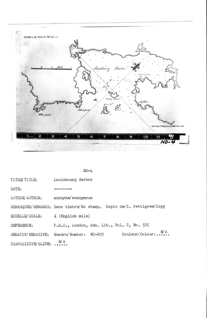
N/A [Louisbourg Harbor; White Point; Black Point; Green Island; Battery Island; Careening Place; Lighthouse]
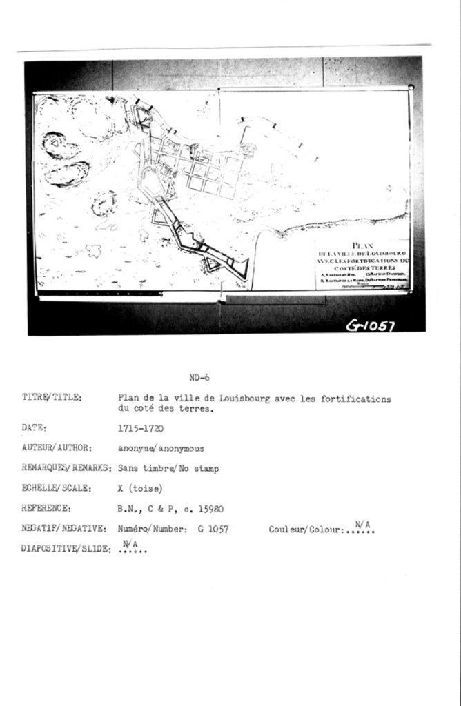
PLAN DE LA VILLE DE LOUISBOURG AVEC LES FORTIFICATIONS DU COSTÉ DES TERRES
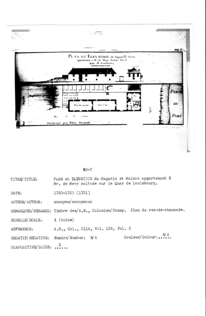
PLAN ET ELEVATION du Magazin et Maison appartenant a Mr. de Mezy Scitueé Sur le Quay de Louisbourg
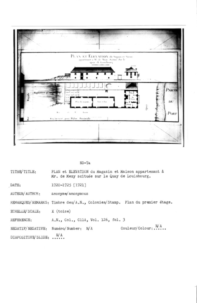
PLAN ET ELEVATION du Magazin et Maison appartenant a Mr. de Mezy Scitueé Sur le Quay de Louisbourg
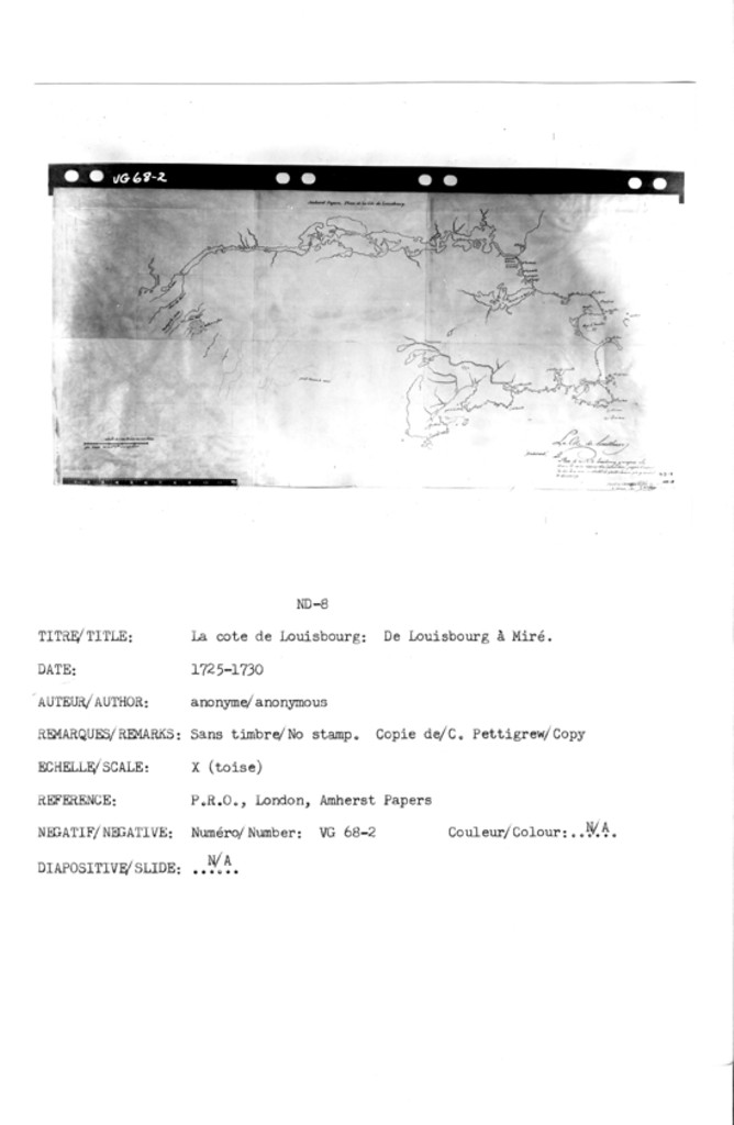
Le Cote de Louisbourg [Endorsed] ... Plan de la Cote de Louisbourg y compris La Riviere de miré depuis son embouchure jusqu ŕ l endroit du Lac de ce nom, ou aboutet Le grand chemin qui y conduit de Louisbourg
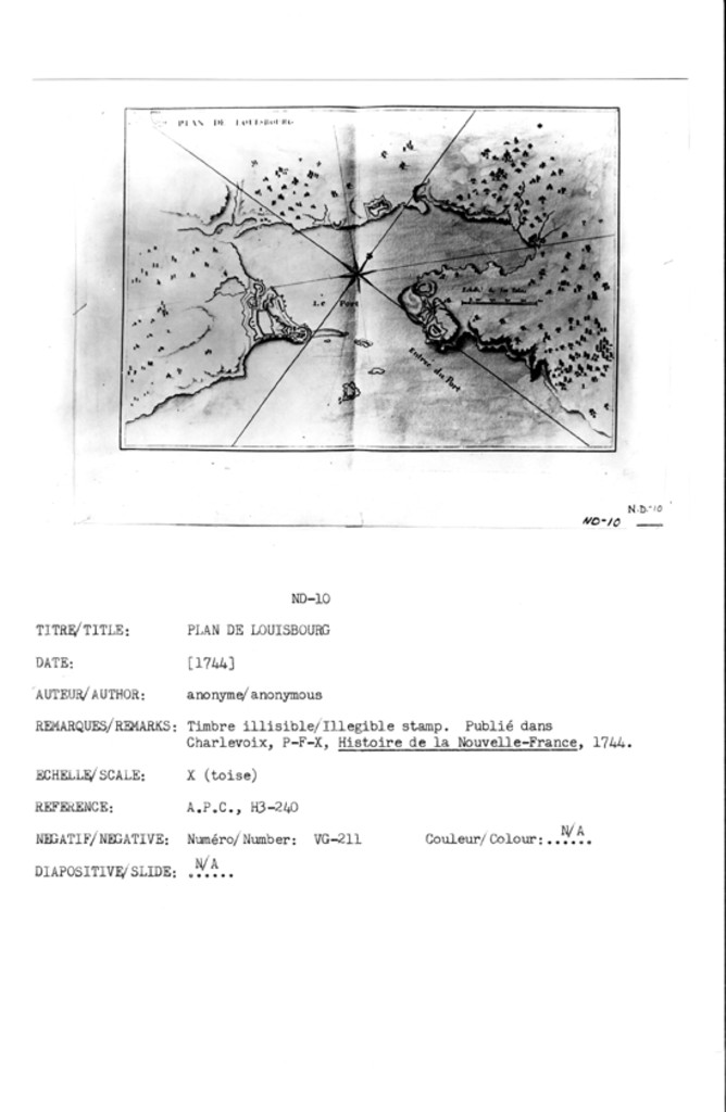
PLAN DE LOUISBOURG
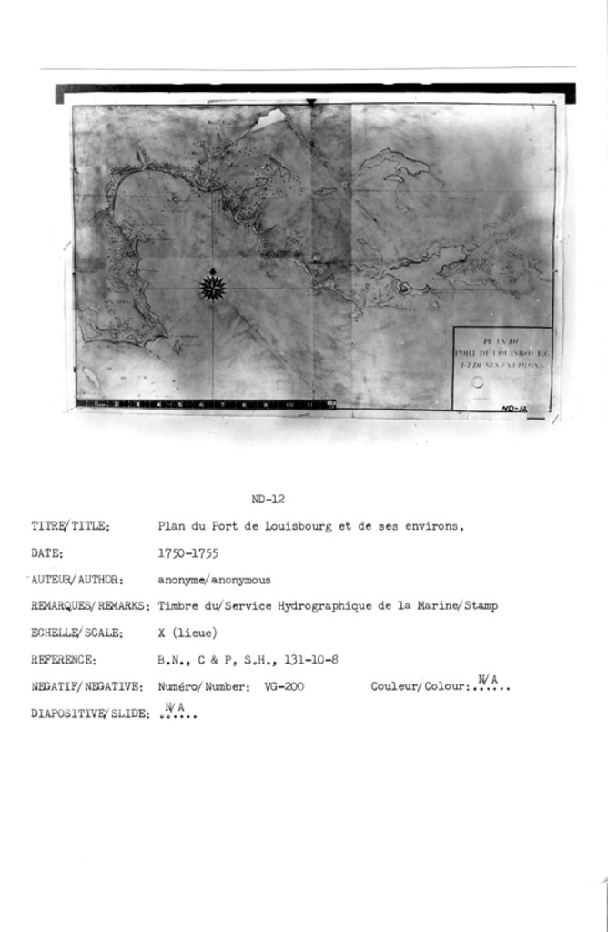
PLAN DU PORT DE LOUISBOURG ET DE SES ENVIRONS
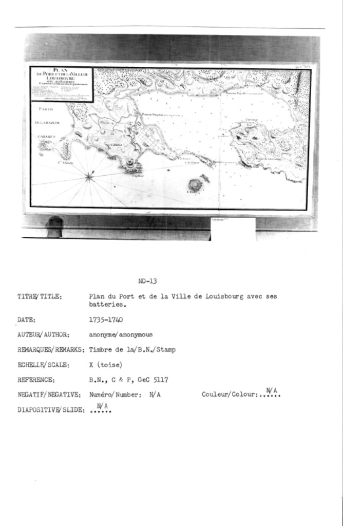
PLAN DU PORT ET DE LA VILLE DE LOUISBOURG AVEC SES BATTERIES Representé de basse mer dans le grandes marées
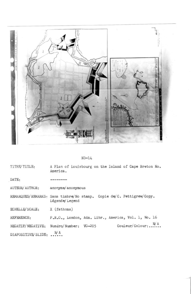
A Plan of Louisbourg on the Island of Cape Breton No: America
; The King's Gate, or Port Frederic
The East Gate or Port Morepas
Carte du havre des Trois rivieres en Lisle St. Jean
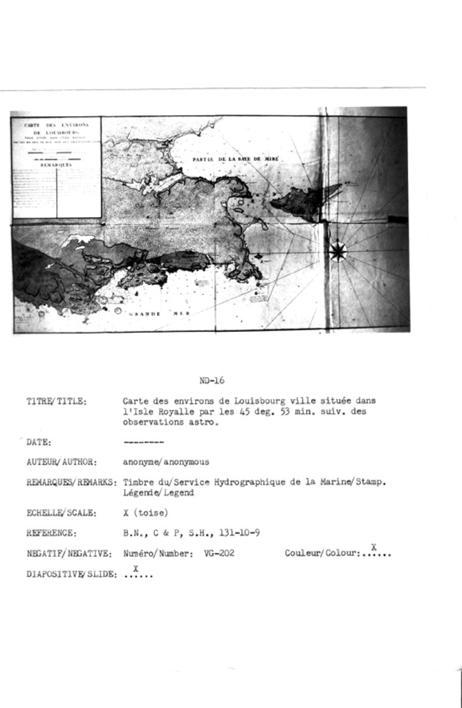
CARTE DES ENVIRONS DE LOUISBOURG VILLE SITUÉE DANS L'ISLE ROYALLE PAR LES 45 DEG. 53 MIN. SUIV. DES OBSERVATIONS ASTRO
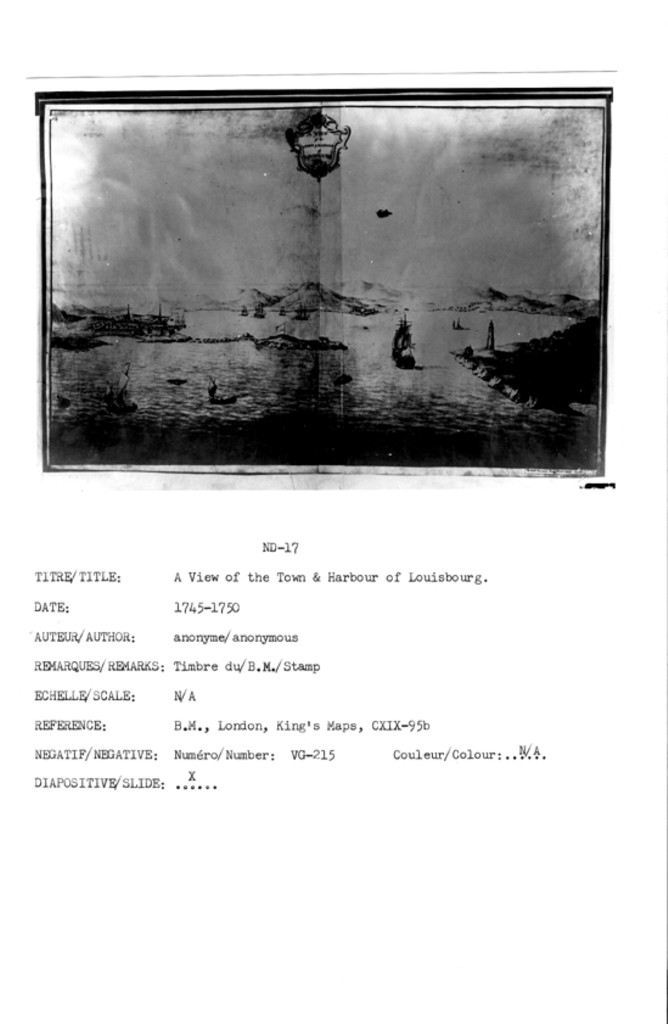
A VIEW of the TOWN & HARBOUR of LOUISBOURG
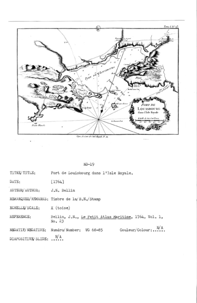
PORT DE LOUISBOURG dans l'Isle Royale
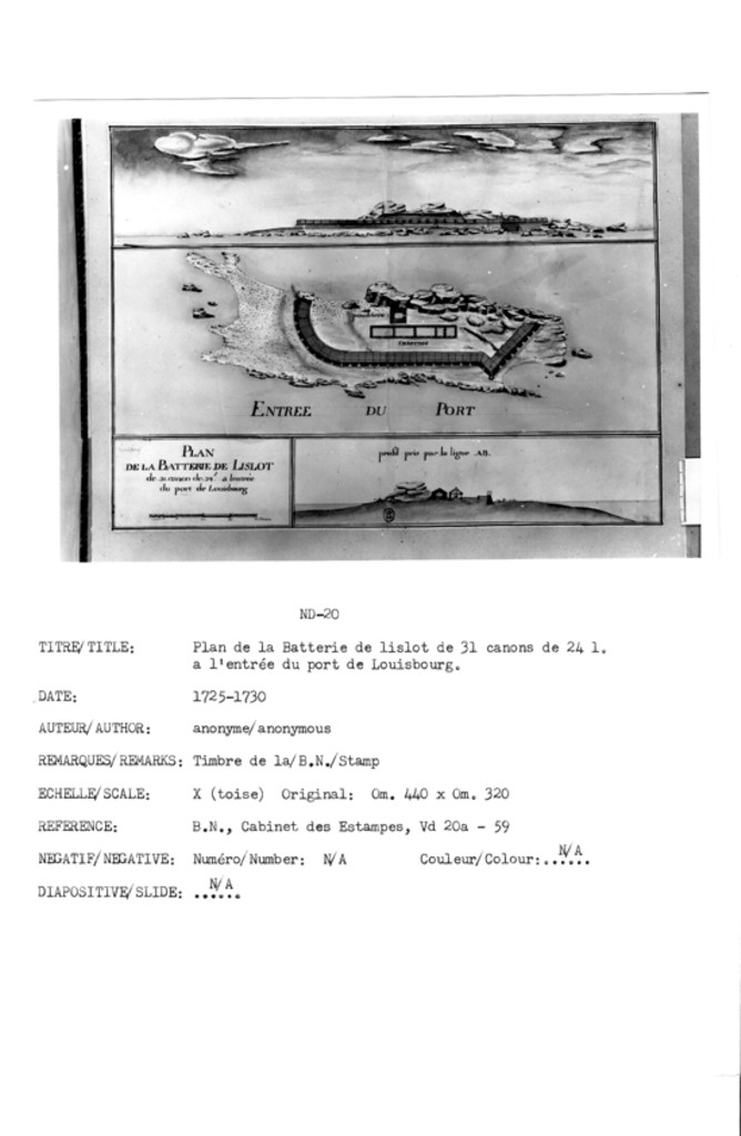
PLAN DE LA BATTERIE DE IISLOT de .31. canon de .24. Ł a lentrée du port de Louisbourg
;
profil pris par la ligne .AB.
BASTION DU ROY FAISANT PARTIE DE LENCEINTE DE LA VILLE DE LOUISBOURG
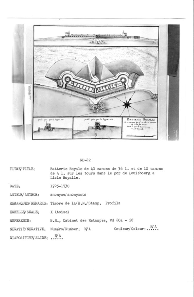
BATTERIE ROYALE de .40. canons de 36. Ł et de .12. canons de 4 Ł sur les tours dans le por de Louisbourg a Lisle Royalle
profil pris par la ligne .AB.
profil pris par la ligne .CD.
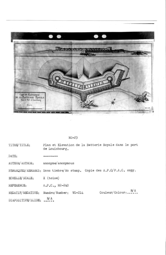
PLAN ET ELÉVATION DE LA BATTERIE ROYALE dans le Port de Louisbourg
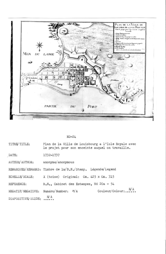
PLAN DE LA VILLE DE LOUISBOURG ALISLE ROYALLE avec le projet pour son enceinte auquel on travaille
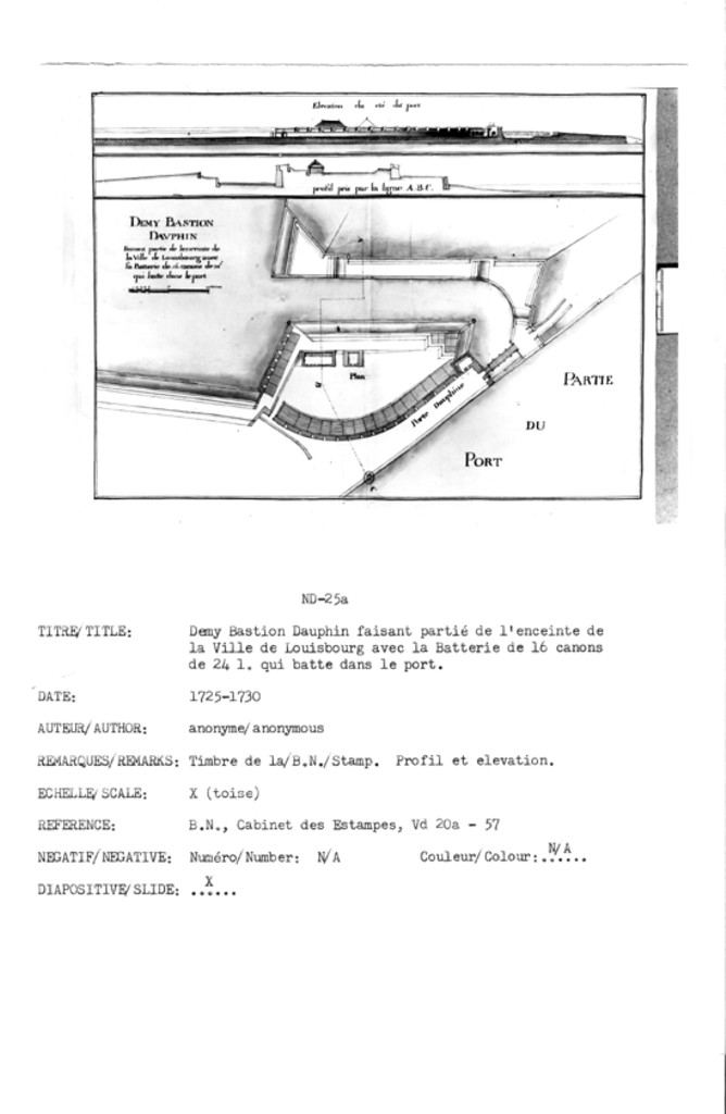
DEMY BASTION DAVPHIN Faisant partié de lenceinte de la Ville de Louisbourg avec sa Batterie de .16. canons de 24 Ł qui batte dans le port
Elevation du cté du port
profil pris par la ligne .A.B.C.
Plan
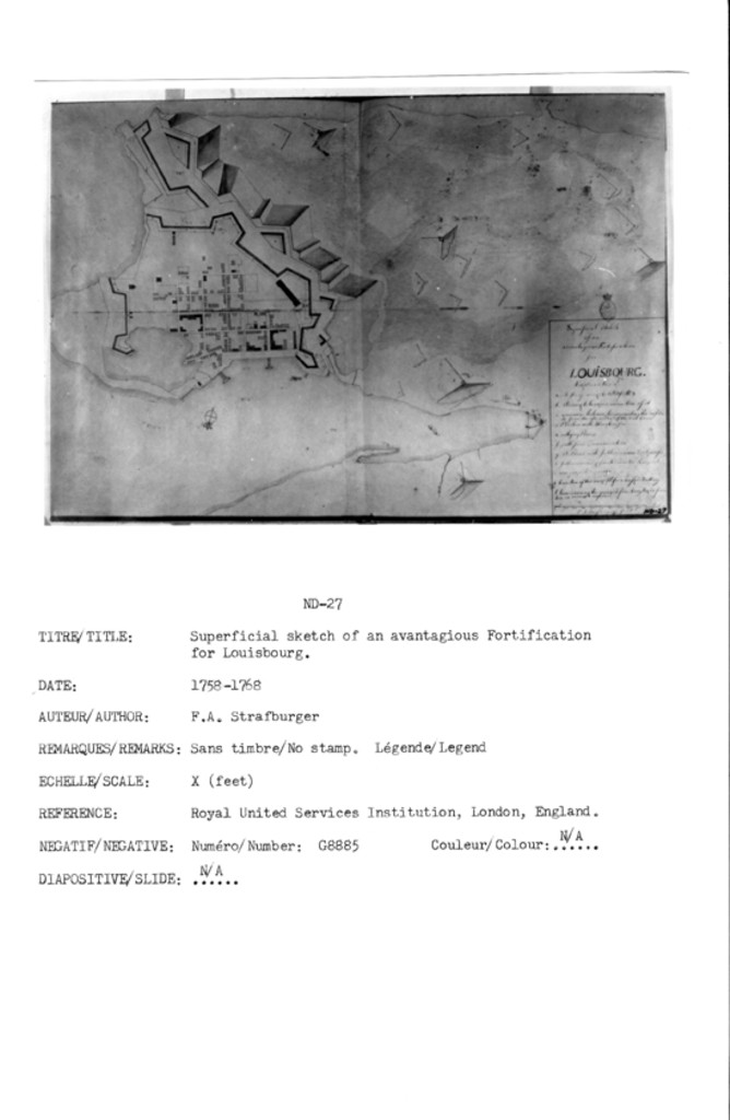
Superficial Sketch of an avantagious Fortification for LOUISBOURG.
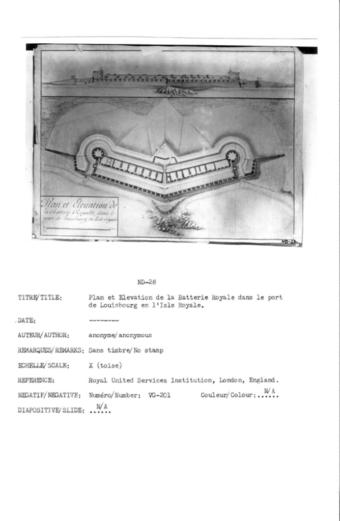
Plan et Elevation de la Batterie Royalle, dans le port de louisbourg, en l'isle Royale
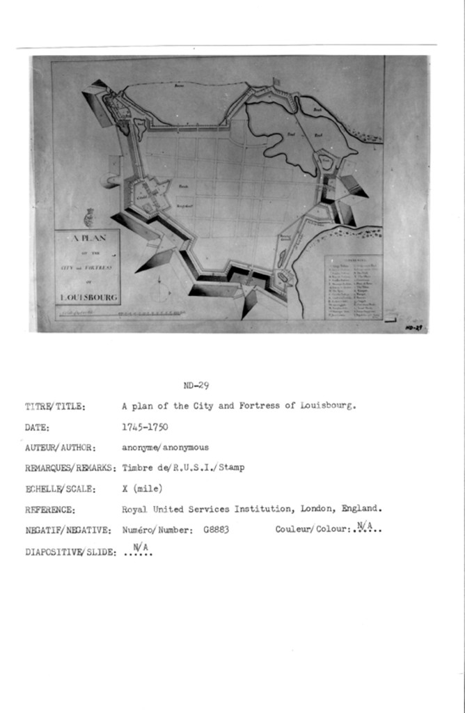
A PLAN OF THE CITY and FORTRESS OF LOUISBOURG
![]()
All Maps and Plans © Institution Holding the Original
For additional text details (no images): HISTORICAL MAPS AND PLANS COLLECTION / CARTES ET PLANS HISTORIQUES (Description and Analysis of the Louisbourg and Isle Royale Map and Plan Collection / Descriptions de la Collection des plans et cartes de Louisbourg et d'Ile Royale - fortmaps.tba)