FortressImages
Website Design and Content
© by Eric Krause, Krause House
Info-Research Solutions (© 1996)
All Images ©
Parks Canada Unless Otherwise Designated
Report/Rapport ©
Krause House Info-Research Solutions
Researching
the Fortress of Louisbourg National Historic Site of Canada
Recherche sur la Forteresse-de-Louisbourg Lieu historique national du Canada
![]()
PROULX COMPILATION: 1800 - 1899
For assorted Fortress of Louisbourg image examples and resolutions click here
All Maps and Plans © Institution Holding the Original
Louisbourg Supposed to have been surveyed in in 1784 or 1785
Western Part of the Island of Cape Breton according to late surveys of the Roads
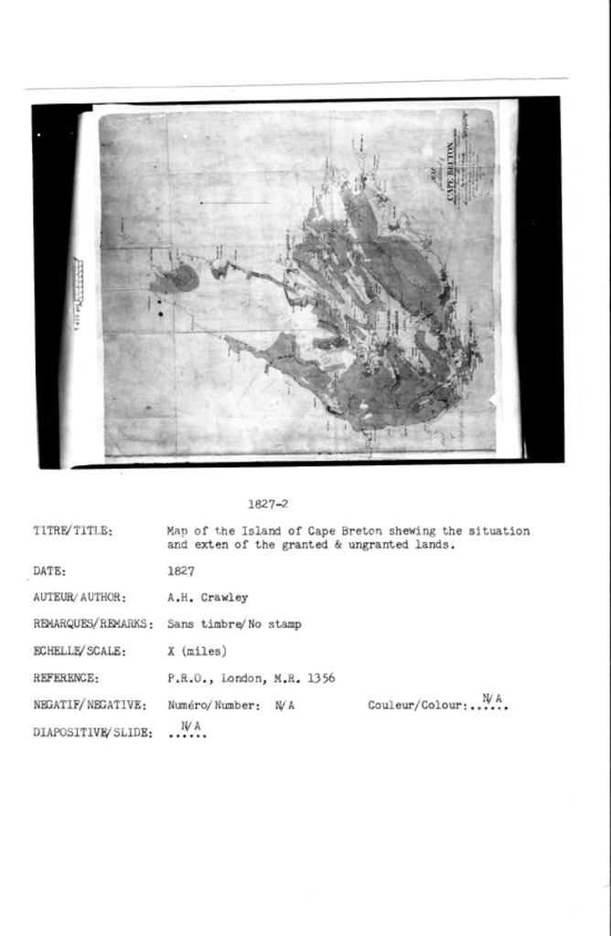
MAP of the Island of CAPE BRETON, shewing the Situation and extent of the Granted & Ungranted Lands ...
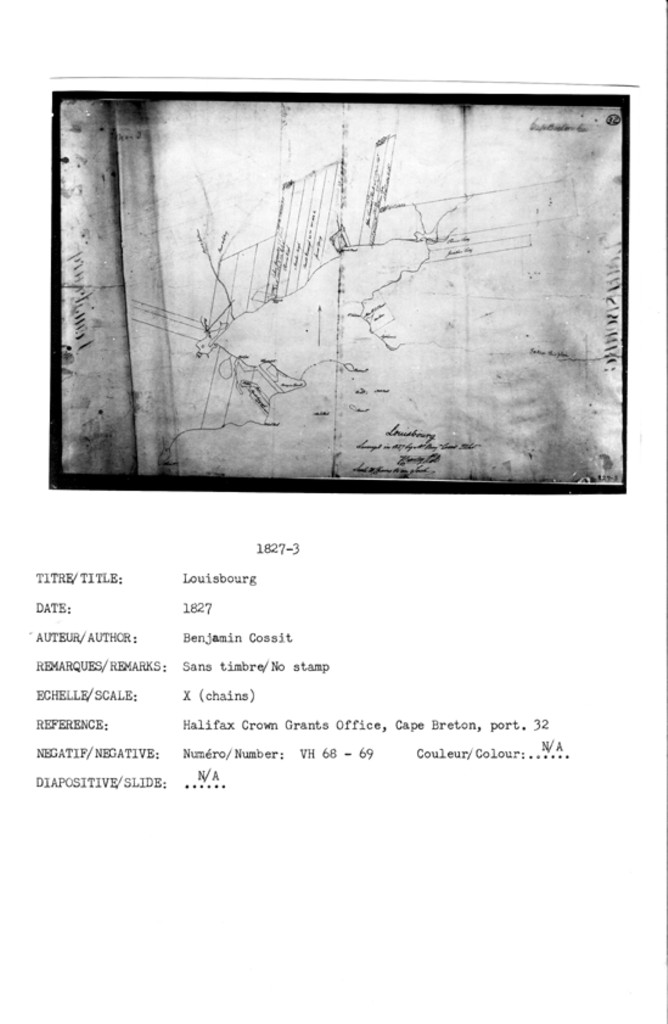
Louisbourg Surveyed in 1827 by Mr. Benjm. Cossit ...
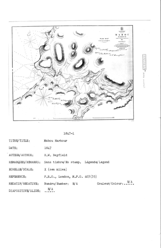
MABOU HARBOUR SURVEYED BY CAPTAIN H.W. BAYFIELD, R.N., ... 1847
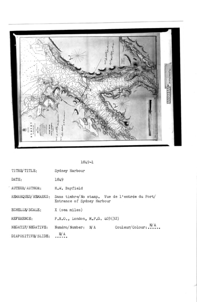
SYDNEY HARBOUR SURVEYED BY CAPTN. H.W. BAYFIELD, R.N., ... 1849
CONTINUATION OF THE SOUTH ARM
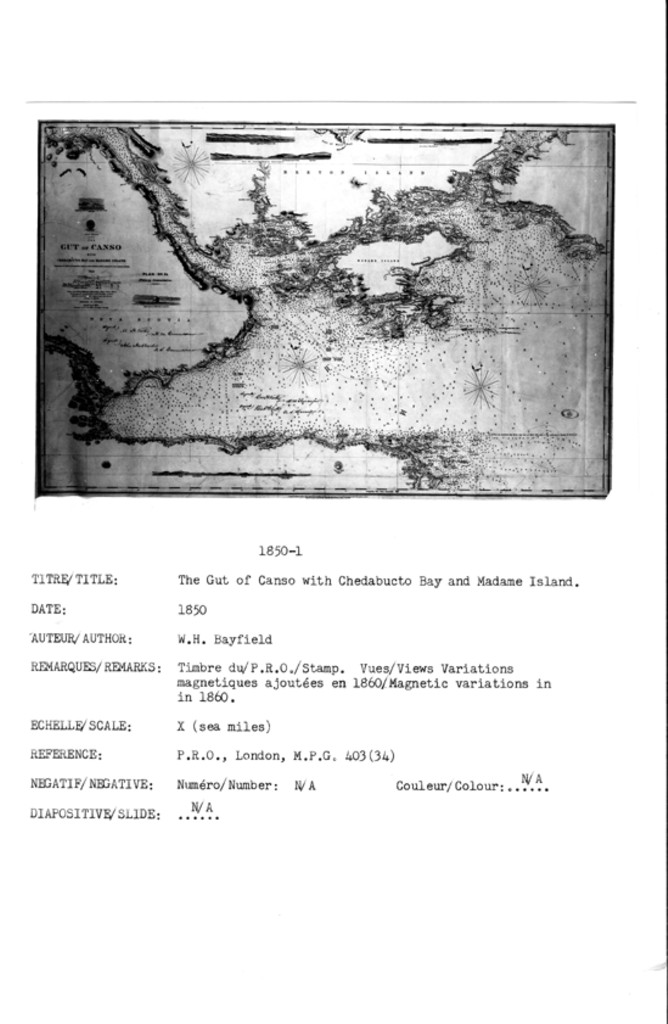
THE GUT OF CANSO WITH CHEDABUCTO BAY AND MADAME ISLAND SURVEYED BY CAPTN. H.W. BAYFIELD, R.N., ... 1850
Light House on ...
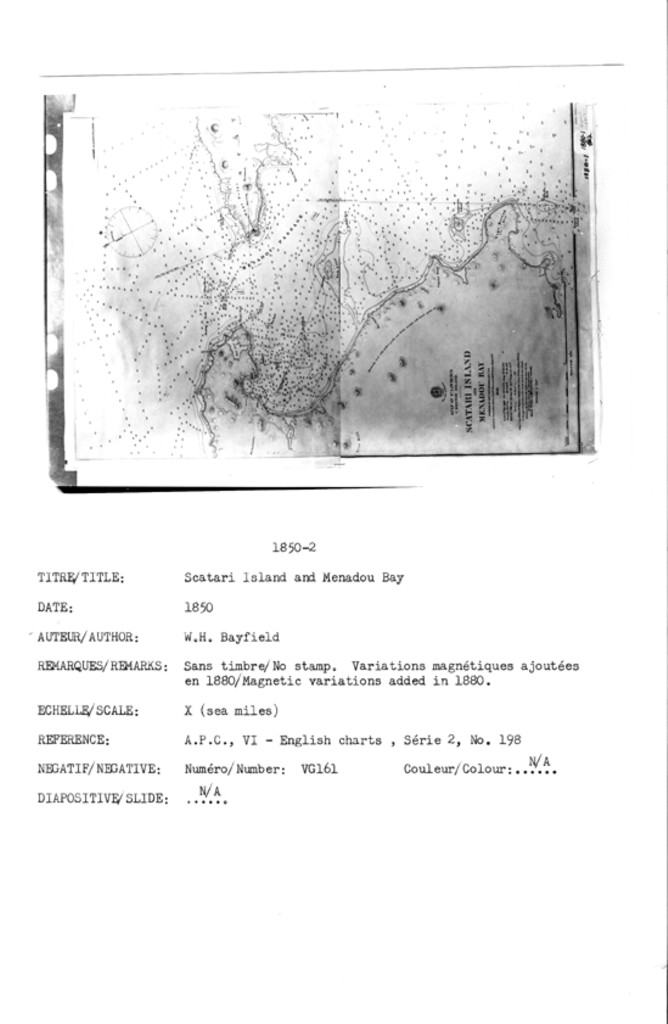
SCATARI ISLAND AND MENADOU BAY SURVEYED BY CAPTN. H.W. BAYFIELD, R.N., ... 1850
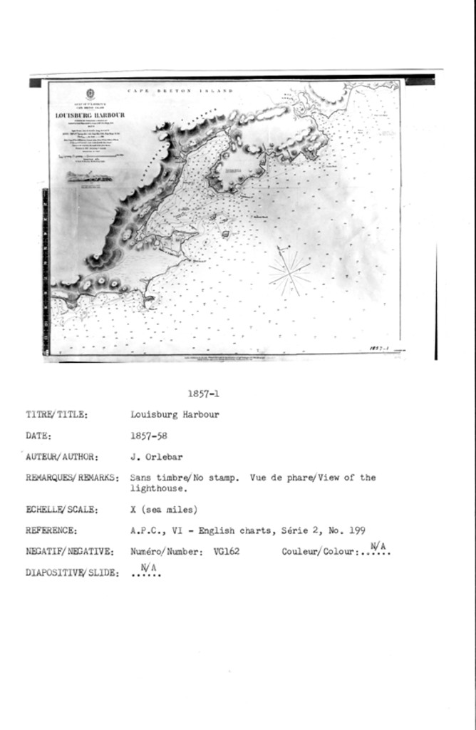
LOUISBURG HARBOUR SURVEYED BY COMMANDER J. ORLEBAR ... 1857-8
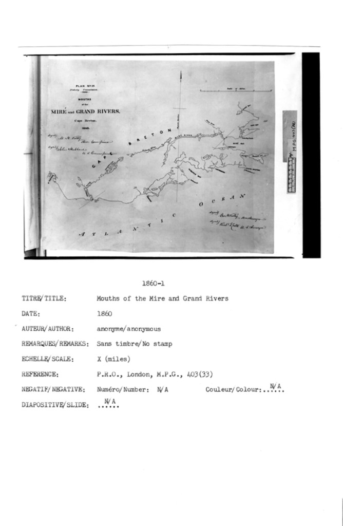
MOUTHS OF THE MIRÉ AND GRAND RIVERS. Cape Breton. 1860
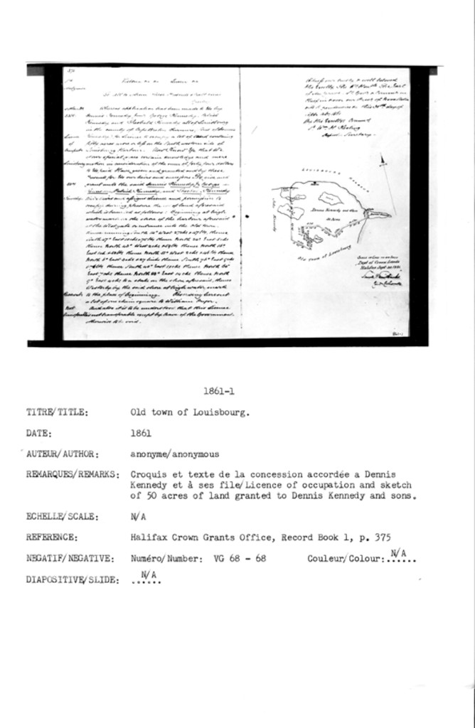
Old Town of Louisbourg
Anonymous
Licence of occupation and sketch of 60 acres of land granted to Dennis Kennedy and
sons
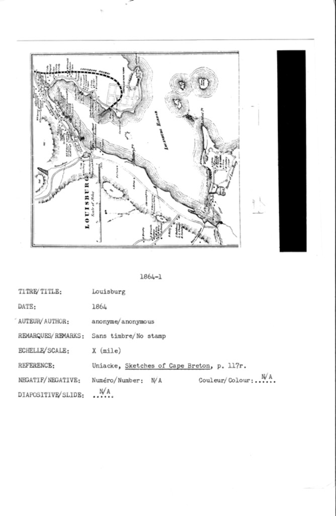
Louisburg
[ADDED AUGUST 13, 2022 - Church, Ambrose F. "Topographical Township Map of Cape Breton County," Nova Scotia, 1864, pub. 1877]
Lithographed to accompany the Report on Canadian Archives for 1886 by Douglas
Brymner, Archivist
Report on Canadian Archives by Douglas Brymner, Archivist 1886
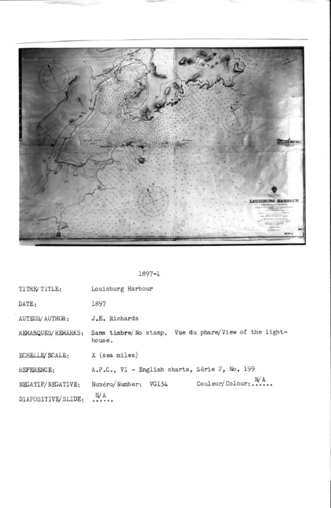
LOUISBURG HARBOUR SURVEYED BY COMMANDER G. E. RICHARDS ... H.M. SURVEYING SHIP 'RAMBLER' 1896 ...
![]()
All Maps and Plans © Institution Holding the Original
For additional text details (no images): HISTORICAL MAPS AND PLANS COLLECTION / CARTES ET PLANS HISTORIQUES (Description and Analysis of the Louisbourg and Isle Royale Map and Plan Collection / Descriptions de la Collection des plans et cartes de Louisbourg et d'Ile Royale - fortmaps.tba)