FortressImages
Website Design and Content
© by Eric Krause, Krause House
Info-Research Solutions (© 1996)
All Images ©
Parks Canada Unless Otherwise Designated
Report/Rapport ©
Krause House Info-Research Solutions
Researching
the Fortress of Louisbourg National Historic Site of Canada
Recherche sur la Forteresse-de-Louisbourg Lieu historique national du Canada
![]()
PROULX COMPILATION: 1759 - 1769
For assorted Fortress of Louisbourg image examples and resolutions click here
All Maps and Plans © Institution Holding the Original
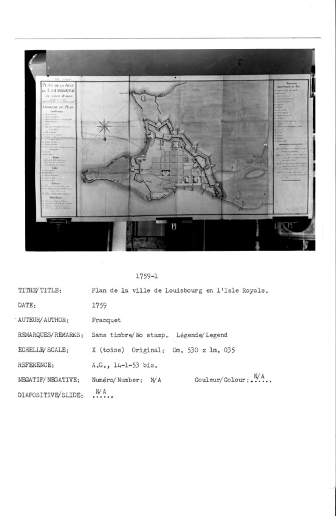
PLAN DE LA VILLE DE LOUISBOURG EN LISLE ROYAL
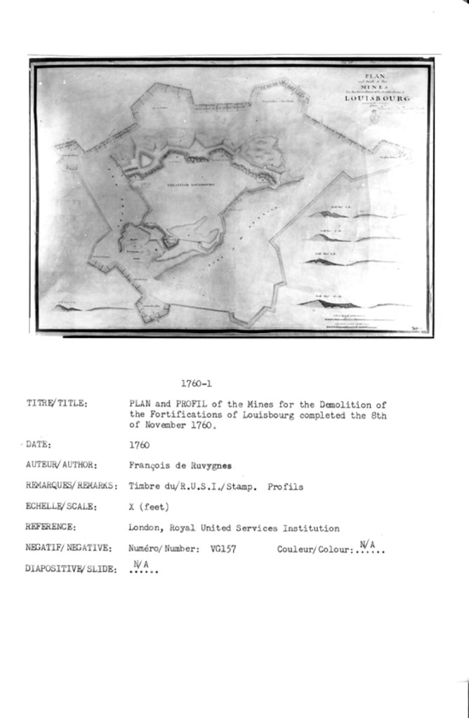
PLAN and Profil of the MINES for the Demolition of the Fortifications of LOUISBOURG completed the 8th of November 1760
To His Excellency Edwd Cornwallis Esq Governor &c of his Majestys Province of Nova Scotia in America &c This MAP of the Province of NOVA SCOTIA and Parts adjacent, is humbly presented by ...
The Situation of HALIFAX Draught of the HARBOUR
Plan of HALIFAX
Plan of QUEBEC
City & Port OF LOUISBOURG
View of BOSTON [City?]
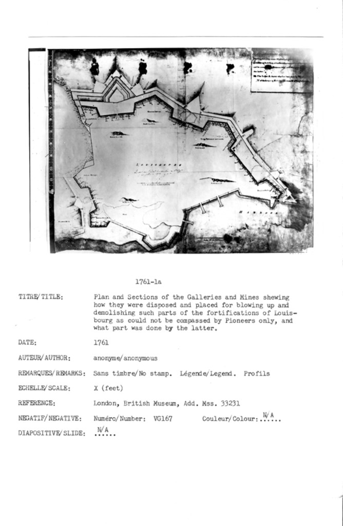
Plan and Sections of the Galleries and Mines shewing how they were disposed and placed for blowing up and demolishing such Parts of the Fortifications of Louisbourg as could not be compassed by Pioneers only, and what part was done by the latter. The Letter A. shews what has been done by hand No of Gallery 47 No of Chambers ...
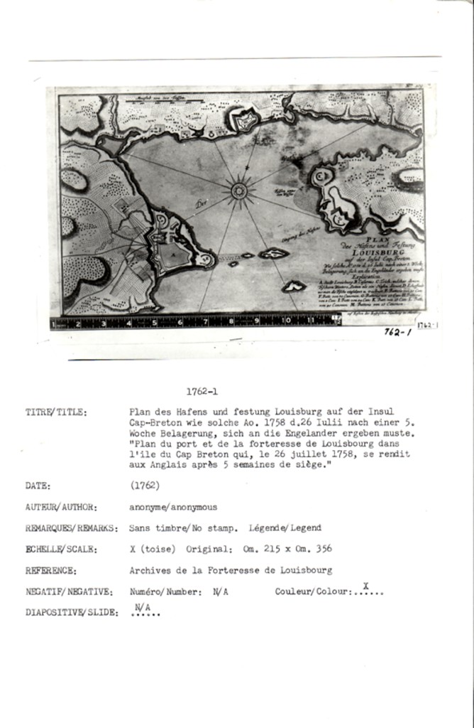
PLAN des Hafens and Festung LOUISBOURG auf der Insul Cap-Breton. Wie solche Ao. 1758 d.26 Iulii nach einer 5. Woche Belagerung, sich an die Engelĺnder ergeben muste.
A view of Louisburg in North America taken near the Lighthouse
A Sketch of the Harbour of Port La Joye in the Island of St: John's
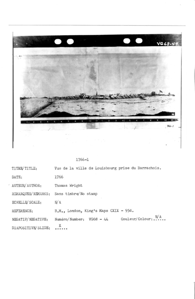
N/A [North west view of the town of Louisburg in the Island of Cape Breton taken in April of 1766 by Thomas Wright]
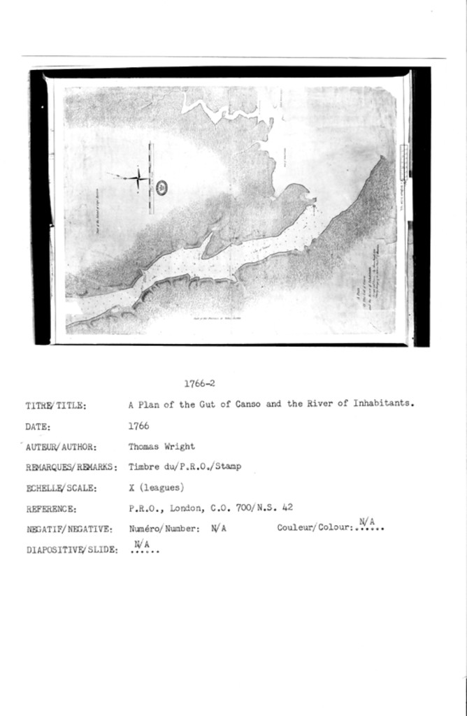
A PLAN of The Gut of Canso and the River of Inhatitants Surveyed and Drawn By Thomas Wright 1766 Deputy Surveyer of the Northern District of America
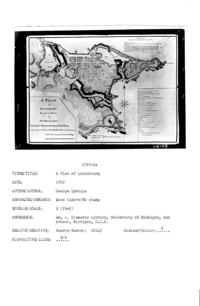
A PLAN of LOUISBOURG Surveyed and Drawn for HIS EXCELLENCY THE HONBLE. MAJOR GENERAL THOS. GAGE Commander in Chief of His Majesty's Forces in America &c. By Ensn. George Sproule of the 59th. Regt....
A PLAN of LOUISBOURG Surveyed and Drawn for HIS EXCELLENCY THE HONBLE. MAJOR GENERAL THOS. GAGE Commander in Chief of His Majesty's Forces in America &c. By Ensn. George Sproule of the 59th. Regt....
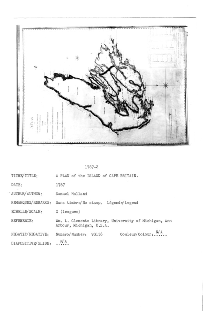
A PLAN of the ISLAND of CAPE BRETON Reduced from the large Survey MADE by the ORDERS and INSTRUCTIONS of the RIGHT HONORABLE the LORDS COMMISSIONERS for TRADE and PLANTATIONS by SAMUEL HOLLAND ESQR: Surveyor General of the Northern District of America & with the Assistance of his Deputies
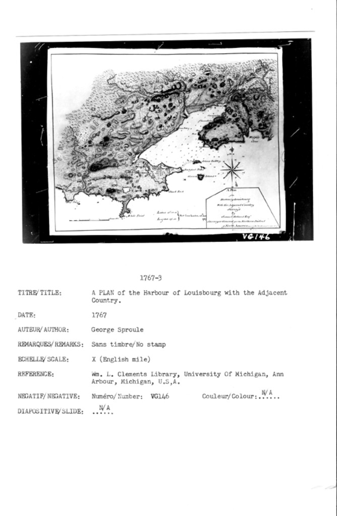
A Plan of the Harbour of Louisbourg With the Adjacent Country Survey'd by Samuel Holland Esqr. Surveyer General for the Northern District of North America drawn by Ensn. Geo. Sproule of the 59th. Regt.
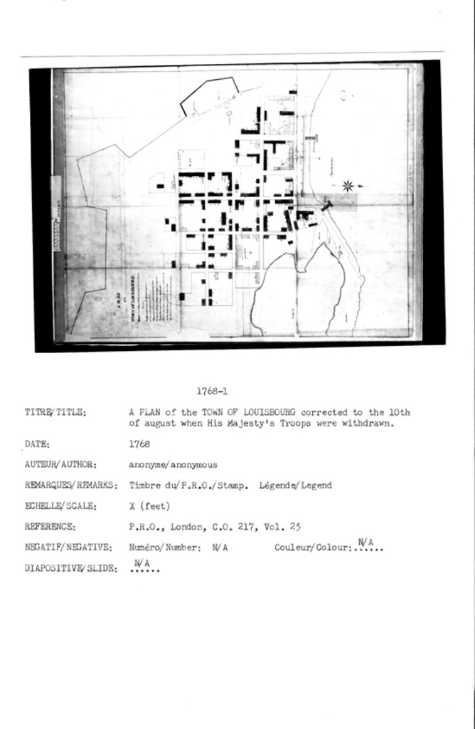
A PLAN of the TOWN OF LOUISBOURG Corrected to the 10th of August when His Majesty's Troops were withdrawn
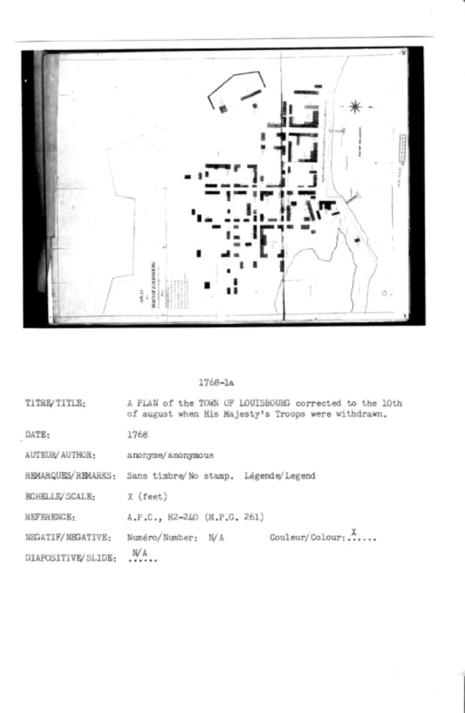
A PLAN of the TOWN OF LOUISBOURG corrected to the 10th of august when His Majesty's Troops were withdrawn
MAP OF NOVA SCOTIA OR ACADIA; with the ISLANDS OF CAPE BRETON and ST. JOHN'S, from Actual SURVEYS, by Captn. MONTRESOR, , Engir. 1768.
![]()
All Maps and Plans © Institution Holding the Original
For additional text details (no images): HISTORICAL MAPS AND PLANS COLLECTION / CARTES ET PLANS HISTORIQUES (Description and Analysis of the Louisbourg and Isle Royale Map and Plan Collection / Descriptions de la Collection des plans et cartes de Louisbourg et d'Ile Royale - fortmaps.tba)