FortressImages
Website Design and Content
© by Eric Krause, Krause House
Info-Research Solutions (© 1996)
All Images ©
Parks Canada Unless Otherwise Designated
Report/Rapport ©
Krause House Info-Research Solutions
Researching
the Fortress of Louisbourg National Historic Site of Canada
Recherche sur la Forteresse-de-Louisbourg Lieu historique national du Canada
![]()
PROULX COMPILATION: 1758
For assorted Fortress of Louisbourg image examples and resolutions click here
All Maps and Plans © Institution Holding the Original
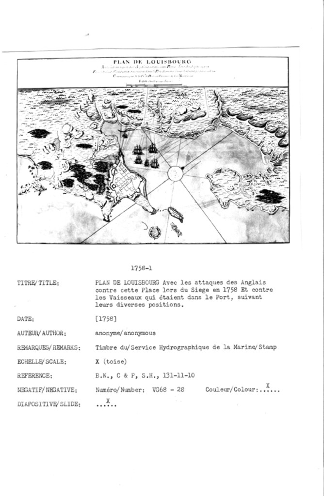
PLAN DE LOUISBOURG Avec les attaques des Anglais contre cette Place Lors du Siege en 1758. Et contre les Vaisseaux qui étoient dans le Port, Suivant leurs diverses positions~ Communiqué par M le Chv. de Drucourt Capitaine de Vaisx. Gouverneur
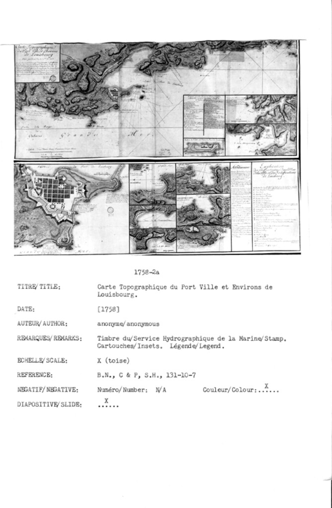
Carte Topographique du Port Ville et Environs de Louisbourg Situé par les 45 dég 53 mte. latd. Nord
Batterie de L'Isle de l'Entrée du Port de Loüisbourg.
On na pas Jugé Necessaire de Fortificiers deux havres ...
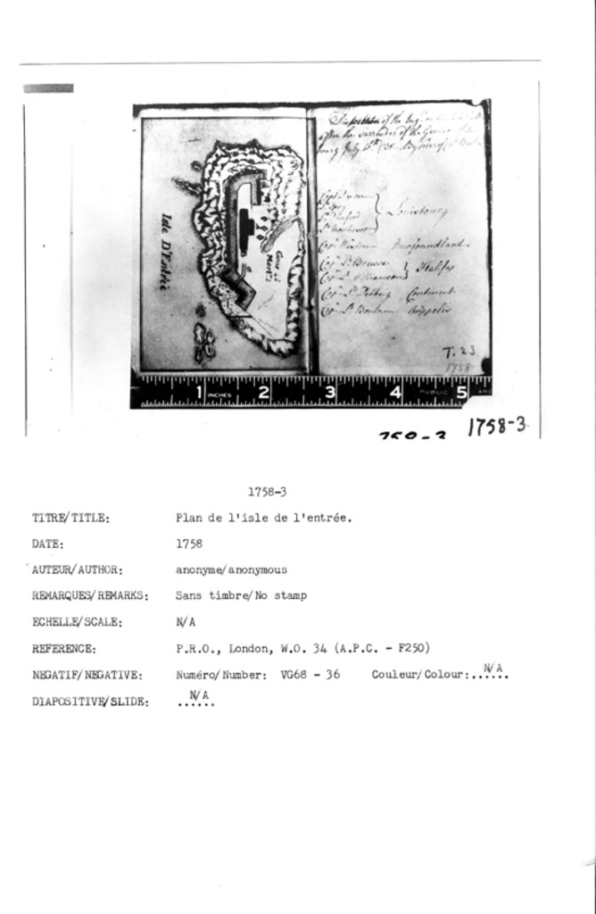
N/A [Plan de l'isle de l'entrée]
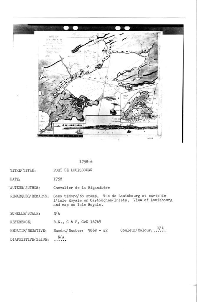
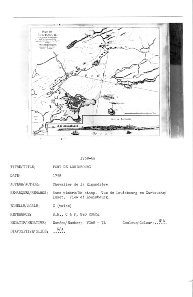
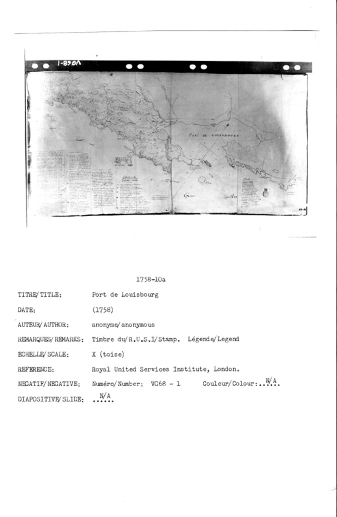
PORT DE LOUISBOURG Levé par le Cher. de la Rigaudiere Lieutnt. de Vaisseaux du Roy. PARIS Chez le Sr. le Rouge rue des grds Augustins
VEUE DE LOUISBOURG
CARTE DE LISLE ROYALE
PORT DE LOUISBOURG Levé par le Cher. de la Rigaudiere Lieutnt. de Vaisseaux du Roy. PARIS Chez le Sr. le Rouge rue des grds. Augustins
VEUE DE LOUISBOURG
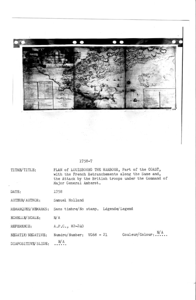
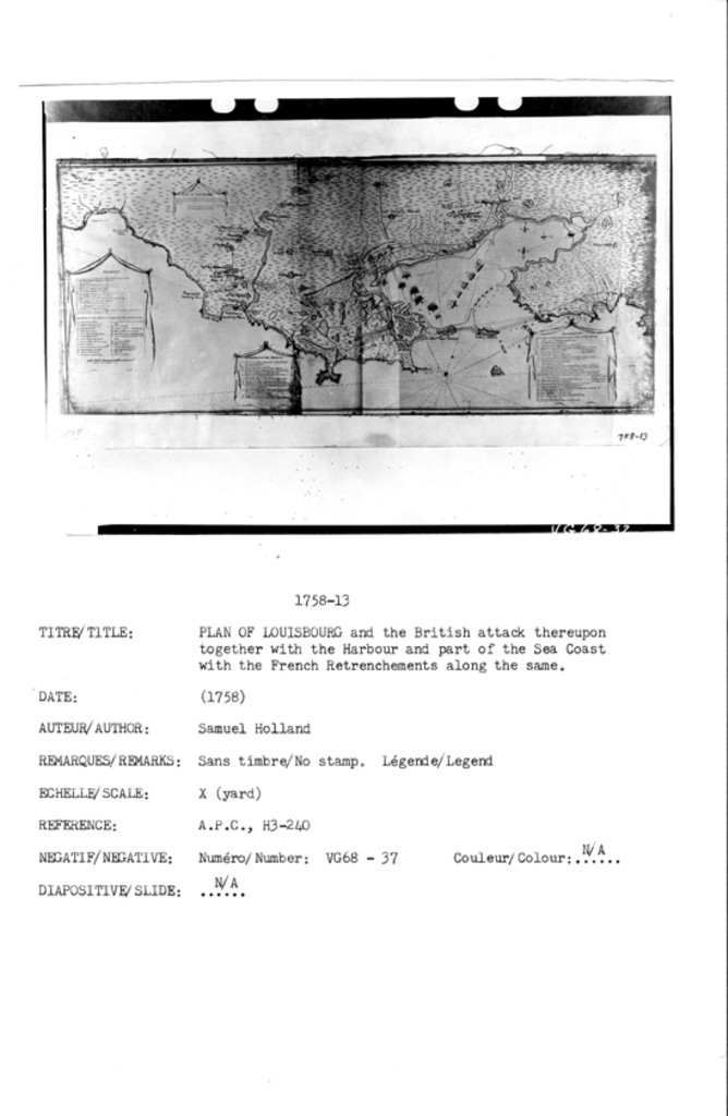
PLAN OF LOUISBOURG THE HARBOUR, Part of the COAST, with French Retranchements along the Same and, the the Attack by the British Troops under the Command of Major General Amherst
PLAN DU Cap BRETON DIT LOUISBOVRG AVEC SES ENVIRONS PRIES PAR LAMIRALLE BOCKOUME LE 26 jullET 1758
PARTIE DE L'ISLE DU CAP BRETON
PLAN de LOUISBOURG
N/A [Port de Louisbourg]
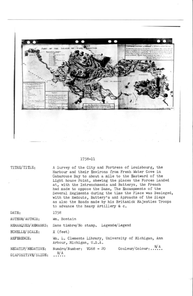
A SURVEY of the CITY and FORTRESS of LOUISBOURG, the HARBOUR and their Environs from Fresh Water Cove in Gabarouse Bay to about a mile to the Eastward of the Light house Point, shewing the places the Forces Landed at, with the Intrenchments and Batterys, the French and made to oppose the Same, The Encampments of the Several Regiments during the time the Place was Besieged, with the Redouts, Battery's and Aproachs of the Siege, as also the Roads made by his Britanick Majesties Troops to advance the heavy Artillery &c Survy'd by Wm. Bontain ...
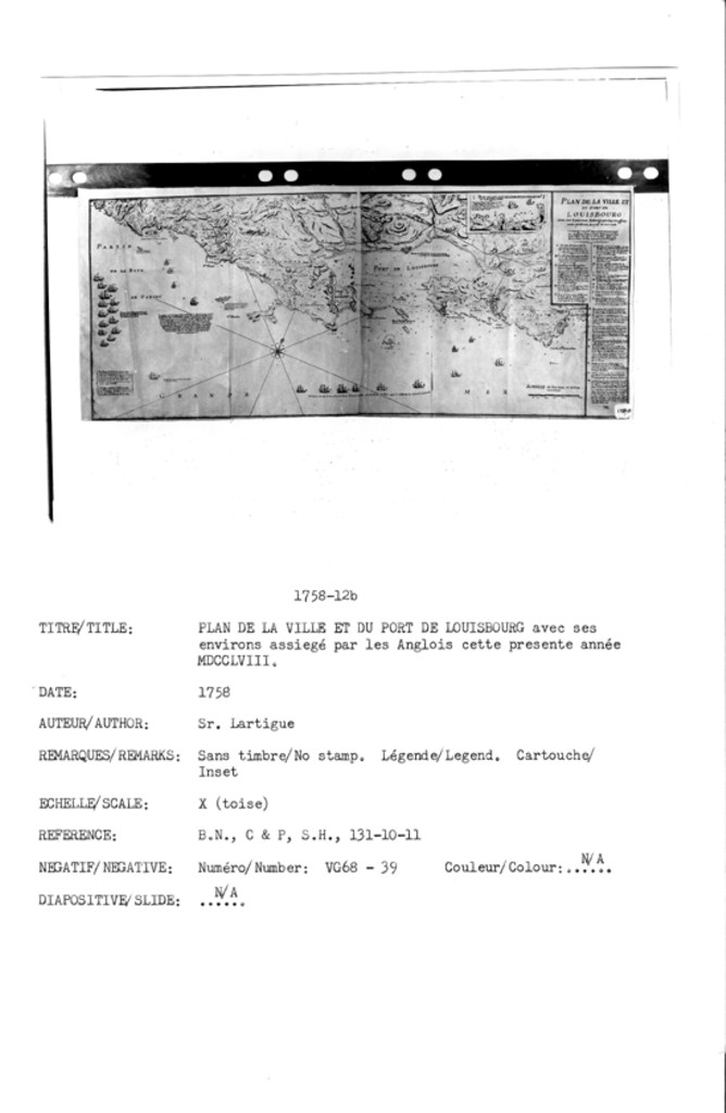
PLAN DE LA VILLE ET DU PORT DE LOUISBOURG AVec Ses Environs assiege par les Anglois cette presente Annee M DCC LVIII.
PLAN DE LATTAQUE DE LANCT. DE LA CORMORAND[?] Par le Brigadier Wolfe
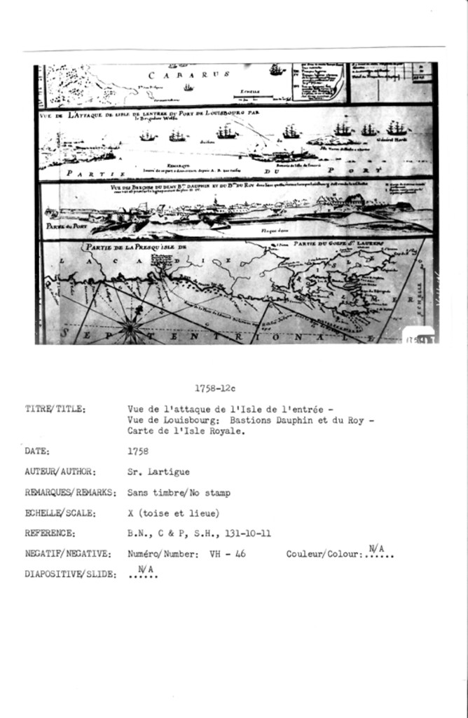
VUE DE L'ATTAQUE DE LISLE DE LENTREE DU PORT DE LOUISBOURG PAR le Brigadier Wolfe
VUE DES BRECHES DU DEMY BON. DAUPHIN ET DU BON DU ROY dans l'etat quelle étoient lorsque loüisbourg sest rendu le 26 Juillet
PLAN DE LA VILLE ET DU PORT DE LOUISBOURG AVec Ses Environs assiege par les Anglois cette presente Annee M DCC LVIII.
PLAN DE LATTAQUE DE LANCT. DE LA CORMORAND[?] Par le Brigadier Wolfe
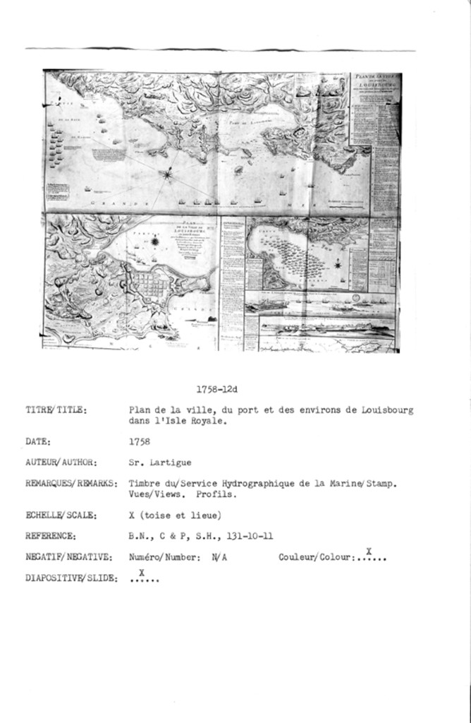
PLAN DE LA VILLE DE LOUISBOURG EN LISLE ROYALLE avec les Eminences qui l'avoisment, leur distances Entr'elles ainsi que de la Fortiffication, Ensemble les ouvrages d'attaques de lennemi et celles de deffces. de la part des Assiegé levé et dessinne sur les lieux par le Sr. Lartigue _____ M DCC.LVIII
SIEGE DE LOUISBOURG/CARTE DE LA BAYE CABARUS
VUE DE L'ATTAQUE DE LISLE DE LENTREE DU PORT DE LOUISBOURG PAR le Brigadier Wolfe
VUE DES BRECHES DU DEMY BON. DAUPHIN ET DU BON DU ROY dans l'etat quelle étoient lorsque loüisbourg sest rendu le 26 Juillet
PLAN OF LOUISBOURG and the British attack thereupon together with the Harbour and part of the Sea Coast with the French Retrenchements along the same ...
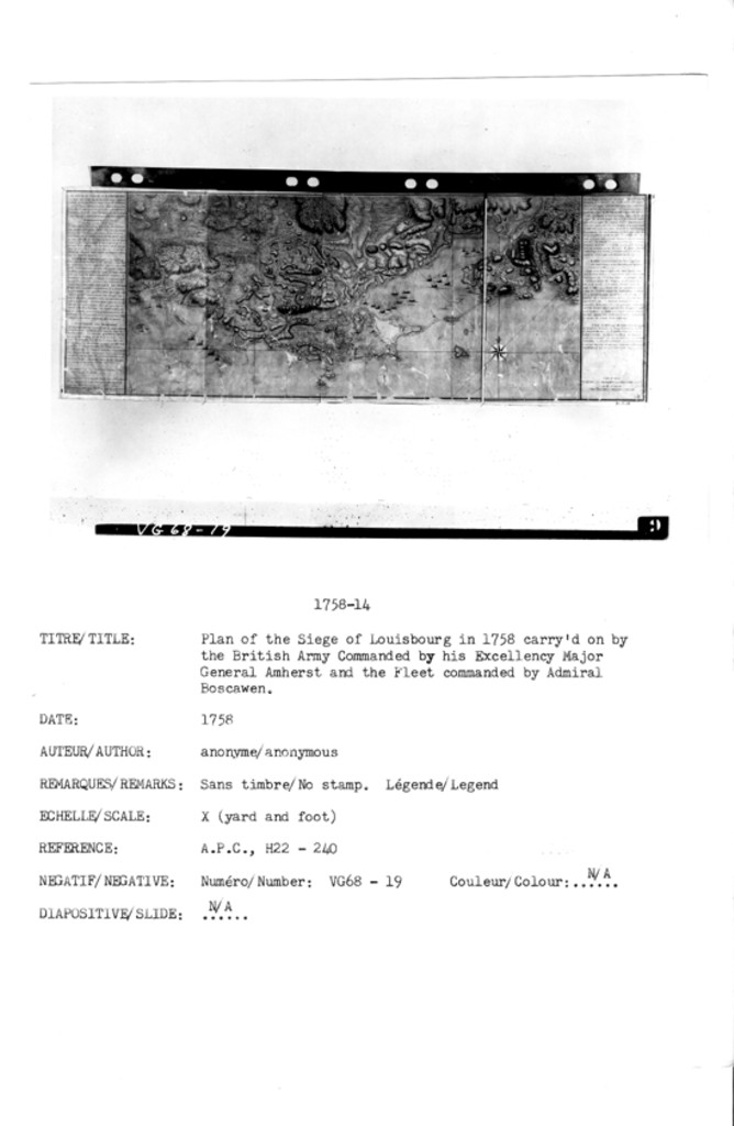
PLAN of the SIEGE of LOUISABOURG in 1758, carry'd on by the British Army Commanded by his Excellency Major General Amherst and the Fleet commanded by Admiral Boscawen. The Place capitulated the 26th. July, a month after breaking Ground. NB The works of the Besieger are Colour'd yellow, and those of the Besieged blue.
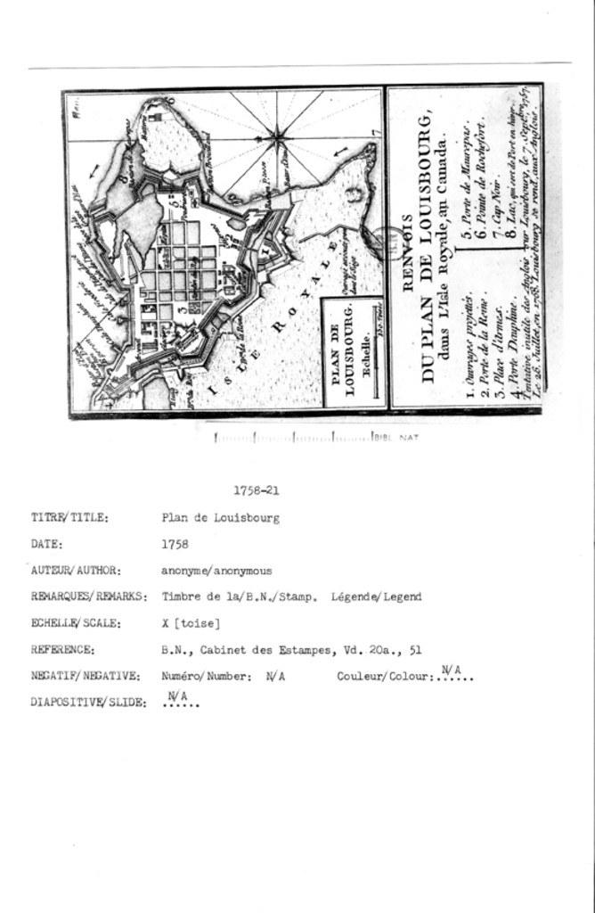
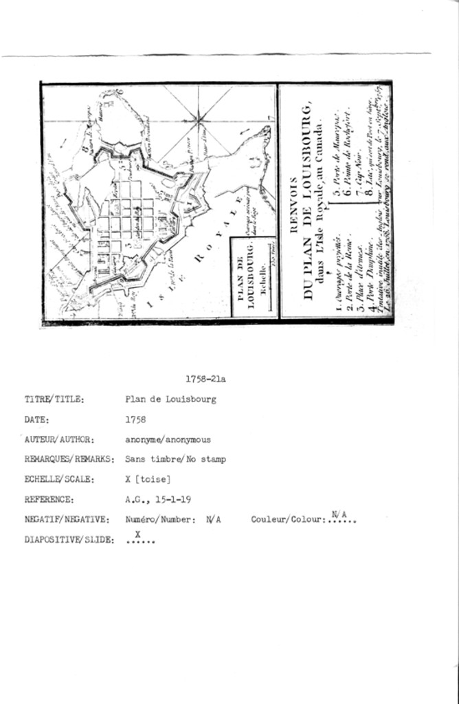
PLAN DE LOUISBOURG
LE PLAN de LOUISBOURG dans l'Isle royale au Canada. Les Anglais tentoient Sans Succčs de S'emparer de cette Fortresse le .7. Sep.tembre 1757. le 26. Juillet en 1758 elle se rend aux
Anglais.
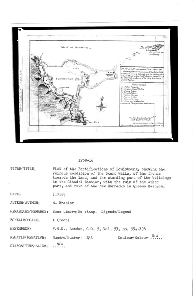
PLAN of the Fortifications of LOUISBOURG; shewing the ruinous condition of the Scarp Walls, of the fronts towards the Land, and the standing part of the buildings in the Citadel Bastion, with the ruin of the other part, and ruin of the New Barracks in Queens Bastion.
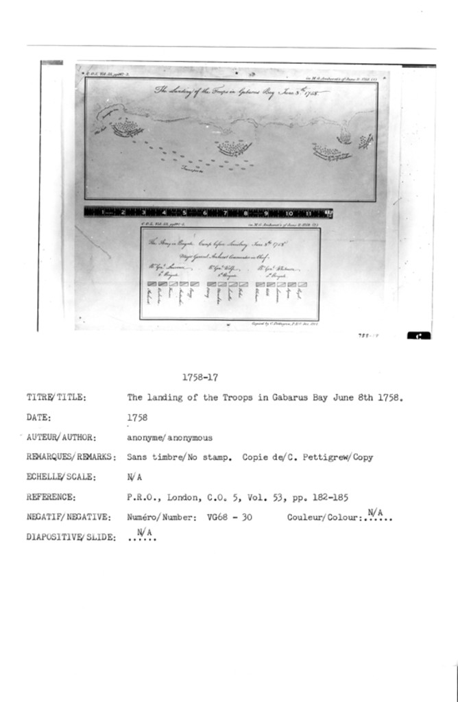
The Landing of the Troops in Gabarus Bay June 8th: 1758
The Army in Brigade. Camp before Louisbourg. June 8th: 1758
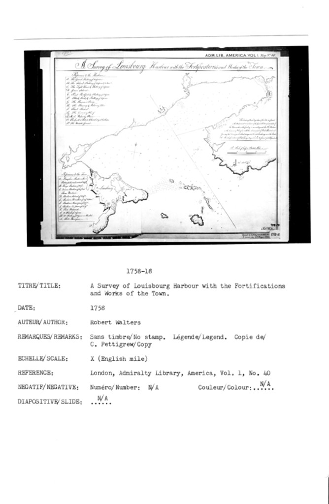
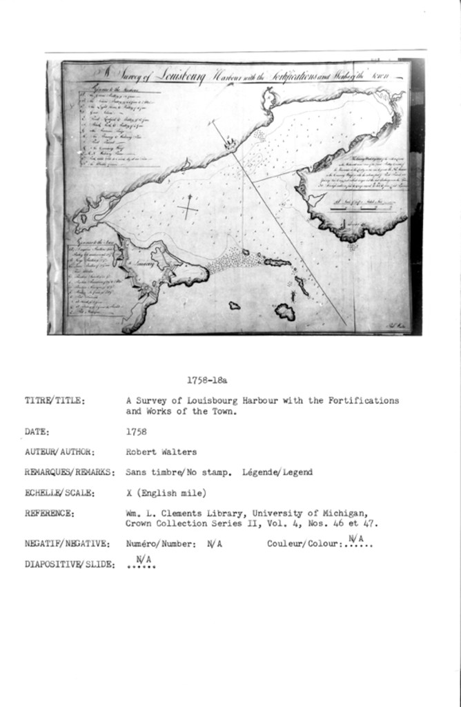
A Survey of Louisbourg Harbour with the Fortifications and Works of the Town
A Survey of Louisbourg Harbour with the Fortifications and Works of the Town
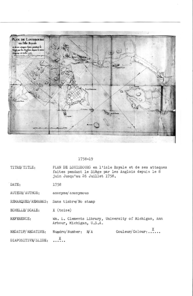
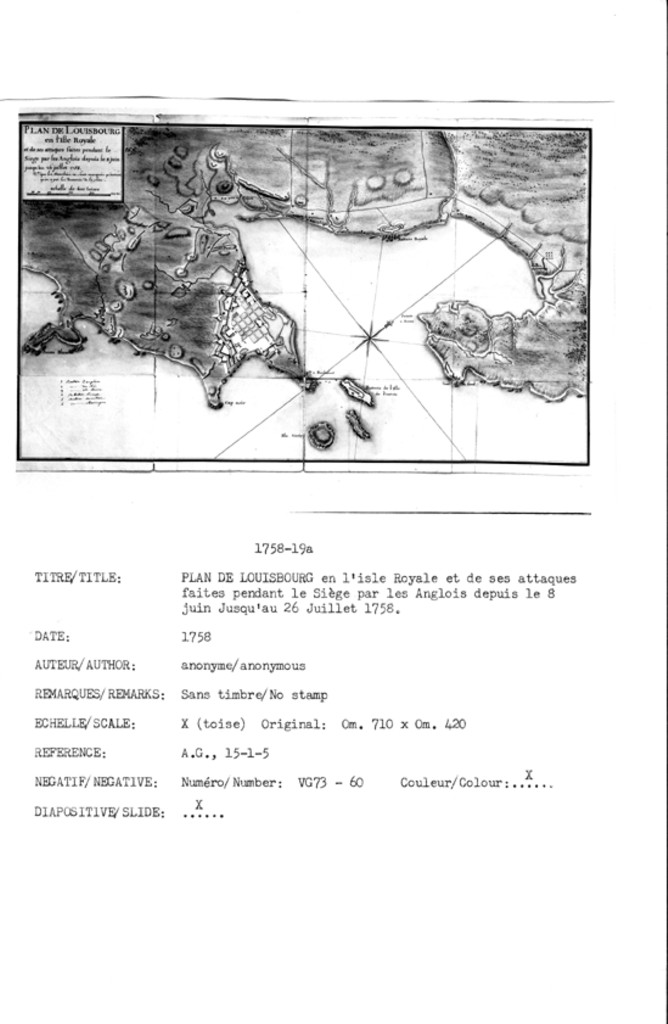
PLAN DE LOUISBOURG en l'isle Royale et de ses attaques faites pendant le Sičge par les Anglois depuis, le 8 juin Jusqu'au 26 Juillet 1758. Na. que les tranchées ne Sont marquées, qu'autant qu'on a [put?] découvrie de la place.
PLAN DE LOUISBOURG en l'isle Royale et de ses attaques faites pendant le Siege par les Anglois depuis le 8 juin Jusq'au 26 Juillet 1758. Na. que les tranchées ne Sont marquées qu'autant qu'on a [put?] decouvrie de la place.
PLAN OF FORTRESS OF LOUISBOURG SHOWING ENTRENCHMENTS AS IN 1758, ENLARGED FROM PLAN OF LIEUT. HOLLAND R.N. 1758
PLAN DE LOUISBOURG
PLAN DE LOUISBOURG
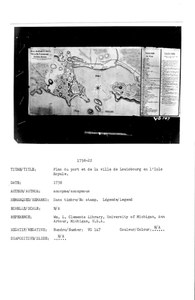
PLAN DU PORT ET DE LA VILLE DE LOUISBOURG EN L'ISLE ROYALE Et des Attaques faites par les Anglois pendent le Siege depuis le 8 Juin Jusquau 26 Juillet 1758
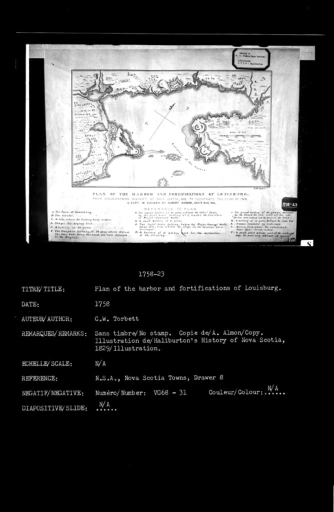
PLAN OF THE HARBOR AND FORTIFICATIONS OF LOUISBOURG. FROM HALIBURTON'S HISTORY OF NOVA SCOTIA, 1829, TO ILLUSTRATE THE SIEGE OF 1758. A COPY IN COLORS, BY ALBERT ALMON, GLACE BAY, 1911.
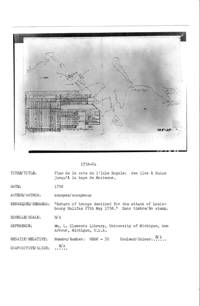
N/A [Plan de la cote de l'Isle Royale: des iles ŕ Guion jusqu'ŕ la baye de Morienne]
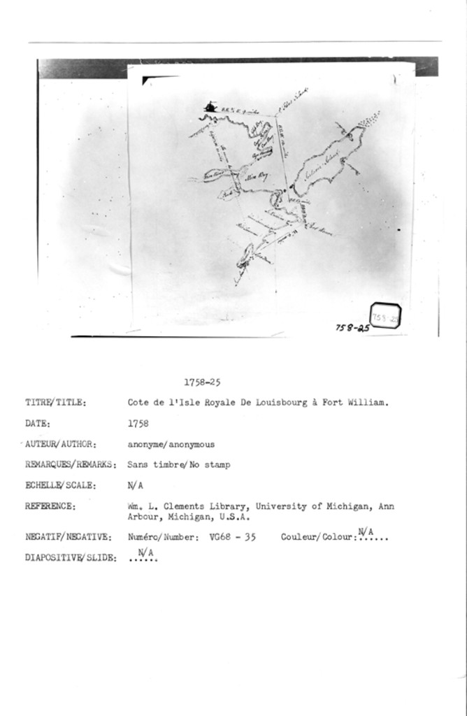
N/A [Cote de l'Isle Royale De Louisbourg ŕ Fort William]
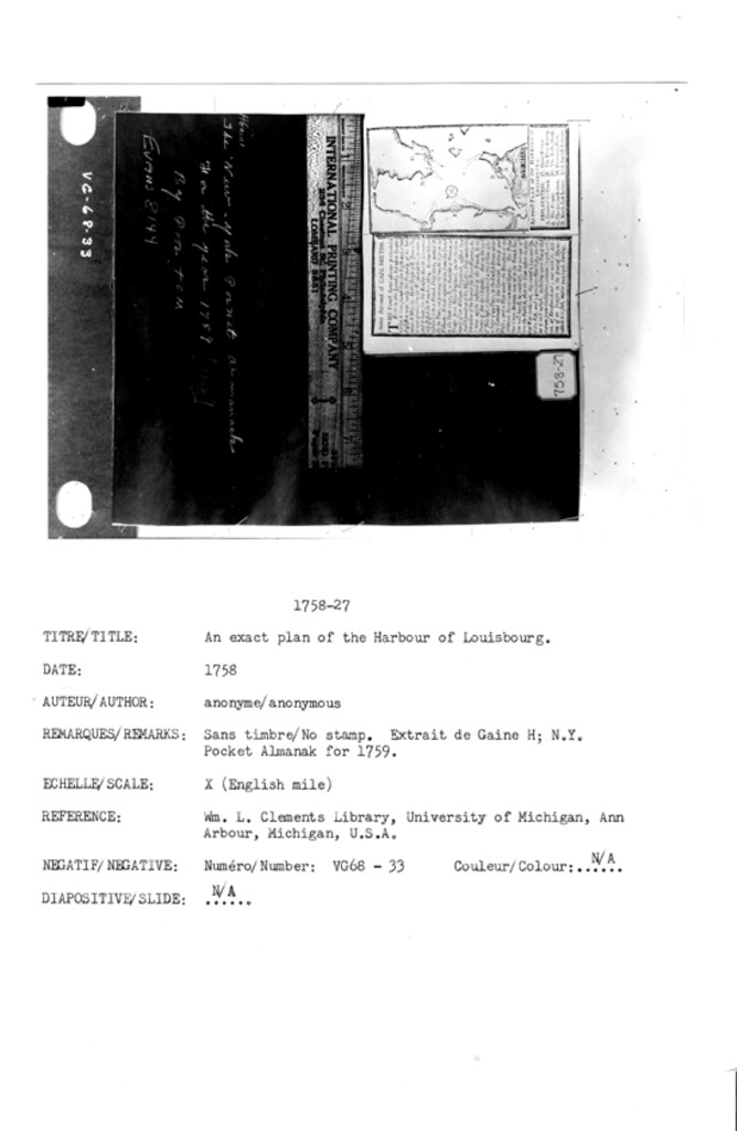
An exact Plan of the Harbour of Louisbourg
PLAN DE LA VILLE DE LOUISBOURG EN L'ISLE ROYALE 1758
PLAN of LOUISBOURG and of the Encampments & Works of the English Army under the Command of Major General Amherst 1758
N/A
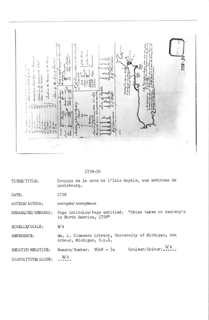
[Croquis de la cote de l'Isle Royale, aux environs de Louisbourg] - Ships taken or destroy'd in North America, 1758]
N/A
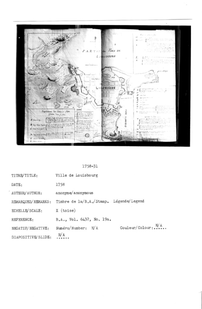
[Ville de Louisbourg]
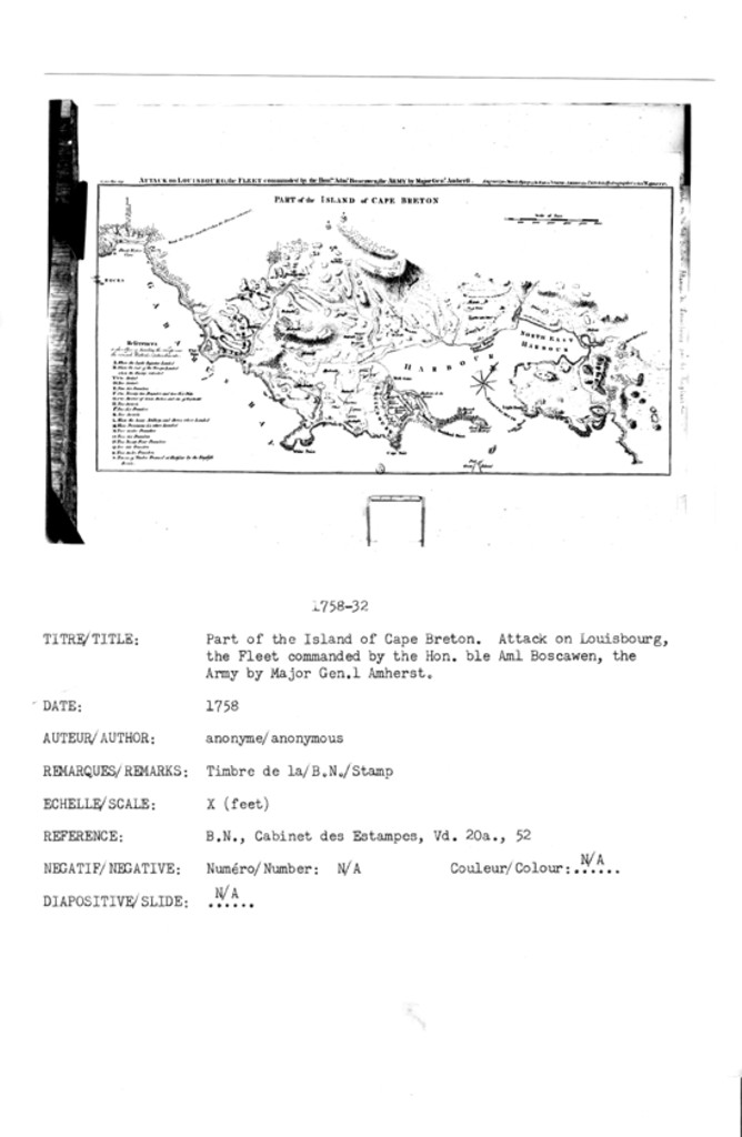
ATTACK ON LOUISBOURG, the FLEET comanded by the Honable. Aml. Boscawen, the ARMY by Major Genl. Amherst.
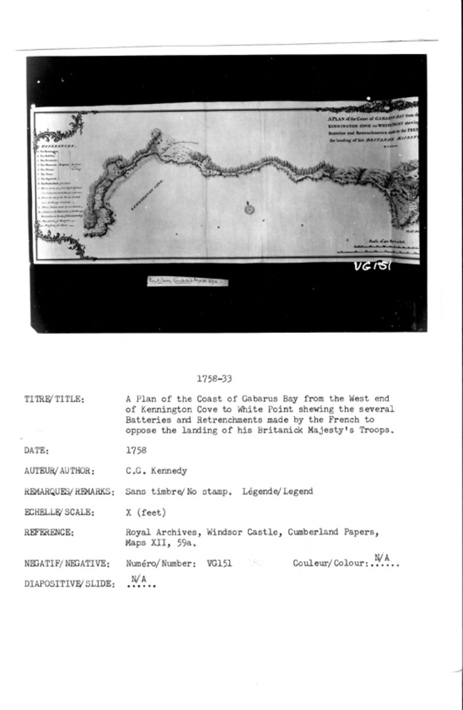
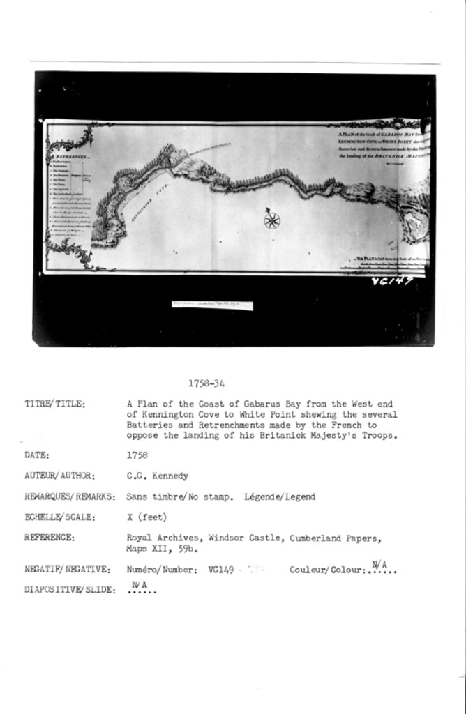
A PLAN of the Coast of GABARUS BAY from the West end of KENNINGTON COVE to WHITE POINT shewing the several Batteries and Retrenchments made by the FRENCH to oppose the landing of his BRITANICK MAJESTY'S Troops.
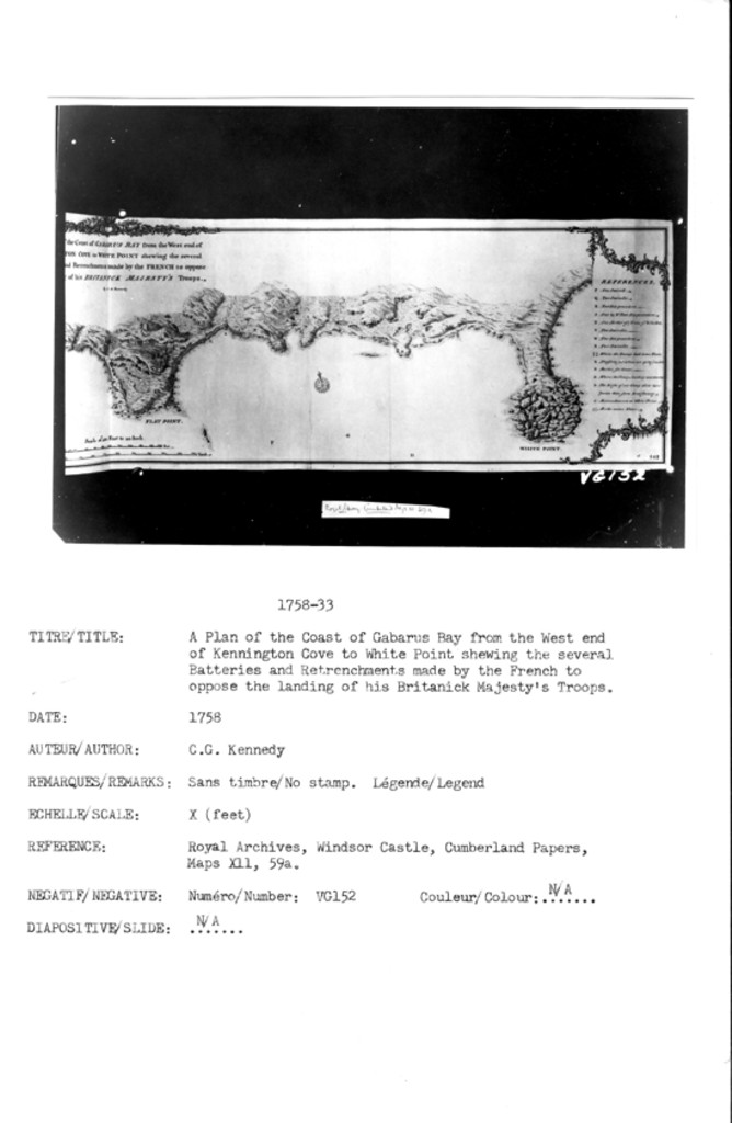
A PLAN of the Coast of GABARUS BAY from the West end of KENNINGTON COVE to WHITE POINT shewing the several Batteries and Retrenchments made by the FRENCH to oppose the landing of his BRITANICK MAJESTY'S Troops.
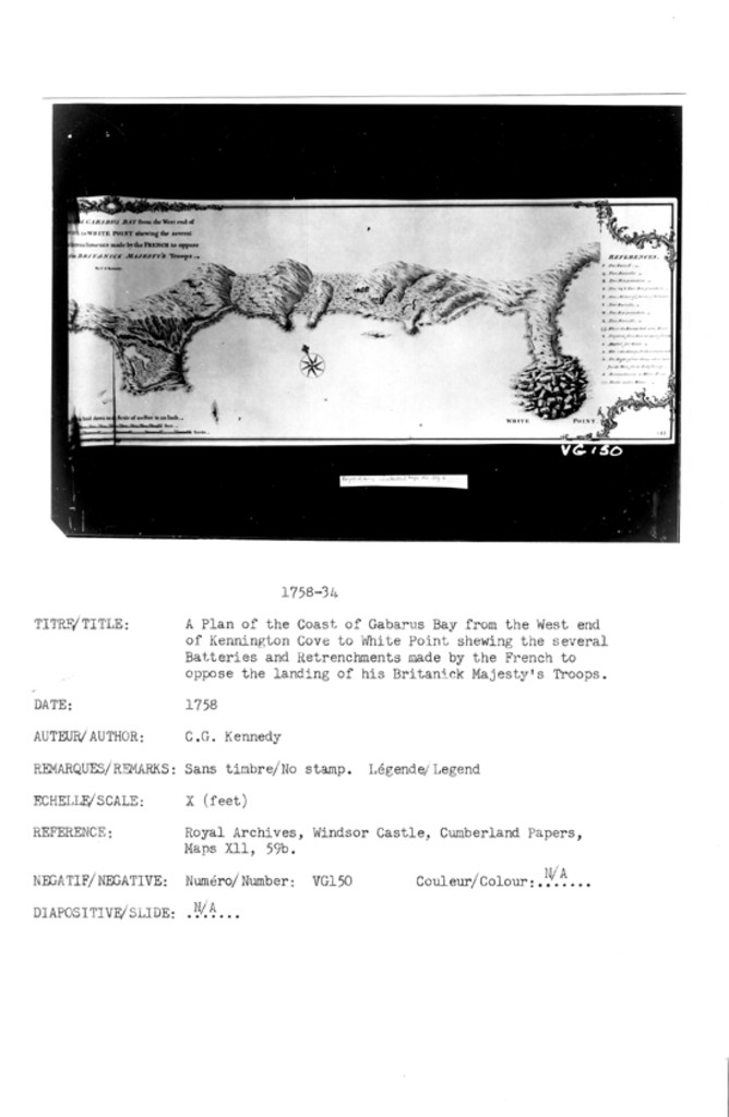
A PLAN of the Coast of GABARUS BAY from the West end of KENNINGTON COVE to WHITE POINT shewing the several Batteries and Retrenchments made by the FRENCH to oppose the landing of his BRITANICK MAJESTY'S Troops.
A PLAN of the Coast of GABARUS BAY from the West end of KENNINGTON COVE to WHITE POINT shewing the several Batteries and Retrenchments made by the FRENCH to oppose the landing of his BRITANICK MAJESTY'S Troops
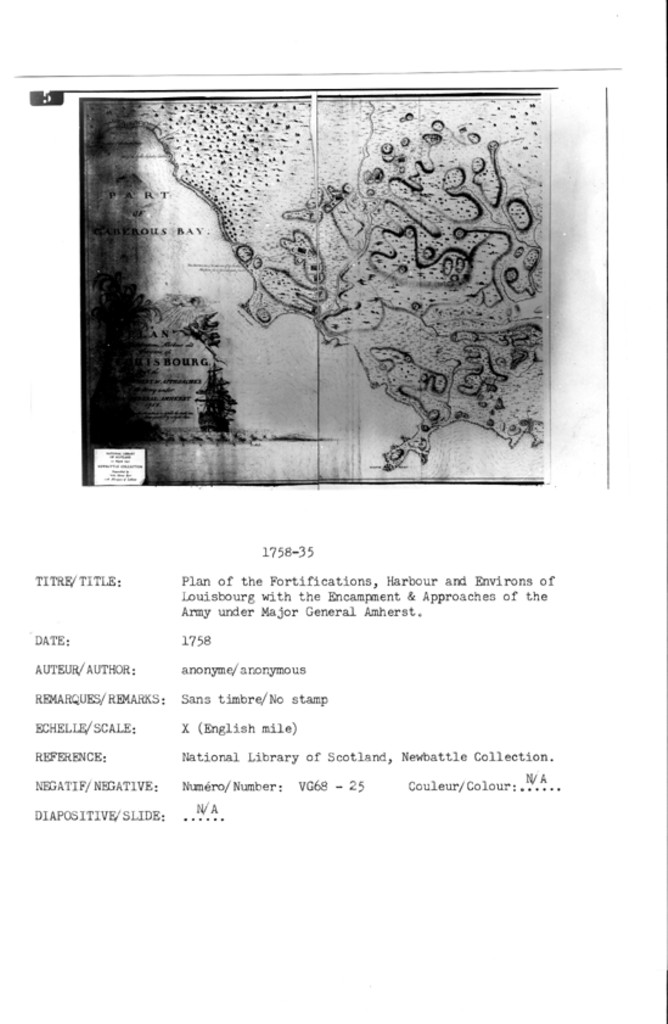
PLAN of theFortifications, Harbour and Environs of LOUISBOURG With the ENCAMPMENT & APPROACHES of the Army under MAJOR GENERAL AMHERST 1758. Works and Batteries to defend the Coast are distinguished by a light Red.
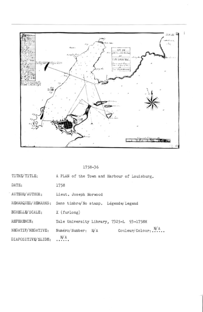
A PLAN of the Town and Harbour of LOUISBURG From an actual Survey Taken in the Year 1758
A View of the Siege of Louisbourgh commanded by His Excellency Major General Amherst in the year 1758 taken from the Center Redoubt
Importan[t] [Vess]els of [the French Fleet taken Ju]ly [26th] 1758 By Admiral Bosca[wen]
![]()
All Maps and Plans © Institution Holding the Original
For additional text details (no images): HISTORICAL MAPS AND PLANS COLLECTION / CARTES ET PLANS HISTORIQUES (Description and Analysis of the Louisbourg and Isle Royale Map and Plan Collection / Descriptions de la Collection des plans et cartes de Louisbourg et d'Ile Royale - fortmaps.tba)