FortressImages
Website Design and Content
© by Eric Krause, Krause House
Info-Research Solutions (© 1996)
All Images ©
Parks Canada Unless Otherwise Designated
Report/Rapport ©
Krause House Info-Research Solutions
Researching
the Fortress of Louisbourg National Historic Site of Canada
Recherche sur la Forteresse-de-Louisbourg Lieu historique national du Canada
![]()
PROULX COMPILATION: 1745
For assorted Fortress of Louisbourg image examples and resolutions click here
All Maps and Plans © Institution Holding the Original
PLAN DE LA VILLE DU PORT DE LOUISBOURG DE SES BATTERIES AVEC SA PERSPECTIVE OU L'ON VOIR LES ourages de fortiffications faittes par les Anglois pour l'attaque de la Place et de ses Batteries
VEUE et PERSPECTIVE DE LA VILLE DE LOUISBOURG
Elevation de la batterie Royalle du coste de la terre
PLAN de la Batterie de L'Jsle de l'entrée
Elevation de la batterie Royalle du coste du port
PLAN DE LA BATTERIE ROYALLE
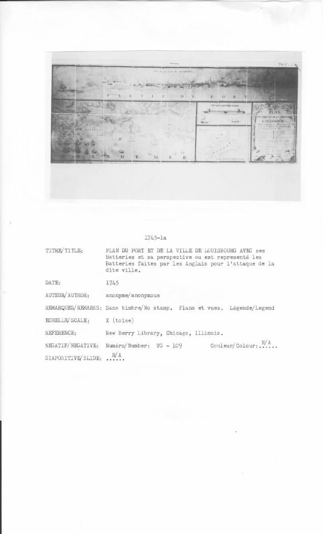
PLAN DU PORT ET DE LA VILLE DE LOUISBOURG AVEC ses Batteries et sa Perspective ou est réprésenté les Batteries faites par les Anglais pour l'attaque de la dite ville
VEÜE DU LA VILLE DE LOÜISBOURG
VEÜE DE LA BATTERIE ROYALLE
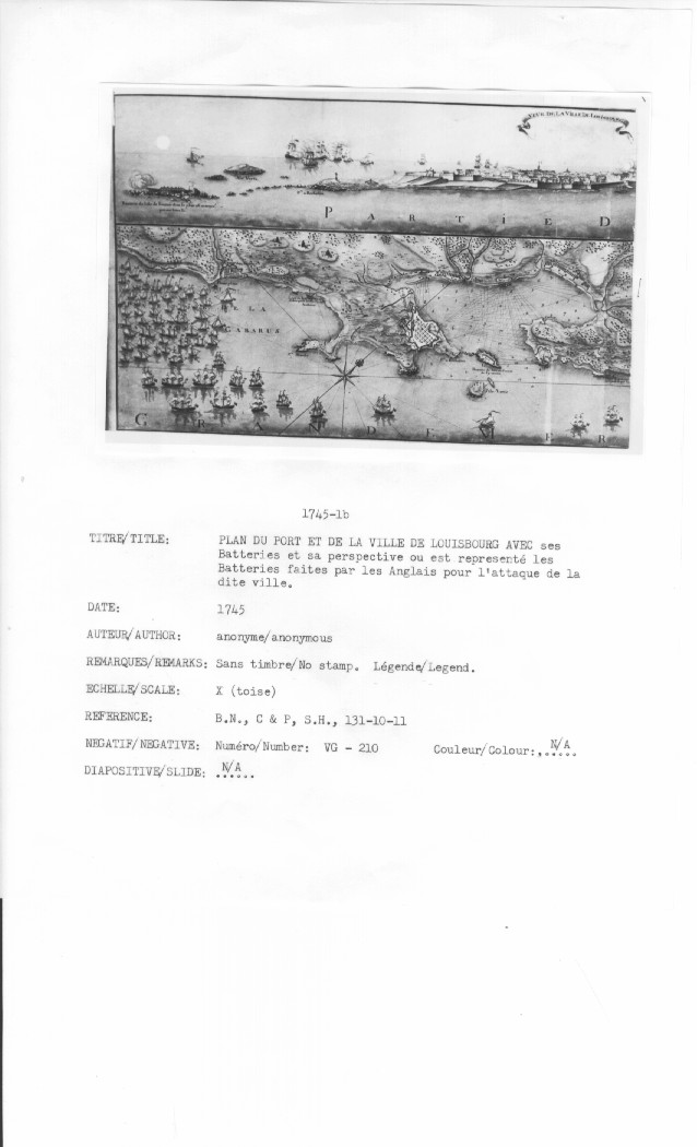
PLAN du port et de la Ville de LOUISBOURG avec ses batteries et sa perspective Ou est representé les Batteries faites par les anglais pour l'attaque de la dite Ville
VEÜE DE LA VILLE DE LOUISBOURG
VEÜE DE LA BATTERIE ROYALLE
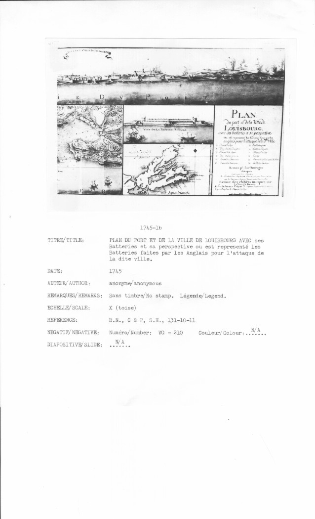
PLAN du port et de la Ville de LOUISBOURG avec ses batteries et sa perspective Ou est representé les Batteries faites par les anglais pour l'attaque de la dite Ville
VEÜE DE LA VILLE DE LOUISBOURG
VEÜE DE LA BATTERIE ROYALLE
PLAN DE LA VILLE PORT ET BATTERIES DE LOUISBOURG AVEC LES ATAQUES DES ANGLOIS en 1745
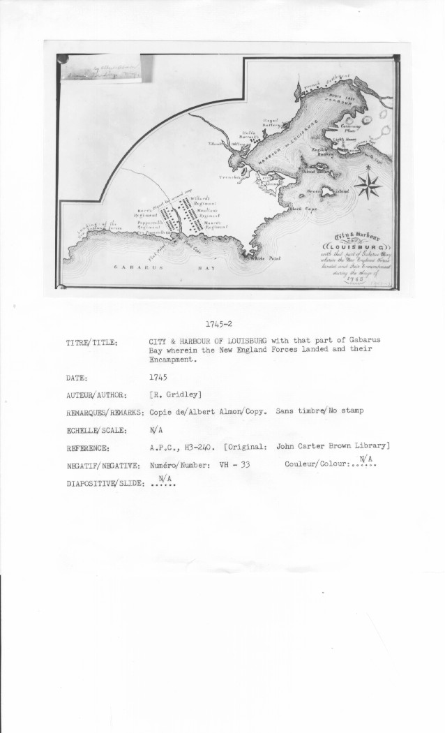
City& Harbour of LOUISBURG with that part of Gabarus Bay wherein in the New England Forces landed and their Encampment during the Siege of 1745
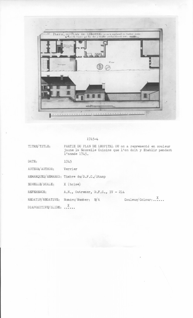
PARTIE DU PLAN DE LHOPITAL ou on ŕ represénté en Couleur jaune la Nouvelle Cuisine que l'on doit y Etablir pendant l'année 1745
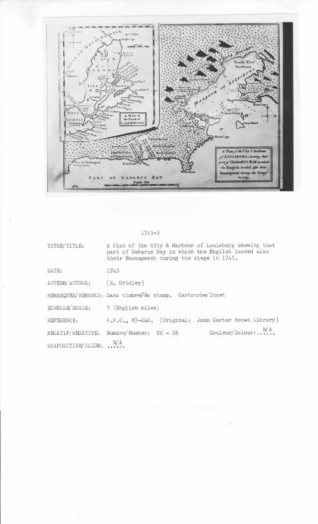
A Plan of the City & Harbour of LOUISBURG; shewing that part of GABARUS BAY in which the English landed,also their Encampment during the siege in 1745.
A MAP of the Island of CAPE BRETON
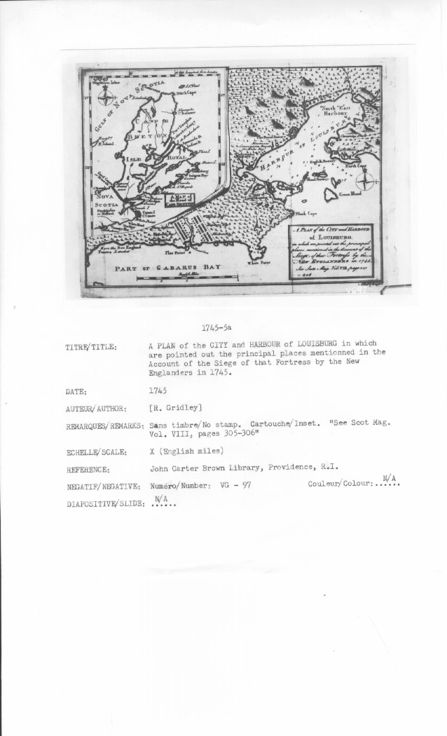
A PLAN of the CITY and HARBOUR of LOUISBURG in which are pointed out the principal places mentionned in the Account of the Siege of that Fortress by the NEW ENGLANDERS in 1745. See Scot Mag. Vol. VIII, pages 305-306
A MAP of the Island of CAPE BRETON
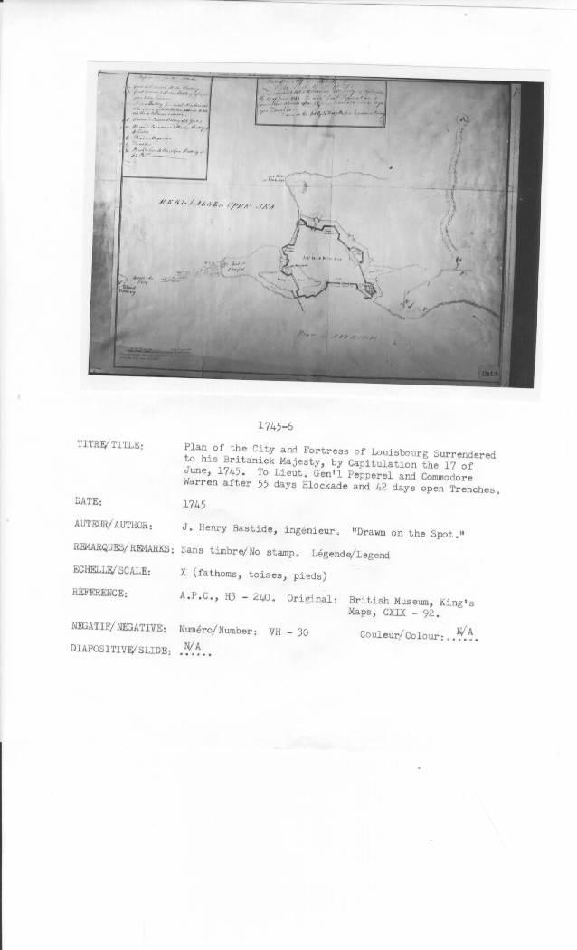
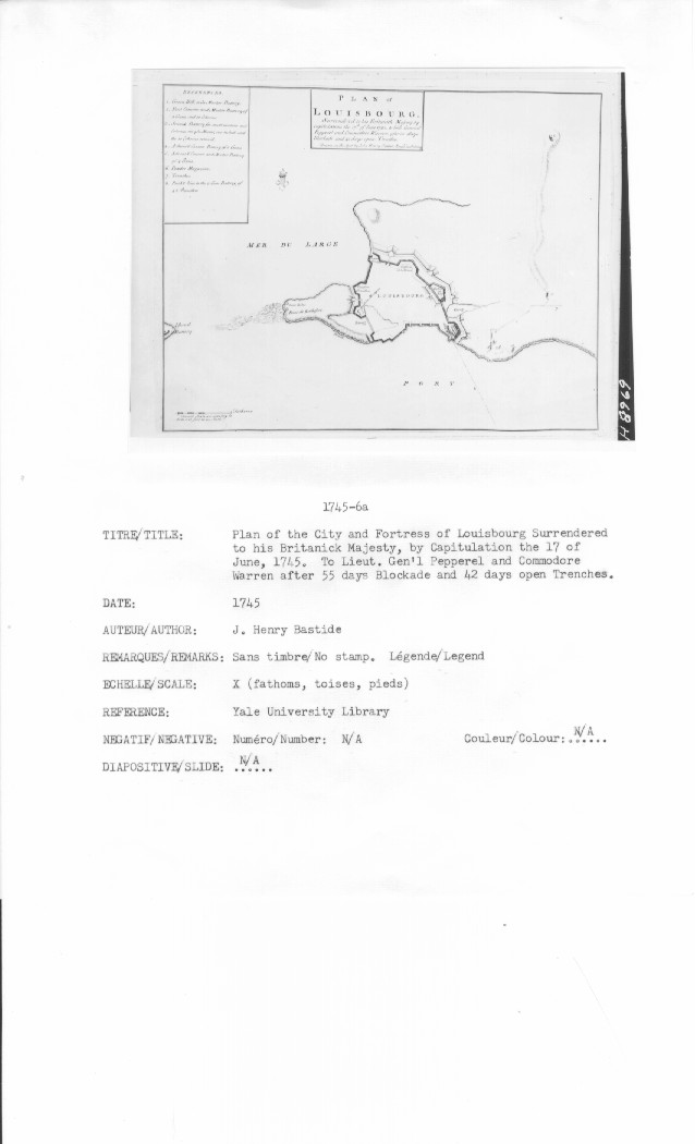
Plan of the City and Fortress of LOUISBOURG Surrendered to his Britanick Majesty, by Capitulation the 17 of June, 1745. To Lieut. Gen'l Pepperel and Commodore Warren after 55 days Blockade and 42 days open Trenches
PLAN of LOUISBOURG Surrendered to his Britanick Majesty by Capitulation the 17th. of Iune 1745. To Lieut. General Pepperel and Commodore Warren, after 55 days Blockade and 42 days open Trenches
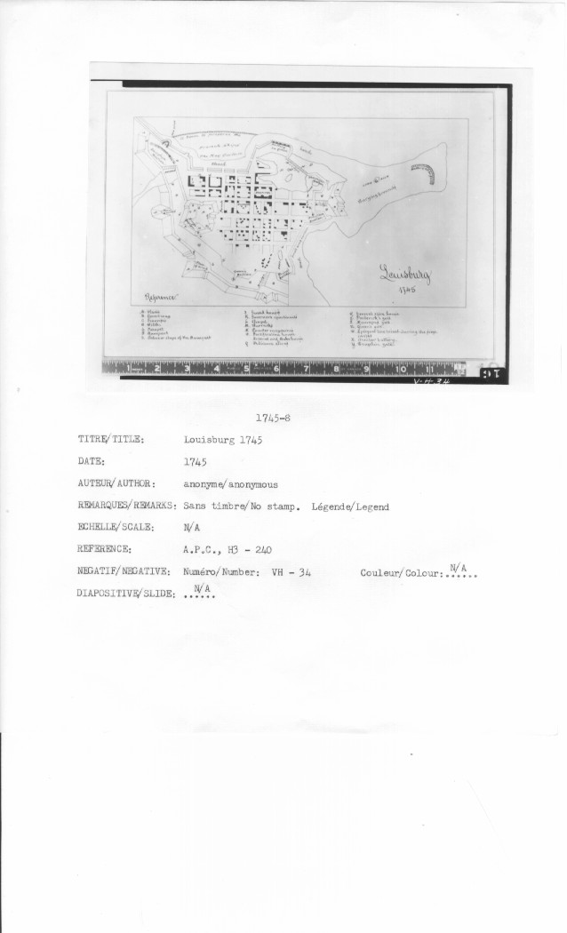
Louisburg 1745
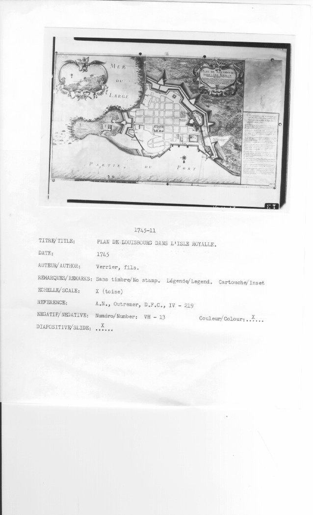
PLAN DE LOUISBOURG DANS LISLE ROYALLE
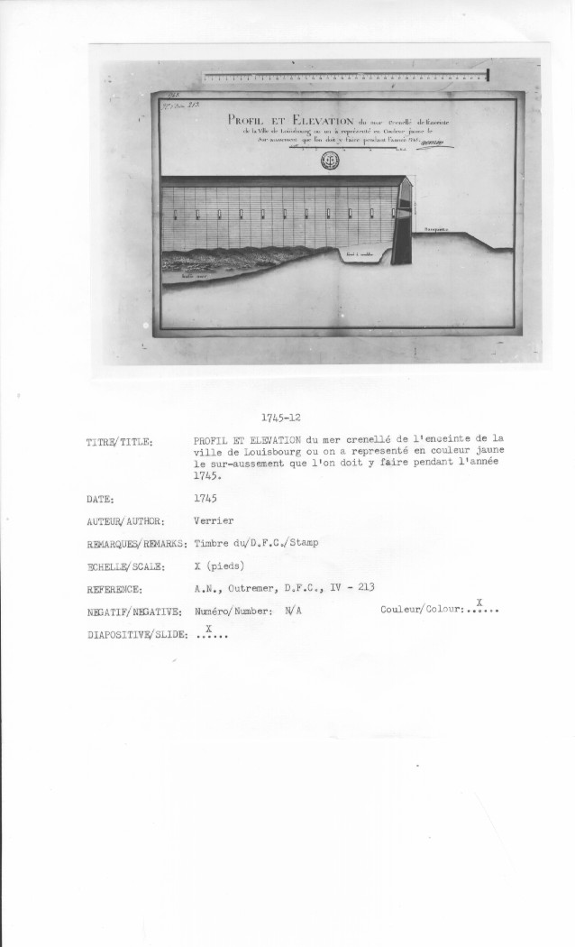
PROFIL ET ELEVATION du mer crenellé de l'Enceinte de la Ville de Loüisbourg ou on ŕ représenté en Couleur jaune le Sur-aussement que l'on doit y faire pendant l'année 1745
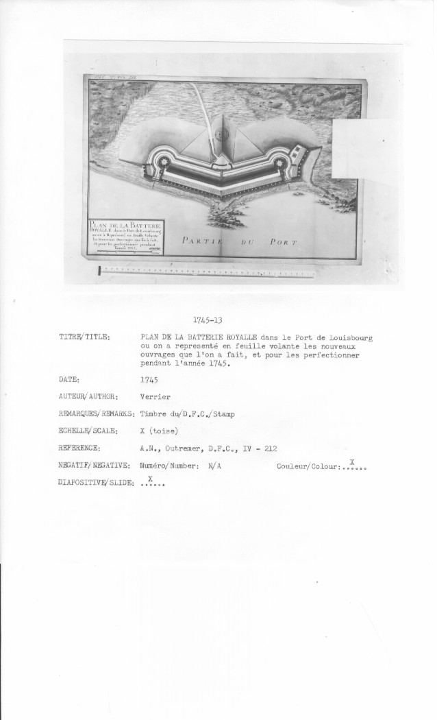
PLAN DE LA BATTERIE ROYALLE dans le Port de Loüisbourg ou on ŕ représenté en feüille volante les Nouveaux Ouvrages que l'on ŕ fait, et pour les perfectionner pendant l'année 1745
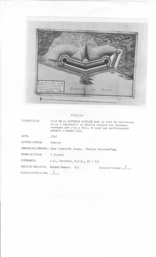
PLAN DE LA BATTERIE ROYALLE dans le Port de Loüisbourg ou on ŕ représenté en feüille volante les Nouveaux Ouvrages que l'on ŕ fait, et pour les perfectionner pendant l'année 1745
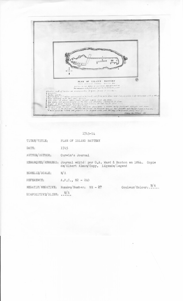
PLAN OF ISLAND BATTERY FROM CURWIN'S JOURNAL BOSTON 1864 SKETCHED FOR WARD IN LOUISBOURG JULY 25TH 1745 AD The embrasures in the front were not more than three feet from the ground
Curwin's Journal
Journal edité par G.A. Ward ŕ Boston en 1864.
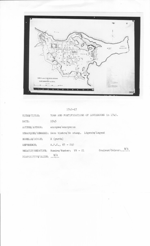
TOWN AND FORTIFICATIONS OF LOUISBOURG in 1745
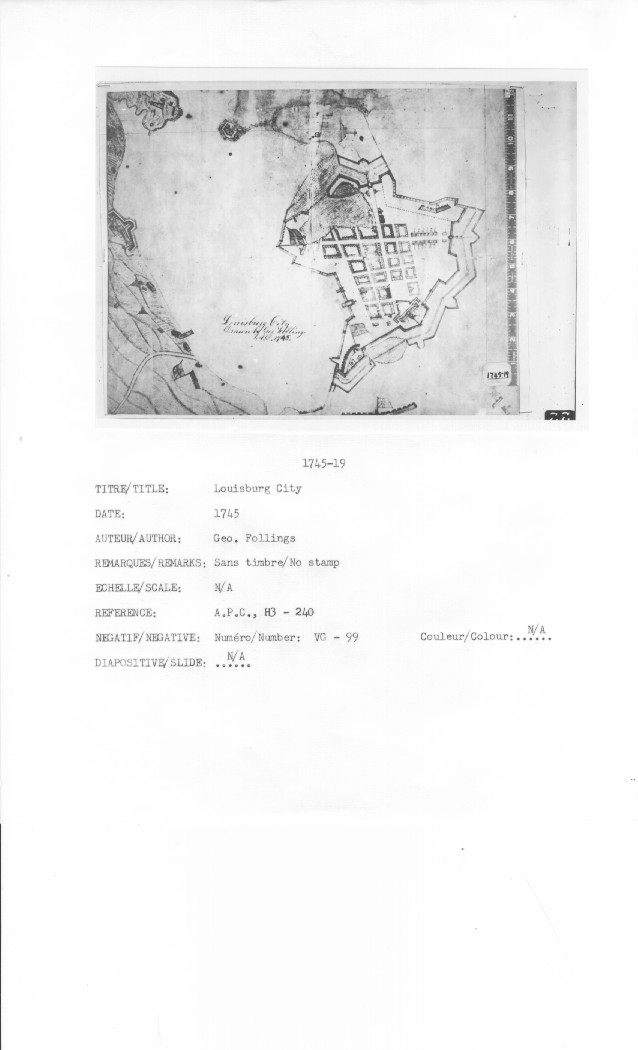
Louisburg City Drawn by Geo. Follings A.D. 1745.
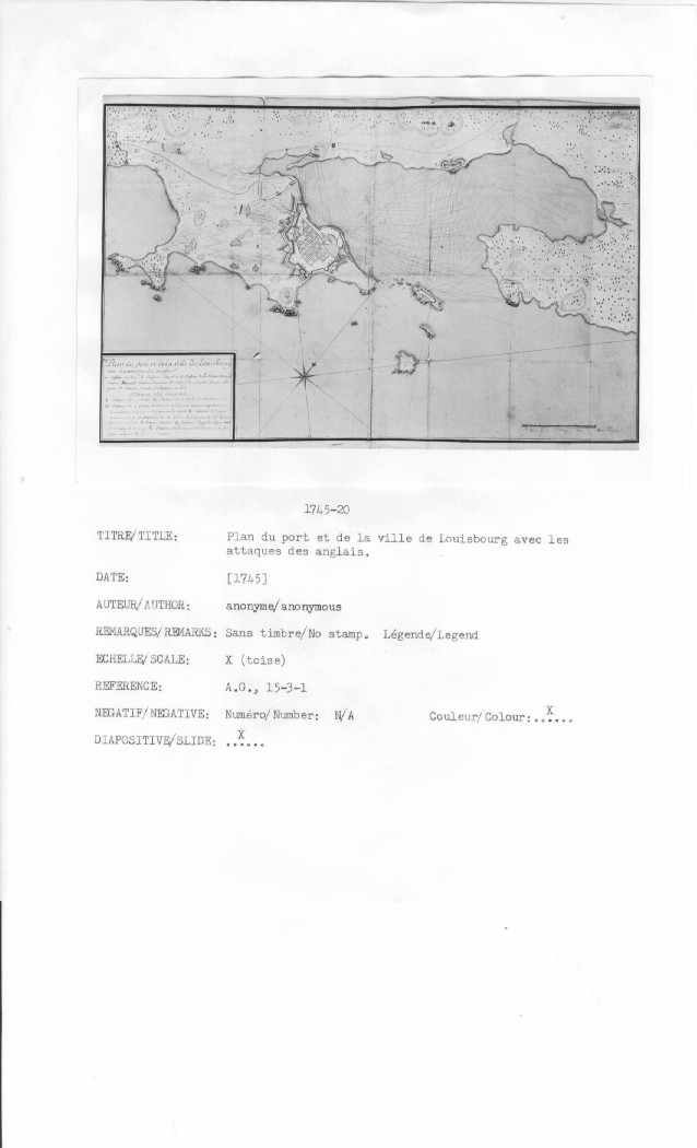
Plan du port et de la Ville de Louisbourg avec les attaques de anglais
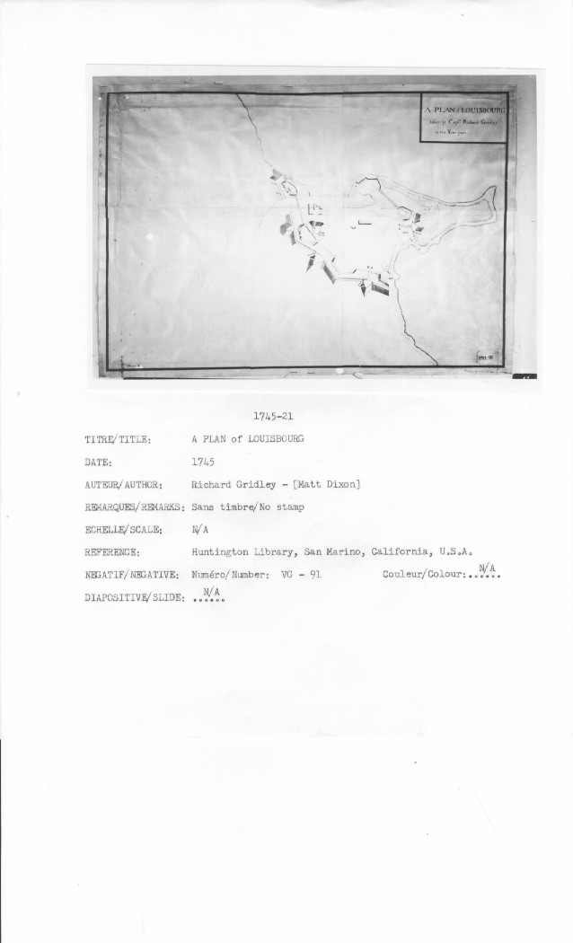
A PLAN of LOUISBOURG taken by Captn: Richard Gridley in the Year 1745
N/A
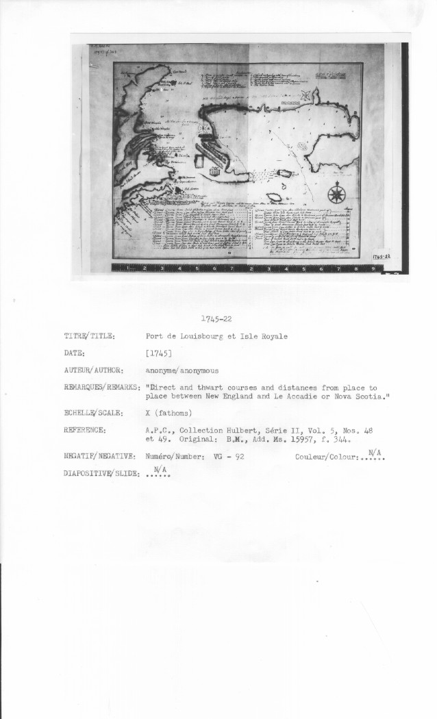
[Port de Louisbourg et Isle Royale] ... Anonymous
"Direct and thwart courses and distances from place to place between New England and Le Accadie or Nova Scotia."
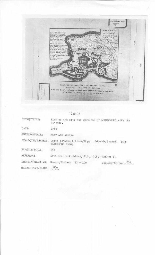
PLAN of the CITY and FORTRESS of LOUISBOURG with the Attacks
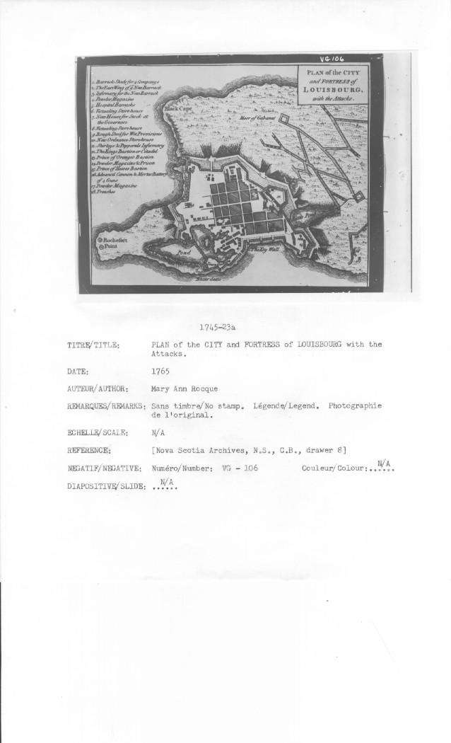
PLAN of the CITY and FORTRESS of LOUISBOURG with the Attacks
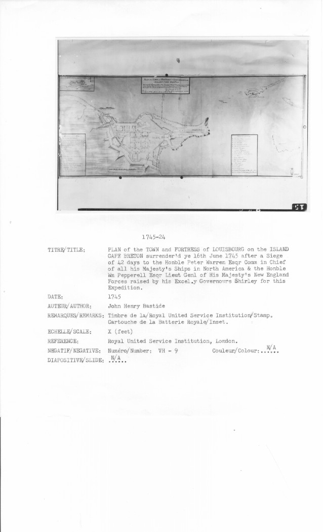
PLAN of the TOWN and FORTRESS of LOUISBOURG on the ISLAND CAPE BRETON Surrender'd ye 16th June 1745 after a Siege of 42 days to the Honble Peter Warren Esqr Comm in Chief of all his Majesty's Ships in North America & the Honble Wm Pepperell Esqu Lieut Genl of His Majesty's New England Forces Rais'd by his Excel.y Governours Shirley for this Expedition. Taken & Drawn after the Siege by John Henry Bastide , Chief Engineer for Nova Scotia
The Grand Battery Cross the Harbour ...
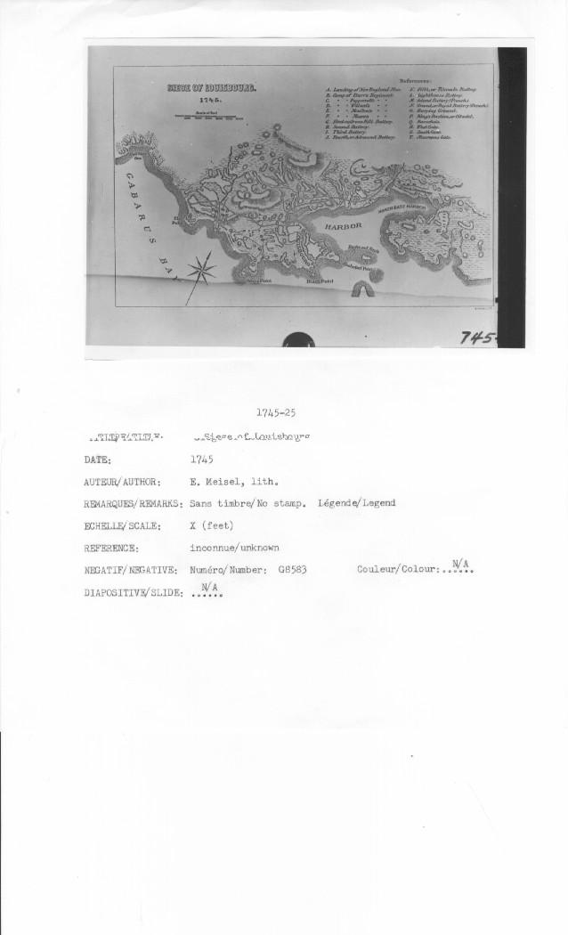
SIEGE OF LOUISBOURG. 1745.
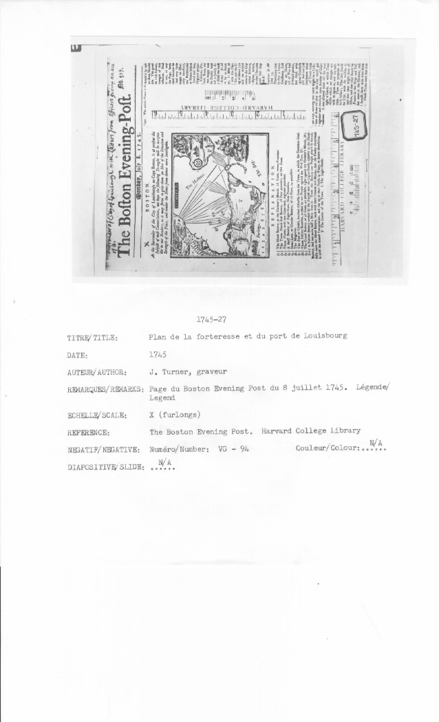
As the Surrender of the City of Louisburgh on Cape Breton, is at present the Subject of most Conversations, we hope the following Draught will be acceptable to our Readers, as it may serve to give them an Idea of the Situation and Strength of the Place, and render the News from thence more Intelligible.
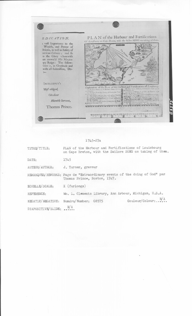
PLAN of the Harbour and Fortifications Of Louisbourg on Cape-Breton, with the Sailors SONG on taking of them.
A Plan of Cape Breton, &c Fort Louisbourgh. &c
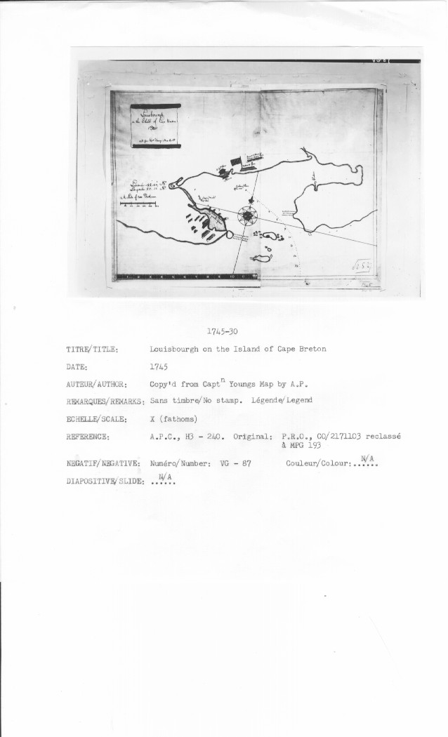
Louisbourgh on the Island of Cape Breton &
Copy'd from Capt n Youngs Map by AP
An Explanation of the Garrison or Fort built on Canso Hill by order of the Honble Sr. William Pepperell Bart: Lieut. Genl && AD .1745
N/A
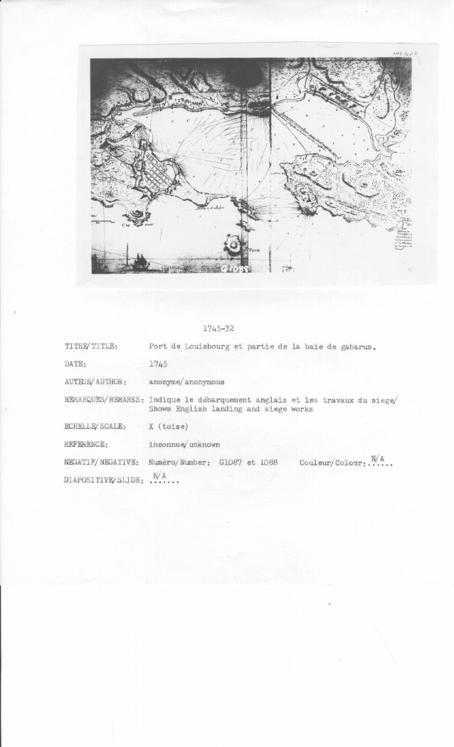
[Port de Louisbourg et partie de la baie de gabarus]
N/A
[Port de Louisbourg et partie de la baie de gabarus]
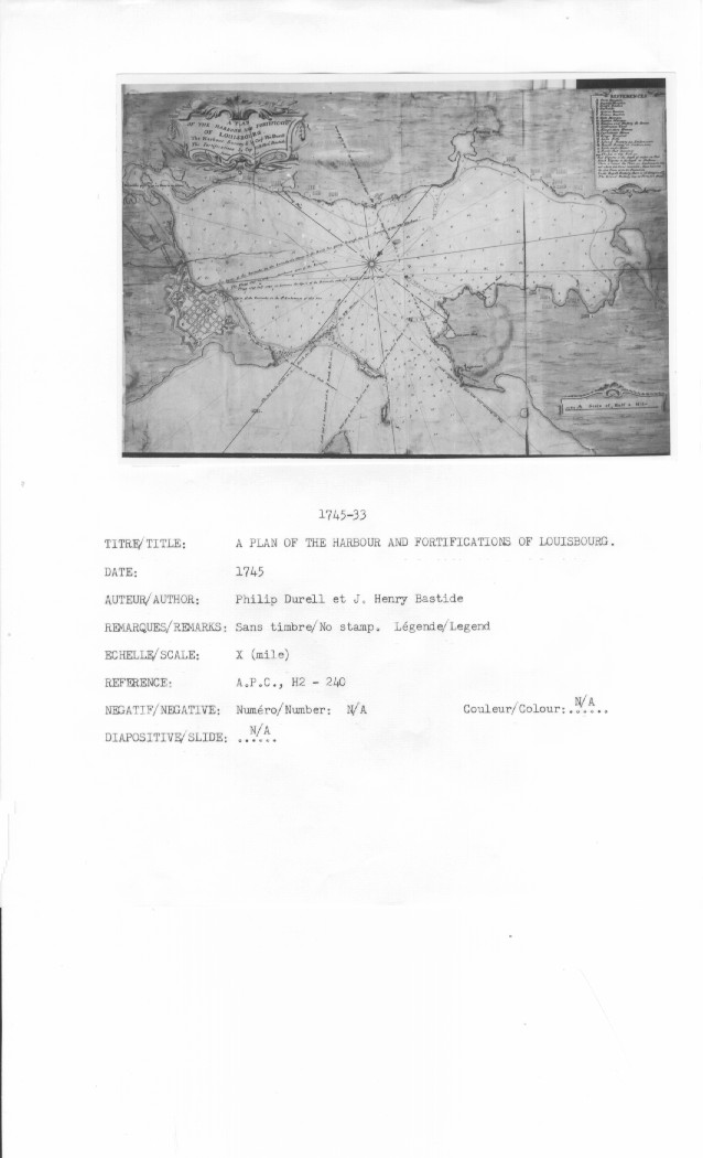
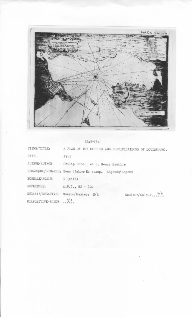
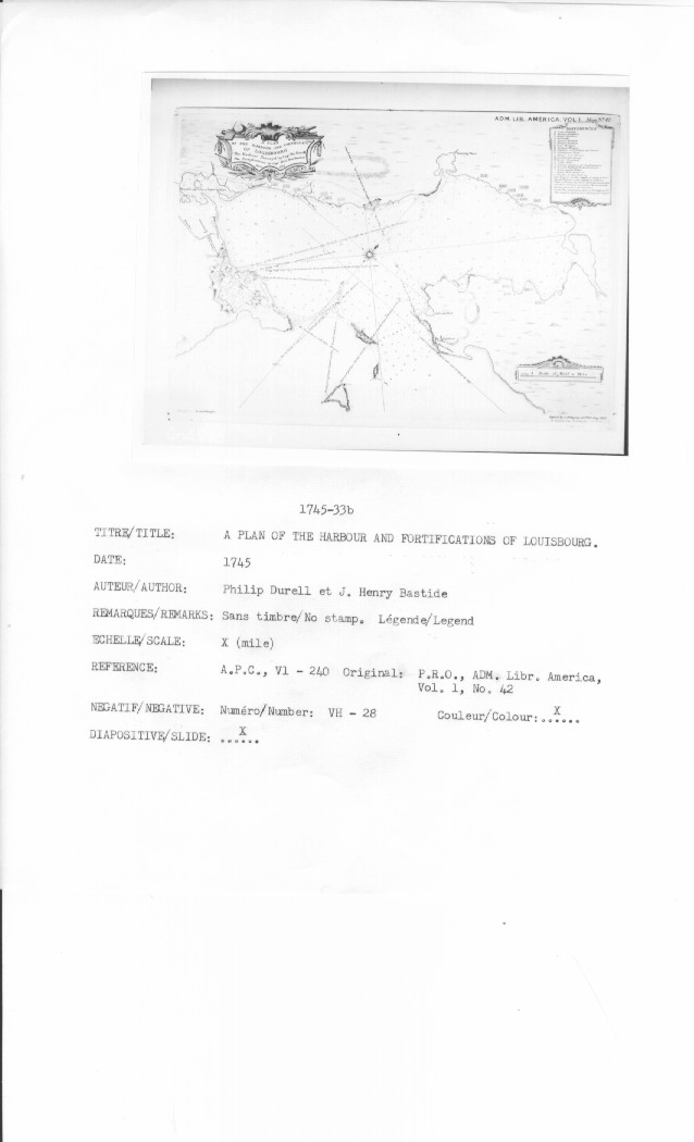
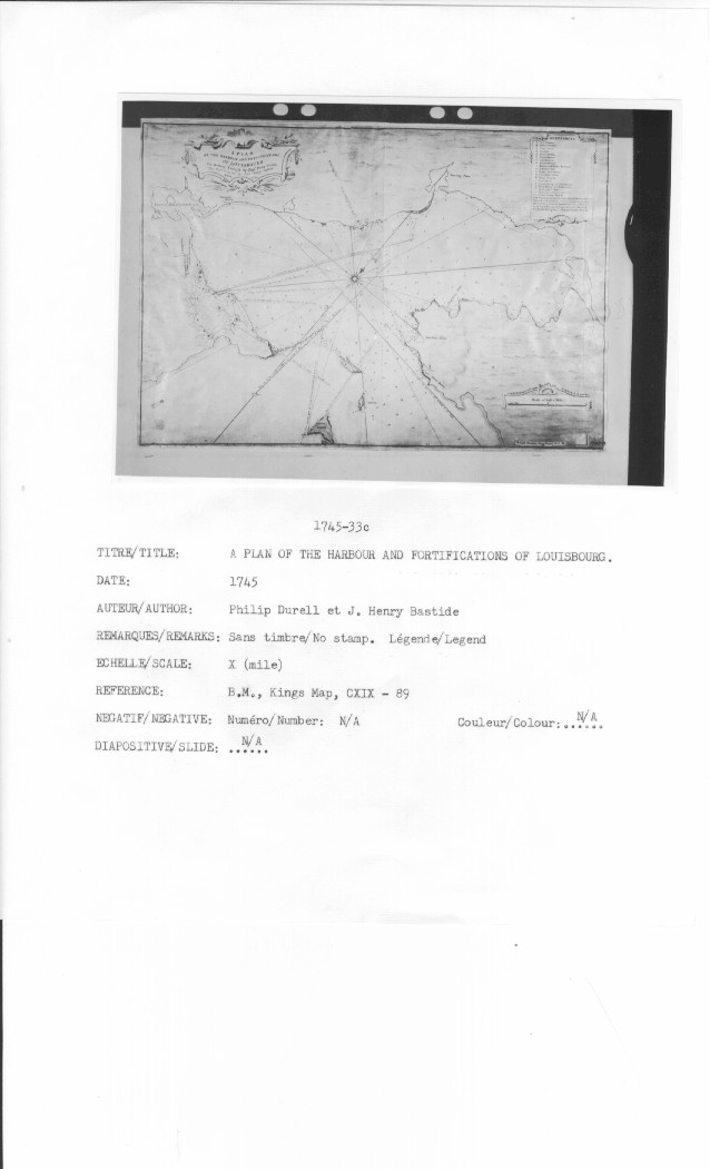
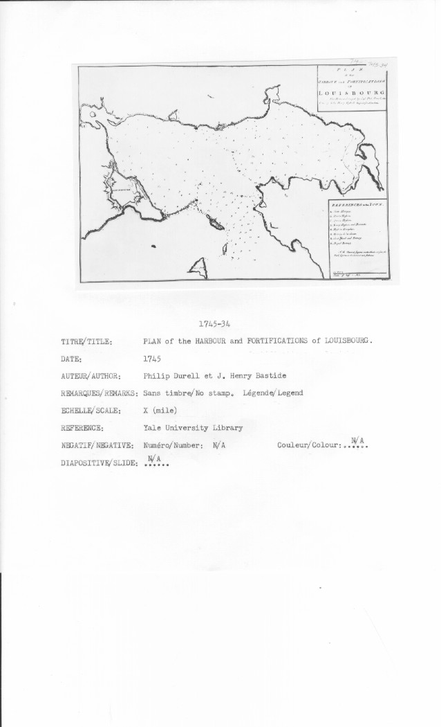
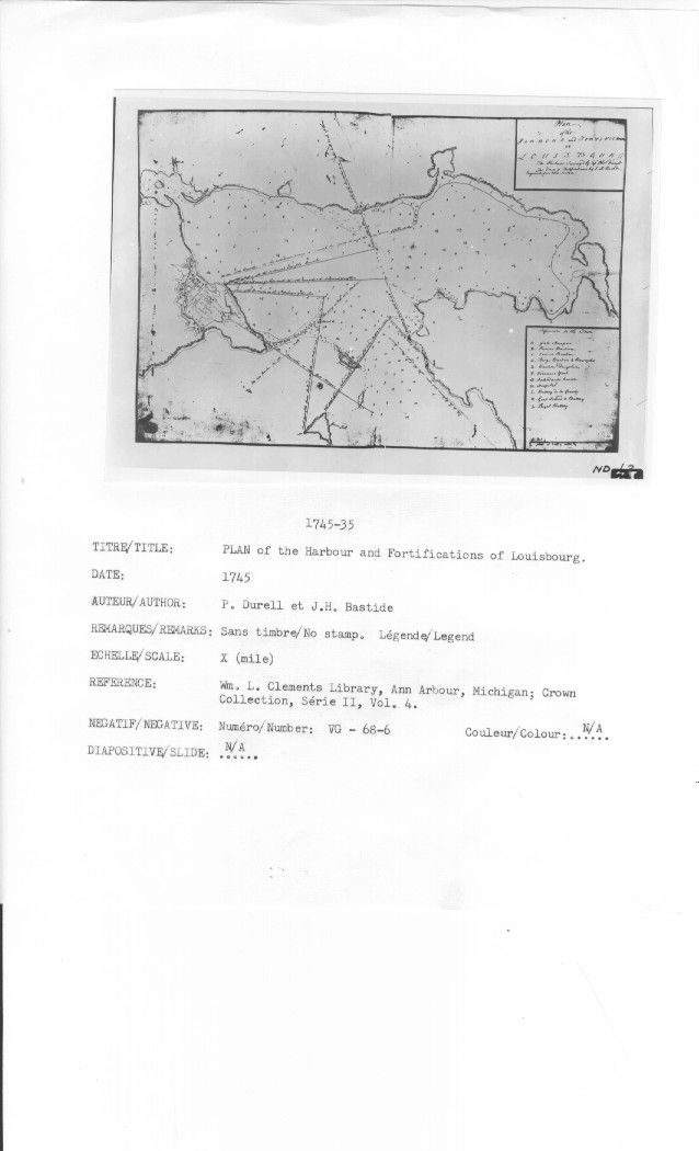
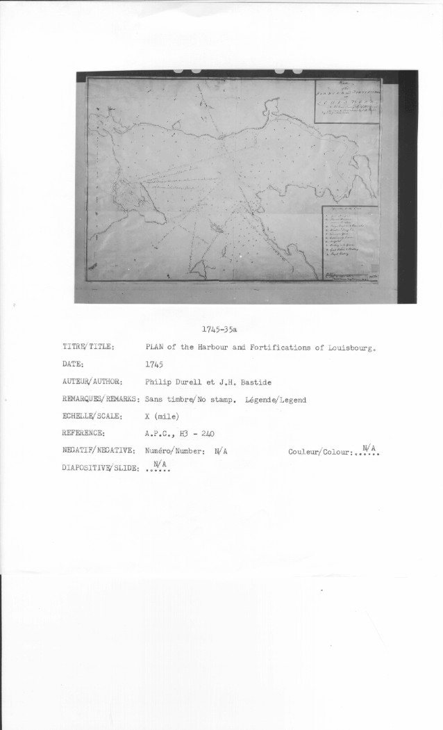
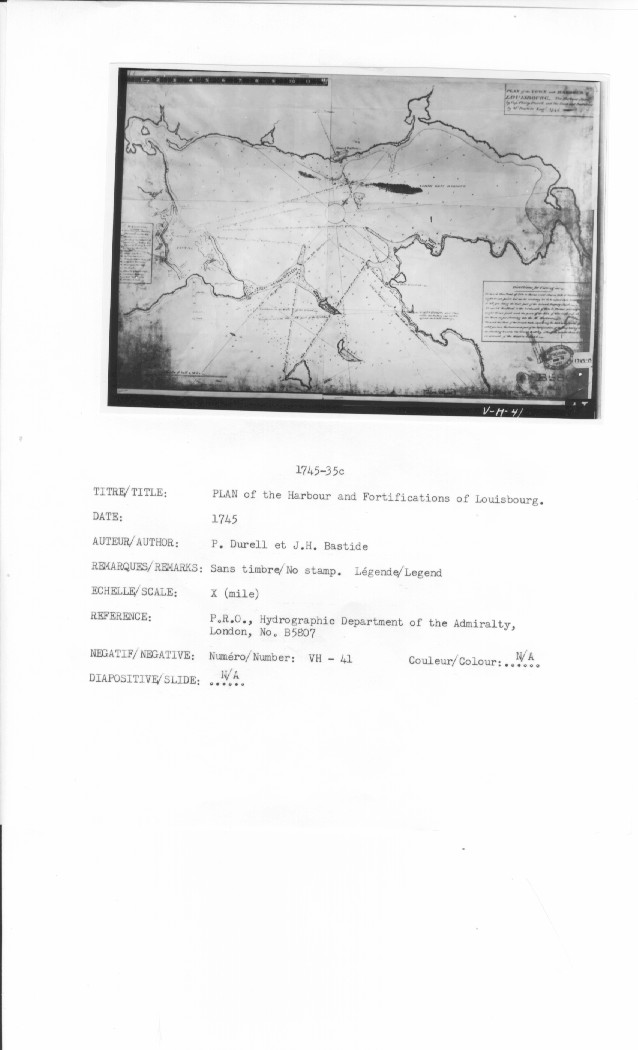
A PLAN OF THE HARBOUR AND FORTIFICATIOions OF LOUISBOURG. The Harbour Survey d by Capt. Phi: Durell The Fortifications by Capt. Will: Heny. Bastide Anno 1745
A PLAN OF THE HARBOUR AND FORTIFICATI:ONS OF LOUISBOURG. The Harbour Survey'd by Capt. Phi. Durell. The Fortifications by Capt. Will: Heny. Bastide Anno 1745
A PLAN OF THE HARBOUR AND FORTIFICATIOions OF LOUISBOURG. The Harbour Survey d by Capt. Phi: Durell The Fortifications by Capt. Will: Heny. Bastide Anno 1745
A PLAN OF THE HARBOUR AND FORTIFICATIONS OF LOUISBOURG. The Harbour Survey'd by Capt. Philip Durell The Fortifications by Capt. Henry Bastide Anno 1745
PLAN OF THE HARBOUR AND FORTIFICATIONS OF LOUISBOURG The Harbour Survey'd by Capt. Phi: Durell & The Fortifications by Capt. Willm Henry Bastide
PLAN of the HARBOUR and FORTIFICATIONS OF LOUISBOURG The Harbour Survey'd by Capt. Phi. Durell, The [fORT?] by [John?] Henry Bastide Engineer for Nova Scotia.
Plan of the HARBOUR and FORTIFICATIONS of LOUISBOURG The Harbour Survey'd by Capt Phil: Durell The Town & Fortifications by I. H. Bastide Engineer for Nova Scotia
Plan of the HARBOUR and FORTIFICATIONS of LOUISBOURG The Harbour Survey'd by Capt Phil: Durell The Town & Fortifications by I. H. Bastide Engineer for Nova Scotia
PLAN of the Harbour and Fortifications of Louisbourg
PLAN of the TOWN and HARBOUR of LOUISBOURG The Harbour [Survey'd?] by Capt Philip Durell and the Town & Fortifications by [H.?] Bastide Engr 1745
PLAN and SURVEY of the TOWN and HARBOUR of LOUISBOURG
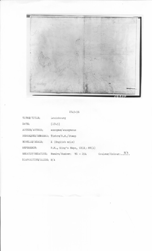
Louisbourg
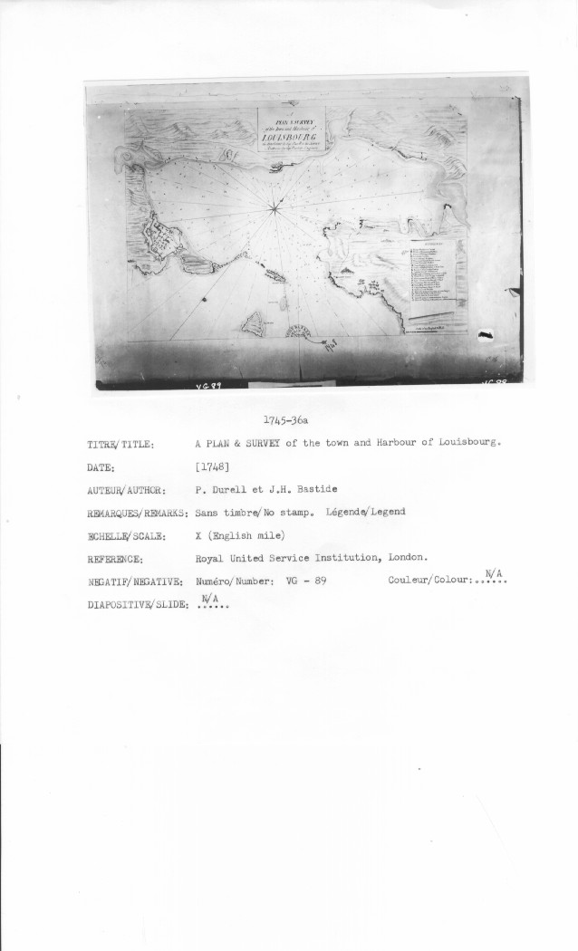
A PLAN & SURVEY of the Town and Harbour of Louisbourg the harbour by Capt Durell & the Town & Batteries by Capt Bastide Engineer
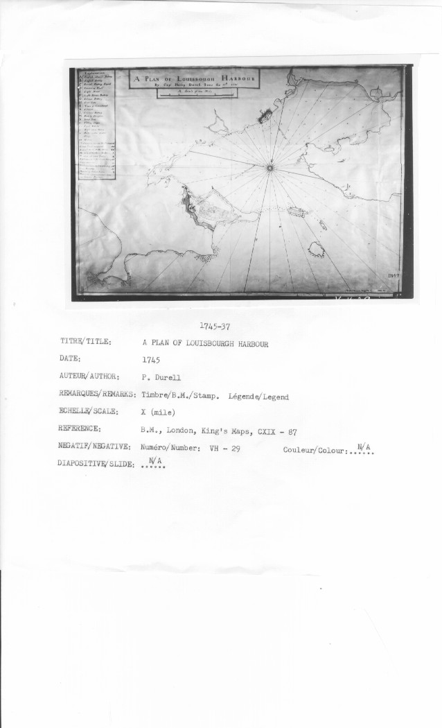
A PLAN OF LOUISBOUGH HARBOUR by Capt Philip Durell Iune the 17th : 1745
N/A
[Taking of Louisbourg]
CARTE DE LA RIVIRE DU CANADA LA TERRE NEUF CAPE BRITTON ET LA COTTE DE LACADIE fait
A Prospect of the City of Lewisbourg also the Harbours and Garrisons on the Island of Gaspey or Cape-Breton in North America. ~ Surrendered to the New England Land Troops on the 17 June after a Siege of 48 days ~ [?] General Pepperril Esqr Commander of the land troops ~ And Commodore Petr. Warren Esqr Commander of His Majesties Fleet there to Guard ye Coast
![]()
All Maps and Plans © Institution Holding the Original
For additional text details (no images): HISTORICAL MAPS AND PLANS COLLECTION / CARTES ET PLANS HISTORIQUES (Description and Analysis of the Louisbourg and Isle Royale Map and Plan Collection / Descriptions de la Collection des plans et cartes de Louisbourg et d'Ile Royale - fortmaps.tba)