REPORTS
"NORTH OF '66 AND MORE" 2011 TOUR (Saturday, February 5-Friday, May 27)
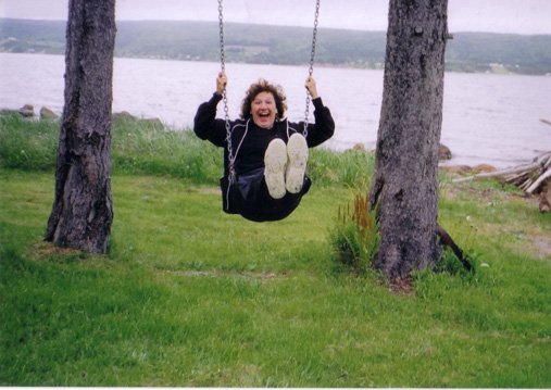
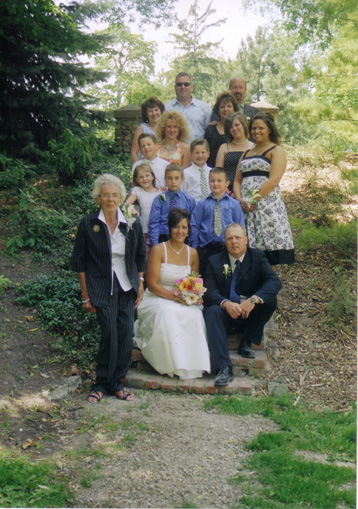
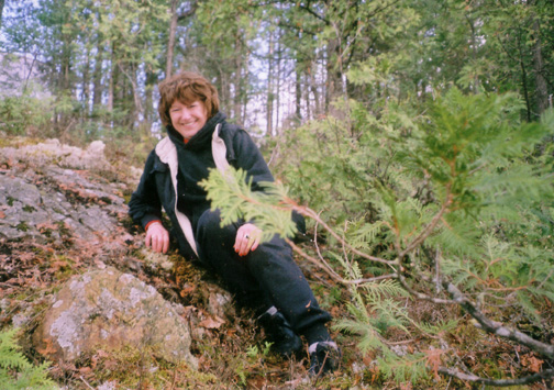
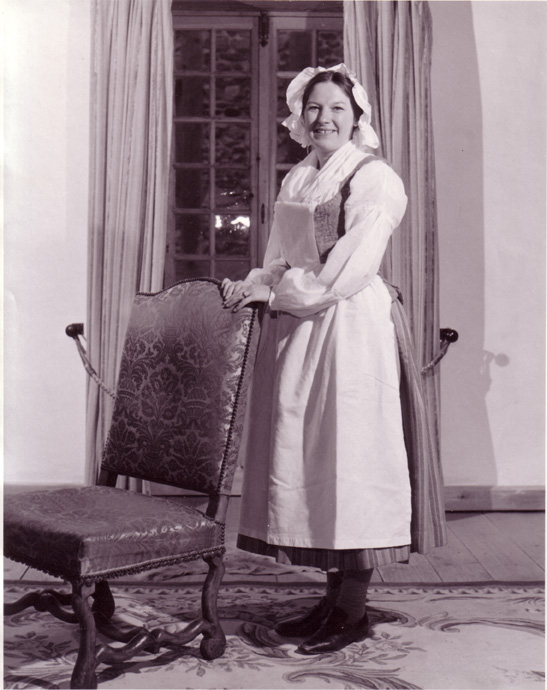
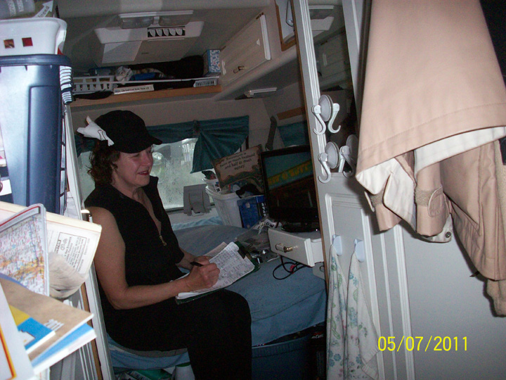
Click On These Images of Lynda To Enlarge Them

As mentioned in last year's letter, Eric & I went "North of '66" & More on a 4-month tour of the USA hoping to explore states not visited on our 2007 "Route 66" tour. I ended saying "It will be a "gre-e-eat" trip w/ many adventures." However, the trip proved to be the busiest adventure we have had so far in the "Big Guy". We ended up having almost as many misadventures as adventures (or so it seemed at the time) & lived to tell about them. We left Cape Breton early on Feb. 5, & arrived back in Cape Breton on Fri., May 27, at 4:52 P.M. after 111 nights/112 days on the road & travelling c. 25,000 km (15,500 mi). The states we passed thru on this trip in order: Maine, New Hampshire, Massachusetts, Connecticut, New York, New Jersey, Delaware, Maryland, Virginia, North Carolina, South Carolina, Georgia, Florida, Alabama, Mississippi, Louisiana, Texas, New Mexico, Arizona, Nevada, California, Oregon, Washington, Idaho, Montana, South Dakota, Nebraska, Iowa, North Dakota, Minnesota, Wisconsin, Illinois, Indiana, & Michigan. We have now visited 45 states, only missing Arkansas, Colorado, Utah, Alaska, & Hawaii!
We left Cape Breton early on February 5, 2011 and headed south quickly to avoid possible snowstorms, but alas no such luck as we awoke to snow the next morning and had to wait to be plowed out of our motel in Woodstock, N.B., thus having to drive later that evening hoping to get past the snow. As it got dark, the "Check Engine Light" came on so Eric readjusted the "GPS" to another plug and we continued on. However just as we got off the Massachusetts Turnpike heading to Danbury, Connecticut, we lost all power and coasted to the toll booths just before I-84S and got to the side of the road. Using a flashlight, we called C.A.A. for a tow on the back of a flatbed to nearby Sturbridge, Massachusetts where we spent the next two nights waiting for a new alternator to be installed. (Perhaps then, we should have hightailed it home and saved a whole lot of money and later mishaps), but we continued forward. Oh well!! (It turned out the Chrysler Dealer in Sturbridge was out of business but AAA found us one nearby.)
As we got further south, we were now able to stay in campgrounds. First though, we had to get a part for our broken sewer valve which occurred during the towing episode. We lucked out in Jacksonville, Florida, and then after getting fixed up decided to start heading west on Highway 10 as we've visited Florida several times. We passed several areas seen on our "Route 66" tour in northern Florida, Mississippi, and Alabama and then headed north to stay in Shreveport, Louisiana for four nights to revamp. Finally, we are in "new" territory so let the adventures begin. HA, HA.
Next we continued into Northern "Don't Mess with Texas" - Dallas, Arlington, Fort Worth and Abilene. We toured downtown Dallas - "Wonder which office tower J.R. Ewing worked in?"; took pictures of the "Mustangs of Los Colinas" - a bronze sculpture depicting nine horses galloping though a granite stream (largest equestrian sculpture in the world - 1984). We then headed to nearby Fort Worth and the "Stockyards National Historic District" with original brick streets; Billy Bob's Bar B Q Pit restaurant; saloons and dance halls, "Cowgirl and Cowboy clothing and handmade boots and "Texas Fried Pickles." Heading to Abilene to stay overnight, we passed many abandoned buildings and oil "mules" not pumping reminiscent of bygone oil booms and lots of pecan trees. Moving into New Mexico, "The land of Enchantment," we passed many huge ranches and the "World's Largest Wind-farm" cause, as you know, "everything is bigger in Texas"; lots of cotton fields, new oil drilling and refineries; lots of peanut farms.
We stayed in Carlsbad, New Mexico, and toured nearby Roswell as all "Aliens Welcome" - very touristy, so we decided to head to "Carlsbad Caverns" located in a mountainous limestone area covered with lots of cactus and tall yuccas in the Chihuahuan Desert with few pull-off areas. After a great tour with amazing rock formations such as "Hall of Giants, Top of the Cross, Caveman Junction, Painted Grotto", etc., it appeared that the "Big Guy" was in trouble and the gears seemed stuck, but Eric managed to get it shifted finally and we slowly worked our way back and forth through the mountains to our campsite. Next day saw a big change in our plans as we headed south to find a Five-Star Chrysler in Tucson, Arizona, in case we needed transmission parts or whatever as nothing but desert and mountainous flatlands up next - very deserted! Stayed in an "overflow" campsite as everything booked and to bed early as up next morning at 5:30 A.M. to get to the Service Department - scanned the transmission codes but couldn't find the problem so did an oil change and off we went at 10 A.M. We decided to head to the "Mesa/Apache Junction KOA" outside of Phoenix (stayed there in March 2007) and stayed awhile in the warmth (one week @ 15% off) plus predicted to be in the mid-70s during week of February 27. Eric put up my suet feeder as lots of birds , especially a huge "covey" of 24 desert quail (really cute). However, as has been a continued problem this whole trip - no payphone!! We relaxed most days - I sorted my many brochures and did my notes and toured area one day and called home after finding a payphone; put on my Cape Breton tartan pants and Cape Breton sweater to meet a couple from Cape Breton and postcards, and of courses- bird watched (especially Emma).
We are now "California bound" passing miles and miles of settlement in the "Valley" area full of fields and yellow wildflowers with huge aqueducts and canals coming through the desert from surrounding mountains. After crossing the Colorado River in California, we decided to head north to "Needles Koa", California (stayed there in March 2007). As we started climbing, the desert vegetation kept changing from prickly pear cactus to ocotillo, to red barrel cactus (in the Mojave Desert now) and Teddy Bear Cholla. Surprise of all surprises - we're heading to Las Vegas Nevada, "The Silver State", (with our 50 cents) only because it is now on our new route and there is a KOA at "Circus Circus" right on the strip (no grass and just cement). We walked the various parts of the strip for the next three days and I can guarantee we didn't miss many of the sights - only the casinos and costly shows. Oh Well!! At least, we still have our 50 cents. However in "Circus Circus, Riviera; Encore and the Wynn Resorts; Trump International Hotels; the Egyptian themed Luxor; Tropicana; MGM Grand; New York, New York; Eiffel Tower and Paris Les Vegas; Planet Hollywood; Bellagio's with synchronized musical fountain shows; Margaretville in the Flamingo Hotel; Caesar's palace and its Forum shops and restaurants; the Mirage with its erupting volcano; Treasure island; the Venetian with gondola rides; etc., etc. We took the "Deuce" bus one day down to Mandalay Bay but it was closed for a private party so we worked our way back seeing other sights instead of waiting for other buses. Later we caught it near our end to see the "original" Strip - Fremont Avenue" and the Sahara (now closed in 2011).
We backtracked to see the Hoover Dam on Day Four - very spectacular but traffic jams; Seven dollars for parking so we went to Parking Area Eleven and walked back; tours were thirty dollars each and even an admission fee at the Visitor Centre with exhibits. Thus we took steep steps down to various observation areas, got some postcards and hit the road. After bypassing "the Strip - Las Vegas Boulevard", we headed north to Amargosa Valley (Nevada) to camp before going through "Death Valley Park and California.
Up early on March 8, to get an early start so we can make it through Death Valley and stay in "Lone Pine" on the other side. Turned out we had to turn back one-half hour later for gas as the gas station before the park was closed and there's no station in the park and no more gambling/slots. As we finally enter the park, we see "a sandplow" - looked like our "snowplow". We've been climbing through volcanic rock all along and are at 3000 feet before heading down to the lowest point of Death Valley at 282 feet below sea level. We pass through an area of salt pans; the "Badlands" with interesting rock formations and colours; and just as we start on "Artists Drive", on very curvy one-way narrow road with rock walls on each side, the "Big Guy" clicks out of gear forcing Eric to try and pull over a bit to rock it back into gear before cars come up behind us. Finally it did and since we couldn't go back, we continued onward and upward. After that, we could not really enjoy our unique surroundings and decided not to go further on to "Badwater" - the lowest level in the U.S.A., so took first road back to the Visitor Centre at Furnace Creek (only - 190 feet but will have to do). "Big Guy" seems fine now - guess it doesn't like "hills"! However, we know that we still have to climb back out of Death Valley!
At 4956 feet there was a brake check area before we started heading slowly to 2000 feet with many sharp curves and "soft shoulder" signs and look-offs" - Don't think so! Then we climbed slowly back up to 5000 feet and were on a plateau with Joshua trees and Mohave Year. We would see a snow-covered mountain range in the distance. Oh No!! At the cut for "Lone Pine" with nearby Mt. Whitney at 14, 494 feet (highest peak in California), we decided to head south to Bakersfield (a larger city) in case we have a major problem. We passed through a salt flat/dry Bake bed; Red Rock Canyon (Area looks like Ayres Rock in Australia); more mountains with larger "wind-mill farms" and long tunnels for trains, and on the other side of the range near Bakersfield into green grass hills and trees and blooming cherry orchards. What a sudden change!
Early next morning (March 9), we headed to Chrysler's but booked solid for days. He sent us to a small local transmission garage who did a scan and said it definitely wasn't a transmission problem because the oil was "good and red", but it could be electrical or in the computer system so we headed to Carquest to get a fuse for Eric to change and see if it might solve the immediate problem. We decided to head to Santa Clarita, California which had a Five-Star Chrysler dealer to solve the mystery. As we started climbing the problem started again and we couldn't gain power, so we stayed in the truck lane with flashers on but okay on the flat areas. We stayed in nearby Castaic Lake and headed to Santa Clarita. At 6 A.M. next morning to the Chrysler dealer. Emma must be getting used to these dealerships as she now looks around from her box instead of hiding for hours. After a test drive at 9 A.M. with Eric (the problem never occurred) the technician felt from Eric's description that it could be a pump somewhere but would do more tests. By 10 A.M. he says it is the transmission - $5,000.00 - and will have to order it in and since it's the weekend, come back Tuesday at 7 A.M. - Some holiday!! Found a better campground in Castaic Lake for 5 nights and set up near the "dog park" so lots to sit and watch as now 86° F - no payphone of course. We only ventured out to nearby Valencia for groceries and to call Mom in case the "Big Guy" acted up otherwise Eric did "the taxes", I did notes and postcards and went for walks around the park and we relaxed as "Death Valley" almost killed us!
Early Tuesday, March 15, we returned to Chrysler's and sat inside with Emma and paper-work waiting for the "Big Guy" and his new transmission. After loading up, we headed to Santa Paula passing orange groves (some still covered with gauze netting) to a KOA there. Hence we were now going to be near Santa Barbara (originally not even close), I called Anna (a friend that both Bob and I met on our New Zealand tour in 2000 and then stayed with following our Australian tour in 2005). We arranged to see her on St. Patrick's Day for "green' beer so she could finally meet Eric. Alas, as we headed to the KOA, the problem, for a fleeting moment, apparently happened again, so we immediately headed back to Chrysler's in Santa Clarita and got there just at 5 P.M. Of course, the technician was gone so back we went to our old campsite which was still open and stayed overnight. Next morning, at the dealer, I overhead the "techie" tell the service manager - "I don't know what to tell him" before he went on another test drive with Eric. As a last ditch attempt, he adjusted the throttle and pressure plus the kick down cable so that it gears down sooner. Thus as we've said before "Time will tell"!! and off we went. We headed back to the KOA that we didn't reach yesterday and got a lovely site under a locust tree complete with about one dozen "Peacocks" and relaxed.
Up at the "Top'o the morn'in" and headed to meet up with Anna in Santa Barbara to celebrate St. Patrick's Day. Drove along the Pacific Ocean past many "State Beaches" with lots of beautiful flowers everywhere. We took a site in a small RV park near and walked out on Stearns wharf before meeting Anna at the "Endless Summer Restaurant" on the harbour at 3 P.M. (Bob and I were there with Anna in 2005). We had a wonderful visit but I was the only one who had "green" beer. Anna and I left a message with Bob and she finally met Emma. We said our final goodbyes at 6 P.M. and headed to our site where Eric ate the huge "jalapeno" croissant and popcorn that Anna got for him!
Next day we continued heading north on the scenic routes following the ocean - huge ritzy homes, tall palms, lemon trees, lots of lushness everywhere and Canada Geese! We passed through "Buellton" - home of the "Original Split Pea Soup"; "Solvang" - a 1911 re-created Danish Village with lots of tourists and buses (featured in "Saturday Evening Post"), with artificial storks on chimneys for "good luck". We now are entering wine country with many fields of flowers and veggies and orchards. Somehow, we were suddenly on a narrow winding side road working our way up and down a mountain range, but no problem with the "Big Guy" so that's good to know! We worked back to the ocean road to stay overnight at "Oceans - Gateway to the Dunes" and got our first rain in weeks - not knowing then that it wouldn't stop for weeks!!
Still raining the next day as we worked our way along the coast to "Big Sur" following peaceful sideroads and old Highway 1 instead of US 101 North. We passed through lots of live oaks, the "Valley of the Bears", "Harmony" - an artist's colony (population 18); "Cambria" with its Moonstone Beach with lots of little shops on one main street - very quaint (called Mom in my raincoat at a payphone); Next we happened upon "W.H. Hearst State park" and drove up to the "Hearst Castle"; tour to the castle quite expensive but absolutely fabulous free exhibits with postcards and books with its history for us to see. He had unbelievable wealth and many different interests. It seemed that within minutes we left the Hearst Farms and were now climbing up the side of a mountain on a very curvy road with no shoulders. As it was getting too dark to head back, we kept moving slowly forward and climbing with signs saying "Road still open to Big Sur." The rains got even heavier with water driving in through the door on my side by the mountain (never happened before). We passed by many rock slides and could see the road ahead winding back and forth along the mountain side with the waves crashing way below. I of course, looked straight ahead or down at Emma only. We came across huge roadwork to rebuild parts of the washed out areas with narrow one-lane paths to cross over "the slump" (as Eric called it) and heavy, cable netting on my side to catch falling rocks and boulders. As we got closer to "Big Sur", there were expensive gated-private homes hanging on the side of the mountain!! - plus small cafes and art galleries scattered here and there; a library in a small cottage; sign for "Ocean View Dining"; a small Shell station up on a ledge of the mountain; and finally the "Big Sur Campground and cabins. We set up on a cement pad next to a small river but needed rubber boots to wade through the mud to check out the washrooms. And guess what - there was a payphone but it was cold and too rainy and I really wasn't in a good mood. We found out that worst storms were coming and there was a forty-foot washout north towards Monterey, our next destination, so we have to return on the same road. Whoopee!! As there were no TV or Wi-Fi signals, we tucked in early after reading a brochure and realizing that we were camped right by the "Big Sur River", plus Eric thought we should get an early start. Guess we'll see what daybreak brings!
There were heavy rains and winds all night long so we slept very fitfully. I awoke at 4 A.M. and was sure the "Big Sur" river was higher and we were in the midst of our own "Tsunami" and would be washed away. Eric tried to calm me down but it took awhile to calm down (Emma got lots of hugging and petting). Finally I dozed off and on till daylight came and I could finally see the river. We left in heavy rain and were told to drive "slowly" and watch for falling rocks by the camp staff who checked with the road patrol. Road-crew were already out clearing branches and rockslides. We had to cross the one-lane "slump" again but I had my eyes closed most of the time and then we passed through several large rockslides areas and then we passed through several large rockslide areas and mudslides plush gushing waterfalls. At one of the sharp curves, a fella came running towards us waving his arms trying to get a "school bus" around a slide by coming onto our side of the road. Imagine - a way up here!!
We finally reached the "Hearst Castle" area fifty miles back after over two hours - all safe and sound! Rain is really heavy now! We got back to Cambria and crossed over to Highway 101 so we're climbing again - no problem but very loud with the lower passing gear. We entered a huge wine area near "Paso Robles" with many wine tasting haciendas - one was called "Fat Cat Farm" - fields and fields of grapes as far as the eye can see right up to the base of the mountains (many were flooded). After four hours on the road we were directly across from "Big Sur" and moving northward to Monterey (on this side of the mountain range). Suddenly the rain stopped - just as it had started! After following the "City of Monterey - Path of History" markers we passed the old 1845 Fisherman's Wharf; Cannery Row in the historic district with John Steinbeck banners; the old Whaling Station,; Robert Louis Stevenson's 1879 home, etc.
We headed back to the "Santa Cruz RV Resort" in Scott's Valley passing a "Dole" fresh vegetable plant; artichoke fields; a Wildlife Refugee/Canada Geese flying over and went to bed early - hopefully for a better sleep tonight as we sure needed it! Next morning, we went to see the famous "boardwalk" in Santa Cruz - America's true Surf City. We saw the well-known "Cocoanut Grove" and lots of volleyball nets on the beach plus the vintage wooden roller coaster (85+ years old) and the 1911 Looff Carousel with 70 hand-carved horses and the original 342-pipe organ. Both are national historic landmarks. We then followed old Highway 1 along the ocean to San Francisco passing from rain to sun off and on. Soon we are overlooking the lovely city in the valley with its "many-coloured houses"; the Golden Gate Bridge in the distance; many streets with overhead streetcar wires; Alcatraz in the harbour. We passed through the Golden gate Park and entered the 1776 Presidio area; stopped for a picture of the bridge from the "Fort Point National Historic Site "; got pictures of the "Exploratorium" (Before Bob and I had visited there in 2000 on the way to New Zealand); went to "Fisherman's Wharf on Marine Drive and saw the trolley heading down; drove through San Fran's "Little Saigon Area", "Japantown" and "Chinatown", a really great tour and Eric did very well going up and down the steep city streets!
We circled San Fran Bay and camped overnight in Redwood City, California, near San Jose (which Eric really liked) before starting our journey through Silicon Valley (very built up area for miles). We stopped in Oakland for a picture of the bay and guess what ---- Eric saw a screw in the side of a tire - Why not!! Eventually we found a Goodyear dealer and after sitting inside for three hours we were "on the road again" with four new tires! Of course, we missed our exit as so much traffic and couldn't get over in time and ended up on the San Fran/Oakland Bay Bridge for six dollars heading back to Fan Fran. Halfway across we managed to get onto Treasure Island (great view of Alcatraz), made a U-Turn and got back to Oakland. Now rush hour, so we found an alternate street (no freeway) - slower but very steady and worked our way to a campsite in Vallejo, California. Starting to get much cooler as we head north but did see some spring daffodils (quite different from Southern California). We stopped near the Russian River at the "Cloverdale KOA" with a payphone so while doing the laundry, I called Mom, Shirley and a few others. For some reason, there was no door on the laundry room, so while chatting, one male duck and his two females walked right in to see me as raining again!
Next morning, Eric checked the highway situation and it seemed better to keep moving forward as there still was lots of snow inland on the Coast Range Mountains. As we left we lost the front speakers so I got to hear a very loud Rush Limbaugh on the rear speakers! Many fields were flooded so when we saw an overhead sign with "Highway 101 Open-Chains Required", we were shocked. We decided to turn back and stay in Ukiah to wait for the road to clear. Next morning, locals were leaving, so we decided to head north towards the "Redwood Highway" with caution as there was still snow on the sides from yesterday's storm. Now time for heavy tights!! Many tree trunks are covered with water and the rivers are roaring from so much rain as we cut through the mountain range. We are starting to see some huge Redwoods as well as the "Drive Thru Tree", "Confusion Hill", "World's Only TreeHouse" "One Log House", with gift shops and chainsaw carvings -didn't stop! We are also seeing signs - "Road Flooded Out", "Rock Slide", - not again!! Of course, now there is heavy rain. As we got on the highway to the "Avenue of the Giants", we saw a rock slide" sign, so headed back to the main highway. While heading up, Eric noticed the Check ABS brakes warning light and when he got out to check - No brake fluid. We worked our way back slowly to Garberville (6 miles) with flashers on. Eric got the last two bottles of brake fluid. When he put it in, we had an air lock. The only garage in town had a "weed-smoking" proprietor who found pin hole leaks in the line but couldn't hoist us up so we headed for Eureka, California (65 miles ahead) very slowly so we didn't have to use our brakes - what a drive that was (for me, anyway). We got to the Five-Star Chrysler dealer at 4:30 P.M., of course being Friday again, had to make an appointment for early Monday and wait at the "Eureka KOA". We stayed at the site all weekend as the brake fluid was really low but managed to catch up on my notes and postcards and make some calls on their outdoor payphone (dressed warmly in my raincoat).
Up early Monday to a sunny sky after three-four weeks of constant rain and got to Chrysler dealer at 7 A.M. for our 8 A.M. appointment. We moved in with Emma to the lounge area so I worked on my journal. After two hours, the service manager announced that we had a rusty, leaky front cross line and it would take two days to get the part from Mississippi. He also said that since there was so much rust underneath, he would "dump the "Big Guy" - Eric wished that I hadn't heard that part! Then he returned to say that when putting the tires back on, they noticed that the cleaned-off line was actually now so leaky that they recommended we leave the vehicle. Eric took a Chrysler shuttle to Enterprise and rented a Caravan while I gathered things for the next three days spent in the "Big 6 Motel". One good thing was that we did get to drive the "Avenue of the Giants" and tour the area in our rental. (However no pictures as my film did not advance correctly - Oh Well!)
Early Wednesday, March 30, Eric returned our rental and took their shuttle to Chrysler to wait for the part to be installed. I stayed with Emma in the motel. I did not expect the knock on the door was Eric - Back early as wrong part arrived. Unbelievable. Now no rental, no "Big Guy", so later that day, we walked around Eureka and discovered that the "Sequoia Park and Zoo" (an old growth redwood forest) was right near downtown - how wonderful! Finally on Thursday, the Chrysler shuttle came for us and we loaded everything in (Emma and all) and then at Chryslers, we unloaded and waited inside for the "Big Guy" appointment. Finally off, three hours later despite there being some air still in the line since they could not bleed one side owing to a rusty part if removed would be hard to replace immediately. We picked up more brake fluid just in case and headed back for one last night at the "Eureka KOA" with apologies for leaving earlier that week.
Finally "on the road again" Friday and drove through the very beautiful "Redwood National State Park" with ocean on one side, lagoon on the other and lots of elk and of course redwoods; and many tourist traps (as Eric called them). As we entered "Crescent City" we could see the damage from the Tsunami that hit earlier this month. We checked into the "Crescent City Redwoods KOA" for two nights to rest up and they had a payphone and sun! We continued north following the coast on April 3 after 26 days in California and entered Oregon.
The Oregon coastline was magnificent - huge rocks rising from the ocean, white crashing waves, large covered sand-dunes, beautiful, beaches and sun - at least the first day and many state picnic parks. We drove through the "South Coast" (Oregon's Adventure Coast); Brookings/Harbour (Oregon's Banana Belt with the mildest climate); Port Orford (Gateway to America's Wild Rivers Coast - where the mountains touch the Pacific Ocean); Bandon by the Sea (world-class golf courses and Cranberry Capital of Oregon); Coos Bay with "Oregon Dunes National Recreational Area". Next we drove through the "Central Coast" with lots of historic beach areas such as Newport/Nye Beach, condos, motels, inns, shops, galleries, spas, etc. (very built up). We then entered the "North Coast" area between the Columbia River and Neskowin Valley - very pastoral (dairy farms, green fields, commercial flower farms -daffodils); Tillamook and famous cheese factory; "Seaside" - Oregon's first seashore resort with a famous promenade for visitors from Portland, Oregon. We are now on very windy roads and there's heavy rain again. We are now approaching "Washington State", so stayed at the "Astoria/Warrenton/Seaside KOA" with our most beautiful site so far - lots of robins and western Meadowlarks, rhodos, pines with lots of long needles, trees with moss, ravine behind, lodge ahead with indoor heated pool, hot tub and games-room, but tons of kids everywhere using them - but no payphone to call Shirley (April 4 - my baby sister's 60th).
Next day we toured the historic district of Astoria located at the mouth of the Columbia River and Pacific Ocean - lots of freighters and container ships in the harbour. We then headed to Portland, Oregon on a very curvy road in the fog and rain - lots of moss, lichen, ferns and wild daffodils. Portland, known as "The City of Roses" has a beautiful downtown with tree lined streets (many are in bloom), tulips everywhere; central parks, iron water fountains, brick streets, bronze sculpture (like mini New-York complete with Chinatown). Eric said he would live there. We drove through the "Columbia River Gorge National Recreational Area" past the "Multnomah Falls" with its historic lodge (nice but not Niagara Falls). There are seventy-seven water falls on the Gorge and it is the "granddaddy" at 620 feet (only three falls in U.S.A. higher). We stayed near the old locks at "Cascade Locks KOA" (locks now at Bonneville Dam). Still raining next day as we drove back to Portland to head for Seattle, Washington, with a short stop to tour Fort Vancouver, Washington (1849-1906) with its twenty-two big beige homes known as "Officers Row" and the old fort with an English-style garden. Also saw the "Ulysses S. Grant House". On our way, we experienced heavy hail - many cars pulled over with flashers on or in the ditch. We passed the exit for "Mount St. Helen's" (quite a way to go on mountainous highway, so forget it). Highway 5 between Portland and Seattle is heavily travelled - approaching Tacoma near Seattle it grew from six-lanes to 10-lanes with lots of traffic jams and accidents. We stayed at the "Seattle/Tacoma KOA" for two nights so we could explore Seattle - had a payphone so able to call home finally and learned that Bob was in the hospital. The Port of Seattle on Puget Sound is huge and very busy with great views from the "Seattle Space Needle" (605 feet tall - built for the 1962 World's Fair), but couldn't find a parking space to go up. We passed "Pioneer Square"; "Safeco Field" - home of the "Mariners" baseball team; "2 West Field Event Center" - home of the "Seahawks" basketball team; the original Starbucks - all located on a vey hilly downtown street with heavy traffic everywhere and many traffic jams all the way back to our campsite in nearby Tacoma. That evening we got out our sleeping bags as getting much colder.
The next day we started heading east finally as sun predicted followed by another week of rain, so we decided to "make a run" through the mountains while the weather was clear. While heading for the "Snoqualmie Pass" (3,022 feet) there were many pull-over areas - "Chain-Up Area Only" and lots of snow covered mountains as we get higher; trucks with snowmobiles, frozen lakes, wind-farms up on the plateaus with a few irrigated fields and lots of hay storage buildings and horses. As we crossed the Columbia River down from the Wanapum Dam, we started climbing again - no trees here and hit another plateau with flat and no snow scrubland, "Washington's High Desert". Saw a sign - "Crop Names in Fence Line" and as we drove for miles we could see them - (peas, alfalfas, beans, sweet corn, potatoes, Timothy Hay, field corn). Farmers were just starting to till the huge fields and it was flat as far as you could see. It was so windy there were "Sand Spouts" and tumbleweed crossing the highway. There were no mountains at all here - just miles of fields which we had not expected. As we approached Spokane, Washington, we could see snow capped mountains in the distance. Before heading to the "Spoken KOA", we explored downtown with lots of very decorative 1930 buildings, Bob Hope's alma mater - Gonzaga University; Riverfront Park - location of Spokane's World Fair, Expo 74, hand carved wooden Looff Carousel (1909); old "Steam Plant (now with stores, restaurants); "Bing Crosby Theatre" with largest collection of his memorabilia.
Up early for a big day of driving through the Rocky Mountain ranges and gorges on our way to Billings, Montana, hopefully in sun. Many signs such as "Watch for Ice in Shaded Areas"; "Chain Removal Area"; "Potholes for Next 10 Miles"; "Steep Grade - Use Caution". Much more snow at "Lookout Pass"(4,630 feet) as we enter Montana. Some areas had rolling "treeless" hills - must be the "foothills" of the Rocky Mountains. It started to cloud over around 1 P.M. near Butte, Montana with some snow flurries and lots of roadwork as we approach the "Continental Divide" area at 5,902 feet. We continue climbing with lots of snow around the "Big Guy" down-shifting a lot. I choose not to look down now! At 6,393 feet, we start heading downhill - many "Runaway truck gravel ramps", as we curve our way down but thank goodness, the highway is wider (unlike Nevada and California) with a centre median. Finally we see a "Chain Removal Area - End of Grade" sign! However, after passing through an area with fields, some trees - covered hills, lots of grasslands, we started climbing again, and there is more snow with "Chain-Up Areas". We passed the sign for "Yellowstone National Park" but did not turn off in case the weather and roads are worse there or may even be closed?? We are now in the "Crazy Mountains" area with sun again, cows and calves on the mountain sides and herds of pronghorn antelope, plus a long train with coal cars. Surely we are finally in the foothills and the worse is "over!" Yeah!! We finally found a campground as many are closed till April 15 and decided to stay three nights and recuperate. So glad we're through the mountains finally!!!
We stayed on our site all day to catch upon notes and plan our trip strategy. There was an outdoor payphone so I bundled up and managed to reach Bob (just home after one week in hospital). The next day we explored Billings, Montana - UPS store to mail taxes (hard to locate); original "Northern Pacific Railway" buildings and depot station; "Western Heritage Center"; Yellowstone Art Museum; "Wells Fargo" main office; "Boot Hill Cemetery" up on a nearby escarpment overlooking Billings and stopped at "Cabela's - World's Largest Outfitter". The next day, after crossing the Yellowstone River - the nation's longest free-flowing river, we set off from the "High Plains" area to the "Great Plains". We passed lots of wheat and alfalfa fields (no growth yet) and cattle farms with few trees. We stopped for a short visit at the "Little Bighorn Battlefield" which includes the "Custer National Cemetery" and holds an annual "Custer's Last Stand Re-Enactment". We are climbing again through the "Big Horn Mountains", 4,500 feet with lots of huge cattle herds way up here on what appears to be rolling hills (very deceiving). Mid-afternoon found us leaving Montana and entering "Wyoming - Forever West" - suddenly the highway was red with a small red mountain in the distance? but this soon changed as we approached Sheridan. We saw the historic Sheridan Inn (Buffalo Bill and Will Rogers stayed here); "Trail End State Historic Site" (beautiful stone and brick home with tile roof), huge old "Sheridan County" building with gold dome' "Snob Hill" - huge homes above town; all cement streets' lots of old business buildings with great rooflines (1907); bronze sculptures on every block of main Street and snow-capped mountains behind. It truly is a very beautiful, neat and rich city - voted "Best Western Town in the nation". We set up at the "Big Horn Mountain KOA" on "Happy Trails" near "Big Goose Creek" and four Canada Geese flew over - honking away to welcome us, plus fat robins.
The next day we headed for Rapid City, South Dakota. We are still in the "High Plains" area at 4900 feet and very windy with lots of wooden snow fencing along highway and many huge trucks parked next to piles of gravel so they're "ever ready"!! Passed through "Buffalo", population 3900 with the "Occidental Hotel" (Butch Cassidy and the Sundance Lid stayed there); nearly Crazy Woman Canyon (even had "Crazy Woman Liquors" and "Crazy Woman Creek".) We drove into rolling hills area with lots of cattle and horses and mules followed by miles of sagebrush covered plains; coal outcrops and then we started climbing again before heading down into the "Black Hills National Forest" and "Sundance" to see the tiny jail where "The Sundance Kid" spent eighteen months in 1887. We crossed into South Dakota and headed for Rapid City where we finally found a campground open "Happy Holiday Resort" on the Mount Rushmore Road - complete with two bunnies.
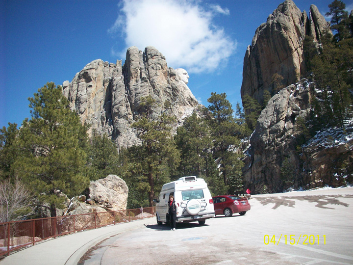
The next day (April 14), we stayed at the site as "Winter Storm Warning" in effect and very cold -high 34° F, low 28° F and I wrote postcards and caught up on notes. We even put on the propane - first time in years! Since it was warmer and sunny the next day, we decided to try and go to Mount Rushmore and do our last mountain climb in sun (hopefully) - very "touristy" things but many not open yet. We didn't pay the Eleven dollars for the "convenience park" at the museum which, of course, had the best views, but still managed to get good pictures from the highway. On our return trip, we saw lots of deer but no "Big Horn Sheep". Rapid City - "Star of the West" was very interesting - "The City of Presidents" project with life-size bronzes of America's Presidents on prominent corners; "Berlin Wall" memorial (largest exhibit of original pieces in USA) with two 12-foot segments of the wall and tank obstacles with photographs and interpretative placards; :Dakota Mill and Grain" and "Abys Feed and Seed" granaries by the tracks near downtown and then a huge development nearby with lots of hotels, businesses, restaurants and subdivisions (some still being built). Back at our site, I read the story of sculptor Gutzon Borglum who worked on the monumental sculptures of George Washington, Thomas Jefferson, Theodore Roosevelt and Abraham Lincoln for fourteen years (began in 1927 at age 60 and cost one million dollars to complete).
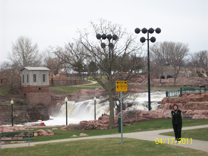
It is very windy as we leave the "Black Hills" and enter "Wall Drug Country" with thirty miles of various signs - "Rooster with Sun"; "Something to Crow About"; "Free Coffee and Donuts for snowmobiles"; Skinny Salon; Tourist Info , etc., etc. We finally entered "Wall " and saw Wall Drug Store ("World Largest Drug Store" - since 1931) - very touristy and packed. Next we entered the "Buffalo Gap National Grasslands" and passed the exit for the "Badlands National Park" (Fifteen dollars entrance fee) with the "Minuteman Mission National Historic Site" (remnants of the Cold war - 1962 underground launch control centre). We passed "Presho", famous for pheasant hunting and were going to stay at their KOA but it was flooded. We moved to "Al's Oasis" (we had seen signs for miles for 5¢ coffee) and it also had a campground overlooking the Missouri River (If you look really hard, you could see it across the highway). It did have a "drive up payphone" with a long cord but it was too cold and windy to stand out there. Next morning, we stopped at "Al's Oasis" - a 91 year South Dakota tradition with 5¢ coffee, Buffalo Burgers and Homemade Pie as well as a gift shop, clothing store, Oasis Pump 'N Pak and supermarket. After crossing the Missouri River, we entered South Dakota's "Prime Pheasant Hunting Area" with miles of corn and stubble fields and many small ponds with muskrat houses. Hunting is a year-round sport here - small games, waterfowl and big game in fall; predator hunting in winter, turkey hunting in spring as well as partridges, quail dove, coyote, fox and deer. The Missouri River Corridor is main route for over 400,000 migrating Canada Geese. We stopped in "Mitchell" to see the "Corn Palace" - unique "ear"chitecture which is decorated each year with thousands of bushels of corn, grains and native grasses and is FREE. The main street signs have "an ear of corn", I got a strip of postcards at the gift-shop showing the various decorations over the years. We then headed for "Sioux Falls" - many buildings made from local red rock (pink quartz). We stopped at "Fall Park" on Big Sioux River with rapid-type falls, observation tower and red rock outcrops - great park. Finally found a campground that was open. Next morning we headed for "Sioux City", Iowa, passing through farmland with cornfields and wheat and lots of cattle. We are now at 1100 feet - lowest we've been since leaving the West Coast. We passed a bluff on the Missouri River - "Spirit Mound" (one of the few sites remaining where Lewis and Clark stood on August 25, 1804). After circling around and crossing the Missouri River a few times, we both agreed that the "Big Soo" area of the "Mighty Mo River" is a "huge mess" to get around and we finally realized this: North Sioux City is in South Dakota, South Sioux City is in Nebraska and Sioux City is in Iowa - all in the "Tri-State/Tri-City" area. We stayed on the "Iowa" side of the Missouri River and headed south. Suddenly, I noticed two huge Canada Geese flying right beside us down the median - unbelievable - they follow us everywhere!
We reached the joint area of "Council Bluff, Iowa and Omaha, Nebraska" on each side of the Missouri River - now under 1000 feet elevation and crossed into Nebraska to explore downtown "Omaha" - lots of bronze sculptures in the financial district on Dodge Street representing the "Wilderness of Nebraska", huge water park with "flocks of Canada Geese flying up" sculpture; large bison sculpture coming though building; and finally saw a humungous sculpture depicting "Wagon Train with Settlers" covering a whole block complete with children, dogs, broken wagon wheels following a rocky road, etc. (very realistic and quite amazing). We decided to do a quick tour of: Council Bluffs, Iowa" before staying at the "West Omaha KOA" in Gretna, Nebraska. "Council Bluff" had many Four-Square Houses (like Sydney); a central park with fountain and large bronze sculpture of "Squirrels playing with Acorns"; Haymarket Square with old store fronts; a unique Squirrel Cage Jail (one of three remaining examples of rotary jails); a small central square with clock - quite a nice city. As we returned to Nebraska and finally got through the rush hour in Omaha, we drove back to rolling fields and farms as we got near our campground. Found a payphone booth outside and called Bob, who was recuperating slowly; Mom and Shirley. We had a huge thunderstorm overnight.
Next morning, we headed back towards Omaha and crossed into Iowa passing through the "Loess Hills" - windblown hills (only two in the world - others in China). Saw a few coal-fired power plants and many flooded fields, especially after the thunderstorm and stopped in "Hamburg", home of the "Vogel Popcorn Co", with huge granaries for corn. We crossed into "Missouri - The Show-Me State", with lots of dark earth fields as we get closer to the "South Loess Hills". There are many budding trees, green grass, blooming Native Daphne and Iandian Pear and flocks of red-winged blackbirds - must be spring! We toured "St. Joseph, Missouri" - home of the "Pony Express"; lots of ornate churches; huge brick homes (many in disrepair); "Robidoux Row" with old store fronts - (many closed); old "warehouse" district; Patee House Museum" - originally an 1858 hotel built to serve travellers as the railroad pushed west; Jesse James home where he was shot and killed on April 3, 1882 by fellow gang member Bob Ford; "Buchanan County Courthouse" where the Ford Brothers were indicted for Jesse James' murder. Also passed "Platte City" and the courthouse where Bland Barrow was on trial for the Bonnie and Clyde robberies and shoot-out in 1933. Next we approached the joint area of Kansas City, Missouri as well as Kansas City, Kansas, also divided by the Missouri River. In one day we have gone from budding trees and not much grass to flowering trees and grass that needs cutting. We toured the "Kansas" side first - huge County Buildings, many boarded-up buildings (as well as a few churches); a huge warehouse/shipping area and old granary near the river; huge "Black Mural" downtown and many bridges. We're now on the other side in Kansas City, Missouri - Historic City Market as well as River Market; "Minsky's" with many shops inside their "delivery doors"; many beautiful old refurbished high-end store fronts; huge new "Convention District" and "Financial District"; "Negro Leagues Baseball Museum" and "American Jazz Museum"; as well as the world headquarters of "Hallmark Cards" (1910). While driving to the Kansas City East KOA", we passed the "Harry Truman Library" in his home in "Independence" and saw sign near Blue Spring "Home of David Cook-American Idol".
Since this area had so much to explore, we stayed three nights. We rested at the site for a day and then toured the city. Kansas City is famous for "barbecue" - "always slow-cooked over wood - usually hickory with sauce added just before serving - More than eighty local establishments with their specialties - ribs, pork, ham, mutton, sausages and even fish. Thus we headed to "Bates City Bar BQue" (advertised in the KOA brochures) "Famous for Hickory Smoked Meats Since 1976". Many locals there and had its own smoker in back (got pictures). After that, we went downtown - first "Union Station" (a renovated jewel of the railroad age) with the "Gottlieb Planetarium" and "Science City"and also the Amtrak Station); next we drove on "Honorary Archives Way" near the National Archives; then to the "Power and Light District" - the "dining and nightclub" area (between 12th-14th Street) - Daddy's, Bazooka's, Drunken Fish, etc.; then the "18th and Vine Jazz District" with huge jazz-related murals; next passed "Sky Station" - four very unique metal towers right over the highway (as space is at a premium downtown) . All in all, a very interesting city!! Most pictures had to be taken from the "Big Guy" as no parking on the streets - only underground. There were lots more sights to see but no time left so we headed to our site.
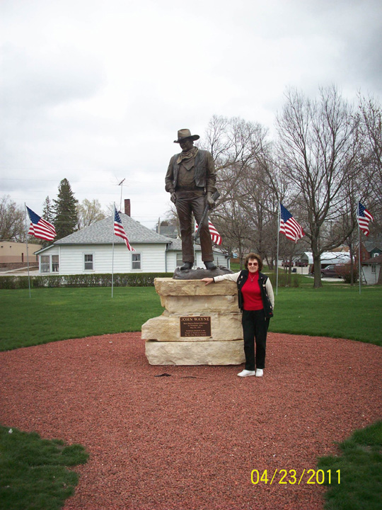
Next day, April 22, "Good Friday", we started heading north to "Des Moines, Iowa" on a rainy day, passed green rolling hills, cattle farms, horses and as we near Iowa, more cornfields with stubble and farming. We entered the "Silos and Smokestacks National Heritage Area" with many dairy farms, vineyards, tractor assembly plants and museums telling the story of American agriculture. We set up for two nights in their local KOA (payphone not hooked up yet) in Adel on the Raccoon River, between "Wild Rose Way" and "Goldfinch Lane". After the rain ended, the sunset over the flat Prairie lands of Iowa was absolutely magnificent! Next day we explored the "Des Moines" area - first to "Winterset" - birthplace of John Wayne with lots of John Deer dealers and six "Madison County Covered Bridge" nearby. We crossed the "Des Moines River" and saw the "State Capital Complex" with huge 275 foot dome and four smaller ones around it; drove down "Grand Avenue" past City Hall - a "Beaux Art" construction with many beautiful metal planters all along the streets full of spring flowers; stopped at the "John and Mary Pappajohn Sculpture Park" (saw a Scottish wedding party with kilts and twenty-six works of art); short stop at the "Botanical Centre" (but five dollar fee); passed many huge homes on "Terrace Hill" as well as in the University area such as the Governor's Residence, Salisbury House and Gardens, Greenwood Park and Rose Garden; then to "Historic Valley Junction" on "Railroad Avenue" - the original downtown "West Des Moines" (1890s) with renovated old stores, art galleries, antique shops and restaurants; passed "Jordan House" once part of the "Underground Railroad Network to Freedom". Heading back, we passed many subdivisions and suddenly, countryside.
On Easter morning I donned my yellow sweats with "Boyds Bear Bunny Brooch" and bought two "Bunny Blue" drumsticks. We left for "Minnesota" driving past miles of fields and huge farms, large granaries, not many bushes, some "wind-farms", large long "hog barns" (not a pig to be seen). We went into "Mason City" (Meredith Willson's boyhood home (1895) - songwriter and playwright of the "Music Man" and "River City")" saw "The Music Men Square" with 1912 River City Streetscape replica and set designs from the Warner Brothers motion picture; two buildings designed by Frank Lloyd Wright; found "Cannonball 457" - former Minneapolis and St. Louis Railway Steam Locomotive (1912). On our return, we entered "Clear Lake" to see "The Surf Ballroom and Museum" - home to big band and rock n' roll entertainers, and where Buddy Holly, Ritchie Valens and the Big Bopper played their final concert. The famous "cloud machine" still operates. As we headed to our campsite in "Albert Lea, Minnesota", we stopped in the town first which is nestled between two lakes - many old brick buildings with very ornate decoration (1880) - but some boarded up, lovely old Post Office building with lots of scrolls, "Liquor Depot" in old train station, Old "Masonic Temple" now an Art Centre. It was obvious that "Albert Lea" had money at one time. As we drove to the KOA, we saw "pelicans" on the fishing pier and of course Canada Geese! Since the sun was still out, we sat out and ate our "Easter" KFC chicken.
As Eric really wanted to visit "Fargo, North Dakota", we started to head west through "Minnesota" and then start north again. We headed back to the outskirts of "Sioux Falls" passing through "Austin, Minnesota" - home of world-renowned "Spam - the miracle meat" and many "drive through" grain-storage barns and fertile farmlands as we're on the eastern edge of the "Great Plains". I-90 is the major east-west highway as I-75 is the north-south highway (Highway 75 is "The King of Trails"). We drove through "Worthington" which hosts the "Great Gobbler Gallop" each fall - a local turkey races against one from Cuero, Texas. Town has many Mexican restaurants, "Red Wing Shoe" store, "Buffalo Billfold Company" and "Pioneer Village". Passed "Luverne" - home of National Geographic photographer, Jim Brandenburg (famous for his striking photos of the prairie and Minnesota wildlife, before crossing the "Big Sioux River" as we bypassed "Sioux Falls" and re-entered "South Dakota". Heading north to Fargo, we could see snow in the tree-line. Oh no!! Passed sign for the "North/South Continental Divide" as we passed through the "Glacial Lakes and Prairies Region" - a land sculpted by glaciers thousands of years ago and inhabited by the Dakota tribes, frontier soldiers and homesteaders. Started to see many flooded fields and marsh areas with muskrat houses as we entered "North Dakota" and approached Fargo heading to a campground in Casselton, North Dakota on the other side. Lots of flooding from the "Red River" along this highway. We took our site for three nights to "rest up" and then explored Fargo and area (not many campgrounds around here). We discovered that Fargo is a joint area with Moorhead, Minnesota (divided by the Red River coming down from Manitoba, Canada). "Moorhead" is located near the trains with lots of containers and has a long "strip" street with small businesses while "Fargo" seems more prosperous - modern "City Hall"; old Hotel Donaldson, Hotel Bison and Powers Hotel; nice old Railway Station with "Bicycle Business" restaurant and "Great Northern" Railway Car; old "Fargo Theatre" (1926); many multi-coloured "Buffalo" statues; Old Fargo bank; "Cass County Courthouse" building with dome and clocks. We left "Fargo - The Old Cattle Town and heading towards "West Fargo" and stopped at the Visitors Centre shaped like a granary with the "Fargo Walk of Fame" (Al Hirt had signed). Also passed "Bonanzaville, USA" with authentic cabins, school, etc. and the "Red River Valley Fairgrounds" and before heading back to our site, we toured the small town of "Casselton" - lots of old brick buildings with ornate fronts and rooflines.
We started south-east to Minneapolis, Minnesota, bypassing Fargo and re-crossing the flooded Red River before entering the "Prairie Pothole Region" of Minnesota (Tall Grass prairie and wetland areas). Saw a big highway sign "DNT TXT + DRV" --- "Don't Text and Drive"; a 'herd of buffalo" on a roadside farm; many "planned" hunting areas with blinds and cornstalk. We had a short stop in "St Cloud" so I could see the "Munsinger and Clemens Gardens" along the Mississippi River which flows through the heart of the city - there was a "Formal Garden" and a "Heritage Garden"; the "Virginia Clemens Rose Garden" and "Renaissance Fountain with Cranes" (not open yet but had outside brochures to pick up). St. Cloud is quite beautiful - lots of granite buildings and statues (an ad campaign in 1921 called it "The Nitty Gritty Granite City" and local granite was shipped all across the U.S.A.). Nearby "Quarry Park" contains thirty old quarries which are now rock trimmed ponds used for swimming, scuba diving, fishing with hiking trails around. We're now heading into "Minneapolis-St. Paul Areas" - Minneapolis "The City of Lakes" is Minnesota's largest city, while St. Paul is the State Capital and second largest city - lots of subdivisions coming in. We stayed at the "Minneapolis Northwest/Maple Grove KOA" out in the countryside complete with prairie dogs in the playground and booked four nights to explore.
Up at 3 A.M. to watch the "Royal Wedding" (thank goodness this place had good aerial digital TV reception as many don't). Watched it and then other specials so remained at site all day. Next day we went into "Maple Grove" to check for a payphone to call Mom and Bob (no luck). Thought we'd head back to "Monticello" as hundreds of trumpeter swans winter on the Mississippi River where warm water released from a power plant keeps the river ice-free but must be gone already. Lots of Canada geese though. Stopped in "Elk River" for pictures of huge bronze elk and two small murals depicting life in the old town. A nearby state historic farm is still a working farm with horse drawn plows and costumed staff from 1850s - still closed. Stopped at "Culver's" for their "Classic ButterBurgers/Crinkle Fries Basket" and Vanilla Frozen Custard Waffle Cones. Next day we headed for the "Twin Cities" hoping for less traffic on Sunday. A few highlights only as many in both cities: Minneapolis - "Necollet Mall, "known as "Eat Street" with ethnic eateries; very ornate Court House/City Hall and State Federal Buildings; "Target Field" with the "Minnesota Twins"; old Warehouse District with many painted signs on sides; old brick roads; the gold-coloured "Wells Fargo Centre"; Historic Hill with huge homes; short stop at "Como Park" (zoo, glass-conservatory, lakeside pavilion, etc. etc.). St Paul: Gold-domed State Capital with "the Quadruga Golden Horses up front; St. Paul Hotel" - 1910; the Cathedral of St. Paul; the "Fitzgerald" - oldest theatre; "XCel Energy Centre (home of the "Minnesota Wild"); "Rice Park" includes sculptures (Plants and statues as Charles M. Schultz was a St. Paul native), et. etc. Buildings in St. Paul are much more ornate as the State Capital, I guess! As we head back to our site, we passed "Little Canada" - checked for payphones at gas station - one inside not working; one next to highway outside being used (and when he finally left called Mom but no answer - Oh Well!!
We left the "Twin Cities" area on May 2, and entered "Wisconsin" (The Badger State and Americas Dairyland) heading east and "homeward" as it starts getting very cold again and we cross the Mississippi River for last time and finally are "East of the Mississippi" in Hudson, Wisconsin. Stopped in "Chippewa Falls" and visited its oldest business - "Jacob Leinenkugel Bearing Company" (1867) - an Old World Germanic brewery and got pictures of many murals depicting "Historic Highlights of Chippewa Falls". Also passed "Mason Shoes" - famous shoes and boots since 1904. Thought we'd stay at "Monster World Campground" way out in farmland but everything closed (it's the Central Wisconsin "Dirttrack Raceway" but must be very seasonal. Worked our way back through farmland on back roads (very well paved and travelled); crossed the Wisconsin River and found a campground on "Lake DuBay Shores" - sand everywhere!!
As we headed to "Green Bay, Wisconsin" next day, we visited the "Leigh Yawkey Wooden Art Centre/Sculpture Park" in "Wausau" and took pictures of the garden sculptures in snow flurries - should be interesting. There were many wonderfully restored Classical Revival style houses (1901) as well as some Grecian Revival (1927) among newer ones. The "River District" on "Washington Square" had restaurants and ritzy stores - very lovely city with "small feeling"! Driving out, we passed "Granite Peak Ski Area" right outside the city. This "Central Sands" area (the heart of Wisconsin) contains pastoral farm towns of the great sand plain plus industrial centres along the Wisconsin River. Saw many "glacier" rocks in front yards with paintings on them. "Green Bay" is Wisconsin's oldest community, settled originally by the French as a fur-trading centre but now famous for the "Green Bay Packers" at "Lambeau Field". Several interesting sculptures near City Hall (with copper dome) - "Spirit of the Northwest" (three figures of Indian/Priest/Scholar); "Two Fur Traders with Canoe". Lots of pubs and poolrooms serving "Brewskis" - sure is a "working man's town". Green Bay Packer decor everywhere plus ""football helmet" on street signs. We crossed the "Fox River" and camped at "Apple Tree" campground near "De Pere" - very nice country farm but very "odoriferous"!
Next day we decided not to circle Lake Winnegago as still very cold and most things would be closed and turned south along Lake Michigan towards Milwaukee. As we followed the water, we stopped in "two Rivers/Home of the Ice Cream Sundae" and visited the historic "Berner's Ice cream Parlour and Gift Shop" (established 1881). Continuing along "Maritime Drive", we passed "Manitowoc" with its "Maritime Museum" explaining the tradition of Wisconsin boat building in 1800s; Three big Budweiser Bottles at Plant next to "Courthouse Pub" which is next to old "Courthouse" Buildings. Into "Sheboygan" - next - many ornate old buildings but centre of city ripped up for new roads (per usual throughout our trip); street signs have a "schooner" on them; "Riverfront Drive" has a boardwalk and "shanty" shops; majestic "Blue Harbour Resort and Conference Centre" on water; lots of old manufacturing buildings with old signage still visible; some original brick streets. Heading into the surrounding area is Wisconsin's premier golf destination. Nearby "Sheboygan Falls" has more than fifty restored buildings from the 1800s, making the city a "Great American Main Street." As we head to "West Bend" (with a campground that is open), we're back on County Roads cutting through farmland - now seeing blooming forsythia and daffodils plus the "Pheasant Ridge Wildlife Sanctuary". We got a beautiful site overlooking Lake Lenwood and decided to walk down to the beach before dark.
After driving through the historic district in "West Bend", we headed to Milwaukee, known as the "City of Cool" - has the world's only "Harley-Davidson Museum" and bronze statue of "The Fonz" on city's fifteen-block "River Walk"; nearby "Germantown" which has preserved its "old world" heritage in the "Dheinsville Historic Park"; "Industrial and Economic Corridor" (Jackie Robinson School, and many buildings boarded up, huge murals "Stop the Violence"). We finally crossed the Milwaukee River into centre of the city with many ornate old buildings - Twenty-three story :Pfister Hotel" (1893), "Mitchell Building" with gold statue in entrance; huge one block "Frontier Airline Centre"; "Usinger's Oldest Sausage Company"; etc., etc. Huge city! Heading out, we stopped at the "Mitchell Park Dome". Three conical-shaped glass domes house a tropical rain forest - "Tropical Dome" (1966); a desert botanical garden - "Arid Dome" (1964); and a changing seasonal floral exhibit - "Show Dome" (1964 - Currently Rocky Mountain Spring). The 1899 original Conservatory was built in traditional glass house style. Heading out, we enter huge farmland with several horse ranches and equestrian centre. We stopped at "Happy Acres Kampground" where we were greeted by horses, two cats, burro, ostrich, alpacas, ducks, geese, a pot-belly pig, and "who knows what else" as we drove up the long laneway. We even saw stars in the night sky which I'm sure we haven't seen since California!
Today May 6 we are heading to Chicago, Illinois (last time there was as we got off "Route 66" in 2007). We even saw a robin pulling up worms and it's 65° F (finally some heat). There are also farmers out tilling their fields. What a beautiful spring day!! We took many side-roads to avoid tolls passing through many ritzy suburbs (Highland Park, Wilmette, Evanston) and finally got on "Lakeshore Drive" heading towards downtown "Chicago" - a very beautiful but hectic city! There were people, bikes, cars, buses, cabs, couriers everywhere! Not much parking so took pictures out the window. Never did find the "Millennium Garages". We finally reached the corner of "Jackson and Lakeshore Boulevards" at 3:30 P.M. (a little earlier than on Sunday, April 22, 2007, following Route 66, which was 4:40 P.M.). We are now in familiar territory - HA!HA! We crossed into "Indiana - Crossroads of America", heading into "Chesterton" and the "Indiana Dunes National Lakeshore" where we camped in 2007. Upon arrival, we realized that the campground had been moved inland so we won't be able to walk in the morning and hike over the dunes to Lake Michigan as we did before. Oh well!! Still very nice and we had a bonfire with Canada Geese honking overhead plus our traditional "train in distance like on Route 66!!
Next morning, we drove to the "Dunes" and saw Lake Michigan before proceeding through "Morgan City" and "Michigan City, Indiana" where we visited "Mt. Buddy" - tallest dune along the lakeshore at 123 feet (rain on way and too steep for me and my "deteriorating hip", so didn't climb to summit). As we went inland through lots of bush, we finally entered farmland on Highway 2 to "South Bend, Indiana" which had lots of Spanish signs and Mexican restaurants as we went to the "South Bend east KOA" in Granger, Michigan, hoping to get TV reception for the "Kentucky Derby." Turned out the hosts, a tall German couple had travelled a lot of "Route 66". They had an old Classic GMC "Canyonland" motorhome (38 years old) and a yellow Mini Cooper car. As they told us about the RV problems they've experienced on their travels over the years, our misadventures looked like nothing!! There were great facilities and an inside payphone. WOW!! - so I washed my hair, put on my new black ball cap (complete with Kleenex flowers) and watched the race! (Heard later that Bob watched it too). We decided to stay three nights to rest, catch up on nots and tour the South Bend area.
After staying at our site relaxing under the tall pines on Sunday, we set out the next day to explore on a sunny and very warm day - 74° F (in short-sleeves)!! We first headed for "Bontragers Surplus Inc" (one of the largest surplus supplies for RV supplies in the area) but ended up on a really big detour as a bridge was out on one of the back roads. After winding around for two hours, we finally found it, but nothing suitable for us! We worked back to "Shipshewana, Indiana" - a huge Amish area and saw lots of horses and buggies; laundry on lines; Amish ladies on bikes in long dresses and caps; lots of Amish Furniture stores; quilts for sale in local homes and fabulous Amish handicrafts. One large restaurant and bakery even did bus tours. Not what we expected - business everywhere! We stopped in "Elkhart - The City with Heart", a vibrant riverside community where the St. Joseph and Elkhart Rivers merge with a new "Arts and Entertainment District" near the newly renovated "Lerner Theatre" (1929); a "Riverwalk" and "Island Park" (in winter there's an "Ice Park" and in summer it's a "Water Park" with splashing among the geysers and gardens - very beautiful. Also had a huge outdoor art piece - a bronze jazz player with a metal marching band with instruments behind him in painted red, white and blue uniforms. As we left "Amish Country (Northern Indiana is home to the second-largest population of Amish in U.S.A.), we followed the St. Joseph River and crossed into "South Bend" on the "Memorial Bridge". Passed a huge Heart and Vascular Centre at the "Memorial Hospital" which also had a huge Spine and neuroscience Centre, "Baby Hospital", etc!! Also saw the "Studebaker Mansion and Museum" in the "Near Westside - South Bend's Oldest Neighbourhood"; and of course "Notre Dame University" (1842) - entrance all tree-lined with huge gold-domed buildings at the end. We found public parking and walked all the way down to visit the "Basilica of the Sacred Heart" and see the plaque for "Brother André Bessette" from Montreal (late 1800's). Next we drove by the "Legends Football Field" and the "Knute Rockne Gate" at the "Stadium"'; "Holy Cross House:\ "Moreau Seminary"; "Congregation of Notre Dame"; "St. Mary's College"; and even a golf club - it's a huge campus! We got back to our campground at 6ish and I later called Bob, Mom and Shirley since there's a payphone inside!
We left our KOA "The Home of Hoosier Hospitality" on Tuesday, May 10, and started wending our way north through "Michigan" on our way back home to Canada. We toured "Kalamazoo" with its "Air Zoo" - airplane display of WWII originals and restorations including the "Flying Feline Foursome" also known as the "Wildcat, Hellcats, Tigercat, and Bearcat" on display plus the pioneering "Wright Flyers". Lots of U.S.A. Flags and various street flags along main streets (City of Kalamazoo, Central City, East City, South Town, etc.). We headed out on Riverview Drive along the Kalamazoo River and passed a cemetery "Mount Ever Rest". "Battle Creek" known as the "Cereal City" has the "Ralston Food Co." as well as "Kellogg". There was a friendship Park with "stoned" riverbanks downtown with sports murals and 3D plaques - lovely. It is also home to the world's largest sculpture honoring the thousands of southern slaves and fugitives who fled north during the 1840's and 50's. We checked Woodall's for a campground as not many open here yet up here and got on I-94 East heading towards Detroit, Michigan, for tomorrow's run home. As we got off the interstate heading for the "Village of Grass Lake" and "Apple Creek C.G. and R.V. Park" we saw a sign with great advice "Live Long, Laugh Often", and there were several Canada Geese in nearby pond! The campground was sort of "Ma and Pa" and they were still working on new bathhouse and pool so only washroom was a long walk away in main house. Oh well!! We chose a site with moss and not much as much mud, so Emma could have her daily stroll before dark - weather permitting.
Next morning, we made a quick stop in "Grass Lake" for a picture of their "Stone Railroad Depot" building (1842) and park with lovely blooming trees. We got back on I-94E with lots of traffic heading to Detroit. After finding the "Bridge to Canada" exit and stopping at Duty Free and Customs with no problems, we finally were back in Canada" on Wednesday, May 11, 2011 at 1:08 P.M.
Since early and everyone in Wheatley, Ontario, will still be at work, we took the long way back through "Amherstburg, Ontario" along the "Detroit River" - lots of memories for sure! Eric stopped at Tim Horton's for his first good coffee in months. As we followed Pigeon Bay on Lake Erie through Colchester, we were on the "Wine Route" - never had that before! We passed through Oxley and Kingsville heading to Leamington and there was still lots of devastation and tree cutting from last year's tornado which Eric hadn't seen yet. We arrived at "Rib's L'il Acres" at 4:40 P.M. and Dennis made a nice supper and then I unloaded "gifts, etc." and did laundry as Shirley worked till midnight. I, of course, surprised her when got home, and then we surprised Dennis on his way to work at 8ish A.M. after Shirley and I were still up watching the sun come up. Bad girl!
We spent the next 12 nights in the Wheatley area, visiting with Mom and family as well as several "old" friends in the surrounding area. We were lucky to be in the area for birthday celebrations on May 21 for Eric's relatives (Uncle Jake 93 in April, Aunt Margaret, his wife, 90 on May 1). We hadn't seen many of his relatives for years - quite a reunion! (Since then, Uncle Jake had a heart bypass). We heard that Bob was back in the hospital and not doing very well, so set off sooner than planned. After a shorter visit with Reta and Bruce at their new summer campsite outside of Kingston, Ontario, (along with Gwen and Larry who were visiting), we hurried home with a short visit in Moncton, New Brunswick, to visit Al in the hospital. We arrived in Cape Breton on Friday, May 27, 2011, at 4:52 P.M.
We got to the hospital finally at 6:45 P.M. in time to have a short visit with Bob as he was heading home by ambulance with his family there and palliative care. I was glad to spend some time with him before he passed away on Saturday, June 4, 2011 at 5:22 A.M. He was a very dear friend for 43 years and a great travel companion!!