ERIC KRAUSE
In business since 1996
- ©
Krause House Info-Research Solutions -
_____________________________________________________________________________________
ERIC KRAUSE REPORTS
MY HISTORICAL REPORTS
PUBLISHED ON THE INTERNET
Krause House Pages,
Website Design, and Reports © by
Eric Krause, Krause
House Info-Research Solutions (© 1996)
webmaster:
krausehouse@krausehouse.ca
© Krause House
Info-Research Solutions
MAJOR UNITED STATES RESEARCH TRIPS SERIES
RESEARCH TRIP ~ HISTORIC ROUTE 66
Friday, March 16, 2007 - Sunday, April 22, 2007
A
HISTORY OF THE
VITRIFIED BRICK ROAD
-----
Route 66: A History of the Vitrified Brick Road, By
Eric Krause -----
Based on the Journal and Accompanying Photographs of Lynda Krause, "Route 66", Tour 2007
OKLAHOMA
THE MOTHER ROAD
(376.4 Miles)
 |
 |
 |
 |
 |
| 1. | 2. | 3. | 4. | 5. |
 |
 |
 |
 |
 |
| 6. |
7. Between Elreno & Hydro |
8. | 9. Near Bridgeport | 10. |
 |
 |
 |
 |
 |
| 11. | 12. | 13. Chandler | 14. Strould | 15. Sapulpa |
 |
|
 |
 |
 |
| 16. | 17. Tulsa | 18. | 19. South from Miami, Towards Afton |
20. Quapaw |
7. Between Elreno & Hydro: "Old 66 Road", 1930's concrete
9. Near Bridgeport: 38-Arch Metal, "Pony Bridge", Built in 1933, South Canadian River
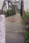
15. Sapulpa: 1925 Iron Bridge, with Brick Deck
17. Tulsa: Twin bridges cross over the McClellan - Kerr Navigation System that links Tulsa to the gulf. The 1936 span is 24 feet wide. The 1957 span (for the 4-lane Route 66) is 28 feet wide.
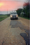
19. At Sidewalk Highway, Ribbon Road, the remnants of the famous 9-foot Highway. It zigzags south from Miami towards Afton. This narrow strip has a concrete base & curbs plus an asphalt road surface. It was paved in 1922 and It served US 66 until 1937.