FortressImages
Website Design and Content
© by Eric Krause, Krause House
Info-Research Solutions (© 1996)
All Images ©
Parks Canada Unless Otherwise Designated
Report/Rapport ©
Krause House Info-Research Solutions
Researching
the Fortress of Louisbourg National Historic Site of Canada
Recherche sur la Forteresse-de-Louisbourg Lieu historique national du Canada
![]()
FORTRESS OF LOUISBOURG PROPERTIES
141 - 150
|
Description |
Jpeg Format |
Pcx Format |
|
| Block 36 Properties (late 1960's Bernard Pothier (A Study of Property and Town Planning) work sheet - Note: Use with care as both the 1723 and the 1734 property designations (which are often different) are used) | 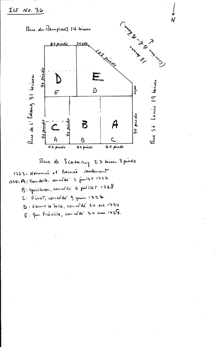 |
 |
|
| . | . | . | . |
| Block 37 Properties (late 1960's Bernard Pothier (A Study of Property and Town Planning) work sheet - Note: Use with care as both the 1723 and the 1734 property designations (which are often different) are used) | 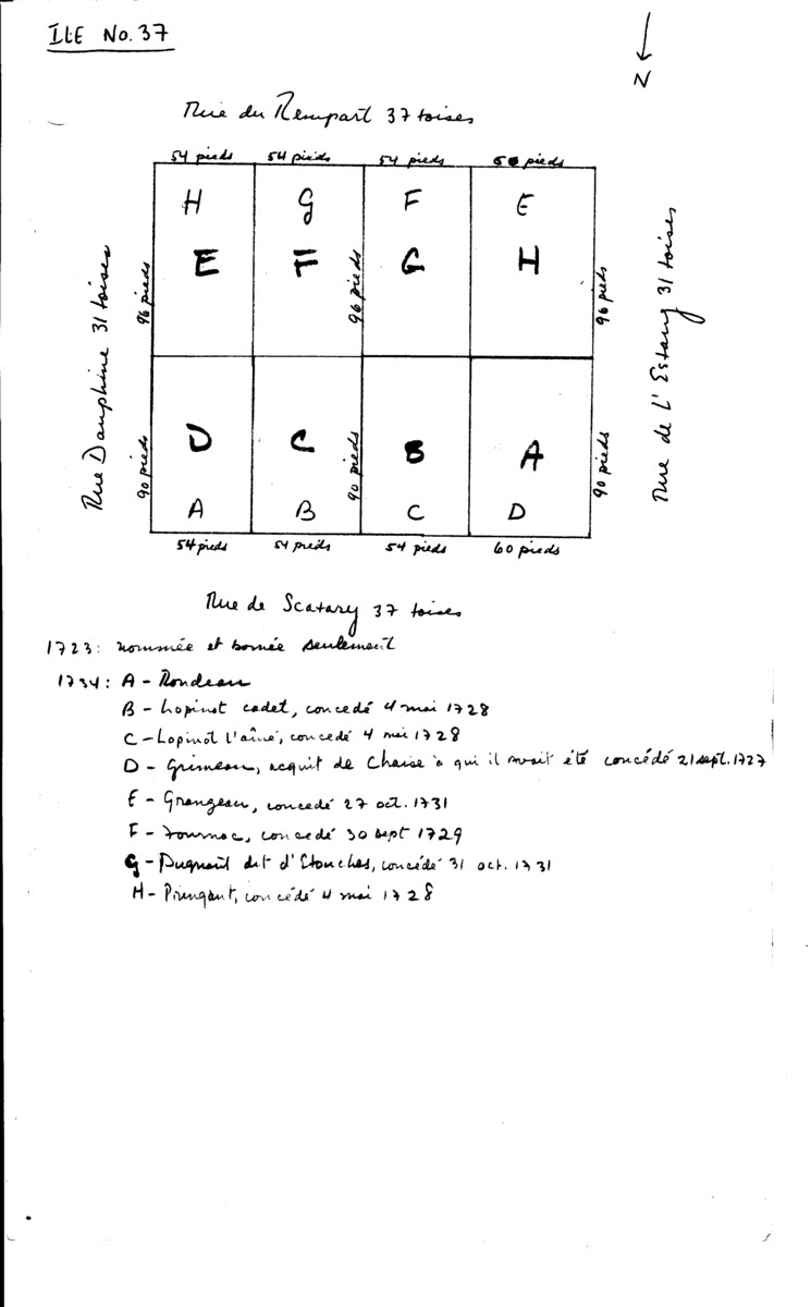 |
 |
|
| . | . | . | . |
| Block 38 Properties (late 1960's Bernard Pothier (A Study of Property and Town Planning) work sheet - Note: Use with care as both the 1723 and the 1734 property designations (which are often different) are used) | 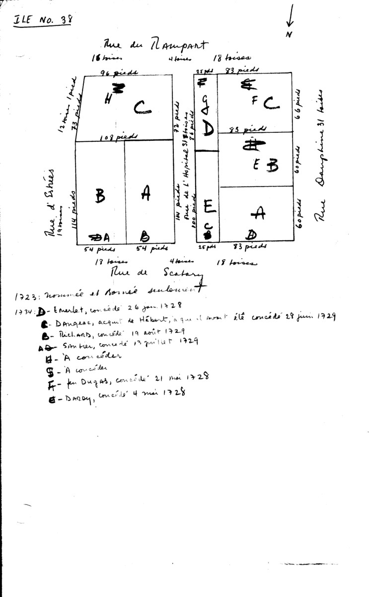 |
 |
|
| . | . | . | . |
| Block 45 Properties (late 1960's Bernard Pothier (A Study of Property and Town Planning) work sheet - Note: Use with care as both the 1723 and the 1734 property designations (which are often different) are used) | 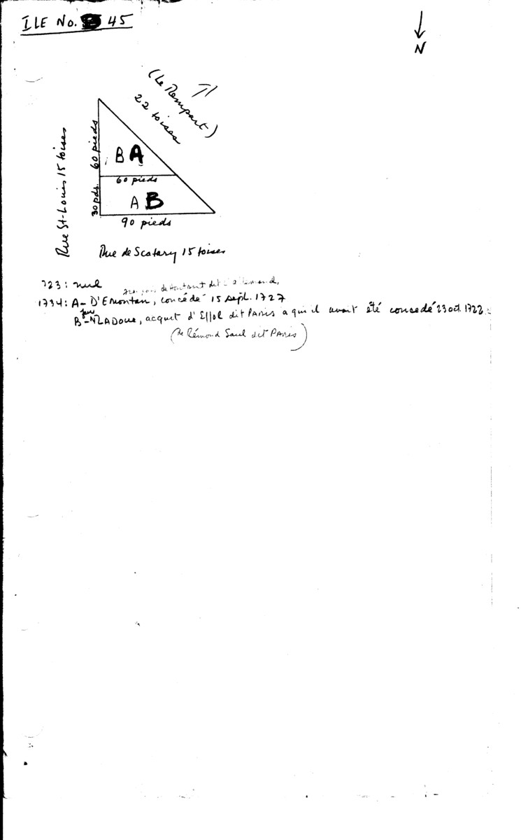 |
 |
|
| . | . | . | . |
| Isle Du Quay Properties (late 1960's Bernard Pothier (A Study of Property and Town Planning) work sheet - Note: Use with care as both the 1723 and the 1734 property designations (which are often different) are used) | 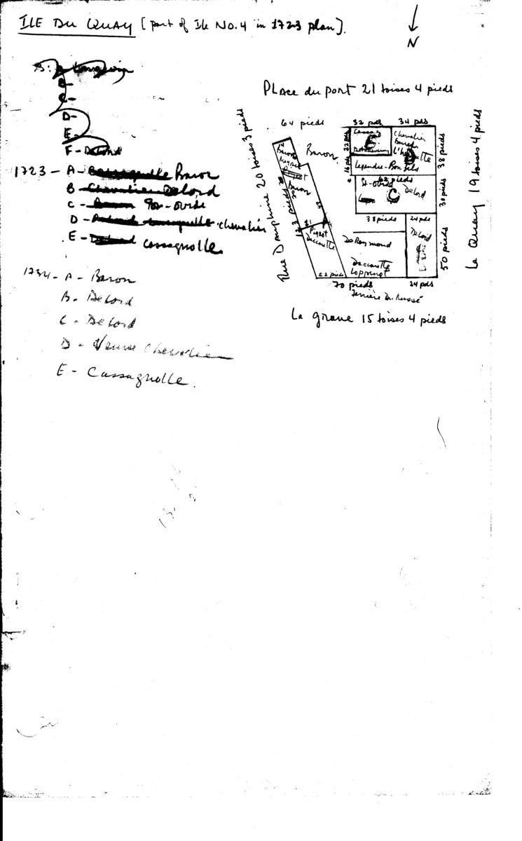 |
 |
|
| . |
. |
. |
. |
| Presqu'Isle Du Quay Properties [part of Block 5 on 1723 plan] (late 1960's Bernard Pothier (A Study of Property and Town Planning) work sheet - Note: Use with care as both the 1723 and the 1734 property designations (which are often different) are used) | 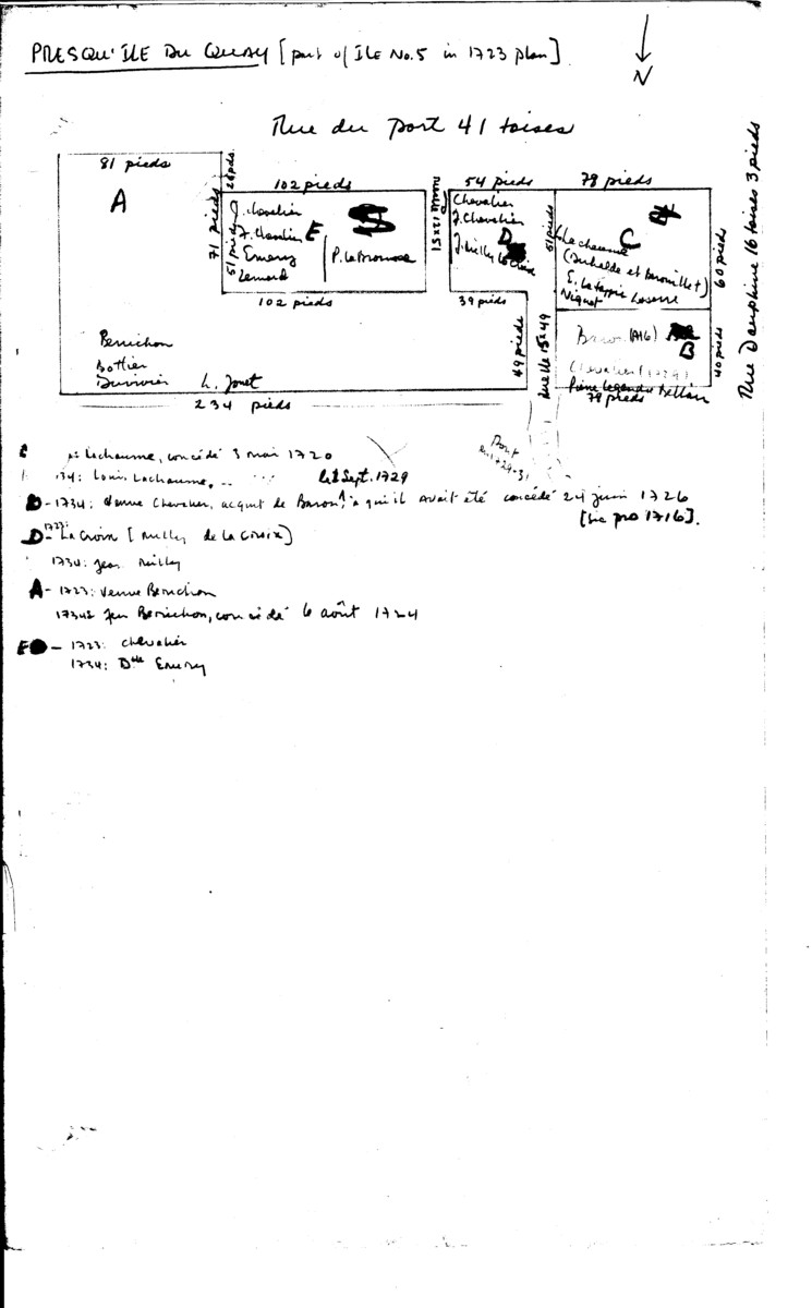 |
. |  |
| . | . | . | |
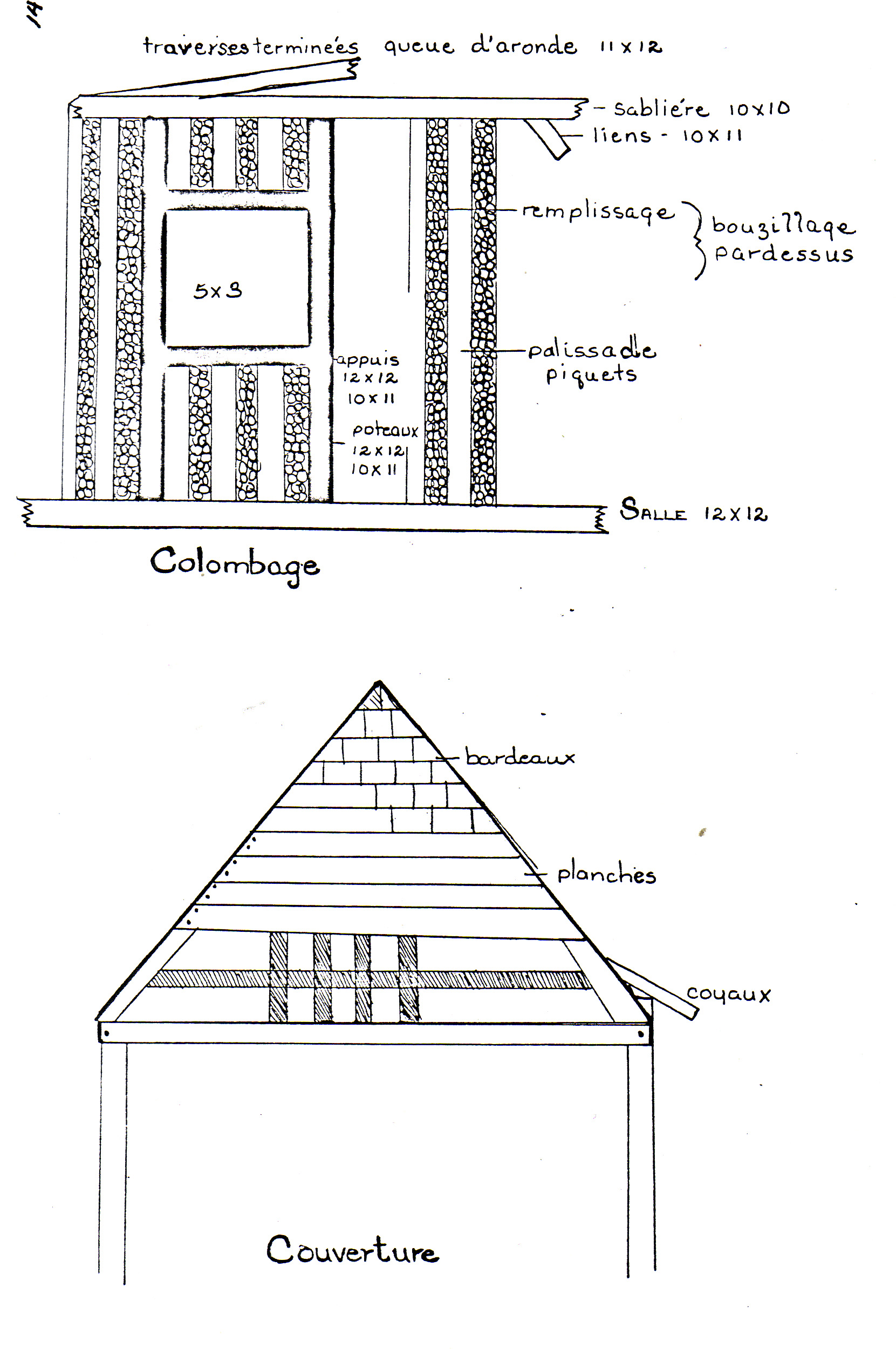
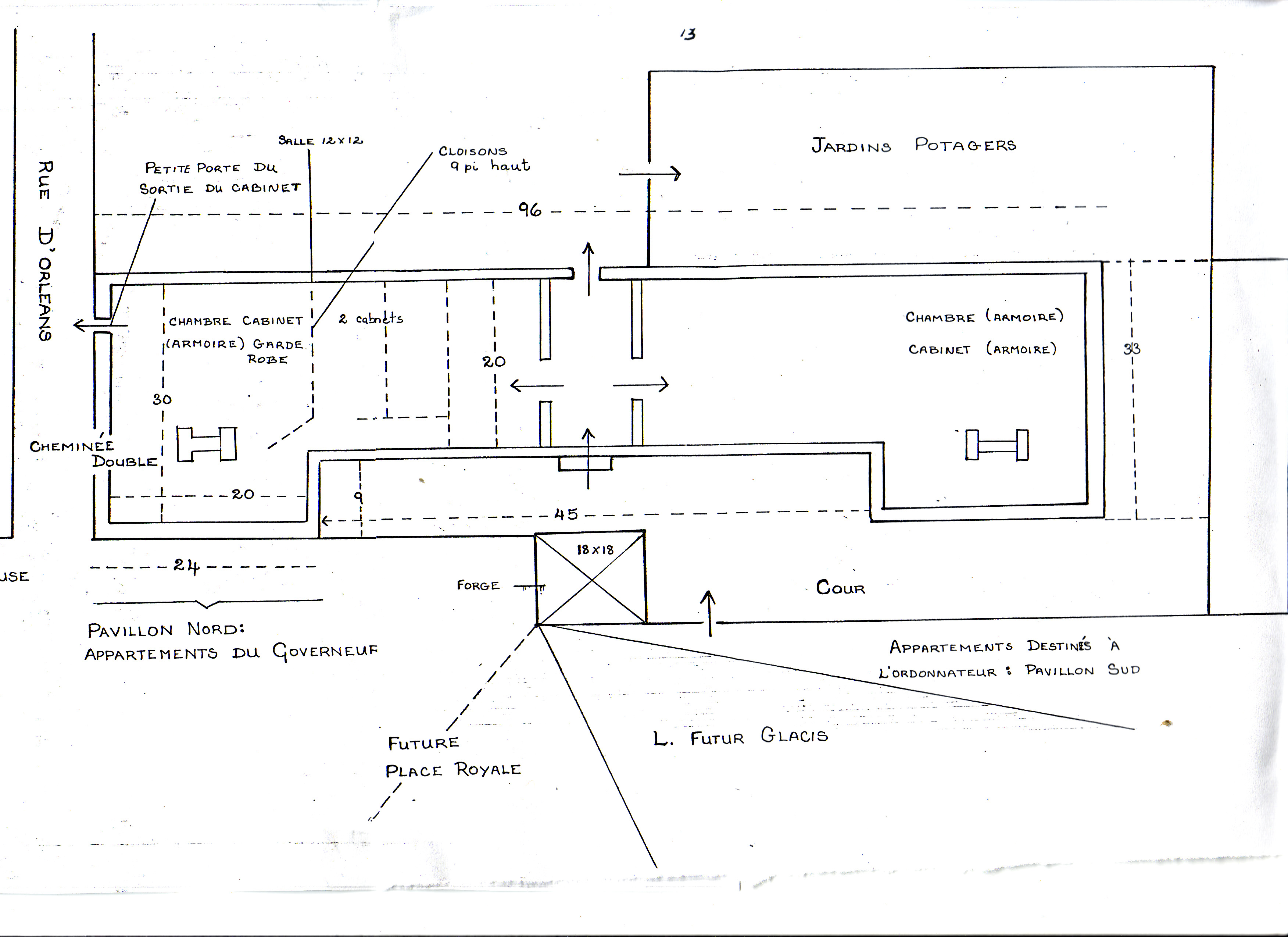
| Select image from: "Ancien Gouvernement" By Claude Poulin, Illustrations: Pierre Mayrand Appendix 4 in: King's Bastion Report VIII: A Survey of the Terrain of the Citadel Area Prepared for the Purposes of Archaeological Excavation By John Fortier, Unpublished Report H A 11 S 2 (Fortress of Louisbourg, July 30, 1965) |
 |
N/A | |
| . | . | . | |
| Select image from: "Ancien Gouvernement" By Claude Poulin, Illustrations: Pierre Mayrand Appendix 4 in: King's Bastion Report VIII: A Survey of the Terrain of the Citadel Area Prepared for the Purposes of Archaeological Excavation By John Fortier, Unpublished Report H A 11 S 2 (Fortress of Louisbourg, July 30, 1965) |
 |
N/A |
![]()